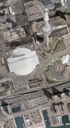
 The City of Toronto’s high-resolution orthoimagery can be used in GIS/CAD applications and the associated geo-referencing of the images enables the overlay of vector data.
Data available: 2021
Coordinate System: NAD83 (CSRS) / MTM Zone 10 (ESPG: 2952)
| Format | Design Scale |
Resolution | Cost |
|---|---|---|---|
| Web Map Service | Varies | Varies | Free on Open Data |
| GEOTIFF | Varies | Varies | $62.93 /tile (500m x 500m) |
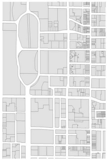
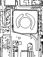 Topographic mapping includes features that are visible on the ground (planimetric) or can be derived from photogrammetric measurements. The mapping contributes towards the Property Data Map series.
The topographic mapping features include but are not limited to curbs, sidewalks, building rooftops, driveways, fences, vegetation, manholes, and catchbasins.
Tiling Scheme: User Defined Area
Total Map Area: 640 km2
Coordinate System: NAD83 (CSRS) / MTM Zone 10 (ESPG: 2952)
For tiled topographic mapping products, see Property Data Map.
| Format | Cost |
|---|---|
| DGN, DWG | $377.59 /km2 |
| Shapefile | Free on Open Data |
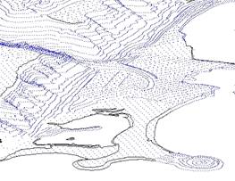 The Digital Terrain Model (DTM) is an irregular grid of 3D points (x,y,z) with the density of the grid varying, dependent upon the terrain. Full breaklines are included as part of the data set. Typically, the DTM is used to generate Triangular Irregular Networks (TINs) for the purposes of 3D modelling and analysis.
Map Area: User-defined (Full Resolution); Entire City (Generalised)
Total Area: 640km2
Coordinate System: NAD27 MTM Zone 10
Vintage: 2005
| Format | Cost |
|---|---|
| DGN, DWG | $314.66 /km2 |
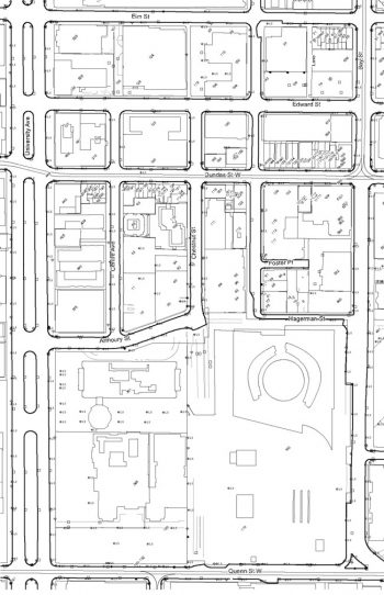
The City’s Property Data Map (PDM) Series is a hybrid product, combining elements of topographic, parcel mapping, the One Address Repository (OAR) and Toronto Street Centreline (TCL). The PDM series provides a base for thematic mapping services and other published hardcopy products.
The PDM depicts the following features: building envelopes, railway lines, major watercourses, curbs, catchbasins, streetlights/poles, municipal addresses, street names, property lines, street lines, and rights-of-way boundaries
Tiling Scheme: Concession
Sub-Block Map Area: Varies up to 1.18 km2
Total Map: 921 maps
Coordinate System: NAD83 (CSRS) / MTM Zone 10 (ESPG: 2952)
Black and White Map
| Format | Cost |
|---|---|
| DGN, DWG | $125.88 /map |
| PDF (11”x17”) (1:4000 scale) | $5.05 /map $176.23 /city set |
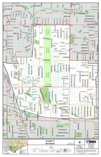
Ward Maps depict streets, parks and street names by City of Toronto Electoral Wards.
Map scales are dependent upon the geographic area of each Ward.
Colour Map
Map Size: 26”x 36” or 11”x17”
Total Map Area: Individual Ward Areas
| Size | Format | Design Scale | Cost |
|---|---|---|---|
| 11″ x 17″ | Various | $6.28 | |
| 26″ x 36″ | Various | $7.53 |
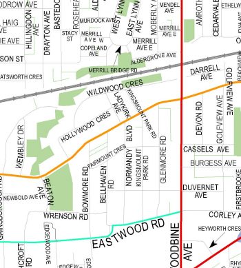
The City of Toronto’s Centreline (TCL) contains a geographic linear representation of transportation, hydro and rail corridors, administrative boundaries and shorelines.
The Toronto Centreline Map show single line representation of streets, street names, railways, and major watercourses in the City, and are to be used for general information purposes only.
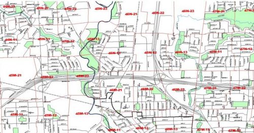
The Community Council Maps cover one City of Toronto Community Council Service Area (North York, Etobicoke York, Toronto and East York, Scarborough).
The Community Council Boundaries and Electoral Wards map displays Electoral Ward boundaries, Community Council boundaries, streets and street maps. There are two Ward Index Map sizes:
| Description | Format | Cost |
|---|---|---|
| Toronto Centreline Map | 36”x70”, colour (PDF) | $31.47 |
| Community Council Boundaries and Electoral Wards map |
36”x70”, colour (PDF) | $31.47 |
| Community Council Boundaries and Electoral Wards map |
24″ x 36″ colour (PDF) |
$18.89 |
| Community Council Boundaries and Electoral Wards map |
11″ x 17″ colour (PDF) |
$12.58 |
| Community Council map (aka.District Street Map) |
36”x45” (PDF) | $18.89 /per Community Council |
| PDM Street Index map | 36”x70”, colour (PDF) | $31.47 |
The Toronto Centreline dataset is available as an ESRI Shapefile for free – Download from Open Data.
 The City of Toronto’s parcel mapping is continuously maintained in a spatial database with associated attributes.
 The City of Toronto’s Centreline (TCL) contains geographic linear representation of transportation, hydro and rail corridors, administrative boundaries, and shorelines.
As of 1 March 2021, Urban Forestry will provide the service of Ravine Protection Line Certification. For more information visit Urban Forestry or contact:
Ravine and Natural Features Protection Office
City of Toronto,
18 Dyas Road, 1st Floor
Toronto, ON,
M3B 1V5
Customer service is available between 8:30 a.m. and 3 p.m.
Telephone: 416-392-2513
Fax: 416-392-1915
Email: rnfp@toronto.ca
Digital Map Owners Group (DMOG) Data and Sewer and Water Network data are maintained and distributed by the Engineering & Construction Services Division.
Note: Prices listed in Municipal Code Chapter 441 Appendix C Section 18. Purchaser must sign a digital data release form for digital map orders.
All prices are subject to HST.