Bus priority on Jane Street can help improve transit reliability and travel times.
Step 2 consultation is anticipated in spring 2024.
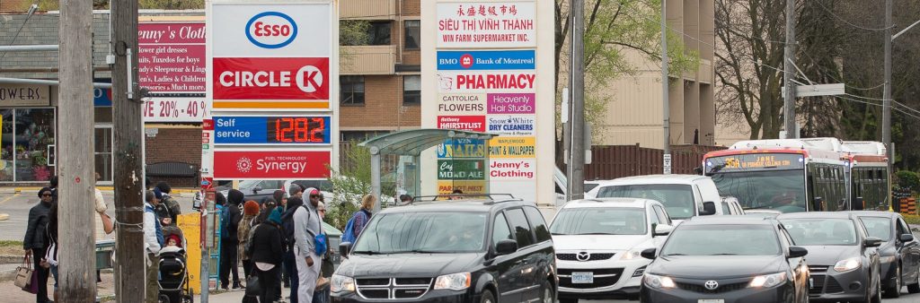
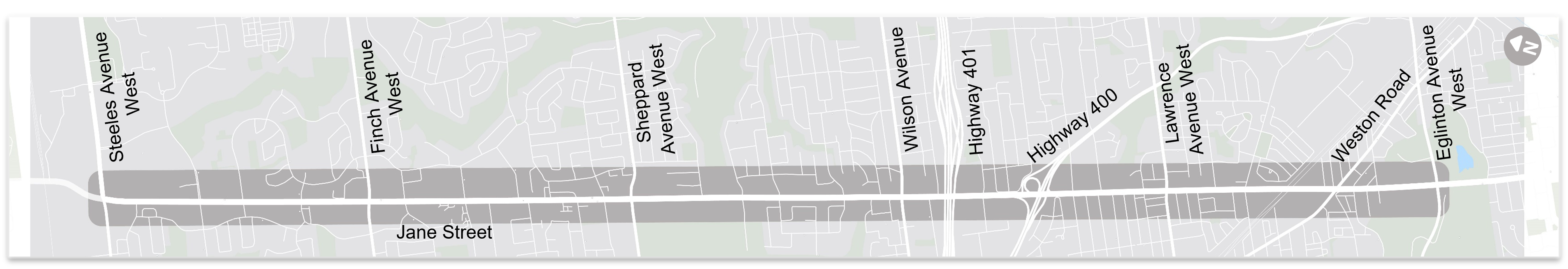
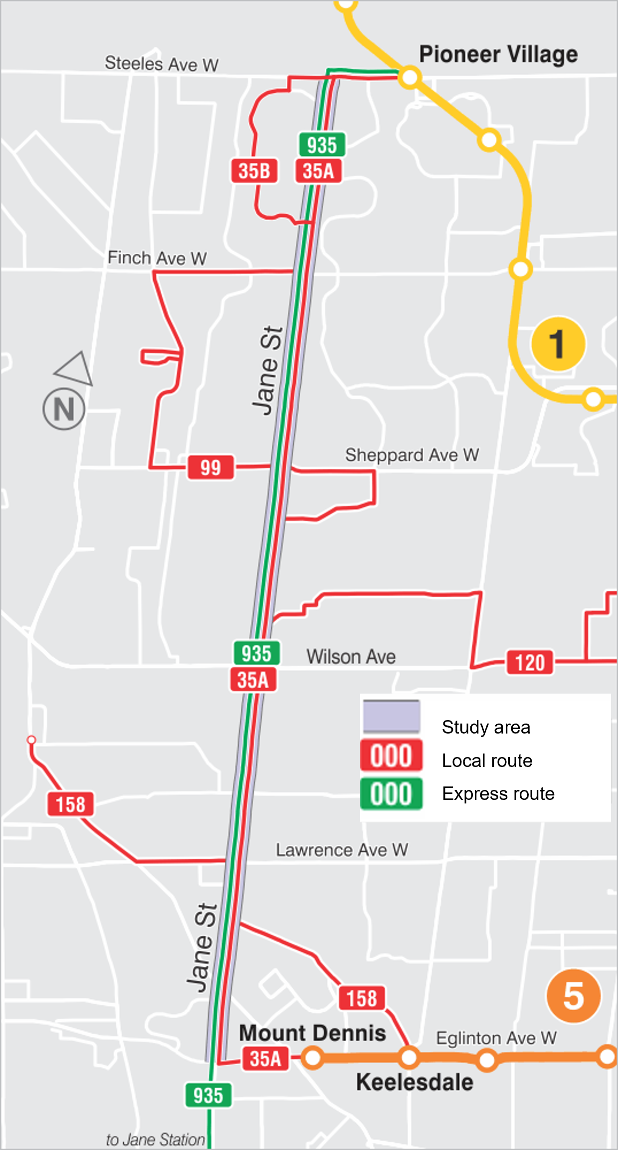
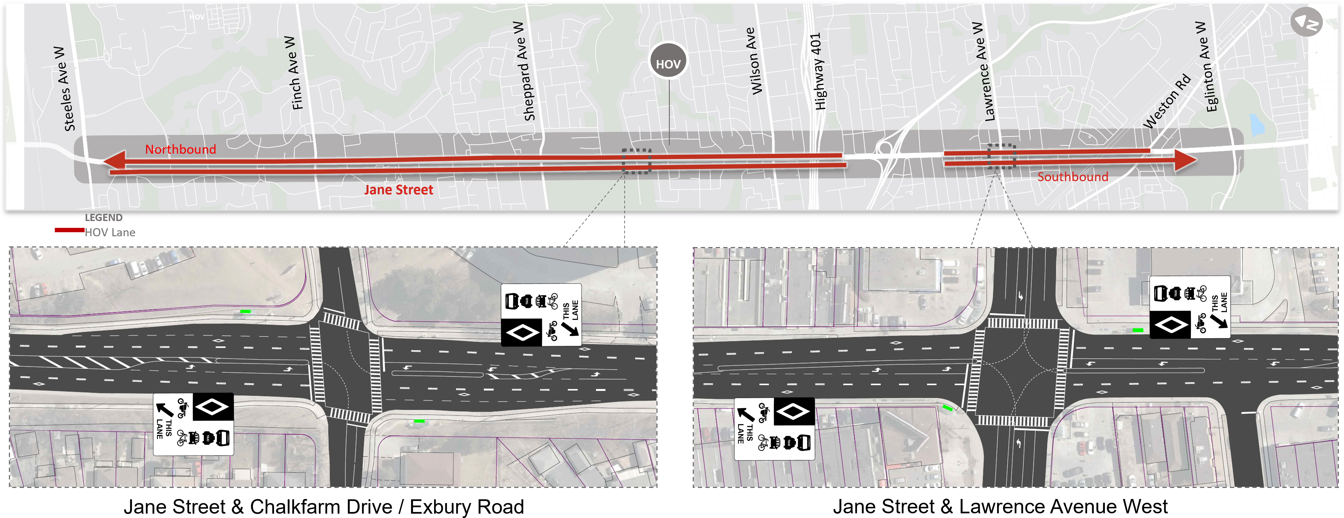
Jane Street, from Steeles Avenue West to Eglinton Avenue West, has been prioritized for the installation of transit priority solutions due to its high ridership, long travel times and its important role in connecting Line 1 Yonge-University (at Pioneer Village Station) and the future Line 5 Eglinton (at Mount Dennis Station). It also passes through many Neighbourhood Improvement Areas. Today, the 35 Jane and 935 Jane bus routes are among the TTC’s most heavily used and play a significant role in moving people around the city.
Get Involved
The City and the TTC will be seeking input from the community and key stakeholders to better understand the Jane Street roadway user needs, challenges, and priorities and advance transit priority solutions. Feedback will be collected in two steps: Step 1: Design Options Review and Step 2: Preferred Option Review.
Public feedback, along with technical considerations and City policies and guidelines will be considered in decisions to be made by staff and City Council.
Study Area
The study area is Jane Street, between Steeles Avenue West to Eglinton Avenue West.
While we aim to provide fully accessible content, there is no text alternative available for some of the content on this site. If you require alternate formats or need assistance understanding our maps, drawings, or any other content, please contact us at rapidto@toronto.ca or 416-338-7797.
Design Options Overview
Roadway Options
The City and TTC are considering the following design options, as well as a potential sixth option combining the options below to account for local challenges and opportunities:
Option #
Option Name
Existing General Lane Configuration
Proposed General Lane Configuration
Proposed Bus Stop Removals
1
Keep Existing Conditions with Minor Road & Public Transit Changes
4 General Purpose Lanes (2 per direction)
No changes
up to 7 northbound
up to 5 southbound
2
Priority Bus Lanes
4 General Purpose Lanes (2 per direction)
2 mixed-traffic lanes (1 per direction)
2 bus lanes (1 per direction)
up to 16 northbound
up to 15 southbound
3
Priority Bus Lanes on Key Segments
4 General Purpose Lanes (2 per direction)
2 mixed-traffic lanes (1 per direction)
2 bus lanes (1 per direction)
up to 16 northbound
up to 15 southbound
4
High Occupancy Vehicle Lanes (3+)
4 General Purpose Lanes (2 per direction)
2 mixed-traffic lanes (1 per direction)
2 HOV lanes (1 per direction)
up to 9 northbound
up to 8 southbound
5
Queue Jump Lanes at Key Intersections
4 General Purpose Lanes (2 per direction)
No changes, except at specific intersections where new or extended right-turn lanes would be built
up to 9 northbound
up to 8 southbound
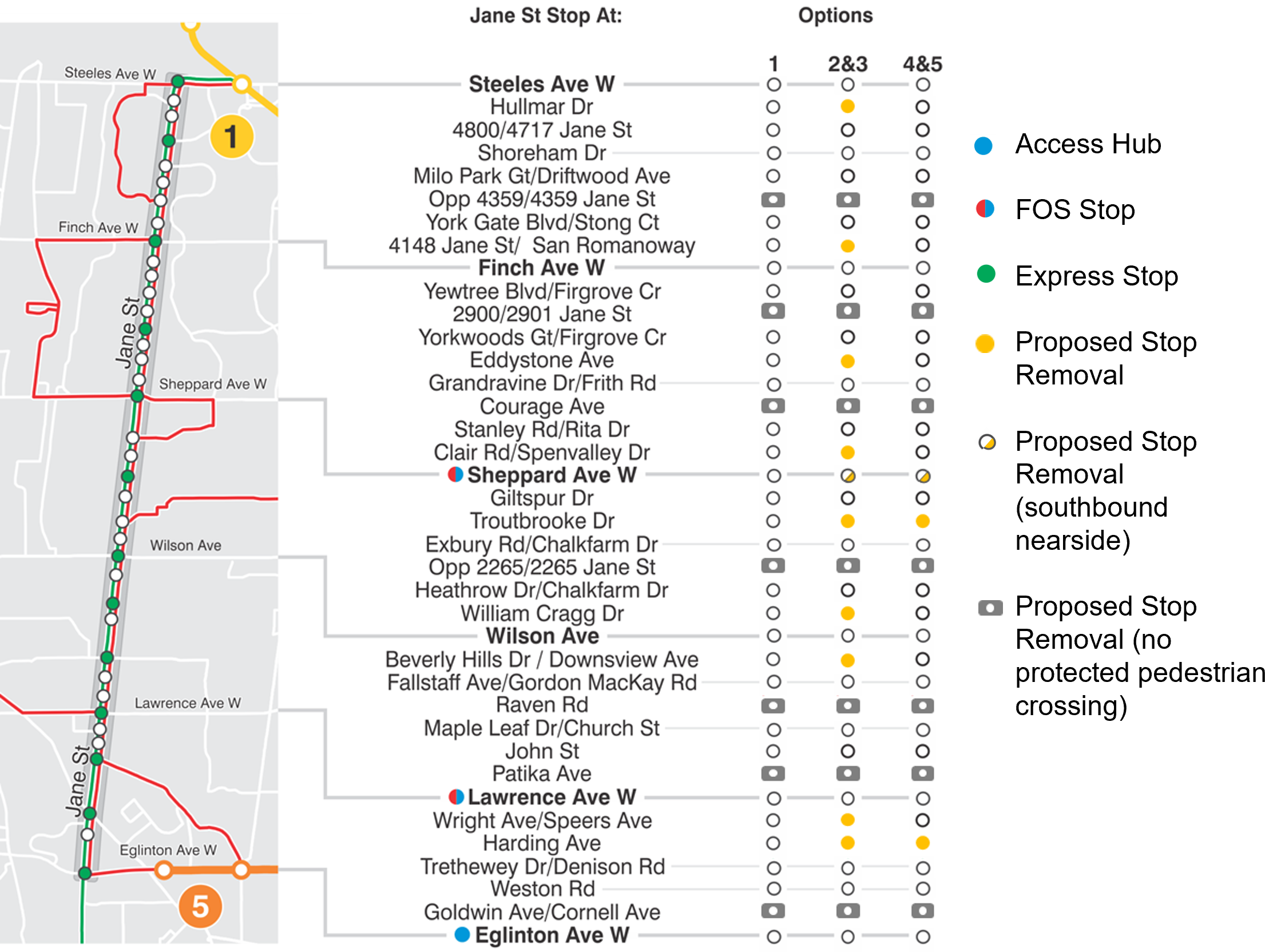
Bus Stop Removals
The City and TTC are also proposing bus stop removals where there is no protected pedestrian crossing. Depending on the option, the City and TTC are also proposing to remove stops that are located closer than TTC service standards or where removals can improve bus reliability and travel times.
Jane Street bus stop changes will be refined through consultation and the selection of a preferred design option.
While we aim to provide fully accessible content, there is no text alternative available for some of the content on this site. If you require alternate formats or need assistance understanding our maps, drawings, or any other content, please contact us at rapidto@toronto.ca or 416-338-7797.
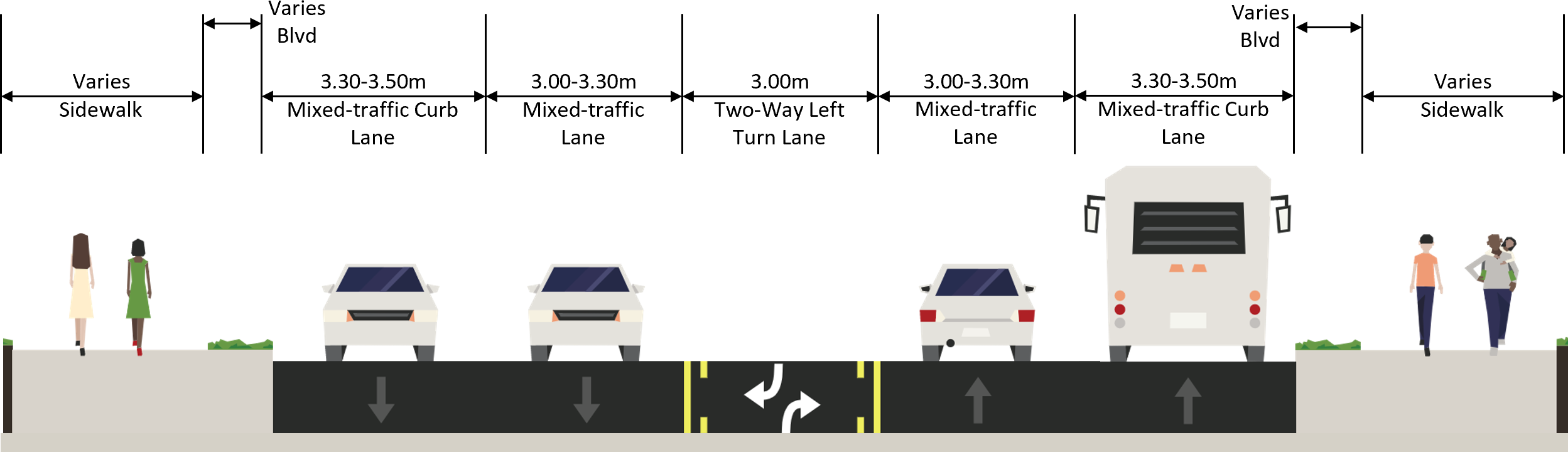
Option 1 – Existing Conditions with Minor Road & Public Transit Changes
Typical Cross-Section
Typical cross-section for existing conditions.
2023+ Changes (After Line 5 Eglinton Opens)
Future local and express routes and connections in the study area.
When Line 5 opens, TTC will modify bus routes in the surrounding area to improve customer connections to and from Line 5. The current 35 Jane route will be split into two routes:
The revised 35 Jane route will operate from Pioneer Village Station along Jane Street to Mount Dennis Station.
A new 27 Jane South route will operate along Jane Street from Mount Dennis Station to Jane Station.
While we aim to provide fully accessible content, there is no text alternative available for some of the content on this site. If you require alternate formats or need assistance understanding our maps, drawings, or any other content, please contact us at rapidto@toronto.ca or 416-338-7797.
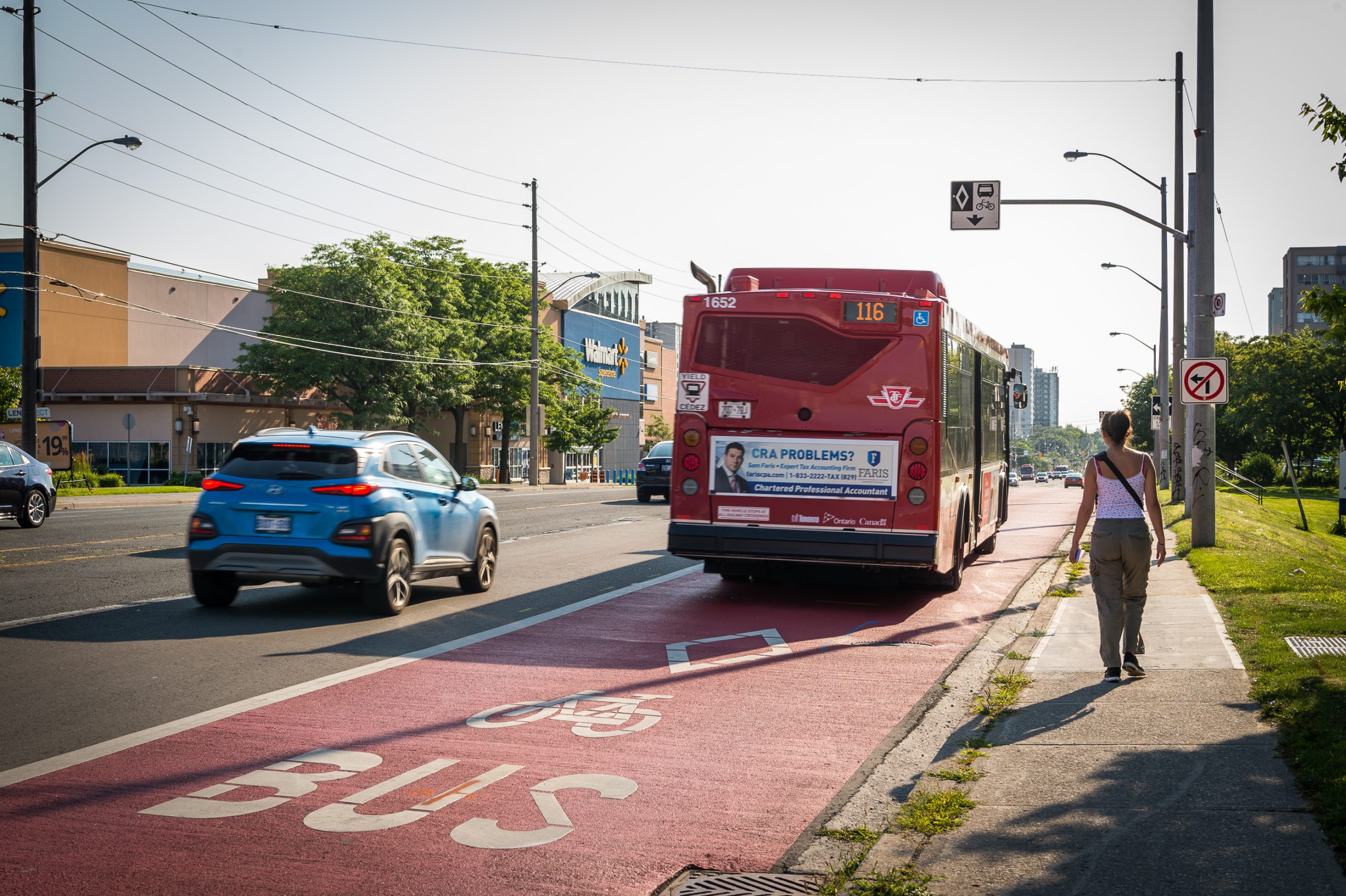
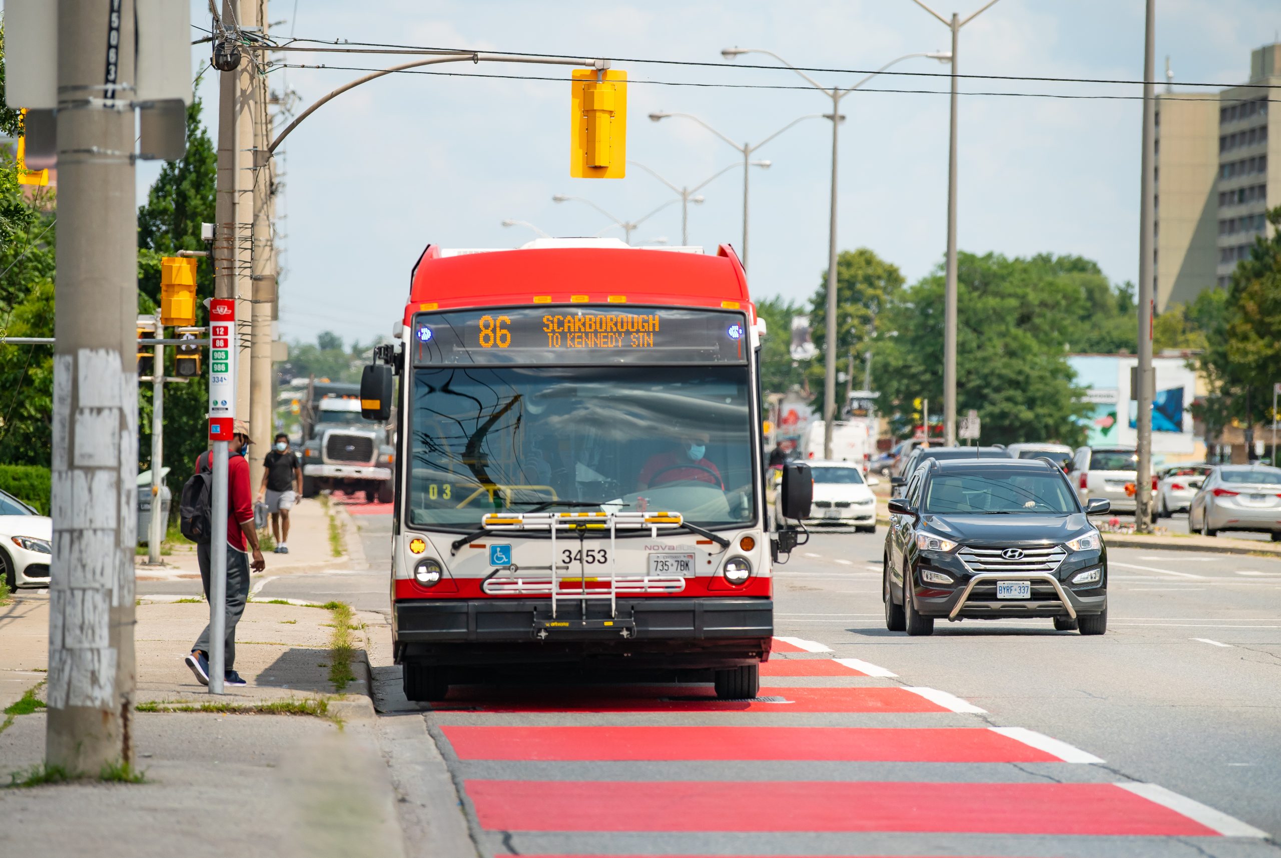
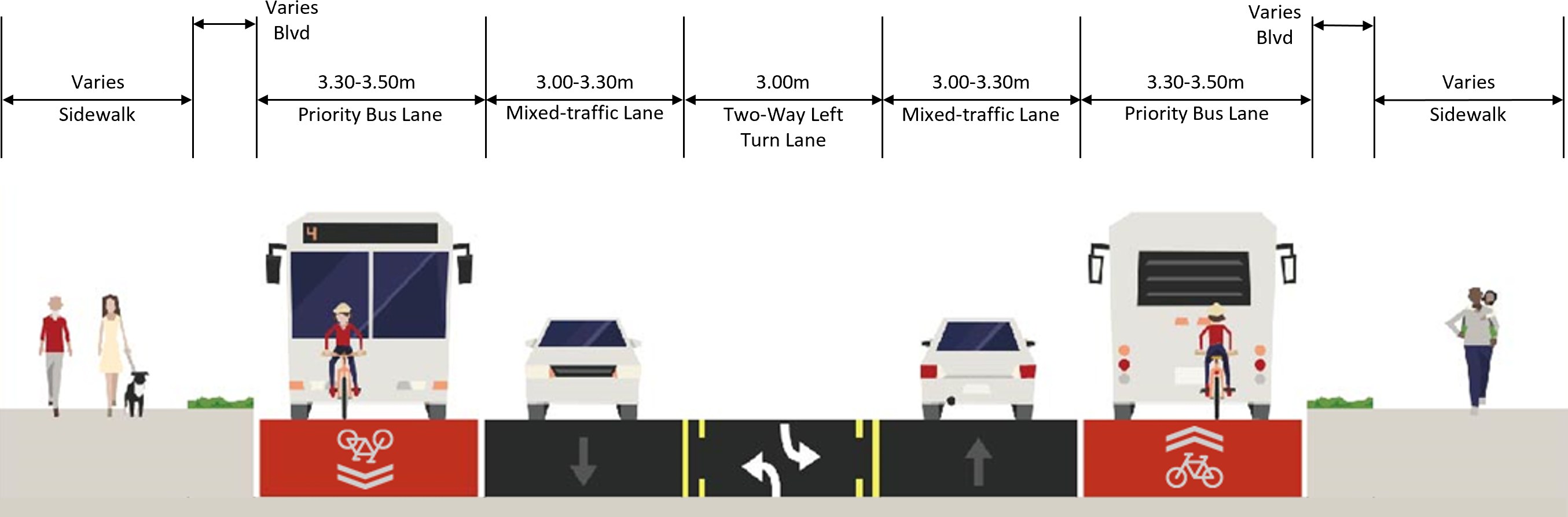
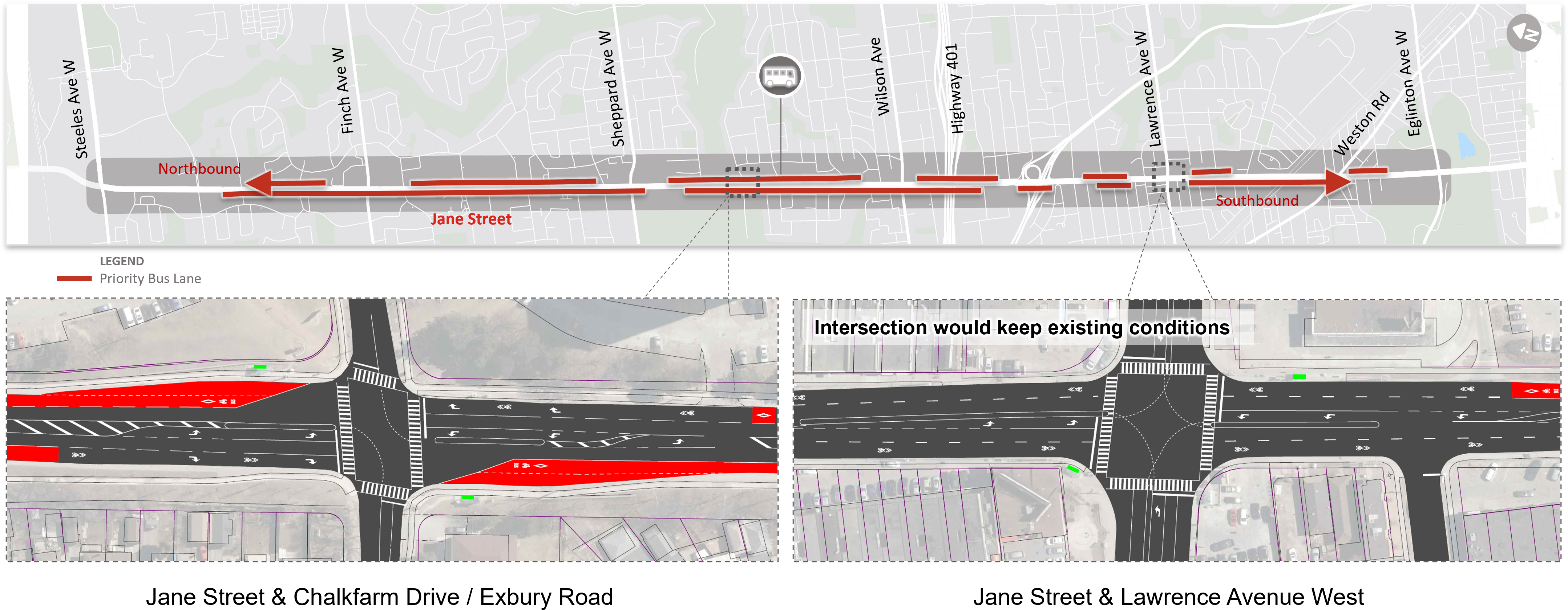
Option 2 – Priority Bus Lanes
Example
A bus using a priority bus lane.
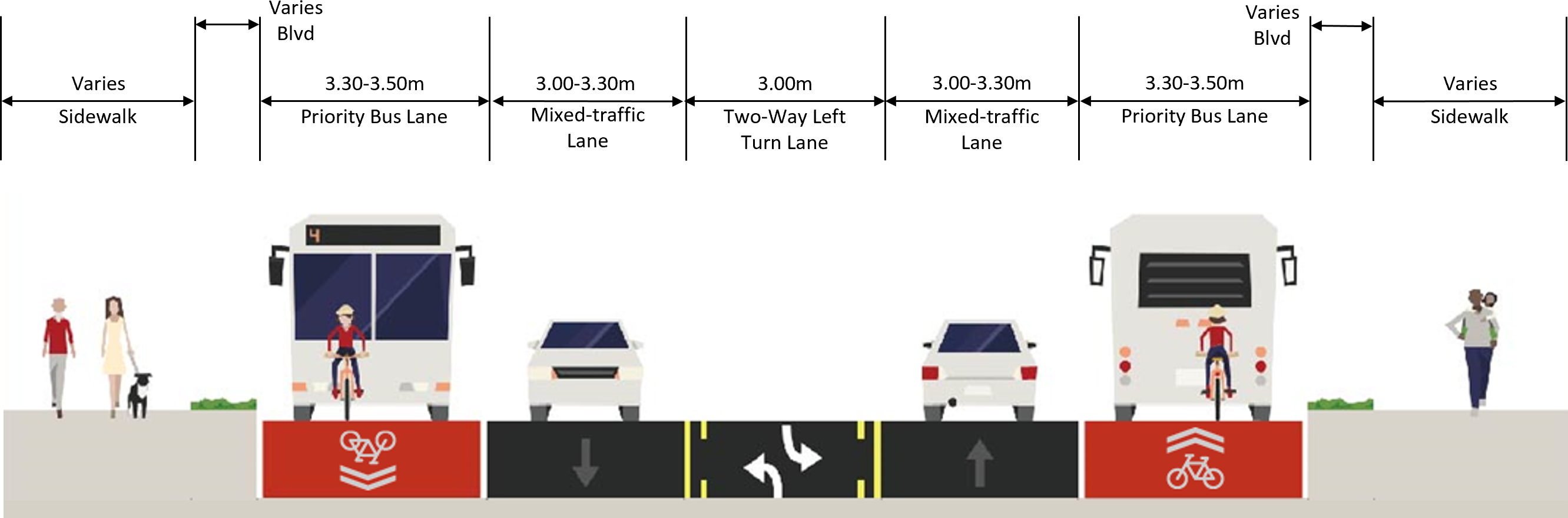
Typical Cross-Section
Typical cross-section for priority bus lanes.
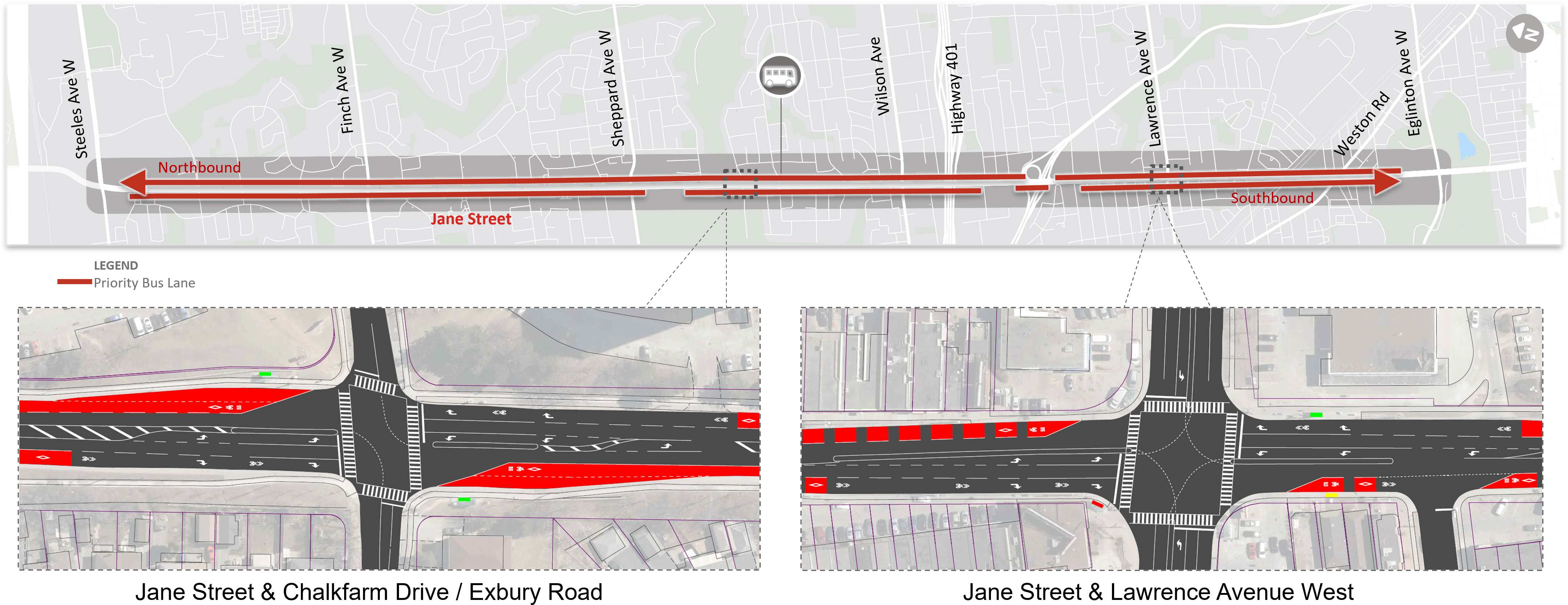
Proposed Locations
Proposed priority bus lane locations.
Key Features
Converts existing mixed traffic curb lanes to priority lanes for buses (including school buses), emergency vehicles and bicycles using red paint
Continuous bus lanes between Steeles Avenue West and Eglinton Avenue West, with breaks near the Highway 400 ramps and Sheppard Avenue West
Cars, trucks and taxis may use the bus lanes to access driveways or make right turns
Up to 9 northbound and 10 southbound bus stops proposed to be removed, in addition to planned stop removals under Option 1
Trade-Offs
Decreases travel times for people riding public transit by 5 minutes during each AM/PM rush hours
Increases average travel distance to bus stop by 55 m (or 55 second walk) as a result of proposed stop removals
Increases travel times for people driving by 3 to 4 minutes during each AM/PM rush hours
Maintains existing sidewalks and street furniture zones
Continuous shared bus lanes reduce exposure to mixed traffic for people cycling
No impacts to properties or driveways
Minor impacts to trees and utilities
Estimated cost of $4.7 million
Quick implementation (1 to 2 years) and no reconstruction required
Proposed Bus Stop Removals
Both Options 2 and 3 propose to remove stops with no pedestrian-protected crossings, optimize stop spacing and maximize benefits of priority bus lanes:
While we aim to provide fully accessible content, there is no text alternative available for some of the content on this site. If you require alternate formats or need assistance understanding our maps, drawings, or any other content, please contact us at rapidto@toronto.ca or 416-338-7797.
Option 3 – Priority Bus Lanes on Key Segments
Example
A bus using a priority bus lane.
Typical Cross-Section
Typical cross-section for priority bus lanes on key segments.
Proposed Locations
Proposed priority bus lane locations.
Key Features
Converts existing mixed traffic curb lanes to priority lanes for buses (including school buses), emergency vehicles and bicycles using red paint – but only applied at key segments of the roadway
Continuous bus lanes between Steeles Avenue West and Eglinton Avenue West, with breaks near the Highway 400 ramps and Sheppard Avenue West
Cars, trucks and taxis may use the bus lanes to access driveways or make right turns
Up to 9 northbound and 10 southbound bus stops proposed to be removed, in addition to planned stop removals under Option 1
Trade-Offs
Decreases travel times for people riding transit by 4 minutes during each AM/PM rush hours
Increases average travel distance to bus stop by 55 m (or 55 second walk) as a result of proposed stop removals
Increases travel times for people driving by 2 to 3 minutes during AM/PM rush hours
Maintains existing sidewalks and street furniture zones
Shared bus lanes reduce cyclists’ exposure to mixed traffic, but lane breaks reduce overall benefit
No impacts to properties or driveways
Minor impacts to trees and utilities
Estimated cost of $3.9 million
Quick implementation (1 to 2 years) and no reconstruction required
Proposed Bus Stop Removals
Both Options 2 and 3 propose to remove stops with no pedestrian-protected crossings, optimize stop spacing and maximize benefits of priority bus lanes:
While we aim to provide fully accessible content, there is no text alternative available for some of the content on this site. If you require alternate formats or need assistance understanding our maps, drawings, or any other content, please contact us at rapidto@toronto.ca or 416-338-7797.
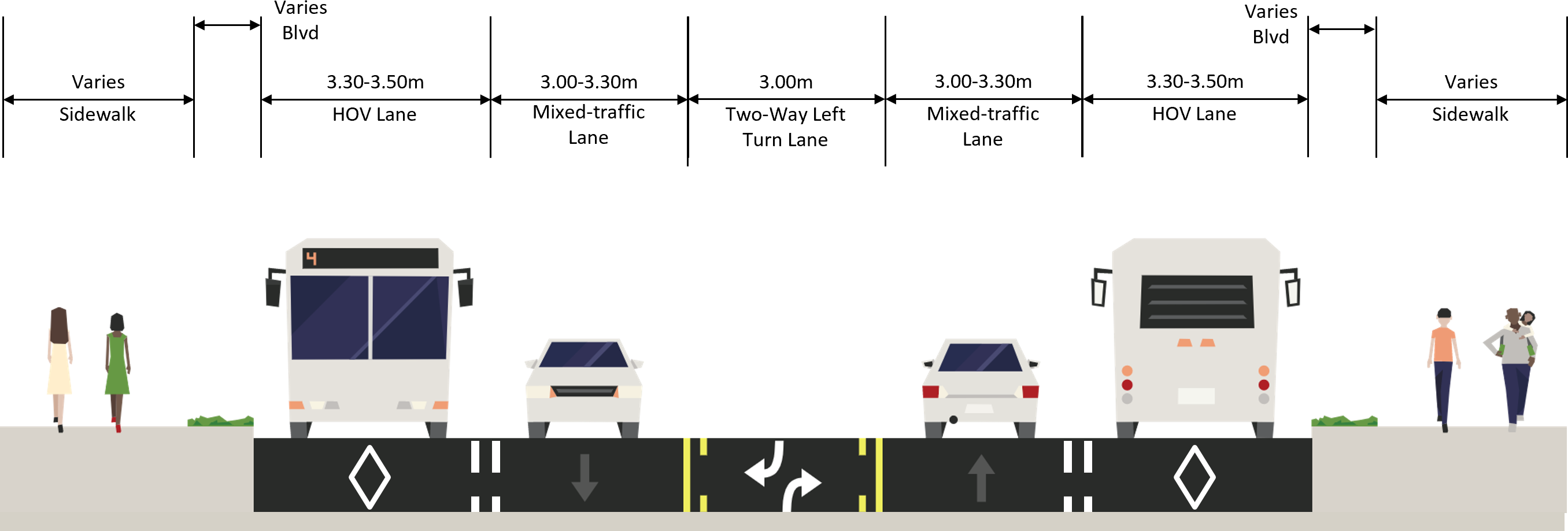
Option 4 – High Occupancy Vehicle Lanes (3+)
Example
A bus using a High Occupancy Vehicle lane.
Typical Cross-Section
Typical cross-section for High Occupancy Vehicle lanes.
Proposed Locations
Proposed High Occupancy Vehicle lane locations.
Key Features
Converts existing mixed traffic curb lanes to priority lanes for High Occupancy Vehicles (HOV 3+), taxis, motorcycles and bicycles
Continuous HOV lanes between Steeles Avenue West and Eglinton Avenue West, with a break near the Highway 400 ramps
All vehicles may use the HOV lanes to access driveways or make right turns
Up to 2 northbound and 3 southbound bus stops proposed to be removed, in addition to planned stop removals under Option 1
Staff will investigate HOV 2+ if the preferred design includes HOV lanes
Trade-Offs
Decreases travel times for people riding public transit by 2 to 3 minutes during each AM/PM rush hours
Increases average travel distance to bus stop by 45 m (or 45 second walk) as a result of proposed stop removals
Increases travel times for people driving by 2 to 3 minutes during AM/PM rush hours
Maintains existing sidewalks and street furniture zones
HOV lanes provide access to people cycling but exposure to mixed traffic reduce overall benefits
No impacts to properties or driveways
Minor impacts to trees and utilities
Estimated cost of $2.5 million
Quick implementation (1 to 2 years), no reconstruction required
Proposed Bus Stop Removals
Both Options 4 and 5 propose to remove stops with no pedestrian-protected crossings and optimize stop spacing:
While we aim to provide fully accessible content, there is no text alternative available for some of the content on this site. If you require alternate formats or need assistance understanding our maps, drawings, or any other content, please contact us at rapidto@toronto.ca or 416-338-7797.
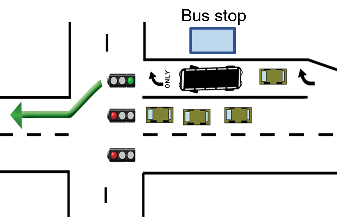
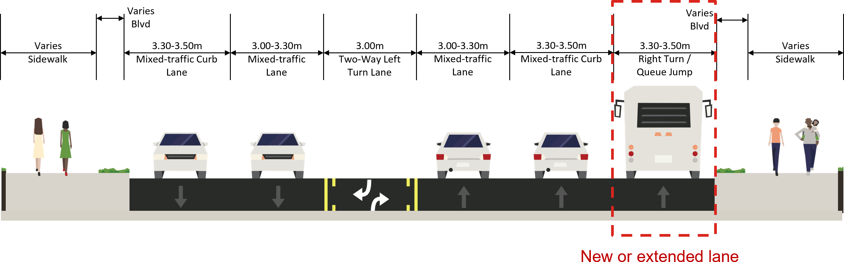
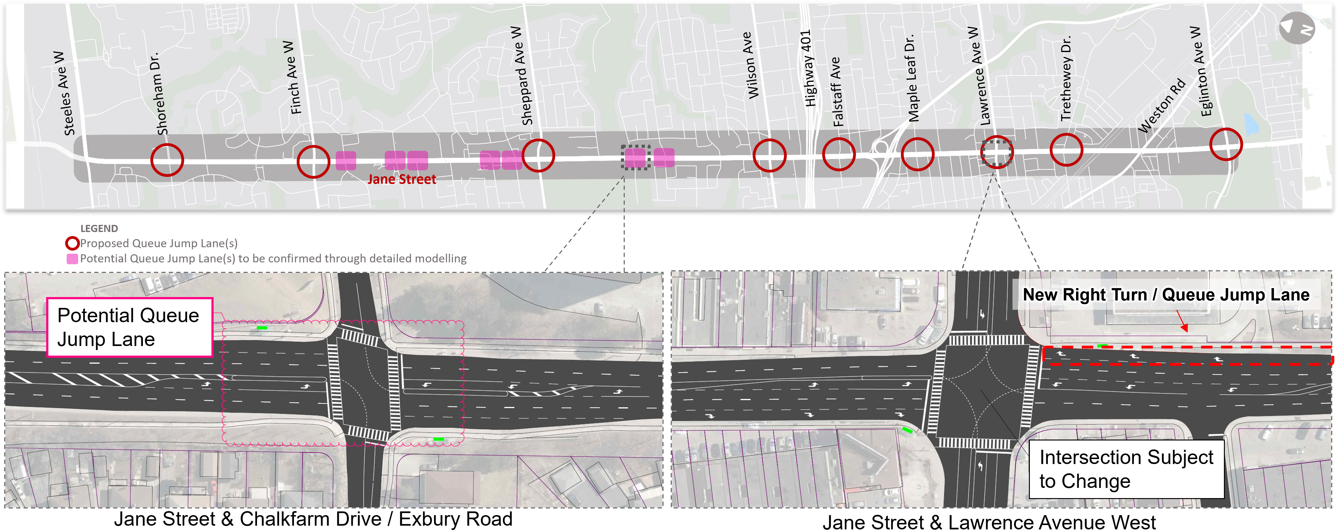
Option 5 – Queue Jump Lanes at Key Intersections
Example
A bus using a queue jump lane.
Typical Cross-Section
Typical cross-section for queue jump lanes at key intersections.
Proposed Locations
Proposed queue jump lane locations.
Key Features
Construct queue jump lanes by adding or extending right-turn lanes at key intersections to give buses a head start
Cars, trucks and taxis may use the queue jump lanes to access driveways or make right turns
Up to 2 northbound and 3 southbound bus stops proposed be removed, in addition to planned stop removals under Option 1
Trade-Offs
Decreases travel times for people riding public transit by 2 minutes during each AM/PM rush hours
Increase average travel distance to bus stop by 44 m (or 44 second walk) as a result of proposed stop removals
Minimal impact on traffic travel time
Localized impacts to existing sidewalks and street furniture zones at key locations
May introduce additional conflicts between cyclists and right-turning vehicles at new queue jump lane locations
No impacts to properties
Minor impacts to driveways at a few intersection locations
Localized impacts to trees and utilities
Estimated cost of $10.7 million
Longer implementation (3 to 4 years), with road reconstruction required
Proposed Bus Stop Removals
Both Options 4 and 5 propose to remove stops with no pedestrian-protected crossings and optimize stop spacing:
While we aim to provide fully accessible content, there is no text alternative available for some of the content on this site. If you require alternate formats or need assistance understanding our maps, drawings, or any other content, please contact us at rapidto@toronto.ca or 416-338-7797.
Public Consultation
Virtual Public Meeting
A virtual public meeting was held on March 8, 2023, and attended by about 50 people. The meeting included a presentation followed by a Question and Answer period.
Meeting minutes will be available soon.
Public Drop-In Events
Two public drop-in events were held on March 22 and 28, 2023, and attended by 51 participants. The public drop-in events an in-person opportunity to review display panels and detailed drawings at participants’ leisure. Members of the project team were available to help answer any questions and record comments.
The City and TTC are exploring bus priority solutions along Jane Street that take into account the unique needs of the community. This study is being coordinated with other studies along Jane Street.
TTC Service on Jane Street
43,000 TTC customers on an average weekday
15 per cent to 26 per cent of afternoon TTC bus trips are on time
37 per cent of people living near Jane Street rely on public transit to get around
Riding public transit takes 66 per cent longer than driving
Serves seven Neighbourhood Improvement Areas
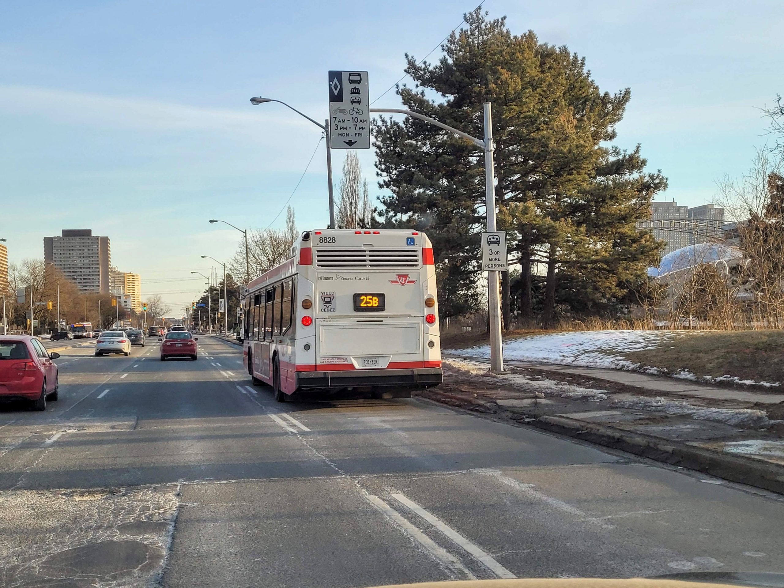
The TTC and City have already made operational improvements through optimized traffic signals and signage, installation of transit signal priority, parking restrictions and bus bays.
Road Safety Audit
A Road Safety Audit was completed through a different consultant team to help identify safety design improvements for all options. An In-Service Safety Review is also underway using an equity-informed lens to identify the safety needs of local residents. Recommended safety improvements will be reflected in the preferred option.
Future Bikeways Improvements
Planned road reconstruction and resurfacing are scheduled for 2027+. These works provide an opportunity to explore dedicated bikeways through the Jane Street-Keele Street Major City-wide Cycling Route Feasibility Study.
Step 2 consultation will explore opportunities to space-proof potential future separated bikeway on the preferred transit alternative. Recommendations will not preclude ability to install separated bikeways in the future where the road right-of-way allows.