The Official Plan must be read in its entirety. Click the “Expand All +” button to read the full contents of this chapter.
The “Policies (Shaded Text)” within chapter two contains policies of the Official Plan. Unshaded text and sidebars (small text) within chapter two is provided to give context and background and assist in understanding the intent of policies but are not policies.
Toronto’s future is one of growth, of rebuilding, of reurbanizing and of regenerating the City within an existing urban structure that is not easy to change.
Population growth is needed to support economic growth and social development within the City and to contribute to a better future for the Greater Toronto and Hamilton Area [GTHA]. A healthier Toronto will grow from a successful strategy to attract more residents and more jobs to the City.
The principles that follow for steering growth and change to some parts of the City, while protecting our neighbourhoods and green spaces from development pressures, are the first layer of a sound planning process for shaping the City’s future. The integrated land use and transportation policies presented in this Chapter are key to achieving this objective.
“… (the urban vision) must strike a balance between the requirements of the community, the economy and the environment. Compatibility between land use and transportation is central to that balance. Therefore, while transportation is a major part of an urban area vision, the urban vision is much broader.”A New Vision For Urban Transportation (1993) Transportation Association of Canada
Chapters Three and Four present additional policy directions that will guide our decision making. Together, these planning and development policies aim to: nurture our residential neighbourhoods, parks, ravines and natural areas; improve air, soil and water quality while growing our economy; and encourage redevelopment of the highest quality.
The success of this growth management strategy will be determined not only by the amount and location of population and employment growth, but also by the degree to which we have advanced Council’s sustainability principles in shaping growth.
Toronto cannot plan in isolation or expect to stand alone in dealing with the effects of urban growth. Our view of the quality of urban life tends to be based on the local conditions in our own neighbourhoods. These conditions are in turn affected by events happening in the larger region. The quality of the air, water, services and region-wide transport systems all affect the quality of life in our neighbourhood, where we work and where we play. The way in which growth and change are managed in Toronto must mesh with that of our neighbours because we are integrally linked in many ways:
Toronto’s Growth Prospects The City of Toronto is forecast to grow to 3.65 million residents and 1.98 million jobs by the year 2051. The Provincial Growth Plan forecast represents 831,000 additional residents and 371,000 additional jobs after 2016. This Plan takes the current Growth Plan forecast as a minimum expectation. The policy framework found here prepares the City to realize this growth, or even more, depending on the success of this Plan in creating dynamic transit oriented mixed use centres, corridors, and other manners of intensification.GreenbeltThe Greenbelt protects agricultural and environmentally sensitive land within and around the Greater Toronto and Hamilton Area from urban development. It protects over 1.8 million acres [7300 km2] of land including the Niagara Escarpment, the Oak Ridges Moraine and the Protected Countryside. River valleys that run through existing and approved urban areas and link the Greenbelt to Lake Ontario and other inland lakes provide ecological and hydrological functions that are important to the long-term health of the Greenbelt.Reurbanization – Better Growth ManagementA co-ordinated approach to the redevelopment of land within the existing urban fabric to accommodate regional growth is known as reurbanization. By improving and making better use of existing urban infrastructure and services before introducing new ones on the urban fringe, reurbanization helps to reduce our demands on nature and improve the liveability of the urban region by:
By shaping the urban fabric of the GTHA into a system of mixed use centres and corridors linked by good transit service we will build better communities, strengthen economic conditions and improve air and water quality.
2.1.1 Toronto will work with neighbouring municipalities, the Province of Ontario and Metrolinx to address mutual challenges and to implement the Provincial framework for dealing with growth across the GTHA which:
2.1.2. Toronto will consult with adjacent municipalities when making decisions regarding matters of mutual interest such as shared transportation corridors and cross-boundary service provision.
2.1.3. Toronto is forecast to accommodate 3.65 million residents and 1.98 million jobs by the year 2051.
In keeping with the vision for a more liveable Greater Toronto and Hamilton Area, future growth within Toronto will be steered to areas which are well served by transit, the existing road network and which have a number of properties with redevelopment potential. Generally, the growth areas are locations where good transit capacity can be provided along frequent bus and streetcar routes and at higher-order transit stations. Areas that can best accommodate this growth are shown on Map 2: Downtown, including the Central Waterfront, the Centres, the Avenues and the Employment Areas. A vibrant mix of residential and employment growth is seen for the Downtown and the Centres. The mixed use Avenues will emphasize residential growth, while the Employment Areas will focus on job intensification.
The Three Lenses – A New Approach to Planning The process of managing growth and change will be different in different parts of the City because some areas will have a greater or lesser capacity to accommodate growth. The scale of change will vary depending on the existing conditions of land use, infrastructure needs and opportunities for realizing reurbanization goals.We can view Toronto’s future through one of three different “lenses”.
On the other hand, the approach to managing change in Toronto’s neighbourhoods and green space system, emphasizes maintenance and enhancement of assets.
Access is the ability for everyone, regardless of their status in society, to use or receive resources, goods and services in an equitable manner and fully participate in all aspects of society. Ensuring access requires the removal of barriers associated with literacy, language, culture, geography, education, socio-economic status as well as mental and physical ability. Providing an accessible transportation system contributes to the success of a healthy and socially inclusive community and economy.
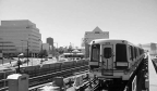
The growth areas are knitted together by the City’s transportation system, the viability of which is crucial to supporting the growing travel needs of residents, workers, students and visitors over the next 30 years. The transportation system consists of connected and integrated networks, elements of which include:
The Plan protects the integrity of the City’s transportation system and provides for its planned expansion through the designation of public rights-of-way and transit corridors as described in the maps and schedules and the policy on laneways. Furthermore, the Plan indicates areas for change, such as sections of streets that are prime candidates for bus and streetcar priority measures (shown on Map 5), and means by which street space could be rebalanced.
Higher-order transit is transit that generally operates in partially or completely dedicated rights-of-way, outside of mixed traffic, and therefore can achieve levels of speed and reliability greater than mixed-traffic transit. Higher-order transit can include heavy rail (such as subways and inter-city rail), light rail, and buses in dedicated rights-of-way. Source: Growth Plan (2019).Space-efficient transportation modes are ones which move a comparatively large number of people or quantity of goods relative to the space they require. Examples of space efficient transportation modes for passengers include walking, cycling and transit. Examples of space-efficient transportation modes for goods include full truck loads.
The integration of transportation and land use planning is critical to achieving the overall aim of increasing access to opportunities throughout the City. Transportation accessibility – a measure of the ease of reaching activity locations – has two components: mobility (transportation) and proximity (land use). Increasing mobility by providing modal choice, and/or increasing the speed, timeliness or directness of travel allows more trips to be made within a given time, whereas increasing proximity through greater mixing of uses and/or higher densities achieves the same effect by shortening trip lengths. The policies of this Plan reflect the importance of mutually supportive transportation and land use policies that combine the mechanisms of mobility and proximity to maximize access to opportunities.
Consistent with the Metrolinx Regional Transportation Plan, this Plan supports a system of Mobility Hubs at key intersections in the regional higher-order transit network that provides travelers with enhanced mobility choices and creates focal points for higher density development. Detailed master plans for Mobility Hubs will be developed in relation to the timing of higher-order transit improvements and will respect the Metrolinx “Mobility Hub Guidelines” and conform to the policies of this Plan.
State of Good RepairThe City of Toronto has a large, complex and diverse range of infrastructure assets on which it relies to deliver essential services to the community. It is important that these assets continue to meet acceptable levels of performance and support the delivery of services in a sustainable manner. The City’s asset management planning aligns with the Official Plan and its key principles are: holistic, systematic, sustainable, integrated, risk-based and continual improvement and innovation.Vision Zero is the application of the safe systems approach to road safety. This approach recognizes that the human body is vulnerable to injury and that humans make mistakes. In July 2016, City Council approved the Vision Zero Road Safety Plan (RSP), an action plan focused on reducing traffic-related fatalities and serious injuries on Toronto’s streets. In July 2019, Council approved Vision Zero 2.0 – Road Safety Plan Update, recommending a set of more extensive, more proactive and more targeted initiatives, informed by data and aimed at eliminating serious injury and fatalities on Toronto’s roads. The RSP follows a widely accepted, holistic approach to improving road safety which includes 5 E’s:
The Metrolinx Regional Transportation Plan designates a system of Mobility Hubs across the Greater Toronto and Hamilton Area that distinguishes between “anchor hubs” and “gateway hubs”. Anchor hubs have a strategic importance due to their relationship with urban growth centres and/or their role as major international gateways. The more numerous gateway hubs are located at the interchange between two or more current or planned regional rapid transit lines as identified in “The Big Move”. The Mobility Hub system is designed to reinforce the land use/transportation policies of the Province’s Growth Plan for the Greater Golden Horseshoe, particularly in terms of focusing development growth around major transit station areas.
2.2.1. This Plan will create a better urban environment, a competitive local economy and a more socially cohesive and equitable city through the integration and coordination of transportation planning and land use planning by:
2.2.2. Growth will be directed to the Centres, Avenues, Employment Areas and the Downtown as shown on Map 2 in order to:
2.2.3. New development on lands adjacent to existing or planned transportation corridors and facilities is required to be compatible with, and supportive of, the long-term purposes of the corridors and facilities and be designed to avoid, mitigate or minimize negative impacts on and from the transportation corridors and facilities.
Improvements to key elements of the transportation system will also be needed to support the City’s growth, such as renovating transit stations to increase and upgrade their passenger handling capacity and reconfiguring streets to move more people and goods within the existing space. A number of other changes related to alterations and additions to the street network and new and improved connections to local and regional transit services are detailed in Secondary Plans such as the North York Centre and the Scarborough Centre plans. The broad objective is to provide a wide range of sustainable transportation options for goods and people of all ages, abilities and means that are safe, seamlessly connected, convenient, affordable and economically competitive to all parts of the city. Within this context, the transportation infrastructure policies of the Plan are designed to address three prime areas of concern:
The network of public rights-of-way which accommodates the City’s streets and laneways is a vital component of the public realm, serving to connect people and places and to support existing and future development and economic growth. These rights-of-way provide space for a variety of users, including pedestrians, cyclists, transit riders, motorists, goods movement and emergency services as well as providing the location of many different uses, including civic events, boulevard cafes, transit shelters and street furniture, street trees, snow and stormwater management, parking and utilities. There is a need to protect and develop the City’s network of streets and laneways and to ensure that the associated rights-of-way are not closed to public use.
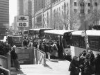
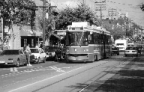
The City will provide better and increased transit service in support of the overall objective of achieving a sustainable pattern of growth and development. Transit networks function best when the connections between services and to the active transportation network are convenient, safe and seamless. To this end, Toronto continues to develop a fully integrated system of transit services that combines the higher-order transit network with the network of bus and streetcar routes in a manner that delivers better transit service to all areas of the City, and connects with other transit services in the broader region. Improving connections between local and inter-regional services is key to developing a fully integrated transit system across the City.

New higher-order transit facilities represent major capital investments that have long-lasting effects on the pattern of access to opportunities. Higher-order transit investments will maintain and enhance the existing transit network and be planned to serve people, strengthen places, and support prosperity.
Bus and streetcar routes provide transit services across most parts of the City as complements to, and extensions of, the higher-order transit network. The majority of transit trips in the city involve a ride on a bus or streetcar. Recognizing their importance, the network of bus and streetcar routes will be enhanced to improve service reliability and travel times by reducing interference from other road traffic through the implementation of transit priority measures, and by improving operational efficiency and rider convenience by such means as providing more frequent service.

Toronto’s transit network is important to the success of the broader region, as recognized in the Metrolinx Regional Transportation Plan (RTP). The RTP supports the development of a Frequent Rapid Transit Network which incorporates many existing and planned services within Toronto.
2.2.4. The City’s transportation system will be maintained and developed to support the growth management objectives of this Plan by:
2.2.5. The City’s network of streets and laneways will be maintained and developed to support the growth management objectives of this Plan by:
2.2.6 The City will work with its partners to develop and implement a comprehensive transit network plan to achieve the advantages of a resilient, fully integrated, comprehensive transportation system and deliver safe, accessible, seamlessly connected, convenient, frequent, reliable, fast, affordable and comfortable transit service to all parts of the city. The comprehensive transit network will comprise higher-order transit routes serving the principal corridors of demand integrated with a grid-network of high quality bus and streetcar routes and be supported by seamless connections to the active transportation network.
2.2.7 The City will work with its partners to improve and expand the higher-order transit network by:
2.2.8 The City will work with its partners to maintain and enhance bus and streetcar services to deliver safe, accessible, seamlessly connected, convenient, frequent, reliable, fast, affordable and comfortable transit service to all parts of the city through such measures as:
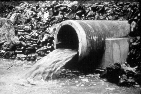
Water, wastewater and stormwater management services are important foundations for growth in a healthy city, as well as for maintaining the quality of life in areas that will not see much growth. Additional infrastructure is needed to provide clean, safe drinking water to everyone, and to manage and treat sewage and stormwater before it enters watercourses and the Lake. This may mean bigger pipes, stormwater facilities and treatment plants in some areas. It is also important to use less water in our homes and businesses, to manage rainwater where it falls and to use our streams and rivers more effectively to minimize flooding in built up areas. Implementing green street designs and initiatives will also help manage stormwater and create healthier environments.
2.2.9 The City’s water, wastewater and stormwater management infrastructure will be maintained and developed to support the city building objectives of this Plan by:
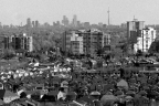
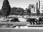
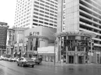
Toronto has only one downtown. It plays a vital role as the city’s economic and cultural hub and is critical to the health and prosperity of the entire region that surrounds it.
Downtown, with its recognizable skyline, is Toronto’s image to the world and to itself: cosmopolitan, civil, urbane, diverse and liveable. It is the oldest, most dense and most complex part of the urban landscape, with a rich variety of building forms and activities.
Downtown is the place where our city’s history was born and where much of our future will be shaped. It is an area that has been inhabited by Indigenous peoples for nearly 15,000 years. Built and cultural heritage can be seen in Downtown’s significant buildings, districts, landmarks, landscapes and archaeological sites. The conservation and promotion of cultural heritage resources – of First Nations and Métis communities and of settlers – should guide future planning and investment decisions Downtown.
Toronto’s Downtown includes a portion of the Central Waterfront, which offers unique opportunities for substantial employment and residential growth and for upgrades and expansion to the public realm and community facilities as waterfront revitalization proceeds. Both Downtown and the Central Waterfront are guided by their own Secondary Plans.
The Province’s Growth Plan for the Greater Golden Horseshoe (2019) identified a Downtown Toronto Urban Growth Centre and establishes a minimum density target for this area.
Downtown Toronto is the most accessible business location in the Greater Golden Horseshoe and the largest employment centre in the regional economy. Thousands of students, shoppers and visitors also spend time in Downtown Toronto every day. The economic strength of Downtown arises not only from the largest concentration of office towers in the nation but also from the myriad of other activities located here:

The concentration, intensity and interaction among all these activities, the access to national and global markets, connections to decision makers in business and government, the ability to easily walk around interesting and safe streets, all give rise to a synergy that fosters innovation, creativity and an atmosphere of success.
While we anticipate and want Downtown to accommodate growth, this growth will not be spread uniformly across the whole of Downtown. In fact, there are many communities Downtown that will not experience much physical change at all. While the population mix within these communities will change over time, their physical character will remain largely unchanged.
Other parts of Downtown will see the development of vertical mixed-use communities in predominantly mid-rise and tall buildings. Mixed use is a key ingredient to the successful functioning of Downtown that creates “accessibility through proximity”. Every home built within the Downtown area offsets the need for in-bound commuting each day.
The Financial District, the Health Sciences District, the institutional complexes of government and higher learning, and the creative industries and cultural sector economies centred on King-Spadina and King-Parliament are the prime areas of job growth.
Toronto’s Financial District is Canada’s premier centre of commerce. This is where commercial activity is most intense with a concentration of large architecturally significant landmark buildings. Jobs are concentrated in large office buildings tightly clustered within walking distance of Union Station and several subway stations, the majority of them connected to one another through the climate-controlled PATH network.
Many of the jobs located Downtown are in government, education or health services, and most of these are located in Institutional Areas north of the Financial District. In addition to being the seat of government for the City and the Province, Downtown is home to large teaching hospitals and other health services that have a regional draw. Equally important are campuses of higher learning, including the University of Toronto, Ryerson University, George Brown College and OCAD University.

There is also an important cluster of arts and culture activities Downtown. From museums, galleries, theatres and performance halls of national significance to small theatre, music and dance companies and individual artists, Toronto’s Downtown helps to shape Canadian culture. The City needs to support the important economic contribution that is forged here through arts and culture.
Many Downtown activities are interdependent. These activities are linked through Downtown’s public realm: the streets, sidewalks and pedestrian connections, parks, squares, open spaces, natural areas and other publicly accessible spaces. This is where people experience public life most directly. The key to successfully shaping Downtown’s future is to improve connections within the public realm and create places that foster public life.
Well-designed connections between the core of the city and the Central Waterfront are important to the vitality of Downtown as a great place to live, work and visit and as an attractive and competitive business location. The renewed Central Waterfront will create new opportunities for business development and contribute in an important way to the image of Downtown and the entire city.
2.2.1.1. The Downtown Toronto Urban Growth Centre will be planned to optimize the public investment in higher order transit within the Centre and thus should exceed the minimum combined gross density target of 400 residents and jobs per hectare set out in the Growth Plan for the Greater Golden Horseshoe, 2019. Map 6 shows the boundaries of the Downtown Toronto Urban Growth Centre, the Financial District and the Health Sciences District. Map 6A shows the Downtown Plan and the Central Waterfront Secondary Plan boundaries.
2.2.1.2. Downtown will continue to be shaped as the largest economic node in the city and the region by accommodating development that:
2.2.1.3. Investment in Downtown on the part of the City, other levels of government and public/private partnerships will be sought to:
Downtown is seen as an attractive place to live. New housing Downtown makes an important contribution to the economic health of the City. There is a great degree of social and economic diversity among the Downtown population, accompanied by a diversity of housing types, tenures and affordability. Different communities have different needs in terms of community services and support. Downtown is an inclusive place for vulnerable people and, as growth continues, there is a need to address the threat of displacement and increase supportive services and affordable housing. Planning for Downtown community services and facilities cannot follow a broad city-wide template.

As Downtown’s population increases, more residents are using its parks and open spaces as their shared backyards and gathering areas. They are joined by hundreds of thousands of workers and visitors who use the same public spaces to gather, celebrate and be active. The development of a connected and expanded system of high-quality public spaces for people and healthy, diverse natural systems will keep Downtown liveable as it intensifies.
Downtown is where our history is richest, but it is also where we continue to rebuild to accommodate a growing economy and a changing society. Given that this is one place in Toronto where “change is constant”, we must ensure that our built heritage is respected, nurtured and celebrated.

Art and culture are key ingredients for a successful Downtown.
Toronto is grappling with the impacts of climate change and extreme weather events, including disproportionate burdens on the city’s most vulnerable residents. As growth continues, there are opportunities to re-shape Downtown in ways that will slow the worst impacts of climate change, build resilience to shocks and stresses, improve business productivity, create employment, safeguard the vulnerable, and contribute to better public health. Downtown’s growth can help transform Toronto into a resilient, low-carbon city.
2.2.1.4. The quality of the Downtown will be improved by:
2.2.1.5. The architectural and cultural heritage of Downtown will be preserved by designating buildings, districts and open spaces with heritage significance and by working with owners to restore and maintain historic buildings.
2.2.1.6. Design guidelines specific to districts of historic or distinct character will be developed and applied to ensure new development respects the context of such districts in terms of the development’s fit with existing streets, setbacks, heights and relationship to landmark buildings.
2.2.1.7. A campaign to improve Downtown over time and to achieve a healthy and competitive future will be pursued by setting priorities for local improvements.
Economic success and accessibility go hand-in-hand. Downtown’s high level of accessibility is a result of the large concentration of jobs and housing (proximity) combined with the convergence of many transportation routes (mobility). Downtown is the largest centre of economic activity in the nation. As the focus of both the regional (GO Transit) and local (TTC) transit systems, it is easily reached by public transit by the nation’s largest labour market. Planned investments in higher order transit to expand the subway and regional rail systems are needed to enhance the existing transit network and support projected growth. The Union-Pearson Express linking Downtown with Pearson International Airport and the pedestrian tunnel to Billy Bishop Toronto City Airport also boost Toronto’s competitiveness by improving national, trans-border and international connectivity.
The large increase in Downtown activity and development over the past several decades has not been accompanied by any significant increase in road capacity. Instead, the growth in trips has been successfully handled by improvements to transit services and by an increase in Downtown housing that has put more people within walking and cycling distance of their place of work and other activities. Lower parking requirements in Downtown, including maximum parking limits for new office development, have helped reinforce this pattern of trip growth. Policies promoting sustainable travel choices, reducing dependence on private automobiles and encouraging mixed use development in Downtown are key components of this Plan.

Downtown streets, sidewalks and the connecting system of public spaces are not just links between activities but are also spaces to be enjoyed in their own right. The quality of the design, construction and maintenance of the public realm is vital to the image of Downtown and to creating an attractive district in which to walk and linger. The appeal of Downtown to pedestrians is an essential part of making the area more attractive and competitive.
The PATH system of climate-controlled walkways offers an alternative for moving between the major office towers, City Hall and the Eaton Centre. It plays an important role in moving commuters from Union Station and other rapid transit stations to their workplace and is an attractive feature in the marketing of Downtown office space and in promoting tourism and the convention business.
2.2.1.8. Priority will be given to improving walking, cycling and transit (TTC and GO) access to and within Downtown while the expansion of automobile commuting and all-day parking will be discouraged.
2.2.1.9. Union Station functions as the major regional transportation hub and will expand its passenger and train handling capacity and incorporate features associated with electrification of the regional rail system.
2.2.1.10. Priority will be given to surface transit vehicles on key Downtown streets, particularly those with streetcars.
2.2.1.11. A program of street improvements will be implemented to enhance the pedestrian environment and expand the cycling network with measures undertaken to make walking and cycling Downtown safe, convenient and comfortable.
2.2.1.12. Development will be encouraged to connect to and expand the PATH network and other climate-controlled walkways without compromising the role of the street as the main place for pedestrian activity.
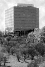
Four key locations on the rapid transit system, shown as Centres on Map 2, play an important role in how we manage growth. The Scarborough, North York, Etobicoke and Yonge-Eglinton Centres are places with excellent transit accessibility where jobs, housing and services will be concentrated in dynamic mixed use settings with different levels of activity and intensity. These Centres are focal points for surface transit routes drawing people from across the City and from outlying suburbs to either jobs within the Centres or to a rapid transit connection.
Substantial past investment in transit and other infrastructure in these Centres has made it possible to accommodate economic growth. Good transit accessibility also makes the Centres attractive locations for developing a range of housing opportunities where people can live close to their work or easily get to their jobs by transit.
The potential of the Centres to support various levels of both commercial office job growth and residential growth outside of the Downtown is important. This Plan encourages creating concentrations of workers and residents at these locations, resulting in significant centres of economic activity accessible by transit.
Building a high quality public realm featuring public squares and parks, community gardens, public art, and a comfortable environment for pedestrians and cyclists, is essential to attract businesses, workers, residents and shoppers. Each Centre is different in terms of its local character, its demographics, its potential to grow and its scale. A Secondary Plan for each Centre will tailor an intense mix of urban activities to the individual circumstances of each location. These Secondary Plans will outline a growth strategy, show how transportation and other local amenities can be improved, specify variations in the mix of land uses and intensity of activities within each of the Centres and knit each Centre into the surrounding fabric of the City.
Hallmarks of the Centres:

Etobicoke Centre is focused on two subway stations and as an inter-regional transit connection point can contribute to growth management objectives of the broader region. It takes in a range of urban conditions including commercial office buildings, high rise apartments, auto-oriented retailing and traditional main street shopping. It has significant development potential, particularly around its subway stations and the City’s own Westwood Theatre lands. The delivery of municipal services to residents in the western part of the City could be improved by relocating municipal and other government functions there.
North York Centre, focused on three subway stations on its Yonge Street spine, is served by both the Yonge subway and the Sheppard subway and is also a terminus for regional transit from communities to the north. It is a major concentration of commercial office space where businesses benefit from excellent transit service to the Downtown core as well as from good highway access. It should continue to grow as an important commercial office location. It should also continue to be a vibrant residential and cultural centre. A dedicated transit corridor should be established on Yonge Street north of Finch Station to facilitate the development of Yonge Street as an Avenue and to improve transit service for residents of York Region.
Scarborough Centre sits at the eastern end of the Scarborough RT line served by two stations, inter-regional transit and is the focal point of TTC surface routes in the eastern part of Toronto. Improving the Centre’s connectivity will be crucial to its success, particularly improving its regional gateway function, replacing the Scarborough RT with an extension of line 2 and extending the Sheppard subway east providing a high-speed connection between the Scarborough and North York Centres. The residential community has grown substantially in recent years and will continue to grow in the near term. This Centre is a focal point for the communities in the eastern part of the City, with a regional mall and municipal and federal government services drawing residents and workers alike. Proximity to a large Employment Area presents unique options for employment growth offering a mix of offices, housing, retailing and services. The Centre’s woodlots and watercourses also offer the opportunity to weave nature into the urban fabric.
Yonge-Eglinton Centre is situated in Midtown Toronto with a more central location in Toronto’s transit network than the other Centres. The Centre is at the crossroads of the Yonge subway line and the Eglinton Crosstown light rapid transit line, both of which bisect the City. At this strategic location, the Centre serves as a major residential area, employment centre and an important institutional, retail and entertainment destination, highly accessible for a large segment of Toronto. Yonge-Eglinton Centre incorporates a variety of streetscapes and neighbourhoods in a compact form. The diverse mix of uses, range of housing options and conveniently accessible transportation options, community facilities, parks and open spaces are enjoyed by a growing residential population and contribute to a complete and liveable community.
Yonge-Eglinton Centre will continue to prosper as a dynamic live-work district. The Centre will be marked by tall buildings and an intense concentration of office, retail, institutional and residential uses at the Yonge-Eglinton intersection. The scale and intensity of development will transition down in all directions. New mixed-use development on Yonge Street, Eglinton Avenue and Mount Pleasant Road will contribute to the public realm on these busy streets and broaden the area’s offering of stores, services and community facilities. The Mount Pleasant Transit Station will serve as a secondary focal point in the Centre’s east end. Residential development in the Apartment Neighbourhoods north and south of Eglinton Avenue will complement the area’s green, landscaped character and the variety of building types and contribute to the area’s diverse housing options. The Centre’s intensity will be balanced with a generously landscaped, enhanced public realm and new parks and open spaces. Improvements to the active transportation and transit networks will expand safe and convenient travel options inside and into this well-connected Centre.
2.2.2.1. A priority for managing growth in the City is the establishment of vibrant transit-supportive mixed use Centres, shown on Map 2.
2.2.2.2. Each Centre will have a Secondary Plan that will:
Community Energy Planning Community Energy Planning (CEP) is an area-based approach to energy planning that models energy needs for existing and future development. The CEP will identify opportunities to conserve energy and reduce demand and emissions, including the energy component in water, solid waste and transportation choices.
The Avenues on Map 2 play a key role in Toronto’s growth. As major streets that are well served by public transit, Avenues will change and grow to provide a full range of housing options and contribute to Toronto’s fabric of complete communities.
High quality, reliable public transit service is essential to the success of the Avenues. The growth and redevelopment of the Avenues should be supported by high quality and reliable transit services, including priority measures for buses and streetcars, and urban design and traffic engineering practices that creates safe, comfortable and attractive Avenues for all users—transit riders, pedestrians, cyclists, and drivers.
As Avenues change and grow, new housing options will help ensure that households of all sizes and life stages have more options in every community. Improvements to the public realm, combined with more spaces for local jobs, shops and services along the Avenues will help create sustainable, complete communities that are vibrant, walkable, and transit-oriented, where the daily needs of all people can be met. As Avenues grow it will also be essential to address the loss of affordable rental housing, as well as the displacement of small businesses and community service providers.
Avenues will serve different roles. Some Avenues act as ‘main streets’ while other Avenues will be primarily ‘residential’. Lands that are designated Mixed Use Areas along Avenues will play a ‘main street’ role, with uses that activate the ground floor like shops and services that residents can conveniently access to meet their daily needs. These ‘mainstreet’ Avenues are neighbourhood focal points, with attractive and busy sidewalks, meeting places for residents, and a broad range of housing options.
While some Avenues already fulfill this role, others are still developing their potential. For those already functioning as ‘main streets,’ redevelopment must preserve or enhance this role. Special efforts are also needed to ensure that the displacement of existing small businesses and community service providers is addressed. New development should maintain, if not improve, the ability of these Avenues to meet residents’ daily needs by providing space for activating uses on the ground floor and, where possible, a variety of unit space sizes to encourage a range of uses.
On Avenues designated as Apartment Neighbourhoods, the primary role will be residential, but uses that activate the ground floor are encouraged. Where residential uses are initially provided on the ground floor, these spaces should be designed so that the ground floor can later transition to activating uses. These spaces can evolve over time to support the daily needs of residents and foster complete communities.
While the function of Avenues varies, the planned built form of Avenues is mid-rise, except where existing and planned subway, light rail transit, and GO rail stations can potentially support greater intensification along Avenues. Mid-rise buildings are a transit-supportive form of development between low-rise and tall building forms. They provide good transition and predictable impacts on nearby low-scale areas while supporting growth.
Mixed Use Areas along Avenues with existing or planned higher order transit stations offer unique opportunities where redevelopment at a greater scale may be appropriate. These areas can support more housing supply and a diverse mix of uses that activate the street and offer the potential for larger format commercial and institutional uses such as grocery stores, recreational facilities, and schools. These areas are not all the same and it is important that development in these areas be contextually appropriate and meet the intent of the built form policies of this Plan. Generally, development with the greatest height and scale should be located at the higher order transit stations and transition down in height and scale further from the stations.
Activating the Ground Floor on Avenues
[Decision by Ontario Land Tribunal (O.L.T) not yet determined: Activating the ground floor of developments with commercial and institutional uses, such as small-scale retail, services, and schools, will help enable equitable, convenient access to the amenities that serve the daily needs of all residents. To help provide opportunities for small businesses, including those that serve or are operated by racialized and marginalized communities, opportunities for commercial community land trusts and cooperative models to secure new commercial space are encouraged.]
Addressing Displacement along Avenues
Many Avenues are home to small businesses and community service providers that are affordable and provide culturally relevant uses for Indigenous, Black, and other equity-deserving Torontonians. Growth along the Avenues has the potential to displace these small businesses and community service providers and the vital role they play to their community. It is important to address the impacts on these establishments that serve diverse communities through a variety of policies, programs, and through engagement that is part of the application process.
Monitoring the Avenues
The City will monitor all Avenues to help guide their growth toward becoming complete communities with a full range of housing. This will include monitoring the pace and intensity of growth, the change in housing stock, the amount of space for businesses and services, the displacement of small businesses and community service providers, transportation mode share, and transit ridership.
2.2.3.1. Growth and intensification will be directed to Avenues as shown on Map 2 to:
a. concentrate jobs and housing in areas well served by public transit;
b. accommodate and contribute to complete communities that meet the daily needs of all people; and
c. provide a full range of housing, including affordable housing.
2.2.3.2. Avenues policies apply to lands or development with frontage on Avenues as shown on Map 2 and the right-of-way of Avenues.
2.2.3.3. To achieve growth and intensification on Avenues, development along Avenues:
a. will be up to the height and scale of a mid-rise building in Mixed Use Areas and Apartment Neighbourhoods; and
b. may go beyond the height and scale of a mid-rise building in Mixed Use Areas when located within a 500 to 800-metre walking distance of an existing or planned subway station, light rail transit station, or GO rail station as shown on Map 4. The greatest height and scale should be focused at the station.
2.2.3.4. Activating the ground floor of buildings along Avenues is important to enable equitable, convenient access to the amenities that serve the daily needs of all residents. To achieve this objective, development along Avenues will:
a. provide appropriate uses that activate the ground floor and minimize ground floor residential uses in Mixed Use Areas;
b. be encouraged to provide appropriate uses that activate the ground floor in Apartment Neighbourhoods;
c. be encouraged to include a variety of unit space sizes that activate the ground floor in Mixed Use Areas; and
d. be designed to protect for future uses that can activate the ground floor in Apartment Neighbourhoods, where appropriate.
2.2.3.5. Development along Avenues will contribute to placemaking and the city’s cultural heritage by conserving heritage properties.
2.2.3.6. Where a development proposal along an Avenue would result in the displacement of existing small businesses and community service providers, including those operated by and/or serving racialized and marginalized populations, the applicant, as part of a complete application requirement in Schedule 3, will demonstrate the following:
a. How the local community will be consulted to assess the range of local community needs for retail and services uses, and how the existing small businesses and community service providers will be consulted to assess the potential for their return in the development.
b. A plan to provide notice of the proposal to the existing small businesses and community service providers located on the applicant's property.
2.2.3.7 To facilitate sustainable, complete communities that are attractive to residents and businesses, Avenues will:
a. include public realm and streetscape improvements, including green infrastructure;
b. have publicly accessible spaces and buildings that are universally accessible to all;
c. include transportation improvements such as transit priority measures, improved connections to higher order transit stations, new or improved laneways and shared off-street parking facilities, cycling improvements, and new walkways;
d. contribute to an attractive, safe and comfortable pedestrian environment that encourages walking and strengthens local retailing; and
e. be served by adequate parks, community services and facilities, and water and sewer infrastructure.
2.2.3.8. The land use designation policies in Chapter Four of this Plan apply to and prevail on lands broadly shown on Map 2 as Avenues.
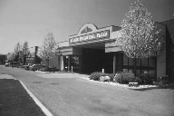
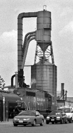
Toronto’s Employment Areas, to be used exclusively for business and economic activities, are an essential cornerstone of our diverse and thriving civic economy. Almost a third of Toronto’s jobs and forty percent of export-oriented jobs with high-multiplier spinoffs are in Employment Areas. The City’s Employment Areas are healthy with considerable investment in new buildings and improvements and overall low building vacancy rates. Important elements of our civic economy, such as manufacturing and warehousing and goods distribution are located almost entirely in Employment Areas and provide for a broad range of jobs and a diverse economic base that helps our City through difficult cycles in the economy.
Our Employment Areas are finite and geographically bounded. Given relative land values, residential lands are rarely converted to employment uses and there is little opportunity to create new employment lands. It is the City’s goal to conserve our Employment Areas, now and in the longer term, to expand existing businesses and incubate and welcome new businesses that will employ future generations of Torontonians. Given the diminishing supply of vacant land in Employment Areas, new development in Employment Areas needs to take place in a more intensive physical form.
Maintaining Employment Areas exclusively for business and economic activities provides a stable and productive operating environment for existing business that also attracts new firms. The introduction of sensitive land uses into Employment Areas can force industry to alter their operations, particularly when the environmental certificates that industries operate under are affected, or complaints are lodged about adverse effects from industrial operations. Even where new sensitive land uses are located outside of, but in close proximity to, Employment Areas, they should be designed and constructed to prevent the residents or users from being affected by noise, traffic, odours or other contaminants from nearby industry.
Toronto’s Employment Areas are important in providing good quality services to our residents and workers. The industrial and commercial properties are vital to maintaining a healthy civic tax base that pays for those services. Most of our City and transportation yards that maintain our infrastructure are located in Employment Areas and have limited alternative locations.
Preserving Employment Areas contributes to a balance between employment and residential growth so that Torontonians have a greater opportunity to live and work in the City, rather than commuting distances to jobs outside of the City. As Employment Areas are spread across the City, work destinations and commuting direction are also spread out, resulting in less road congestion in any one direction. This provides workers who live in close proximity to Employment Areas with the opportunity for shorter commutes to work by either transit, cycling or walking.
The Black Creek Regional Transportation Management Association (BCRTMA) is a non-profit association of employers and other partners working to reduce congestion and air pollution in the Black Creek district (between Weston Road and Dufferin Street north of Highway 401). The mission of the BCRTMA is to work with the public and private sectors to improve mobility and to establish sustainable transportation options within this district.Services offered by the BCRTMA include:
Our Employment Areas are comprised of lands designated both as Core Employment Areas and General Employment Areas, which are both important “employment areas” as defined in the Provincial policy framework. The conversion of lands within Employment Areas is only permitted through a City-initiated Municipal Comprehensive Review, as defined in the Growth Plan for the Greater Golden Horseshoe, of the Official Plan. During a City-initiated Municipal Comprehensive Review of the Official Plan, the City will assess any requests to convert Employment Areas on the basis of criteria that implement the Provincial planning framework and the policies of the Official Plan for Employment Areas.
Clusters of Business and Economic Activities Clusters of business and economic activities may include individual businesses and/ or isolated employment sites that contain or are permitted to contain multiple employment uses and activities.
2.2.4.1. Employment Areas, as shown on Map 2, are comprised of both Core Employment Areas and General Employment Areas, as shown on Maps 13 to 23 inclusive. Employment Areas are areas designated in this Plan for clusters of business and economic activities including, but not limited to, manufacturing, warehousing, offices, and associated retail and ancillary facilities.
2.2.4.2. Employment Areas will be used exclusively for business and economic activities in order to:
2.2.4.3. A more intensive use of lands in Employment Areas for business and economic activities will be encouraged to make better use of a limited supply of lands available for these activities.
2.2.4.4. Employment Areas will be enhanced to ensure they are attractive and function well, through actions such as:
In order to address land use compatibility, a collaborative approach is encouraged among applicants of sensitive land uses, including residential uses, major facilities and the City. The City encourages applicants of sensitive land uses, including residential uses and major facilities to exchange relevant information, subject to appropriate measures to protect confidentiality, for the purpose of undertaking and completing all relevant required studies.
Sensitive Land Uses For clarity and for the purpose of this Plan, the term sensitive land uses means: buildings, amenity areas, or outdoor spaces where routine or normal activities occurring at reasonably expected times have the potential to experience an adverse effect, due to nearby major facilities or due to emissions that may be generated by the land uses permitted by this Plan within an Employment Area. Sensitive land uses may be a part of the natural or built environment, principal uses or accessory/ ancillary uses. Residential uses shall be considered sensitive land uses. Other examples may include, but are not limited to: daycare centres, and educational and health facilities. If the Plan permits a use in an Employment Area, the use is not a sensitive land use within that Employment Area for the purposes of this Plan, but may be a sensitive land use as defined in the Provincial Policy Statement and, if so, such land use may require noise, vibration, air quality, and/or odour studies as part of complete application.Major Facilities “Major facilities” means facilities which may require separation from sensitive land uses, including but not limited to airports, transportation infrastructure and corridors, rail facilities, marine facilities, sewage treatment facilities, waste management systems, oil and gas pipelines, industries, energy generation facilities and transmission systems, and resource extraction activities.
2.2.4.5. Sensitive land uses, including residential uses, where permitted or proposed outside of and adjacent to or near to Employment Areas or within the influence area of major facilities, should be planned to ensure they are appropriately designed, buffered and/or separated as appropriate from Employment Areas and/or major facilities as necessary to:
2.2.4.6. A complete application to introduce, develop or intensify sensitive land uses, including residential uses, in a location identified in Policy 5 shall include a Compatibility/Mitigation Study, which will be addressed in the applicant’s Planning Rationale.
2.2.4.7. The Compatibility/Mitigation Study will:
2.2.4.8. The costs of studies and mitigation measures shall be borne by the applicant of the sensitive land uses, including residential uses, in a location identified in Policy 5. Also, the cost of collecting and producing relevant information for the studies shall be borne by those requesting the information, in the event that such relevant information is not readily available.
2.2.4.9. Upon receipt of the City’s Notice of Complete Application for a sensitive land use, including a residential use, in a location identified in Policy 5, the applicant shall provide expanded notice of the proposal as follows:
2.2.4.10 When considering applications to introduce, develop or intensify sensitive land uses, including residential uses, in a location identified in Policy 5, Council may consider:
2.2.4.11. Employment Areas in the vicinity of existing major transportation infrastructure such as highway interchanges, ports, rail yards and airports are designated to provide for, and are to be preserved for, employment uses that may rely upon the major transportation infrastructure for the movement of goods.
2.2.4.12. Measures will be introduced and standards applied on roads within Employment Areas that give priority to the movement of trucks and transit vehicles.
2.2.4.13. Transit service and use to and from Employment Areas will be enhanced by:
CONVERSION AND REMOVAL POLICIES FOR EMPLOYMENT AREAS
2.2.4.14. The redesignation of land from an Employment Area designation to any other designation, by way of an Official Plan Amendment, or the introduction of a use that is otherwise not permitted in an Employment Area is a conversion of land within an Employment Area and is also a removal of land from an Employment Area, and may only be permitted by way of a Municipal Comprehensive Review. The introduction of a use that may be permitted in a General Employment Area into a Core Employment Area or the redesignation of a Core Employment Area into a General Employment Area designation is also a conversion and may only be permitted by way of a Municipal Comprehensive Review.
2.2.4.15. The conversion of land within an Employment Area is only permitted through a City-initiated Municipal Comprehensive Review that comprehensively applies the policies and schedules of the Provincial Growth Plan.
2.2.4.16. Applications to convert lands within an Employment Area will only be considered at the time of a municipal review of employment policies and designations under Section 26 of the Planning Act and a concurrent Municipal Comprehensive Review under the Growth Plan for the Greater Golden Horseshoe. Applications to convert lands within an Employment Area received between such City-initiated Official Plan Reviews will be not be considered unless Council directs that a Municipal Comprehensive Review be initiated.
2.2.4.17. The City will assess requests to convert lands within Employment Areas, both cumulatively and individually, by considering whether or not:
2.2.4.18. When assessing proposal(s) to convert lands within Employment Areas, the City will:
2.2.4.19. All Employment Areas will be planned for a minimum of 50 jobs per gross hectare. The City will monitor the achievement of this density target and evaluate it at the time of the next Municipal Comprehensive Review.
Influence Area“Influence Area” means any lands and land uses within the potential zone of influence of a major facility, taking into consideration both current and reasonable potential future operations, within which there could be a potential for adverse effect. A zone of influence may extend beyond the boundaries of Employment Areas, but does not include lands and land uses within Employment Areas.
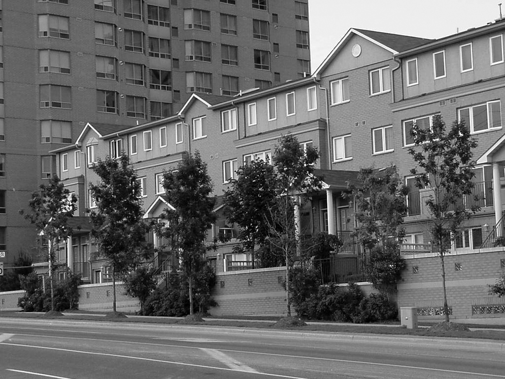
Fully three-quarters of the City’s land area is devoted to neighbourhoods, parks, ravines, watercourses and valleys. Unlike the Downtown, the Centres, Avenues and Employment Areas, these stable areas will see little physical change. The variety and quality of our residential communities and our green spaces are key factors that attract people from around the world to make Toronto their home and place of business.
The diversity of Toronto’s neighbourhoods, in terms of scale, amenities, local culture, retail services and demographic make-up, offers options within communities to match every stage of life. Our neighbourhoods are where we connect with people to develop a common sense of community. They are also an important asset in attracting new business to the City and new workers for growing businesses. Whether these neighbourhoods are low scale or predominantly apartments, the goals found here apply equally to all neighbourhoods and are to be considered in concert with the policies found in Chapter Four.


By focusing most new residential development in the Downtown, the Centres, along the Avenues, and in other strategic locations, we can preserve the shape and feel of our neighbourhoods. However, these neighbourhoods will not stay frozen in time. The neighbourhoods where we grew up and now raise our children help shape the adults and the society we become. Some physical change will occur over time as enhancements, additions and infill housing occurs on individual sites. A cornerstone policy is to ensure that new development in our neighbourhoods respects the existing physical character of the area, reinforcing the stability of the neighbourhood.
Established neighbourhoods will benefit from directing growth to the Downtown, the Centres and the Avenues by enjoying better transit service, greater housing choices, increased shopping opportunities, an improved pedestrian environment and other advantages that these growth areas provide. Accessibility to transit service varies considerably across the City, creating challenges to meeting the objective of reducing reliance on the private automobile. Transit accessibility for our neighbourhoods can be improved by investing in transit service along the Avenues as well as along the major streets that serve the neighbourhoods. At the boundary points between the neighbourhoods and the growth areas, development in the growth areas will have to demonstrate a transition in height, scale and intensity as necessary to ensure that the stability and general amenity of the adjacent neighbourhood areas are not adversely affected.
We can work together in our neighbourhoods to create a healthier Toronto by reducing waste, better managing stormwater runoff, greening our communities, reducing harmful emissions and conserving energy and water. We must also work to ensure that our community services are improved to reflect the changing faces of our communities as Toronto evolves socially and demographically.
When we think of our neighbourhoods we think of more than our homes. Our trees, parks, schools, libraries, community centres, child care centres, places of worship and local stores are all important parts of our daily lives. Increasingly, people work in their neighbourhoods, both in home offices and in local stores and services.
All communities should benefit from and share the rewards and advantages of living in Toronto. Some neighbourhoods need to be strengthened to ensure a better quality of life for their residents. There may be gaps in community-based facilities and services.
Some buildings may need to be upgraded, the neighbourhood may be poorly integrated with its surroundings, or residents may face hardship, social vulnerability or difficulty in accessing essentials such as healthy foods. Strategies and specific measures may be needed to revitalize and improve these priority neighbourhoods to address such issues.
Each revitalization strategy may address factors such as improving community-based services, developing new parks, promoting walking and cycling by improving streets, sidewalks, bikeways and pathways or building community capacity to enhance the broader social infrastructure. Strategies to improve these priority neighbourhoods will vary with local conditions. Some may be led by the City while others may be community-led. To support these efforts the neighbourhood may be designated a Community Improvement Area. Gardens for growing food are encouraged in Apartment Neighbourhoods.
Toronto has over a thousand older apartment buildings, many of which are in need of physical renewal, greening and in some instances, social transformation. The City has established the Tower Renewal Program to encourage the retrofit of these older apartment buildings and improve the quality of life of their residents.
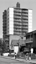
Most of Toronto’s existing apartment buildings are located within built up Apartment Neighbourhoods where significant growth is not anticipated on a city-wide basis. Often, apartment building(s) together with ancillary outdoor recreation facilities, pedestrian walkways, parking lots, service areas and landscape space take up/occupy the entire site. In some areas these sites are located in proximity to each other and form clusters or larger apartment neighbourhoods. There may be sites within Apartment Neighbourhoods that contain space that is not well-utilized by the residents of existing apartment buildings. In some instances these sites could be improved through the addition of infill development that will provide additional housing options, including new rental housing while maintaining and/or improving on-site amenities and conditions for both new and existing residents. In other instances, redevelopment of vacant or underutilized sites in Apartment Neighbourhoods that meets the Plan’s policies can create new housing options in Toronto.

2.3.1.1. Neighbourhoods are low rise and low density residential areas that are considered to be physically stable. Development in Neighbourhoods will be consistent with this objective and will respect and reinforce the existing physical character of buildings, streetscapes and open space patterns in these areas.
2.3.1.2. Apartment Neighbourhoods are residential areas with taller buildings and higher density than Neighbourhoods and are considered to be physically stable. Development in Apartment Neighbourhoods will be consistent with this objective and will respect the criteria contained in Section 4.2.2 and other relevant sections of this Plan. While Apartment Neighbourhoods are not areas of significant growth on a city-wide basis, there are sites containing one or more existing apartment building(s) where compatible infill development may take place. This compatible infill development may take place where there is sufficient space on a site to accommodate additional buildings or building additions while providing a good quality of life for both new and existing residents and improving site conditions by maintaining or substantially replacing and improving indoor and outdoor amenity space; improving landscaped open space; maintaining adequate sunlight and privacy for residential units; and adequately limiting shadowing on outdoor amenity space and landscaped open space. Such infill will be in accordance with the criteria in Section 4.2 and other policies of this Plan. Apartment Neighbourhoods contain valuable rental apartment buildings that often need physical and social renewal and transformation to achieve an improved living environment.
2.3.1.3. Developments in Mixed Use Areas, Regeneration Areas and Apartment Neighbourhoods that are adjacent or close to Neighbourhoods will:
2.3.1.4. Intensification of land adjacent to neighbourhoods will be carefully controlled so that neighbourhoods are protected from negative impact. Where significant intensification of land adjacent to a Neighbourhood or Apartment Neighbourhood is proposed, Council will determine, at the earliest point in the process, whether or not a Secondary Plan, area specific zoning by-law or area specific policy will be created in consultation with the local community following an area based study.
2.3.1.5. The functioning of the local network of streets in Neighbourhoods and Apartment Neighbourhoods will be improved by:
2.3.1.6. Environmental sustainability will be promoted in Neighbourhoods and Apartment Neighbourhoods by investing in naturalization and landscaping improvements, tree planting and preservation, sustainable technologies for stormwater management and energy efficiency and programs for reducing waste and conserving water and energy.
2.3.1.7. Community and neighbourhood amenities will be enhanced where needed by:
2.3.1.8. In priority neighbourhoods, revitalization strategies will be prepared through resident and stakeholder partnerships to address such matters as:
2.3.1.9. The owners of existing apartment buildings will be encouraged to renovate and retrofit older apartment buildings in order to:
2.3.1.10. Small-scale commercial, community and institutional uses are encouraged at grade in apartment buildings and on apartment building properties on major streets shown on Map 3 in Neighbourhoods, and in Apartment Neighbourhoods, to better serve area residents, particularly in areas where residents do not have convenient walking access to a wide range of goods, services and community facilities.
2.3.1.11. Gardens for growing food are encouraged on portions of open space in sites within Apartment Neighbourhoods, particularly in areas where residents do not have convenient walking access to sources of fresh food.
2.3.1.12. Mobile vendors of fresh food are encouraged within Apartment Neighbourhoods in areas where residents do not have convenient walking access to sources of fresh food.

Tower RenewalToronto is home to approximately 1,200 high-rise apartment buildings, largely constructed in the three decades following World War II, which house over 500,000 renters. Many were originally constructed as ‘tower in the park’ communities with ample open space and surface parking areas. By the early years of this century, many of these towers were in need of physical reinvestment and a number of their residents were experiencing economic and social challenges.The City has established the Tower Renewal Program as an agent of change to drive the implementation of environmental, social, economic and cultural improvements to transform these tower sites and neighbourhoods. The City has created programs to support apartment building owners in implementing retrofits, programming and investments to improve the lives of tower residents. The Provincial and Federal governments are following suit in these efforts. The City has also enacted a special RAC zone applicable to almost 500 of these residential tower sites in order to permit new small-scale nonresidential uses to serve area residents in these locations, such as food markets, small businesses and community facilities.Tower Renewal works collaboratively within the City (e.g. City Planning, TCHC and Environment and Energy) and with external parties (e.g. United Way, Centre for Urban Growth & Renewal and Toronto Foundation) to achieve change in these tower neighbourhoods.
Toronto is connected by a wonderful system of green space – from beaches and bluffs, through deep ravines, to parks and cemeteries. This system is vital to both our quality of life and to the health of natural ecosystems both within and beyond our current boundaries. The Green Space System is comprised of those lands with a Parks and Open Space Areas designation which are large, have significant natural heritage or recreational value and which are connected. They should be protected, improved and added to whenever feasible.

Toronto’s waterfront, ravines, watercourses, parks and other open spaces connect to form an extensive web of green space across the City. The waterfront, which extends from Marie Curtis Park in the west to Rouge Beach Park in the east, is a major feature of the Green Space System. It includes parks, beaches, wetlands, bluffs, neighbourhoods and cultural and entertainment destinations. Over time, lands on the water’s edge should become a network of publicly accessible open spaces, offering a range of leisure activities connected by a continuous waterfront trail. Creating a clean and green waterfront that is safe and healthy will contribute to a better environment for the City as a whole.
The Green Space System provides many benefits for the City. These lands:

Through land use designations, planning policies, public undertakings and private development, the goal of strengthening these roles will be supported and advanced. The Toronto and Region Conservation Authority plays an important role in the protection, enhancement and management of these lands.
2.3.2.1. Actions will be taken to improve, preserve and enhance the Green Space System by:
2.3.2.2. Public agencies and Torontonians will be encouraged to support the protection, enhancement and restoration of links within and between elements of the Green Space System.
2.3.2.3. The Green Space System will be expanded by:
2.3.2.4. The sale or disposal of publicly owned lands in the Green Space System will be discouraged. No City owned land in the Green Space System will be sold or disposed of. However, City owned land in the Green Space System may be exchanged for other nearby land of equivalent or larger area and comparable or superior green space utility.
2.3.2.5. Within the Green Space System, development will not result in the loss of public space.
2.3.2.6. Increased public enjoyment and use of lands along the water’s edge will be promoted by ensuring that future development and actions on the part of both the public and private sectors, including the Toronto Port Authority, the Toronto Waterfront Revitalization Corporation and the Toronto and Region Conservation Authority, will help to achieve the following objectives:
2.3.2.7. Private development and public works on lands along the water’s edge or in its vicinity will:
2.3.2.8. The physical and visual continuity of the waterfront corridor will be maintained and enhanced.
2.3.2.9. The sale or disposal of publicly owned lands on the water’s edge will be discouraged.
2.3.2.10. The year-round recreational use of unique regional resources such as Toronto Island Park and Rouge National Urban Park will be encouraged.
2.3.2.11. The important ecological and hydrological functions and park and trail connections that Greenbelt River Valley Connections provide will be recognized through public information, awareness and stewardship programs and partnerships with public and private landowners, First Nations, institutions and organizations.

Rouge Valley Area The Rouge Valley area is an important part of Toronto’s Green Space System. It forms part of a continuous ecological corridor that runs through the City and connects the natural systems of Lake Ontario to the Oak Ridges Moraine. Lands within the Rouge Valley are designated as Greenbelt Protected Countryside and are subject to the policies of the Greenbelt Plan (2005). In recognition of the significance of the Rouge Valley, the federal government has established a national park which extends from Lake Ontario to the Oak Ridges Moraine, including lands within the Rouge Valley area of Toronto. The Rouge National Urban Park Management Plan sets out a long-term vision for and guides the management and operation of lands within the park.
This Plan integrates transportation and land use planning at both the local and regional scales. Within the city, the Plan addresses the differing transportation demands between areas targeted for growth and those other parts of the city where little physical change is foreseen.
The transportation policies, maps and schedules of the Plan make provision for the protection and development of the City’s road, rapid transit and inter-regional rail networks. The Plan provides complementary policies to make more efficient use of this infrastructure and to increase opportunities for walking, cycling, and transit use and support the goal of reducing car dependency throughout the city.
Cycling is gaining popularity in the city as a travel mode with more people cycling for more of their trips or parts of their trips. The vision for the cycling network supports further growth of cycling and consists of dedicated priority cycling and multi-use corridors (which accommodate cycling and other modes of active transportation), overlain with a minor grid of dedicated or designated secondary corridors, which ensure that every part of the city is within no more than one kilometre of a designated cycling facility. Additional initiatives will be needed in some areas to overcome less inviting cycling environments and substantially increase cycling use. Particular attention will be given to enhancing cycling connections between the cycling network and nearby neighbourhood amenities including transit stations, and expanding the public bike share system, to facilitate the use of the bicycle for short trips and multi-modal trips.
In a mature city like Toronto, the emphasis has to be on using the available road space more efficiently to move people instead of vehicles and on looking at how the demand for vehicle travel can be reduced in the first place. Reducing car dependency means being creative and flexible about how we manage urban growth. We have to plan in “next generation” terms to make walking, cycling, and transit increasingly attractive alternatives to using the car and to move towards a more sustainable transportation system.
Moving Ahead: A Campaign for Next Generation TransportationOur overall aim is to provide the widest range of sustainable and zero-emissions transportation options that are accessible, seamlessly connected, safe, convenient, affordable and economically competitive by pursuing the following principles:
Toronto at the Crossroads: Shaping Our Future, June 200The Toronto Walking Strategy (2009) aims to build a physical and cultural environment that supports and encourages walking, including vibrant streets, parks, public squares and neighbourhoods where people will choose to walk more often. By envisioning a city where high-quality walking environments are seamlessly integrated with public transit, cycling and other sustainable modes of travel, the Strategy sets out a plan that will produce tangible environmental, health and social benefits for residents and visitors to Toronto
Travel Demand Management (TDM) TDM measures are aimed at encouraging people to take fewer and shorter vehicle trips to reduce congestion, energy consumption and pollution. In the past, transportation planning has often focused on supply-side solutions by identifying where additional transportation capacity is needed to satisfy forecast travel demands. TDM, in contrast, puts the emphasis on changing travel behaviour to modify and reduce our demand for vehicular travel in cities. TDM is most effective when supported by complementary actions in the key areas of land use planning and public transit improvements. Typical TDM measures include:

2.4.1. Given the health benefits of physical activity, active forms of transportation will be encouraged by integrating and giving full consideration to pedestrian and cycling infrastructure in the design of all streets, neighbourhoods, major destinations, transit facilities and mobility hubs throughout the City.
2.4.2. New developments may be required to conduct a Transportation Impact Study (TIS) in accordance with the City’s TIS Guidelines. The TIS will identify the demands and impacts of new development, and identify transportation improvements, a Travel Demand Management (TDM) strategy and/or other mitigating measures to accommodate travel generated by the development, and where relevant:
2.4.3. The City will show leadership within the region in the implementation of TDM measures to reduce auto dependence and rush-hour congestion in the road and transit networks by:
2.4.4. In targeted growth areas, planning for new development will be undertaken in the context of reducing auto dependency and the transportation demands and impacts of such new development assessed in terms of the broader social and environmental objectives of the Plan’s reurbanization strategy.
2.4.5. The City will work with its partners to ensure that underground higher-order transit stations are integrated into multi-storey developments wherever it is feasible, ensuring that all points of entry:
2.4.6. Development in proximity to existing higher-order transit stations will be required to provide direct and convenient access to the station. Such connections will be encouraged to be weather protected.
2.4.7. An adequate supply of off-street parking for bicycles and automobiles will be provided and maintained to meet the short-term parking demands of commercial, institutional and tourist activities while ensuring a minimal level of all-day automobile parking for commuters that reflects the availability of alternative travel modes.
2.4.8. For sites in areas well serviced by transit, such as locations around higher-order transit stations and along major transit routes, consideration will be given to the establishment of:
2.4.9. Better use will be made of off-street parking by:
2.4.10. In support of the TDM and environmental policies of this Plan, the City may:
2.4.11. Implement curbside management strategies to improve traffic circulation and conditions for commercial vehicles including such measures as designated pick-up/drop-off areas for goods and service vehicles, accessible loading zones, courier delivery zones, temporary film trailer parking and motor coach parking zones.
2.4.12. Encourage the implementation of off-peak delivery programs.
2.4.13. The City will work with other orders of government, other municipalities, representatives from across the goods movement industry and the public to develop a comprehensive multi-modal strategy for the safe, efficient and environmentally sustainable movement of goods within the Greater Toronto and Hamilton Area (GTHA). This strategy will include:
2.4.14. Guidelines, programs and infrastructure will be developed and implemented to create a safe, comfortable and bicycle-friendly environment that encourages people of all ages, abilities and means to bicycle for everyday transportation, recreation and commercial activity and supports the growth objectives of this Plan, including:
2.4.15. An urban environment and infrastructure will be created that encourages and supports pedestrian movement throughout the City, for people of all ages, abilities and means by:
2.4.16.The City will work with the Province to improve safety and connectivity for pedestrians and cyclists travelling along, across or in the vicinity of 400-series highway infrastructure.
2.4.17. The transportation system will be developed to be accessible and inclusive of the needs of people of all ages, abilities and means by:
2.4.18. Inter-modal and inter-line connections will be promoted so that each mode and each carrier – whether for passengers or goods – is conveniently integrated with the rest of the urban transportation system.
2.4.19. New and emerging mobility-related technologies, practices and designs will be assessed to determine their impacts on urban travel conditions, the environment, public health and safety, the economy and the policies of this Official Plan. Regulations will be put in place, as necessary, to achieve the objectives of this Plan.
2.4.20. New technologies, practices and designs that improve urban travel conditions for the movement of people, goods and services and help mitigate the environmental impacts of transportation will be pursued and implemented where appropriate. Such technologies, practices and designs include, but are not limited to:
2.4.21. Large commercial and office buildings and hotels will make provision for vehicles-for-hire on private property.
2.4.22. Development will be encouraged to make off-street provisions for pick-ups and drop-offs, loading and parking activity.
2.4.23. New transportation terminals will require facilities for inter-model connections including those for:
2.4.24. Existing transportation terminals will be retrofitted for inter-modal connections when redevelopment occurs.
Goods Movement The efficient and safe movement of goods is vital to the economic health and competitiveness of Toronto and the larger region. The key elements of the goods movement system in the City are the major road and rail freight networks and the pattern of collection and distribution points they serve. The challenge is to develop and maximize the efficient use of this system by such means as:
Bicycle Policy FrameworkIn 2001, Council adopted the “Toronto Bike Plan – Shifting Gears”, a strategy to guide the development of policies, programs and infrastructure to create a bicycle-friendly environment that encourages the greater use of bicycles for everyday transportation and enjoyment across the city. The Bike Plan remains the foundation upon which more recent cycling initiatives have evolved.The implementation of cycling infrastructure is guided by the Cycling Network Plan (2016; updated 2019) which identifies priorities for cycling routes in order to:
The Cycling Network Plan combines elements of the earlier Bike Plan’s cycling network proposal, the more recent “Toronto Bikeway Trails Implementation Plan” (2012), Secondary Plans and Transportation Master Plans to create an integrated network of on-street and off-street routes.To further support cycling, the City is undertaking measures to increase the availability of bicycle parking facilities in terms of its amount, quality and convenience and expanding the Bike Share Toronto system.

Active and Sustainable School Travel (ASST) programs aim to increase the proportion of youth walking, biking, wheeling, and taking transit. It focuses on creating safer environments for school-aged travellers of all abilities, and fostering healthier and more sustainable transportation habits from an early age. Creating environments that support ASST requires actions, including: