The Official Plan must be read in its entirety. Click the “Expand All +” button to read the full contents of this chapter.
The “Policies (Shaded Text)” within chapter four contains policies of the Official Plan. Unshaded text and sidebars (small text) within chapter four is provided to give context and background and assist in understanding the intent of policies but are not policies.
Land use designations are among the Official Plan’s key implementation tools for achieving the growth strategy set out in Chapter Two – to direct major growth to some parts of the City and away from others. Each land use designation establishes the general uses that are provided for in each designation. Together, they describe where housing can be built, where stores, offices and industry can locate and where a mix of uses is desired. The land uses provided for in each designation are generalized, leaving it to the Zoning By-law to prescribe the precise numerical figures and land use permissions that will reflect the tremendous variety of communities across the City. The development criteria set out in this chapter for the various land use designations are critical considerations that apply when development proposals are evaluated, but they do not constitute the only considerations. All of the policies of the Plan apply when evaluating development proposals.
A new comprehensive Zoning By-law will be the key regulatory instrument that implements the Official Plan policies and provides regulations and standards that shape the City’s built form and land use. The Zoning By-law will create a framework of regulatory certainty, consistency and clarity. The Zoning By-law regulations will be carefully balanced to identify the commonalities and recognize the differences of the City’s various neighbourhoods.
Four land use designations shown on the Plan’s land use maps, Neighbourhoods, Apartment Neighbourhoods, Parks and Open Space Areas and Utility Corridors, will help to protect and reinforce the existing physical character of these areas.
Toronto’s hundreds of low scale residential neighbourhoods, with their distinctive character, together with local institutions, retail and services that serve their populations, are prized by residents. These Neighbourhoods, as well as the Apartment Neighbourhoods, composed largely of apartment buildings and differentiated because of the scale of buildings, share the objectives for contextual stability, better amenities and environmental sustainability.
Our extensive network of parks, valleys, watercourses and natural areas across the City, captured by the Parks and Open Space Areas designation, are to be protected and improved to provide respite, recreation, ecological and hydrological functions and beauty for a growing City.
Finally, the Utility Corridors designation is placed on the hydro and rail corridors to preserve the central nervous system of the City – distributing heat, light, power, people and goods throughout the City.
Four land use designations distribute most of the increased jobs and population anticipated by the Plan’s growth strategy: Mixed Use Areas, Employment Areas, Regeneration Areas and Institutional Areas.
Many of the properties within Downtown, the Centres and along the Avenues are designated Mixed Use Areas, encouraging a broad range of commercial, residential, institutional and open space uses. Flexibility is provided for future redevelopment in these areas to accommodate increases in population and jobs along transit lines.
Toronto’s industrial districts and suburban office parks are designated Employment Areas, reflecting the broad objective of retaining our Employment Areas as places of business and developing and intensifying job growth within these areas, especially those areas that can be reached by transit. Another location for future job growth for a maturing City and region are Institutional Areas, where our hospitals, university and college campuses, and key government centres can reinforce the new economy linkages needed to sustain Toronto’s economic future.
The Regeneration Areas designation is applied to areas with significant vacant lands and/or buildings and in need of revitalization as a means of fostering growth and physical change. Regeneration Areas policies will attract investment, fill the buildings and bring new life to the streets.
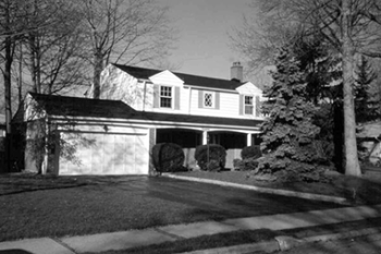
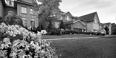
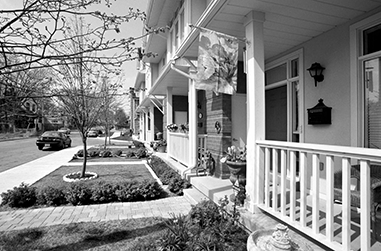
Toronto’s hundreds of Neighbourhoods contain a full range of residential uses within lower scale buildings, as well as parks, schools, local institutions and small-scale stores and shops serving the needs of area residents. Lower scale residential buildings in Toronto’s Neighbourhoods consist of detached houses, semi-detached houses, duplexes, triplexes and various forms of townhouses as well as interspersed walk-up apartments with or without elevators that are four storeys or less.
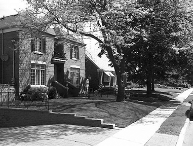
Over the past half-century, scattered high-rise apartment buildings were constructed in the midst of otherwise low scale residential neighbourhoods. The existing higher scale apartments are recognized but no new ones are permitted in areas designated as Neighbourhood.
More recently, as the economy has changed, thousands of Torontonians have begun working from their homes, creating valuable economic activity, enhancing safety by providing “eyes on the street”, and reducing trips to work. These home occupations are provided for in Neighbourhoods across the City.
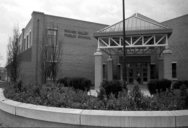
Historical development patterns have also added to the variety of local educational uses in Neighbourhoods. Policies regarding the suitable integration of schools within the context of Neighbourhoods are an important consideration for ensuring quality of life.
4.1.1 Neighbourhoods are considered physically stable areas made up of residential uses in lower scale buildings such as detached houses, semi-detached houses, duplexes, triplexes and townhouses, as well as interspersed walk-up apartments that are no higher than four storeys. Parks, low scale local institutions, home occupations, cultural and recreational facilities and small-scale retail, service and office uses are also provided for in Neighbourhoods.
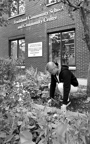
Low scale local institutions play an important role in the rhythm of daily life in Neighbourhoods and include such uses as: schools, places of worship, community centres, libraries, day nurseries and private home daycare, seniors and nursing homes and long-term care facilities, public transit facilities, utility and telecommunications installations, and public services and facilities provided by the local, provincial and federal governments.
4.1.2 Schools will provide open space for outdoor student activities and landscaping and will be designed and operated to limit noise, privacy and traffic impacts on neighbouring residents.
4.1.3 Small-scale retail, service and office uses support daily life in Neighbourhoods and encourage complete, connected communities, contributing to amenity, sustainability, equity, diversity and vitality. Small-scale retail, service and office uses are permitted on properties in Neighbourhoods that legally contained such uses prior to the approval date of this Official Plan. New small-scale retail, service and office uses may be permitted in Neighbourhoods provided that they:
4.1.4 Apartment buildings legally constructed prior to the approval date of this Official Plan are permitted in Neighbourhoods.
The stability of our Neighbourhoods’ physical character is one of the keys to Toronto’s success.
While communities experience constant social and demographic change, the general physical character of Toronto’s residential Neighbourhoods endures. Physical changes to our established Neighbourhoods must be sensitive, gradual and “fit” the existing physical character. A key objective of this Plan is that new development respect and reinforce the general physical patterns in a Neighbourhood.
Scattered throughout many Neighbourhoods are properties that differ from the prevailing patterns of lot size, configuration and orientation. Typically, these lots are sites of former non-residential uses such as an industry, institution, retail stores, a utility corridor, or are lots that were passed over in the first wave of urbanization. In converting these sites to residential uses, there is a genuine opportunity to add to the quality of Neighbourhood life by filling in the “gaps” and extending streets and paths. Due to the site configuration and orientation, it is often not possible or desirable to provide the same site standards and pattern of development in these infill projects as in the surrounding Neighbourhood. Special infill criteria are provided for dealing with the integration of new development for these sites, and for intensification on existing apartment sites in Neighbourhoods.
4.1.5 Development in established Neighbourhoods will respect and reinforce the existing physical character of each geographic neighbourhood, including in particular:
The geographic neighbourhood for the purposes of this policy will be delineated by considering the context within the Neighbourhood in proximity to a proposed development, including: zoning; prevailing dwelling type and scale; lot size and configuration; street pattern; pedestrian connectivity; and natural and human-made dividing features. Lots fronting onto a major street shown on Map 3 and designated Neighbourhoods are to be distinguished from lots in the interior of the block adjacent to that street in accordance with Policy 6 in order to recognize the potential for a more intense form of development along major streets to the extent permitted by this Plan.
The physical character of the geographic neighbourhood includes both the physical characteristics of the entire geographic area in proximity to the proposed development (the broader context) and the physical characteristics of the properties that face the same street as the proposed development in the same block and the block opposite the proposed development (the immediate context). Proposed development within a Neighbourhood will be materially consistent with the prevailing physical character of properties in both the broader and immediate contexts. In instances of significant difference between these two contexts, the immediate context will be considered to be of greater relevance. The determination of material consistency for the purposes of this policy will be limited to consideration of the physical characteristics listed in this policy.
In determining whether a proposed development in a Neighbourhood is materially consistent with the physical character of nearby properties, only the physical character of properties within the geographic neighbourhood in which the proposed development is to be located will be considered. Any impacts (such as overview, shadowing, traffic generation, etc.) of adjacent, more intensive development in another land use designation, but not merely its presence or physical characteristics, may also be considered when assessing the appropriateness of the proposed development.
Lots fronting onto a major street, and flanking lots to the depth of the fronting lots, are often situated in geographic neighbourhoods distinguishable from those located in the interior of the Neighbourhood due to characteristics such as:
In those neighbourhoods, such factors may be taken into account in the consideration of a more intense form of development on such lots to the extent permitted by this Plan.
The prevailing building type and physical character of a geographic neighbourhood will be determined by the most frequently occurring form of development in that neighbourhood. Some Neighbourhoods will have more than one prevailing building type or physical character. The prevailing building type or physical character in one geographic neighbourhood will not be considered when determining the prevailing building type or physical character in another geographic neighbourhood.
While prevailing will mean most frequently occurring for purposes of this policy, this Plan recognizes that some geographic neighbourhoods contain a mix of physical characters. In such cases, the direction to respect and reinforce the prevailing physical character will not preclude development whose physical characteristics are not the most frequently occurring but do exist in substantial numbers within the geographic neighbourhood, provided that the physical characteristics of the proposed development are materially consistent with the physical character of the geographic neighbourhood and already have a significant presence on properties located in the immediate context or abutting the same street in the immediately adjacent block(s) within the geographic neighbourhood.
Development of a less intensive building type than that which already exists in the immediate context will be permitted in all geographic neighbourhoods.
No changes will be made through rezoning, minor variance, consent or other public action that are out of keeping with the overall physical character of the entire Neighbourhood.
Except for apartment buildings and larger townhouse developments with common underground garages, driveways to below-grade garages that are integral to residences will be discouraged.
4.1.6. Where a more intense form of development than the prevailing building type has been approved on a major street in a Neighbourhood, it will not be considered when reviewing prevailing building type(s) in the assessment of development proposals in the interior of the Neighbourhood.
4.1.7. Proposals for intensification of land on major streets in Neighbourhoods are not encouraged by the policies of this Plan. Where a more intense form of residential development than that permitted by existing zoning on a major street in a Neighbourhood is proposed, the application will be reviewed in accordance with Policy 5, having regard to both the form of development along the street and its relationship to adjacent development in the Neighbourhood.
4.1.8. Zoning by-laws will contain numerical site standards for matters such as building type and height, density, lot sizes, lot depths, lot frontages, parking, building setbacks from lot lines, landscaped open space and any other performance standards to ensure that new development will be compatible with the physical character of established residential Neighbourhoods.
4.1.9. In established Neighbourhoods, infill development on properties that vary from the local pattern in terms of lot size, configuration and/or orientation will:
4.1.10. Residential infill development applications on properties that vary from the local pattern in terms of lot size, configuration and/ or orientation as a result of the assembly of lots that previously had adhered to the local pattern will be evaluated applying Policy 5. In all other situations where residential infill development can replicate the existing prevailing lot pattern, Policy 5 and/or Policy 9 will be applied to evaluate development applications. The applicable policy will be determined based on the evaluation of the development application and having regard for potential impacts on other properties within the Neighbourhood.
4.1.11. Where development is proposed on a site with an existing apartment building in Neighbourhoods, the new development must be grade-related and must also meet the criteria regarding infill development in Apartment Neighbourhoods.
Prevailing Lot PatternsPolicies 4.1.9 and 4.1.10 are not to be interpreted so as to encourage, facilitate or justify the assembly of lots within a geographic neighbourhood that adhere to the prevailing lot pattern in that neighbourhood for the purpose of intensification.
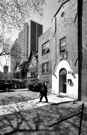
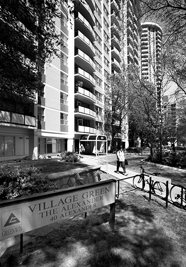
Rental apartment and condominium buildings already contain almost half of the dwelling units in Toronto at the millennium. Many of these buildings are clustered in areas already developed as apartment neighbourhoods. In these established Apartment Neighbourhoods, improving amenities, accommodating sensitive infill, where it can improve the quality of life and promoting environmental sustainability are key considerations. Residents in Apartment Neighbourhoods should have a high quality urban environment, safety, quality services and residential amenities.
Apartment Neighbourhoods are distinguished from low-rise Neighbourhoods because a greater scale of buildings is permitted and different scale-related criteria are needed to guide development. While built up Apartment Neighbourhoods are stable areas of the City where significant growth is not anticipated on a city-wide basis, opportunities exist for additional townhouses or apartments on underutilized sites, including new rental housing. This Plan sets out criteria to evaluate these situations.
On smaller sites infill opportunities in Apartment Neighbourhoods can be as simple as a building addition or a new building on an underutilized part of the lot, such as a surface parking lot. On larger sites, infill opportunities may require planning for new and extended public realm including new streets or shared driveways, and may require preserving significant existing landscape and recreation features as part of integrating older apartments with new development in a manner that improves the quality of life for all.
Development in Apartment Neighbourhoods may also include redevelopment of underutilized or vacant sites. This Plan sets out criteria to evaluate these situations.
4.2.1 Apartment Neighbourhoods are made up of apartment buildings and parks, local institutions, cultural and recreational facilities, and small-scale retail, service and office uses that serve the needs of area residents. All land uses provided for in the Neighbourhoods designation are also permitted in Apartment Neighbourhoods.
4.2.2 Development in Apartment Neighbourhoods will contribute to the quality of life by:
4.2.3. Although significant growth is not intended within developed Apartment Neighbourhoods on a city-wide basis, compatible infill development may be permitted on a site within a developed Apartment Neighbourhood with one or more existing apartment buildings which improves the existing site conditions by means such as:
Any application for infill development on a site containing one or more existing apartment building(s) will be considered in the context of these evaluative criteria, and other relevant policies of this Plan. A discussion of how the development addresses these criteria should be included in any Planning Rationale Report accompanying the application.
4.2.4. Infill development may be permitted on a site within a developed Apartment Neighbourhood that creates a horizontal addition to an existing apartment building provided:
While a horizontal addition should be low-rise or mid-rise in form, an addition in the form of a tall building may also be considered and will also meet the criteria set out in a) and b) above.
4.2.5. Infill development may be permitted on a site within a developed Apartment Neighbourhood that creates an addition on top of an existing apartment building provided the vertical addition:
4.2.6. On larger sites which have the opportunity for more than one new building, a framework of additional public streets, shared driveways, new parkland and shared open space may be required to create infill development that meets the objectives of this Plan.
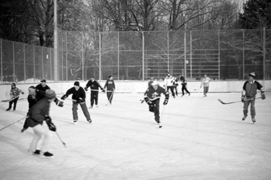
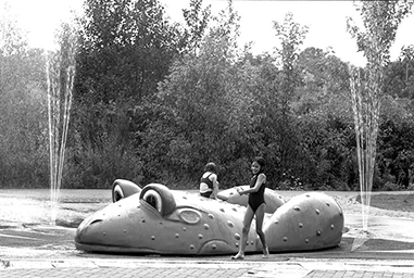
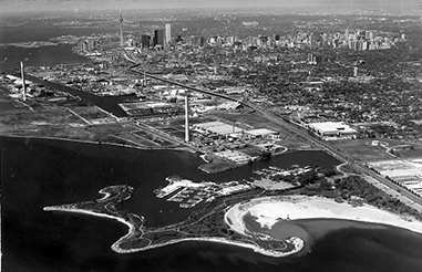
Toronto’s many parks and open spaces offer residents, workers and visitors a range of experiences – everything from the extensive urban wilderness of the Rouge National Urban Park to the urbanity and intimacy of the community parks that are scattered throughout the city’s neighbourhoods. The Parks and Open Space Areas in our city are the places where we can take a break from the bustle of city life, participate in a sporting activity, or play an informal game of frisbee with friends on a Sunday afternoon. They contain many of the City’s natural habitat areas, recreation trails, stormwater management facilities and include some privately owned lands which adjoin a ravine or the waterfront.

4.3.1. Parks and Open Space Areas are the parks and open spaces, valleys, watercourses and ravines, portions of the waterfront, golf courses and cemeteries that comprise a Green Space System in Toronto. They comprise the areas shown on Maps 13-23 shown as Natural Areas, Parks and Other Open Space Areas.
4.3.2. Development is generally prohibited within Parks and Open Space Areas except for recreational and cultural facilities, conservation projects, cemetery facilities, public transit and essential public works and utilities where supported by appropriate assessment. Hydro uses will have primacy of use on those lands identified as hydro corridors on Maps 13-23.
4.3.3. The areas shown as Natural Areas on Maps 13-23 will be maintained primarily in a natural state, while allowing for:
4.3.4. The areas shown as Parks on Maps 13-23 will be used primarily to provide public parks and recreational opportunities.
4.3.5. The areas shown as Other Open Space Areas on Maps 13-23 will be used primarily for golf courses, cemeteries, and open spaces associated with utilities and other specialized uses and facilities.
4.3.6. Any development provided for in Parks and Open Space Areas will:
4.3.7. Parks and Open Space Areas that are privately owned are not necessarily open to the general public nor intended to be purchased by the City. If an application is made to develop such lands and the City or a public agency does not wish to purchase them to extend the public open space system, the application will be considered on the basis of its consistency with the policies of this Plan.
4.3.8. The sale or disposal of publicly owned lands in Parks and Open Space Areas is discouraged and no City owned lands in Parks and Open Space Areas will be sold or disposed of. However, City owned land in Parks and Open Space Areas may be exchanged for other nearby land of equivalent or larger area and comparable or superior green space utility.
Utility Corridors play a vital role in the City as corridors for the transmission of energy, communication and the movement of people and goods. Utility Corridors mainly consist of rail and hydro rights-of-way. These linear corridors are a defining element of the landscape fabric of the City and many of these corridors also serve important local functions as parkland, sport fields, pedestrian and cycling trails and transit facilities. These corridors should be protected for future public transit routes and linear parks and trails.
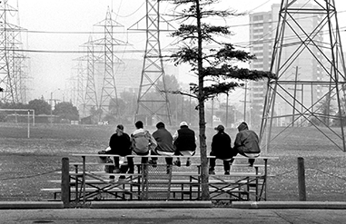
From time to time, active hydro and rail corridors may be decommissioned and the lands declared surplus. Although often narrow, there are many opportunities for reuse of hydro and rail corridors. When corridors are declared surplus every effort should be made to secure Utility Corridors for a variety of public uses.

4.4.1. Utility Corridors are hydro and rail corridors primarily used for the movement and transmission of energy, information, people and goods.
Hydro corridors are used primarily for the transmission of energy. They may also be used for secondary purposes such as parks, pedestrian and bicycle trails, agriculture, parking lots, open storage, essential public services, stormwater management ponds, public transit facilities and garden centres with temporary buildings. Secondary uses in hydro corridors will:
4.4.3. Linear rail corridors are used primarily for the movement of people and goods. In the event they are no longer required for rail use, they will be protected for future use as public transportation routes, bicycle and pedestrian trails and telecommunications and electrical corridors, where appropriate.
4.4.4. Where Utility Corridors are declared surplus, they may be acquired or leased by the City or other public agencies for public services and amenities, such as public transportation routes, bicycle and pedestrian trails, community and allotment gardens, linear parks and open space or shared parking facilities.
4.4.5. Where appropriate, development or redevelopment on lands nearby or adjacent to Utility Corridors will:
4.4.6. Protection, enhancement or restoration of the natural heritage system within Utility Corridors will be pursued wherever possible, as shown on Map 9.
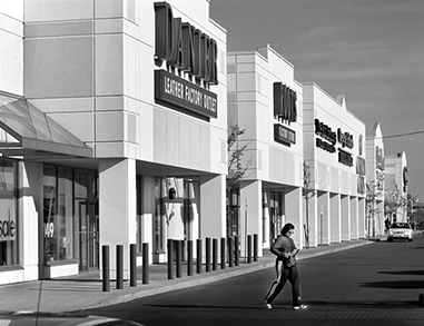
Mixed Use Areas achieve a multitude of planning objectives by combining a broad array of residential uses, offices, retail and services, institutions, entertainment, recreation and cultural activities, and parks and open spaces. Torontonians will be able to live, work, and shop in the same area, or even the same building, giving people an opportunity to depend less on their cars, and create districts along transit routes that are animated, attractive and safe at all hours of the day and night.
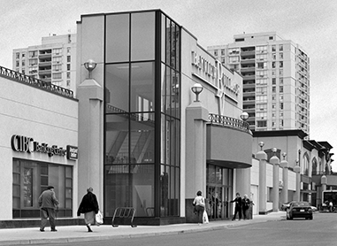
Mixed Use Areas will absorb most of the anticipated increase in retail, office and service employment in Toronto in the coming decades, as well as much of the new housing. The proportion of commercial and residential uses will vary widely among Mixed Use Areas. For example, office and retail uses will continue to be paramount in the Financial District, but much of the new development along the Avenues will have a residential emphasis.
Not all Mixed Use Areas will experience the same scale or intensity of development. The highest buildings and greatest intensity will typically occur Downtown, particularly in the Financial District. The Centres will develop at differing scales and densities, set out in their respective Secondary Plans and zoning by-laws, reflecting the context of their surroundings and transportation infrastructure. Development along the Avenues will generally be at a much lower scale than in the Downtown and most often at a lower scale than in the Centres.
4.5.1.Mixed Use Areas are made up of a broad range of commercial, residential and institutional uses, in single use or mixed use buildings, as well as parks and open spaces and utilities.
4.5.2. In Mixed Use Areas development will:
4.5.3. Large scale, stand-alone retail stores and/or “power centres” are not permitted in Mixed Use Areas within the Central Waterfront, and Downtown, and are permitted only through a zoning by-law amendment in other Mixed Use Areas. Where permitted new large scale, stand-alone retail stores and/or “power centres” will ensure that:
4.5.4. Existing large scale, stand-alone retail stores and/or “power centres” legally established prior to the approval date of this Official Plan in Mixed Use Areas are permitted.
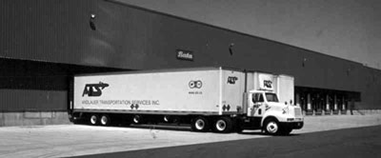
Employment Areas are places of business and economic activities vital to Toronto’s economy and future economic prospects. Both Core Employment Areas and General Employment Areas are important and comprise the City’s “Employment Areas” as defined under the Provincial Planning framework.
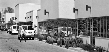
The majority of Employment Areas are designated as Core Employment Areas where uses identified in Policies 4.6.1 and 4.6.2 are permitted. Core Employment Areas are, for the most part, geographically located within the interior of Employment Areas. Uses that would attract the general public into the interior of employment lands and possibly disrupt industrial operations are not generally permitted in Core Employment Areas. Industrial trade schools are traditionally permitted in Employment Areas and are provided for in Core Employment Areas. Media facilities include uses such as, but are not limited to, production studios and establishments that manufacture printed and/or digital communications.
General Employment Areas are generally located on the periphery of Employment Areas on major roads where retail, service and restaurant uses can serve workers in the Employment Area and would also benefit from visibility and transit access to draw the broader public. Retail uses on the periphery of Employment Areas frequently serve as a buffer between industries in the interior of Employment Areas and nearby residential areas. In addition to all of the uses permitted in a Core Employment Area, the uses identified in Policy 4.6.3 are also permitted in General Employment Areas. Automobile dealerships are permitted as a retail and service use in a General Employment Area.
All types of retail are provided for in a General Employment Areas. However, because major retail developments have the potential for greater impacts, they may be permitted only through an amendment to this Plan and the enactment of a site specific zoning by-law by way of a City-initiated Municipal Comprehensive Review. All land designated Core Employment Areas and General Employment Areas contribute equally to the achievement of economic development and growth objectives.
4.6.1. Core Employment Areas are places for business and economic activities. Uses permitted in Core Employment Areas are all types of manufacturing, processing, warehousing, wholesaling, distribution, storage, transportation facilities, vehicle repair and services, offices, research and development facilities, utilities, waste management systems, industrial trade schools, media, information and technology facilities, and vertical agriculture.
4.6.2. The following additional uses are permitted provided they are ancillary to and intended to serve the Core Employment Area in which they are located: parks, small-scale restaurants, catering facilities, and small-scale service uses such as courier services, banks and copy shops. Small scale retail uses that are ancillary to and on the same lot as the principal use are also permitted. The Zoning By-law will establish development standards for all these uses.
4.6.3. General Employment Areas are places for business and economic activities generally located on the peripheries of Employment Areas. In addition to all uses permitted in Policies 4.6.1 and 4.6.2, permitted uses in a General Employment Area also include restaurants and all types of retail and service uses.
4.6.4. Fitness centres are permitted in General Employment Areas. Ice arenas legally established before March 26, 2018 in General Employment Areas are permitted.
4.6.5. New retail developments that result in the establishment of a major retail site with 6,000 square metres or more of retail gross floor area on a lot may only be permitted as the primary use in General Employment Areas through an amendment to this Plan and enactment of a site specific zoning by-law by way of a City-initiated Municipal Comprehensive Review if:
4.6.6. New retail developments that include one or more stores totaling 6,000 square metres or more of new retail gross floor area may only be permitted as the primary use in General Employment Areas through an amendment to this Plan and enactment of a site specific zoning by-law by way of a City-initiated Municipal Comprehensive Review where:
4.6.7. Residential uses are prohibited on lands designated Core Employment Areas and General Employment Areas.
4.6.8. Development will contribute to the creation of competitive, attractive, highly functional Employment Areas by:
4.6.9. Implementing Zoning By-law(s) will create a gradation of zones that distinguish between employment uses on the basis of their potential operations and impacts to ensure a compatibility of uses within Employment Areas.
Residential uses prohibited in Core Employment Areas and General Employment Areas include but are not limited to, living accommodations such as dwelling units, bed-sitting rooms, group homes, laneway suite, nursing home, residential care home, retirement home, and seniors’ community house.Sensitive Land UsesFor clarity and for the purpose of this Plan, the term sensitive land uses means: buildings, amenity areas, or outdoor spaces where routine or normal activities occurring at reasonably expected times have the potential to experience an adverse effect, due to nearby major facilities or due to emissions that may be generated by the land uses permitted by this Plan within an Employment Area. Sensitive land uses may be a part of the natural or built environment, principal uses or accessory/ ancillary uses. Residential uses shall be considered sensitive land uses. Other examples may include, but are not limited to: daycare centres, and educational and health facilities. If the Plan permits a use in an Employment Area, the use is not a sensitive land use within that Employment Area for the purposes of this Plan, but may be a sensitive land use as defined in the Provincial Policy Statement and, if so, such land use may require noise, vibration, air quality, and/or odour studies as part of complete application.
Regeneration Areas open up unique areas of the City to a wide array of uses to help attract investment, re-use buildings, encourage new construction and bring life to the streets. These areas are key to the Plan’s growth strategy, reintegrating areas of the City that are no longer in productive urban use due to shifts in the local or global economies. In Regeneration Areas, commercial, residential, live/work, institutional and light industrial uses can be mixed within the same block or even the same building.
Not all Regeneration Areas will have the same mix of uses or development policies. Each will differ in terms of its existing built context, character of adjacent areas and market opportunities for revitalization. Regeneration Areas will need “tailor-made” strategies and frameworks for development, provided through a Secondary Plan. In some cases, there will be a need for extensive infrastructure improvements as in the case of the Central Waterfront. In other smaller Regeneration Areas, the road system may be in place and the emphasis will be on re-use of existing buildings and compatible infill. But, in every case Regeneration Areas represent a tremendous opportunity to unlock potential and help direct growth within the City.
4.7.1. Regeneration Areas will provide for a broad mix of commercial, residential, light industrial, parks and open space, institutional, live/work and utility uses in an urban form to:
4.7.2. For each Regeneration Area a framework for new development will be set out in a Secondary Plan. Development should not proceed prior to approval of a Secondary Plan. The Secondary Plan will guide the revitalization of the area through matters such as:
4.7.3. Large scale, stand-alone retail stores and “power centres” are not permitted in Regeneration Areas.
4.7.4. Existing large scale, stand-alone retail stores and “power centres” legally established prior to the approval date of this Official Plan in Regeneration Areas are permitted uses.
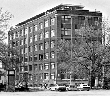
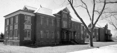
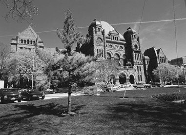
We rely upon quality public institutions at every stage of our lives. Our schools, universities, health care facilities and public cultural facilities are major contributors to a high quality of life in our City. Local community institutions such as schools, libraries, day nurseries, nursing homes, homes for the aged, places of worship and recreation centres are woven into communities throughout the City and permitted in most designations. However, the major health, post-secondary education and governmental institutional campuses are designated as Institutional Areas with applicable policies.
Toronto is home to:
These major institutions are among the largest employers in the City and attract thousands of employees, patients, students and visitors every day. A thriving, adequately funded network of major institutions must be supported in Toronto. As the population of the GTA grows, there will be a growing demand for expansion of our hospital and post-secondary education networks. To provide for future institutional expansion, major institutions are encouraged to consider leasing rather than selling lands that are surplus to their current needs and to consider alternative public uses for those lands.
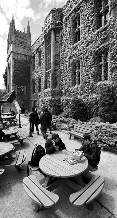
These major institutions are also home to a core concentration of research, cultural and educational institutions that are fundamental to emerging economic sectors. The clustering and interaction of our universities, hospitals and associated research facilities plays a critical role in innovation and the creation of new products and services. Major institutions need the flexibility to partner with private sector concerns to create joint research facilities, or to house private research and development facilities.
Some of Toronto’s hospitals have specialties that draw patients from across Ontario. In emergency situations, patients are flown into heliports at hospitals. It is vital to protect the flight paths to these hospital heliports.
4.8.1. Institutional Areas are made up of major educational, health and governmental uses with their ancillary uses, cultural, parks and recreational, religious, commercial and institutional residence facilities, including the full range of housing associated with a health institution, as well as utility uses. Our major health and educational institutions are important employers and service providers and will continue to grow to serve the needs of an increasing city and regional population.
4.8.2. Strong linkages between major institutions and the private sector for joint research, innovation and the creation of new products and services will be encouraged by:
4.8.3. Institutional facilities that serve a broader regional population should, wherever possible, locate close to an existing rapid transit line. Where an existing university, college or hospital campus, or major cultural institution is not directly served by rapid transit, the provision of excellent surface transit to these institutions will be pursued.
4.8.4. New buildings and structures in the vicinity of hospital heliports will be sited and massed to protect the continued use of flight paths to hospital heliports.
Toronto’s universities, colleges and hospitals need flexibility to develop their lands quickly according to a strategic plan when a donor or government provides the money to build. Campus development plans provide these institutions with the opportunity to identify sites for future expansion and lands surplus to campus needs. They also offer a chance to build a consensus on the form and scale of new development.

Hospitals must be allowed to grow to serve us but these expansions must be planned to minimize increases in traffic and parking on nearby neighbourhood streets and the loss of affordable housing, especially when expansions are proposed beyond the boundaries of Institutional Areas. In such cases, early consultation between the hospital, the City and area residents needs to occur. Campus plans may form the basis for a Secondary Plan.
4.8.5. Universities, colleges and hospitals will be encouraged to create campus plans in consultation with nearby communities that will:
4.8.6. When lands in Institutional Areas or the sites of major government, health care or educational institutions are declared to be surplus, the owner is encouraged to investigate the possible use of the site for an alternative suitable public institutional purpose, affordable housing or public open space, before applying to redesignate the lands for other purposes. Institutional owners of well-located parcels of surplus lands are encouraged to lease rather than sell such properties wherever possible.