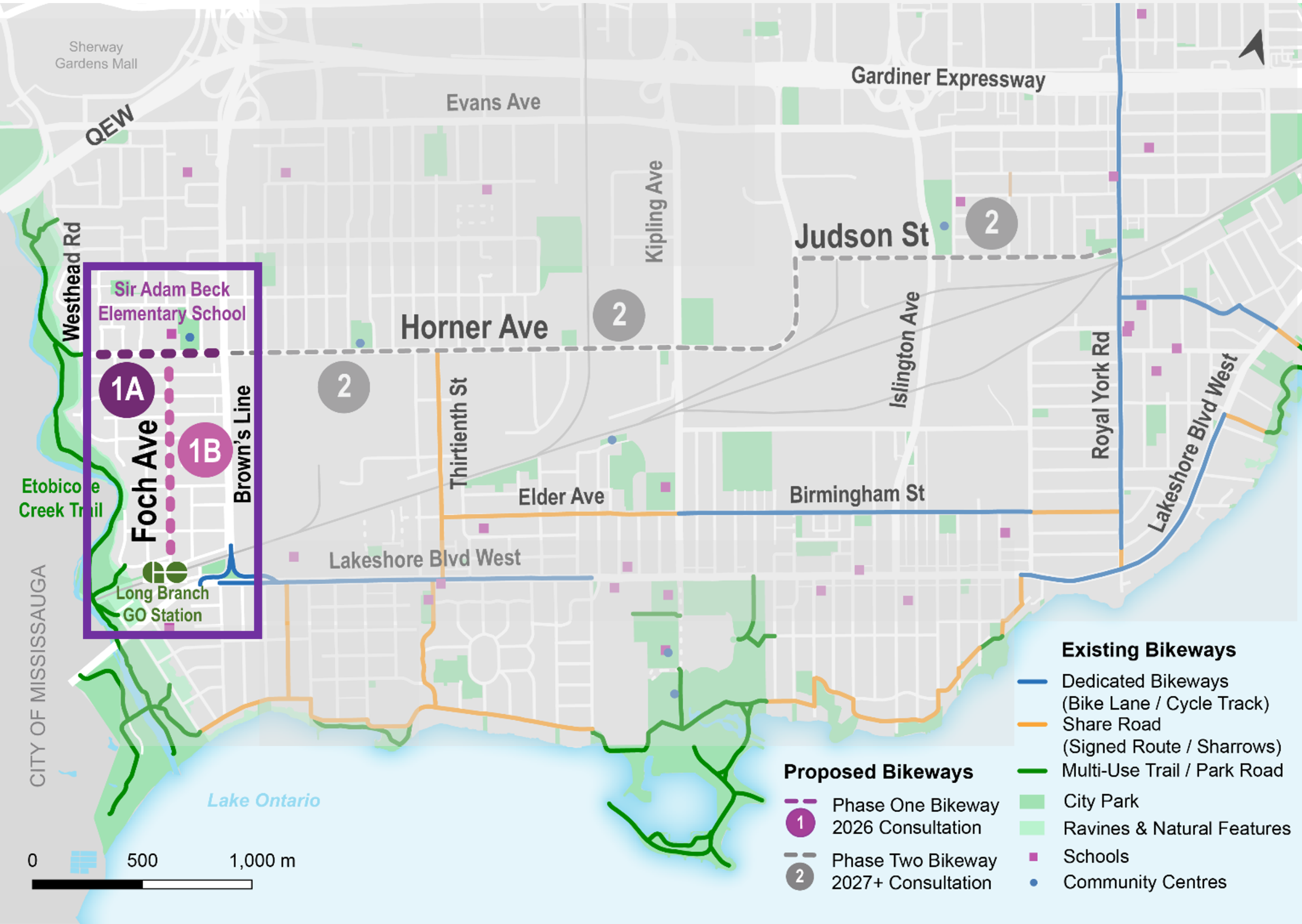
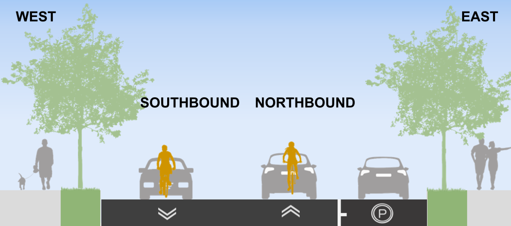
The proposed changes will be designed and consulted on in two phases. Phase 1 changes are proposed for Horner Avenue from Westhead Road to Brown’s Line, and Foch Avenue from Horner Avenue to Edgeware Drive. Improvements would maintain motor vehicle lanes while slowing the speed of cars through traffic calming and the addition of bike lanes and shared lane markings. The bikeways would connect the Etobicoke Creek Trail, Sir Adam Beck School, Alderwood Pool and Library, residences, church, and the Long Branch GO Station.
Public consultation and installation for the Horner Avenue Road Safety Improvements will take place over two phases described below. The project is currently in Phase 1.
Public consultation for Phase 2 is anticipated as early as 2027, at which time further details about proposed design changes, reporting and implementation schedule will be available.

*Observed parking demand could be accommodated in existing parking lots and side streets.
There would be no bike lanes, change to motor vehicle lanes or change to the existing parking rules. A potential Bike Share Station and bicycle lockers at Edgeware Drive by GO Station are under review.
The comment period for this consultation has closed. A Public Consultation Report will be shared on this page in the coming weeks.
Public feedback, along with technical and policy considerations, will be used to inform staff recommendations and decisions made by City Council.
The Public Drop-In Event took place on February 2 at Alderwood Community Centre. It provided an opportunity to view the project information panels and speak with members of the project team one-on-one.
A feedback survey on this project was conducted from January 19 to February 13.
The City Council-approved Cycling Network Plan is a comprehensive roadmap and work plan that outlines the City’s planned investment in our cycling network. It includes a Long-Term Cycling Network Vision, the planned Major City-Wide Cycling Network Routes, and a three-year rolling Near-Term Implementation Program.
The aim of the Cycling Network Plan is to connect gaps in Toronto’s current cycling network, grow the network into new parts of the city, and upgrade existing cycling routes to improve safety and comfort for all road users.
Horner Avenue is identified as a proposed cycling route in the Plan for study and design in the near-term.
While we aim to provide fully accessible content, there is no text alternative available for some of the content on this page. If you require alternate formats or need assistance understanding our maps, drawings or any other content, please contact us at 416-392-8833 or email katelynn.northam@toronto.ca.
To receive project updates by email, please contact us and indicate that you would like to be added to the mailing list.