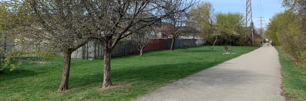
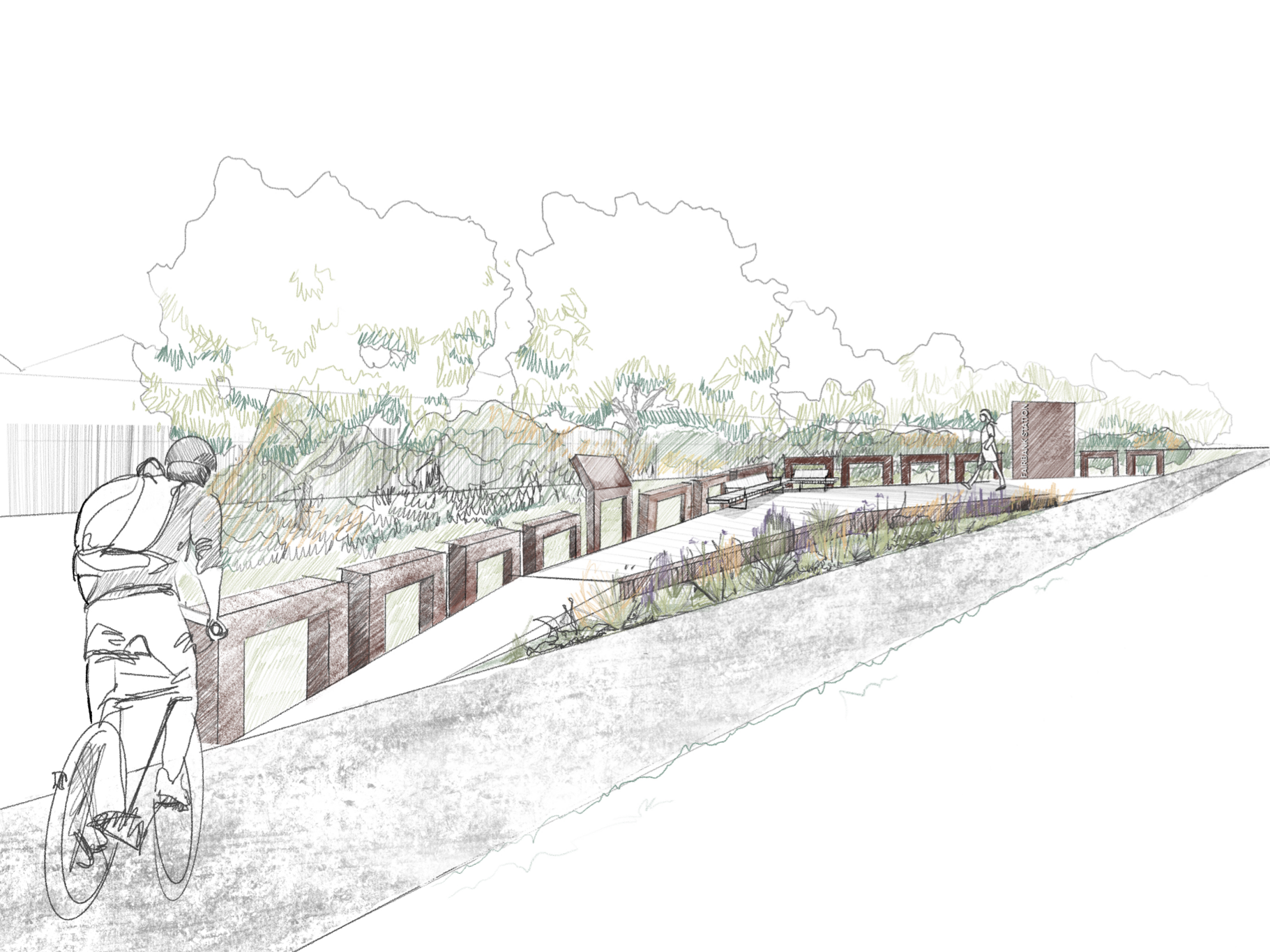
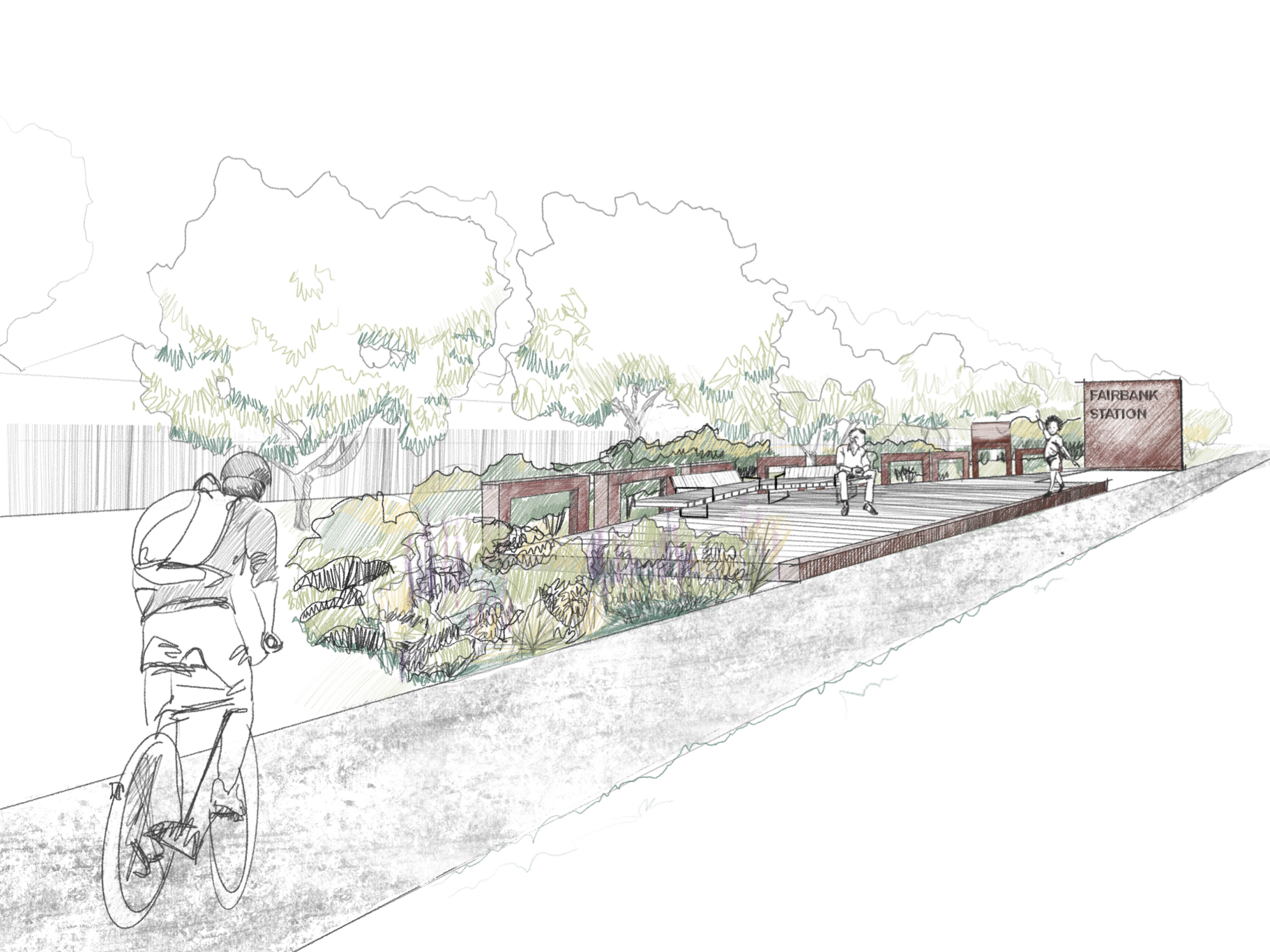
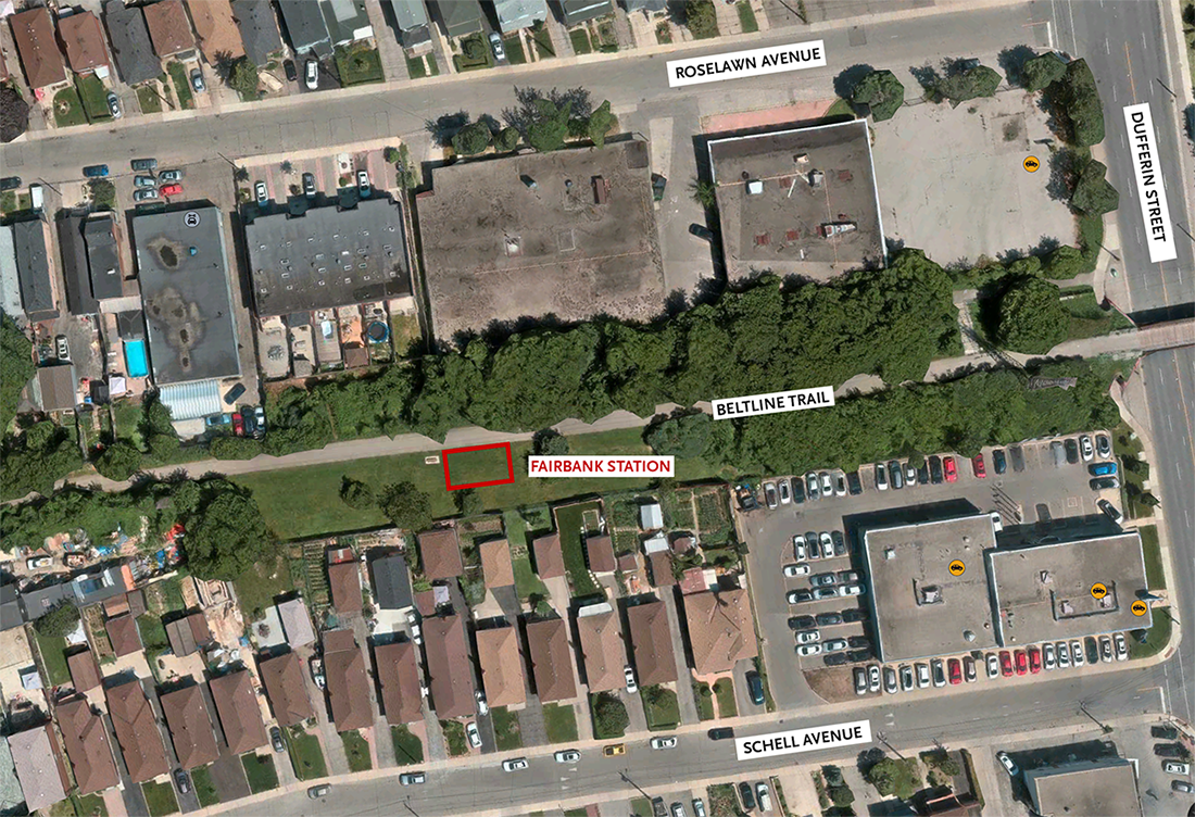
Beltline Trail east of the future location of the Fairbank commemorative station.
In the early 1890s, the Belt Line Railway connected new suburbs to downtown in a circular route around the city. Today, it is known as the Beltline Trail, a popular 4.5-kilometre tree-lined corridor enjoyed by all. Two new interpretive installations are being added along the trail to commemorate the Belt Line Railway as a part of Toronto’s Heritage.
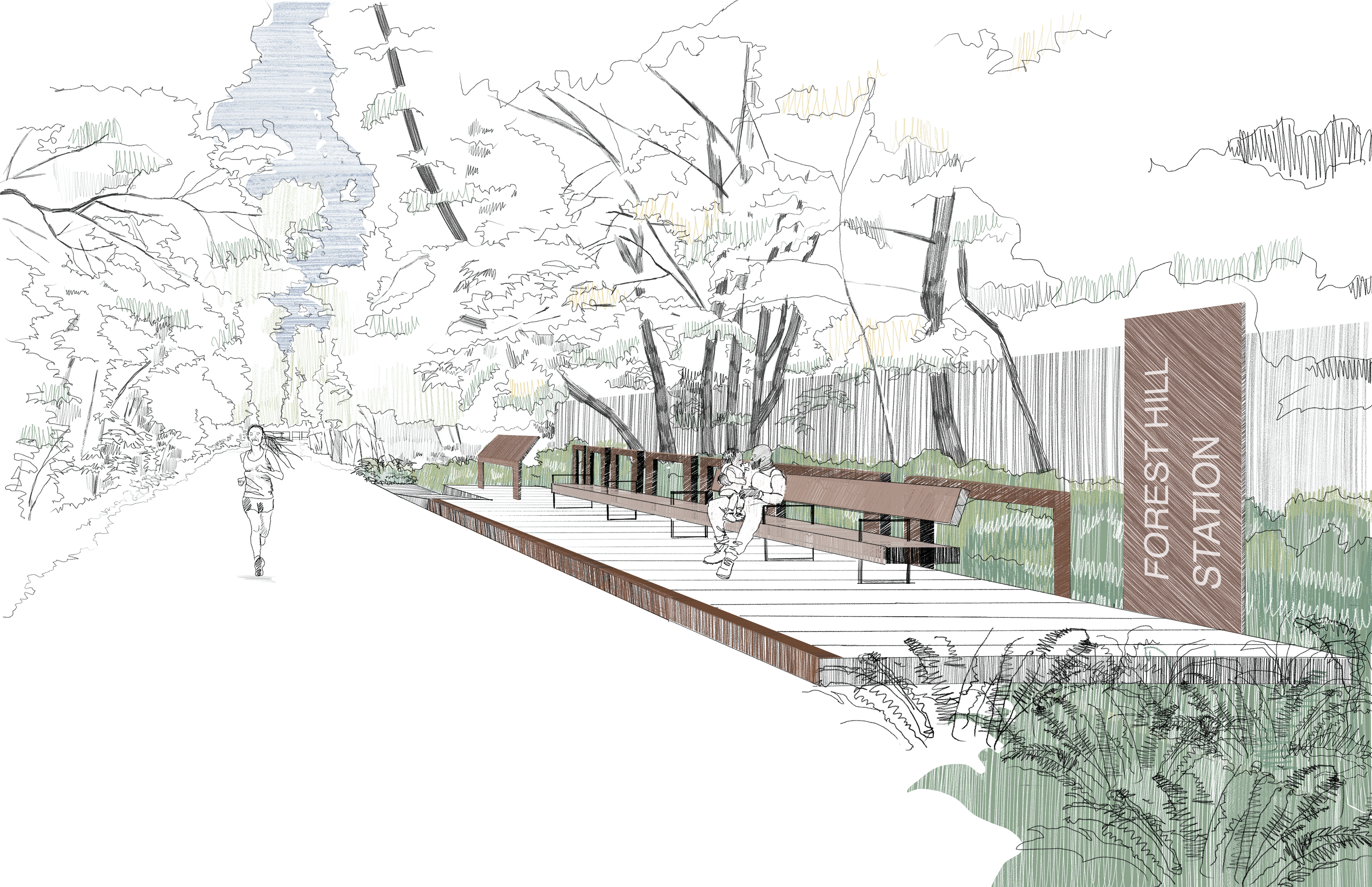
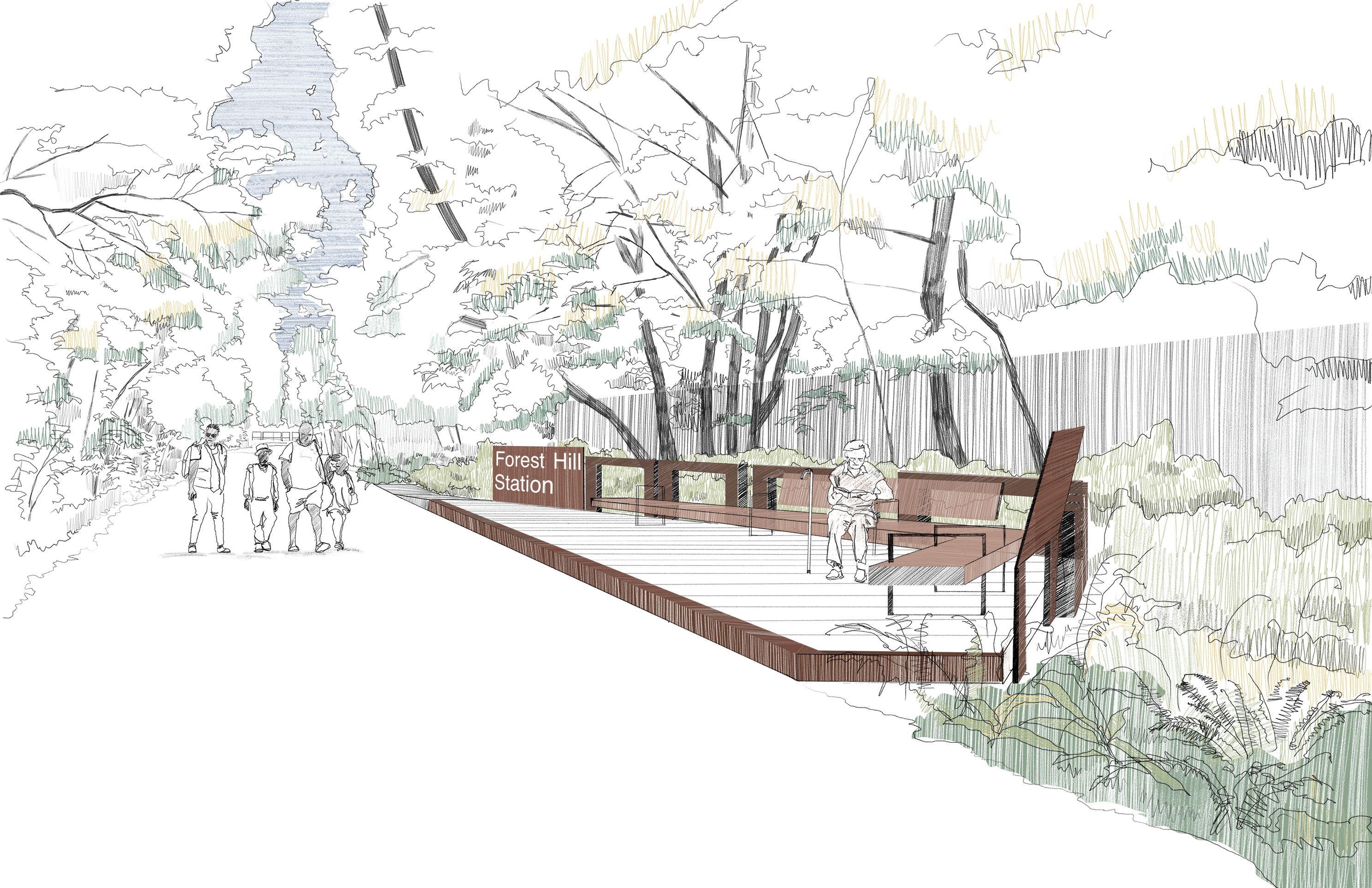
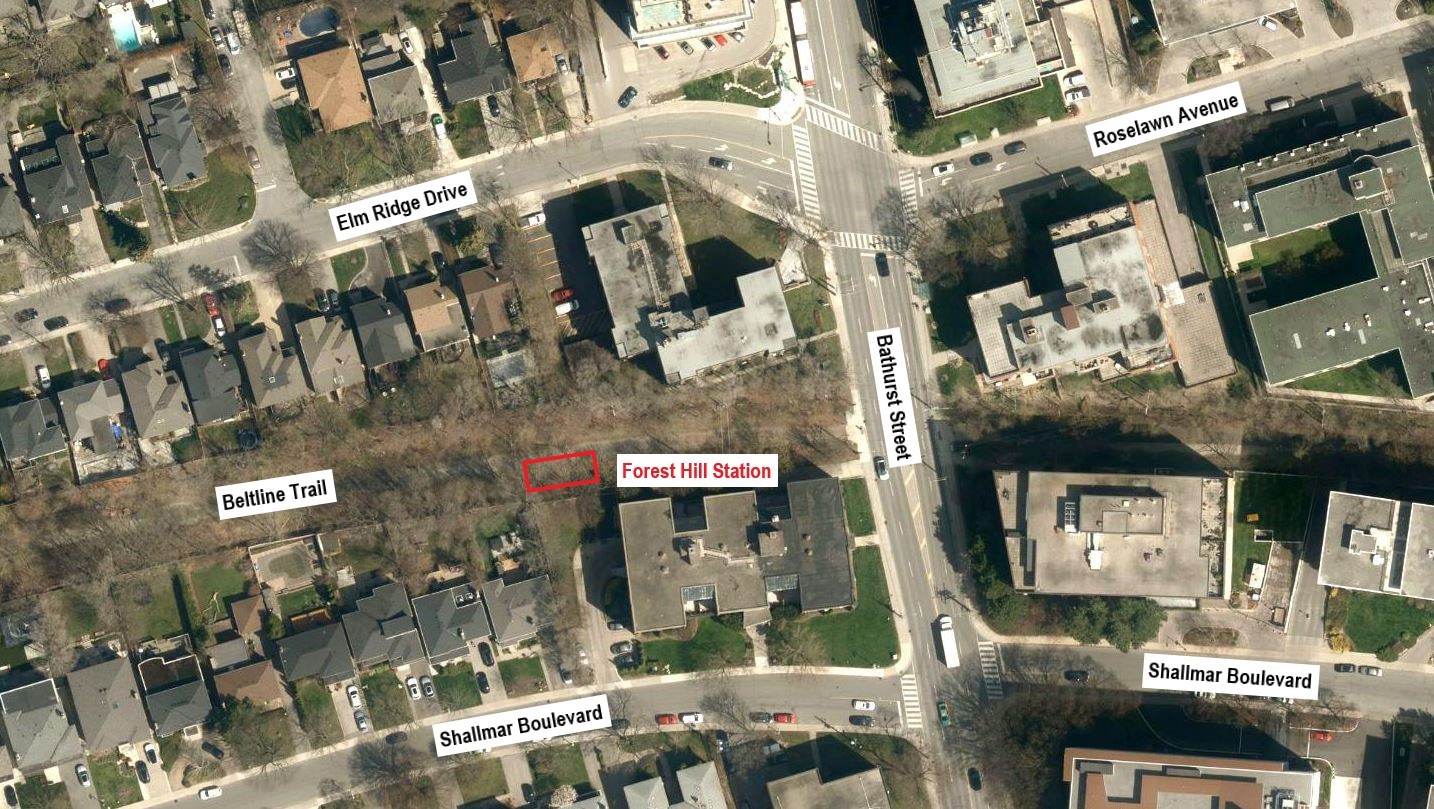
The Fairbank commemorative station will be located west of Dufferin Street, and the Forest Hill Lost Station will be located at Bathurst Street. The design for each installation will be determined with the help of community feedback.
While we aim to provide fully accessible content, there is no text alternative available for some of the content on this site. If you require alternate formats or need assistance understanding our maps, drawings, or any other content, please contact Andrea Awdish at 416-396-8173.
Project Timeline
Fall 2023: Community engagement for Fairbank Station
Winter 2023/2024 to Spring 2024: Site analysis and concept design of Forest Hill Commemorative Station
Summer 2024: Community engagement for Forest Hill Station
Fall 2024 to Summer 2025: Detailed design
Fall 2025: Hire a construction team
Fall 2026: Construction starts
Winter 2026: Construction complete
The timeline is subject to change.
Project Updates
September 2024
Online Survey
From August 28 to September 17, 2024, an online survey collected community feedback from at least 244 community members on two design options for the Forest Hill Lost Station.
Feedback Summary
Overall, 45 per cent of respondents preferred Design Option B and 41 per cent preferred Design Option A.
In response to Design Option A:
92 per cent liked the addition of an accessible ramp
82 per cent liked the access from the Beltline trail
75 per cent agreed there were enough seating options
73 per cent agreed there were enough plaques/historical interpretative elements
64 per cent agreed the station design was inclusive
48 per cent agreed there were enough plantings
In response to Design Option B:
86 per cent liked the addition of an accessible ramp
78 per cent liked the access from the Beltline trail
70 per cent agreed there were enough seating options
68 per cent agreed there were enough plaques/historical interpretative elements
63 per cent agreed the station design was inclusive
56 per cent agreed there were enough plantings
In total, 38 per cent of respondents provided comments or suggestions, some of which were beyond the scope of this project. This feedback included:
Overall design: Some respondents suggested making the design more reminiscent of a railway station and including more interactive, decorative or whimsical elements. There was also a call to protect the station against vandalism.
Amenities: There was a strong demand for a drinking fountain or bottle filling station. Suggestions also included the addition of shaded or sheltered areas, garbage bins, tables, bike parking, a bike repair station, power outlets and lighting.
Greenery: A few emphasized the importance of adding more plants, including flowers, grasses, shrubs and native species.
Signage and interpretation: There were calls to include more historical information and to commemorate the local community. Some suggested including the word “lost” on the station sign.
Seating: Some suggested the inclusion of longer benches or the removal of armrests from the proposed benches. Others called for separate shorter benches and backrests on all seating.
Safety: There was a request for lighting and a suggestion to include an emergency call button.
Accessibility: Many emphasized the need to include accessible ramps for mobility devices and strollers on both sides of the platform as well as handrails.
Indigenous Placemaking: There was a call to honour Indigenous peoples in the design rather than focusing solely on the colonial history associated with the site.
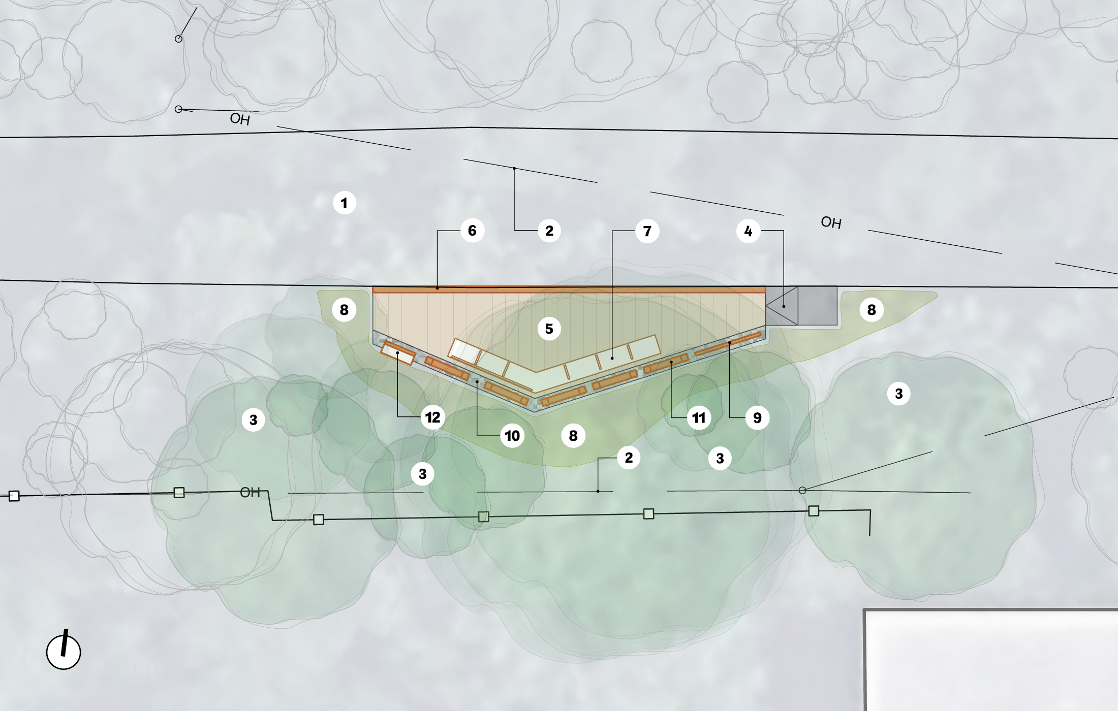
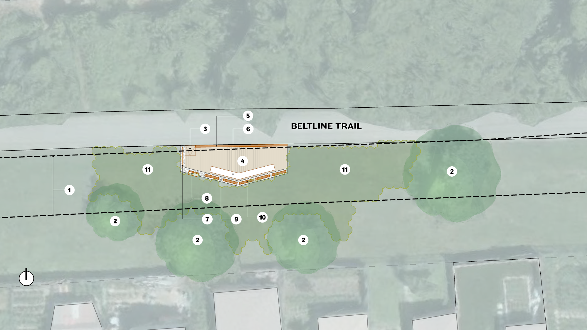
Design Option A
Belt Line Trail
Hydro wires
Existing trees/shrubs
Accessible concrete ramp
Wood platform
Rail edge
Long bench
Planting
Station sign
Crushed stone edge
Railing
Plaque/interpretive element
Design Option B
Belt Line Trail
Hydro wires
Existing trees/shrubs
Accessible concrete ramp
Wood platform
Rail edge
Angled bench
Planting
Station sign
Crushed stone edge
Railing
Plaque/interpretive element
January 2024
Construction of the Fairbank Lost Station will continue as planned, while the Fairbank Junction Station will be deferred indefinitely due to the ongoing construction of the Metrolinx Caledonia Station. As a result of the Fairbank Junction Lost Station deferral, the Forest Hill Lost Station will be added where the Beltline meets Bathurst Street.
October 2023
Online Survey
From September 25 to October 15, 2023, an online survey collected feedback from at least 395 community members on two design options for the Fairbank Lost Station.
Feedback Summary
Overall, 53 per cent of respondents preferred Design Option B and 35 per cent preferred Design Option A.
In response to Design Option A:
86 per cent of respondents liked the inclusion of an accessible ramp
76 per cent liked the access from the Beltline trail
62 per cent agreed there are enough plaques/historical interpretative elements
59 per cent agreed the station design is inclusive
57 per cent agreed there are enough plantings in the station design
38 per cent agreed there are enough seating options throughout the station design
In response to Design Option B:
78 per cent of respondents liked the inclusion of an accessible ramp
69 per cent liked the access from the Beltline trail
67 per cent agreed there are enough plaques/historical interpretative elements
59 per cent agreed the station design is inclusive
67 per cent agreed there are enough plantings in the station design
52 per cent agreed there are enough seating options throughout the station design
In total, 36 per cent of respondents provided comments or suggestions, some of which were beyond the scope of this project. This feedback included:
Safety: Many prioritized better lighting for nighttime use and some advocated for other features that enhance safety.
Amenities: There was a strong demand for more seating, particularly in shaded areas. Suggestions also included the addition of garbage cans, bike parking, fitness and playground equipment, a dog park, drinking fountains, and washrooms.
Greenery: Some emphasized the importance of adding more plants and trees, especially native species that support wildlife and pollinators. There was a concern that the designs introduce too much hard infrastructure at the expense of green spaces.
Accessibility: Many emphasized the need for accessible ramps in both design options to ensure the station is usable by everyone. Some called for adding a second ramp to Design Option B.
Indigenous placemaking: There was a call to honour Indigenous peoples in the design rather than focusing solely on the colonial history associated with the site.
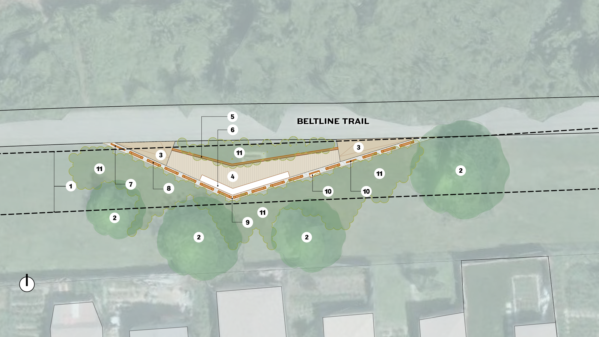
Design Option A
Hydro Wires
Existing trees/shrubs
Accessible ramp
Wood platform
Rail edge
Bench
Sign
Railing
Crushed stone
Plaque/interpretive element
Planting
Design Option B
Hydro Wires
Existing trees/shrubs
Accessible ramp
Wood platform
Rail edge
Bench
Sign
Plaque/interpretive element
Crushed stone
Railing
Planting
About the Project
Three installations commemorating the former train stations of the Belt Line Railway were installed in 2021: Yonge Station, Upper Canada Station and Eglinton Station. The design for Fairbank Junction and Fairbank commemorative station will have a similar appearance to the existing installations, with a material palette reminiscent of the historical stations.
Locations
The location of the Fairbank commemorative station.The location of the Forest Hill commemorative station.
History
In 1892, the Grand Trunk Railway completed construction of the Belt Line, a railway built to connect new suburbs with the downtown in a circular route around the city. While popular in the first few months of operation, the railway service ended in November 1894 and the line from Mt. Pleasant Cemetery to Rosedale was abandoned.
Decades after the Belt Line ended operations, the areas through which the railway once travelled became some of the most desirable neighbourhoods. These new neighbourhoods needed building supplies and fuel, which travelled by rail, so in 1910, the Grand Trunk Railway rebuilt the northern section of the Yonge Street Loop to transport these commodities.
When the W.R. Allen Road opened in the 1970s, the rail service ended east of Marlee Avenue. Kay Gardner and local activists saved the Belt Line from being sold to private owners. The Canadian National Railway Company sold the Belt Line to the City for the purpose of converting it into a recreational trail and linear park.
Today, the 4.5-kilometre corridor is a beautiful tree-lined trail connecting neighbourhoods, parks and open spaces. While none of the Belt Line train stations remain, three of the former locations, referred to as “lost stations”, are now commemorative stations: Eglinton Station, Upper Canada College Station and Yonge Street Station.