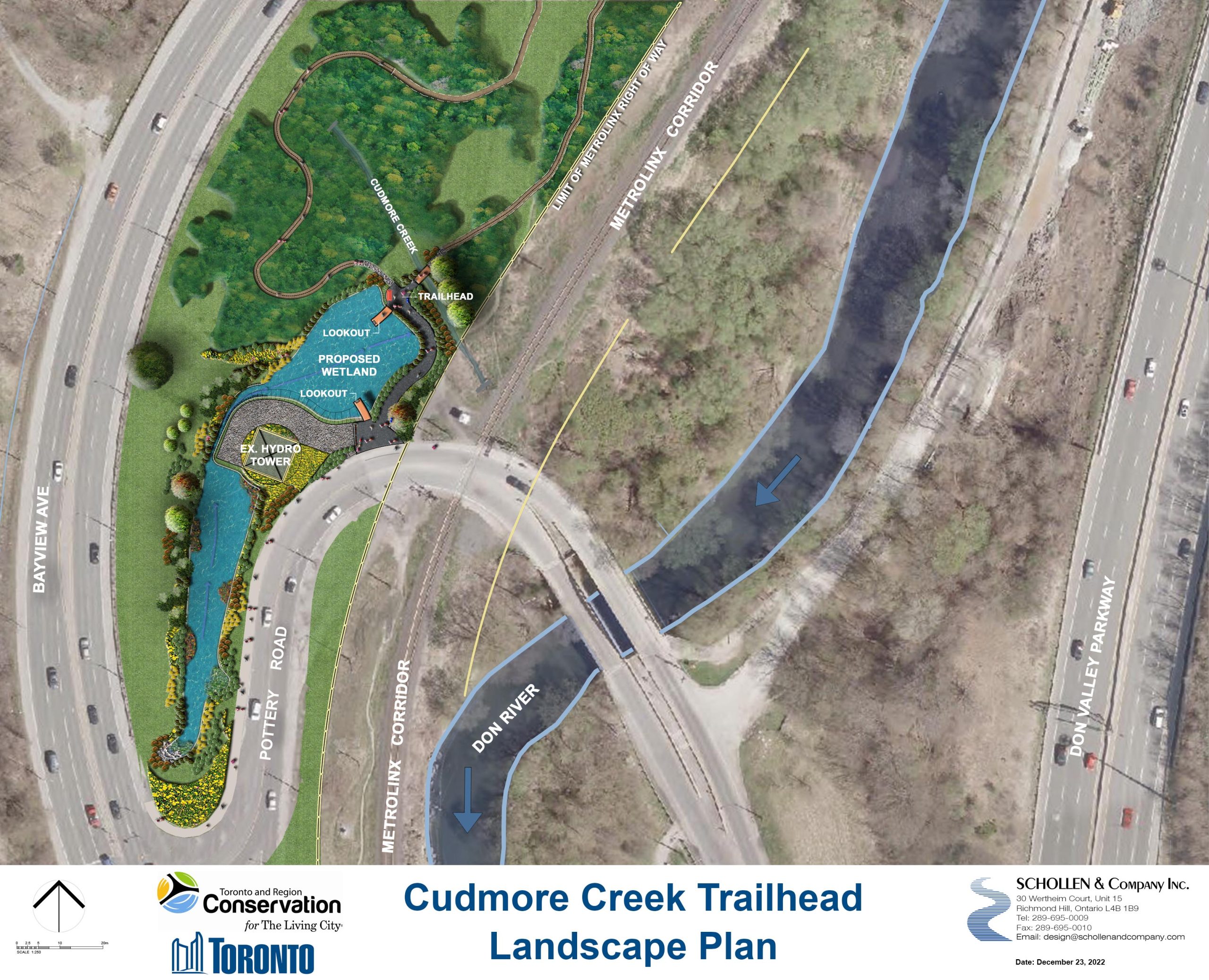
City of Toronto and Toronto and Region Conservation Authority (TRCA) is revitalizing the wetland and creating a new trailhead feature at Cudmore Creek, located at the intersection of Pottery Road and Bayview Avenue.
This project has been funded in part by the Government of Canada’s Investing in Canada Infrastructure Program (ICIP), with additional funds provided by the Hydro One Biodiversity Initiative.
While we aim to provide fully accessible content, there is no text alternative available for some of the content on this site. If you require alternate formats or need assistance understanding our maps, drawings, or any other content, please contact Cheryl Post at 416-392-1948.
This project is now complete and open to the public, as of June 20, 2025. Additional planting, seeding and signage installation can be expected in the coming weeks.
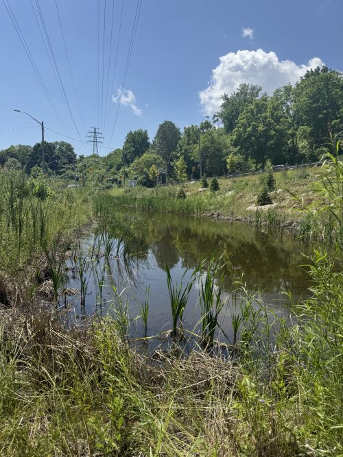
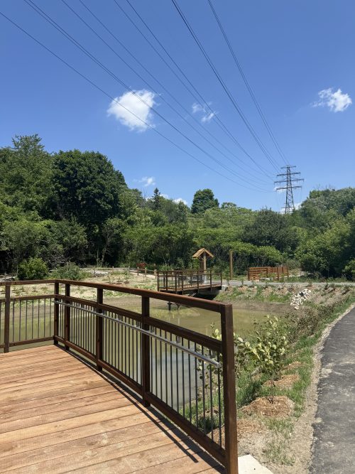
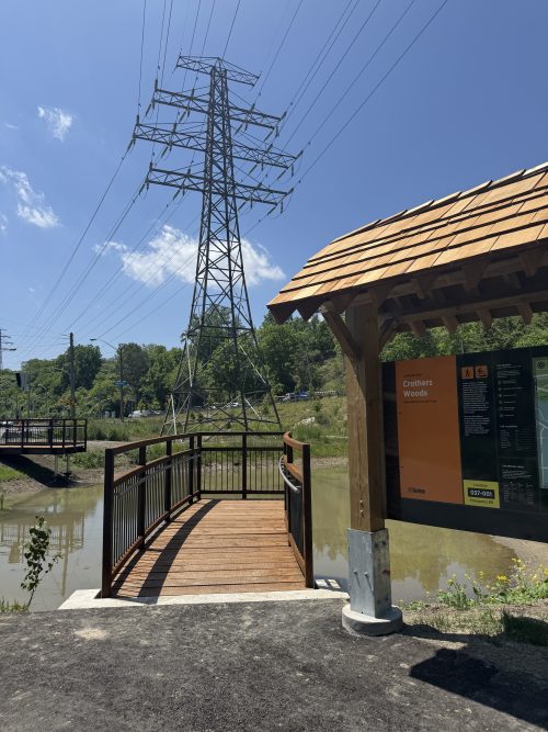
Construction of the Cudmore Creek Wetland and Trailhead is now complete, and the site is open for public use. Trail connections have been completed to the Crothers Woods natural surface trail network, and the new lookouts and all trails are now open. Users will also find a new kiosk with a trail map of the system.
Installation of additional signage, terrestrial and aquatic plantings, and seeding can be expected in the coming weeks. The site will remain open, and no further closers will be required for these remaining works.
Wetland construction is nearing completion. Trail connections, site furnishings and lookouts are being installed. The project completion timeline has been adjusted to Spring 2025 to accommodate the weather requirements for paving and outstanding tree planting. Please continue to respect all trail detours.
During construction, the trailhead at Pottery Road will be closed and access to/from the Crothers Woods trail network from Pottery Road will not be available. Users will be redirected around the site and to alternative access points. Project and detour signage will be provided at main trailheads and decision points throughout construction.
Respect all fencing, trail closures, detours, and construction staff.
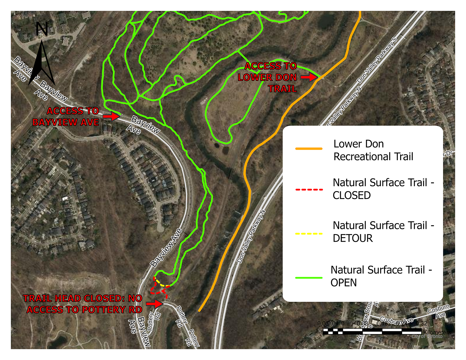
Access points to/from the trail network are available at the following trailheads:
A temporary detour around the project site will be provided throughout construction in order to retain a southern trail loop for bikers or hikers.
This loop does not exit to Pottery Road.
Parking for nearby trail amenities is available at the following locations:
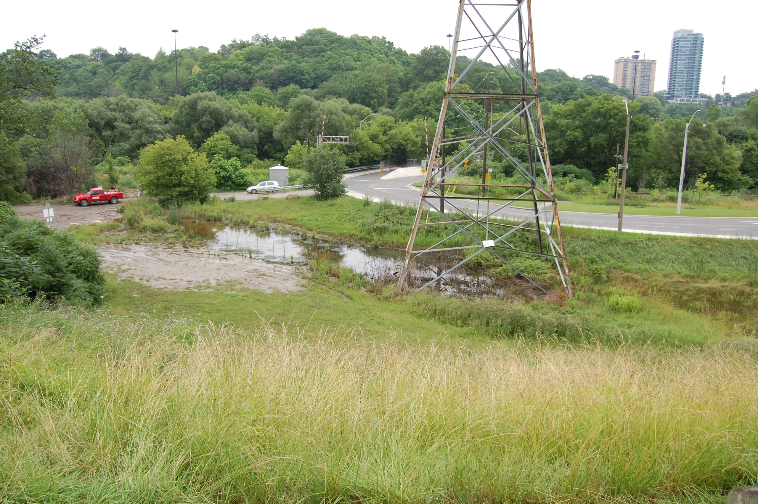
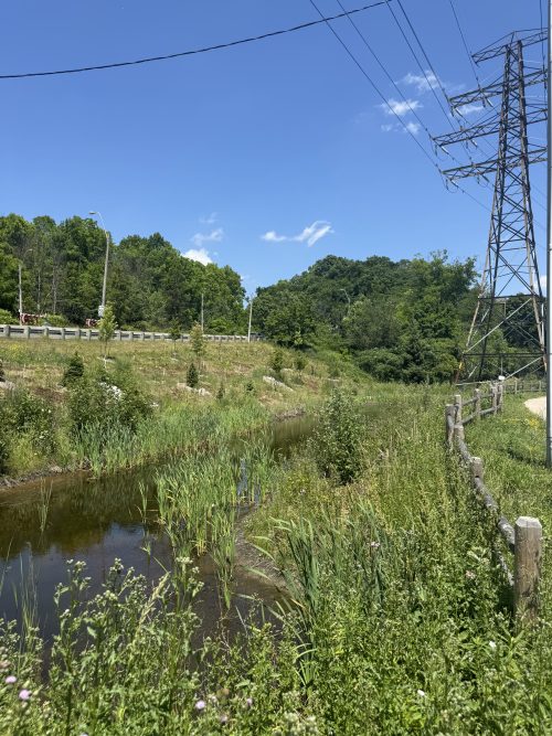
Cudmore Creek is an urbanized tributary of the Don River. This project site is located at the north-east corner of Bayview Avenue and Pottery Road, at the the bottom of Crothers Woods, an Environmentally Significant Area (ESA). The location is the southern-most access point to the Crothers Woods natural-surface trail network, and a close connection point to both the Bayview Multi-Use Trail and the Lower Don Trail.
In the early 1990s, the site was filled in for emergency works after a sewer line break, however following that work, the gravel fill was not removed and the site began being used as an informal parking lot. This restricted the natural regeneration of the site back to wet meadow and wetland habitat. The location of this informal parking area also resulted in an unsafe intersection in conflict with a major Metrolinx railroad crossing, and was often a site of illegal dumping activity, further impacting natural regeneration.
In 2019, the City of Toronto and Metrolinx worked together to successfully close the site to vehicle parking and illegal dumping, while still maintaining user access to the Crothers Woods trail network and nearby parking sites. Additional works are now required to fully restore and enhance natural function and connectivity on the site, utilizing a new wetland and trailhead design developed through extensive coordination between Parks Forestry and Recreation, Toronto Water, Transportation Services, TRCA, Hydro One and Metrolinx.
The new wetland and trailhead design will remove the old gravel parking area, regrade the site, and plant a variety of native trees and shrubs in order to restore and enhance the wetland/wet meadow habitat area. It will also improve trail access by functioning as a formal trailhead for the Crothers Woods trail network, improving connectivity to the Lower Don Trail, and Bayview Multi-use trail nearby. Lookout features will provide an enjoyable user experience, allowing visitors to step off of main trails and view the new wetland. The new design will also improve the safety of traffic, pedestrians and cyclists around the Bayview Intersection and Metrolinx crossing, while maintaining critical maintenance access for HydroOne to their tower.