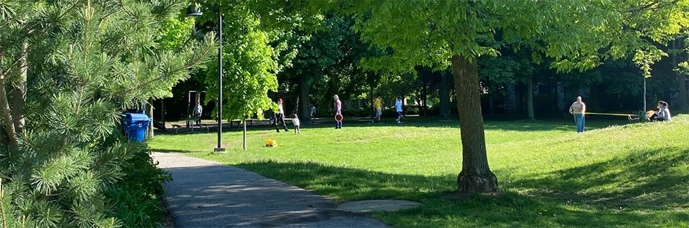
The City is improving Pricefield Road Playground, located near Yonge Street and Summerhill Avenue, and engaging the community in the park design. Proposed improvements under consideration include new pathways, seating, signage, lighting, trees, plantings, and upgrades to the playground.
The engagement plan has been revised in response to community feedback and the webpage content has been reorganized to reflect these updates.
The timeline is subject to change.
Sign up for or unsubscribe from updates related to Pricefield Road Playground Park Improvements.
This project has been classified as a Consult project based on the International Association for Public Participation Spectrum. This means the City will obtain public feedback on the preferred option for the park improvements while keeping the community informed, listening to concerns, acknowledging aspirations and sharing how input influences decisions. This classification was assigned during Community Engagement Phase 3.
This phase started in September 2023. In this phase, planning students from Toronto Metropolitan University worked with residents and stakeholders to explore ideas for the park, which informed the development of design options.
From September 28 to November 12, an online survey gathered feedback from 22 community members. The survey asked participants how they use the park, what changes they would like to see and what features they would like to see retained.
On October 12, the town hall introduced the 20 attendees to the student-led project team and the planning process. Key discussion topics included specific park areas for improvement, seasonal changes, desired amenities and community activities. Participants were encouraged to complete the online survey and attend future events.
October 22 and October 24, pop-up events took place. Six members of the student-led project team were present to provide information, answer questions and guide participants through feedback activities using a map of the existing park. Approximately 20 community members participated in the first event and 14 participated in the second event.
Through Community Engagement Phase 1 and their own research, the student-led team identified the following areas for improvement, opportunities and diverging opinions related to the park improvements.
Areas for improvement include:
Opportunities include:
Diverging opinions:
A student-led team then worked off the outcomes of the student led engagement to develop two study options for the park improvements. These were presented to local residents and stakeholders for feedback, with the input collected used to develop the students’ final design for the park.
In this phase, a student-led team worked off the outcomes of Phase 1 to develop two study options for the park improvements. These were presented to local residents and stakeholders for feedback, with the input collected used to develop the students’ final design for the park.
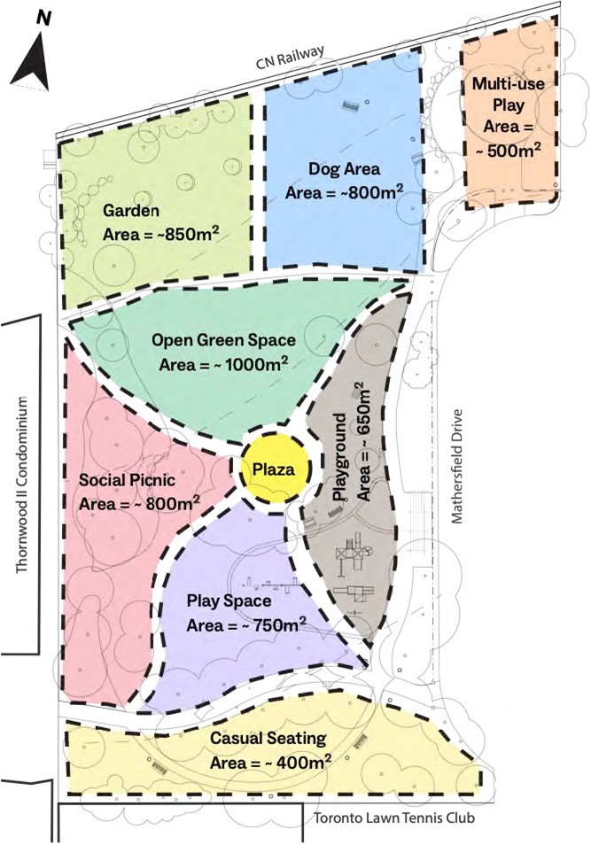
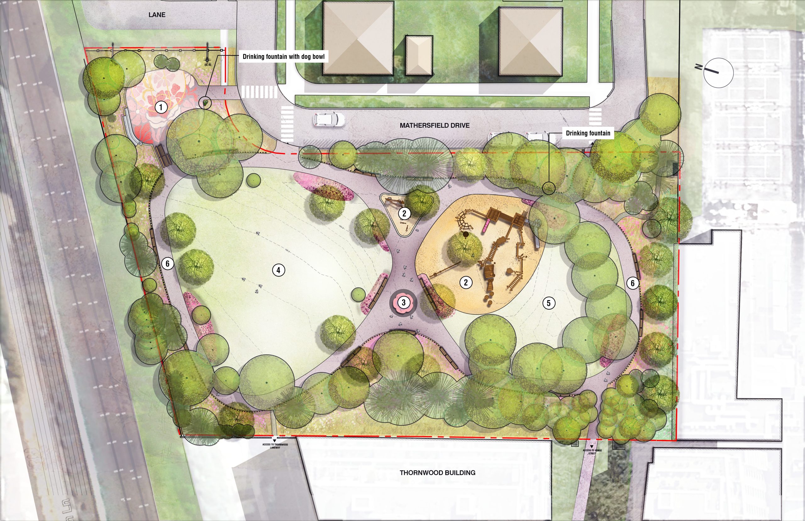
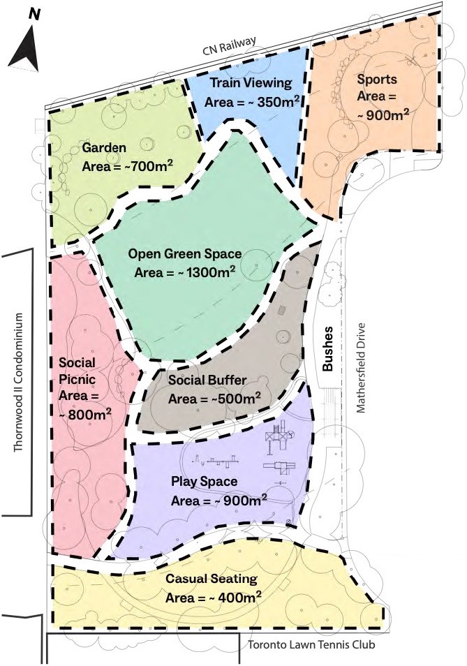
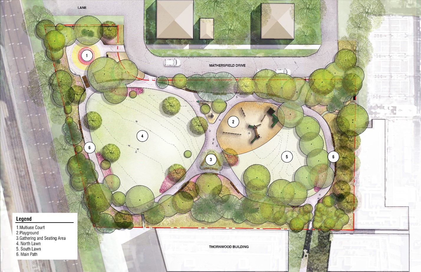
The park includes the following sections:
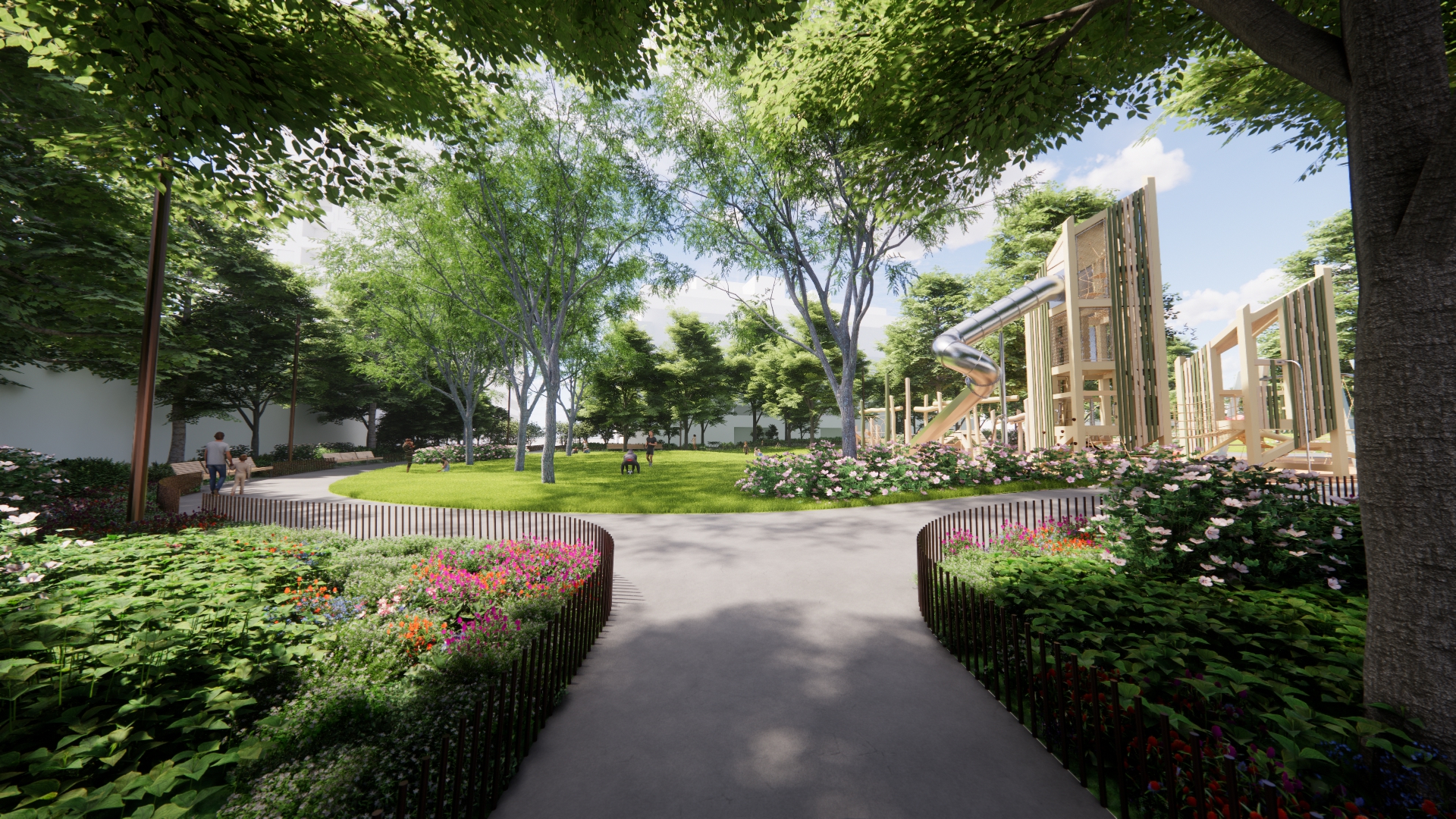
The plan also includes walking paths, trees and seating areas throughout the park, with the different zones separated by dashed black lines.
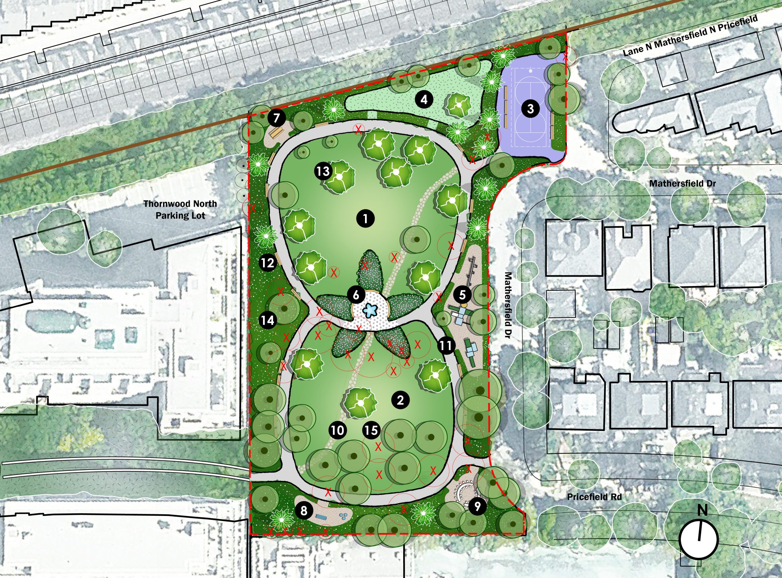
The park includes the following zones:
The plan features pathways, trees, and seating areas spread throughout the park. The different zones are outlined with dashed black lines for clarity.
Hosted at the Toronto Lawn and Tennis Club on November 6, 2023, the workshop presented the two study options and provided an open discussion format where 38 participants engaged with eight information stations. Participants could leave written comments and discuss the study options with members of the student-led project team and the City.
Through community engagement, the student-led team collected the following feedback on each study option and identified the following areas of agreement and disagreement related to the park improvements.
Positive Feedback about Option 1:
Concerns and Suggested Improvements to Option 1:
Positive Feedback about Option 2:
Concerns and Suggested Improvements to Option 2:
Green Spaces and Landscaping:
Play and Recreation:
Seating and Gathering Spaces:
Wayfinding and Circulation:
Dog Off-Leash Area:
In this phase, the City began to lead the engagement and planning for park improvements. This phase started with sharing the students’ study, final concept and its translation into a draft park design with the community. Through Community Engagement Phase 2 and 3, the draft design will be developed into a preferred design used to guide future park improvements.
On November 20, 2025, 72 members of the community attended an in-person community workshop at Jesse Ketchum School to review responses to community feedback on an earlier draft design, including updated guiding principles and design options.
Several members of the project team attended the meeting, including City staff and design consultants, as well as the local Councillor. The meeting was advertised through social media, park signs, the project mailing list, and the local Councillor’s office.
The three-hour meeting began with an opportunity to view the revised design and design elements on printed materials posted around the room. This was followed by a presentation including a summary of the design and engagement process to date, a presentation on the revised design by the designers, and a Question-and-Answer (Q and A) session. After the Q and A, the community had the opportunity to explore display boards and provide feedback through cue cards, sticky notes, dot stickers and by speaking to the team in a general discussion area.
Download the November 20, 2025 workshop presentation.
The following summary reflects feedback collected during the Q and A and in the general discussion area, written feedback submitted by participants on cue cards and post-it notes, dot-voting and drawing on the display boards, as well as feedback received in person and through email after the event.
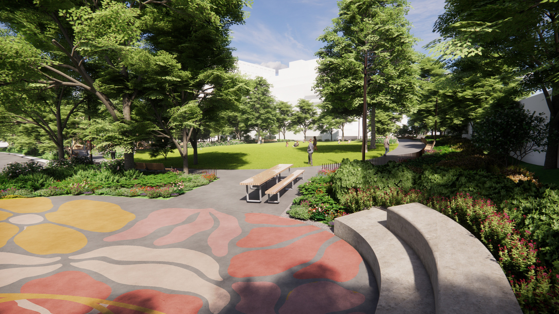
Overall design:
Trees and open space:
Drainage and topography:
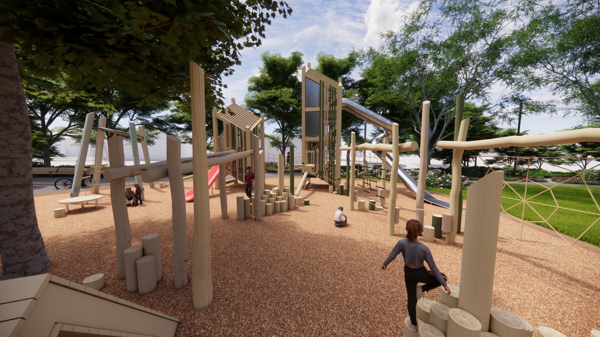
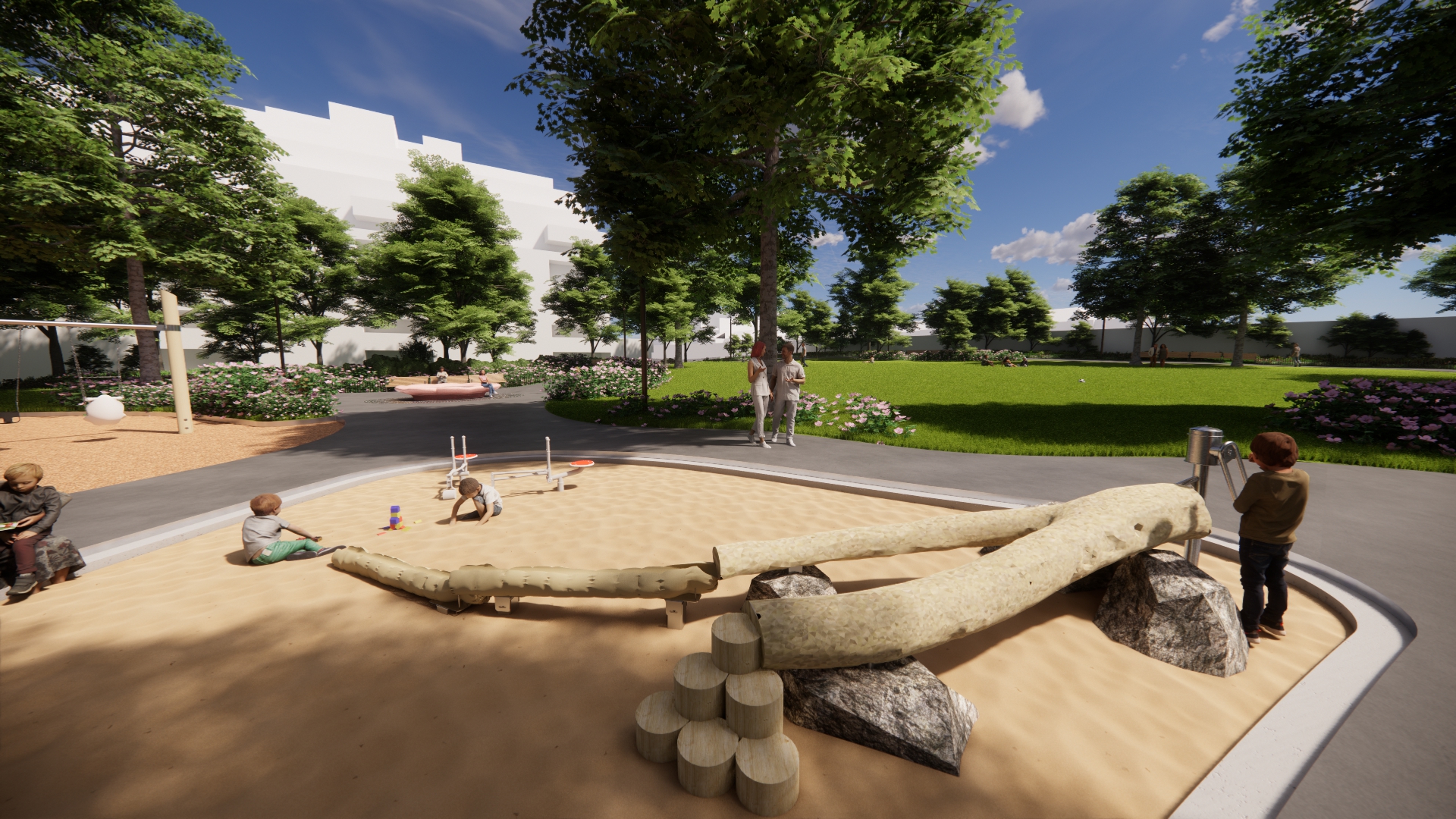
Playground layout:
Playground equipment:
Sport/Basketball court:
Fencing:
Planting and roses:
Pathways:
Safety and lighting:
Seating:
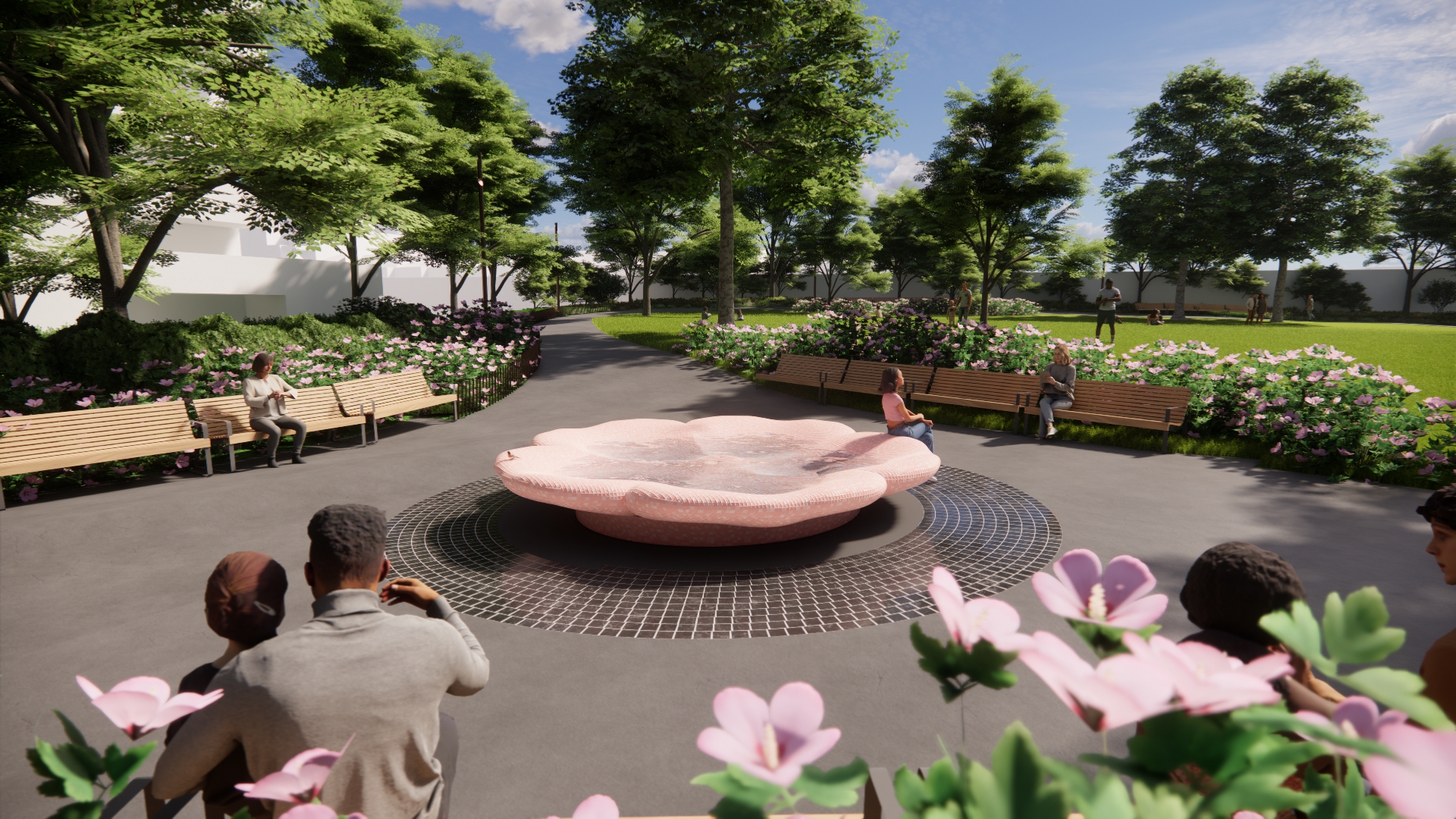
Central feature:
Construction issues:
Process concerns:
Additional comments include suggestions about garbage, off-leash dogs, requests for shade structures, support for ping pong, preference not to have chess, appreciation for the councillor and concern about attracting more park users.
From June 16 to July 14, an online survey collected 680 responses with feedback on the proposed park improvements. The survey was advertised through social media, park signs, the project mailing list, the local Councillor’s office and targeted community outreach.
When asked to rank features and amenities from most to least important to include in the new park design, respondents ranked them in the following order:
When asked to indicate their level of support for the proposed features and amenities shown in the draft design, the following received considerable support:
When asked to indicate their level of support for the proposed features and amenities shown in the draft design, the following received mixed support:
When asked to indicate their level of support for the proposed features and amenities shown in the draft design, the following were not supported:
When asked to indicate their level of support for potential changes to park access and connections:
When asked to select their preferred park seating or furniture types:
When asked to select their preferred style of playground:
When asked to indicate their level of satisfaction with the draft design overall:
The following summarizes other written feedback about the proposed park.
Overall sentiment:
Lighting and safety:
Playground and children’s use:
Off-leash area and dog use:
Opposition to adding a water feature due to concerns about maintenance, cost, noise and environmental impact.
Green space and vegetation:
Maintenance and drainage:
Access and pathways:
Seating and amenities:
Noise and overuse:
On June 16, approximately 90 community members attended a virtual public meeting to review the draft design, learn about past and upcoming community engagement activities and share questions and comments about the project. The meeting was advertised through social media, park signs, the project mailing list, the local Councillor’s office and targeted community outreach.
Several members of the project team attended the meeting, including City staff and design consultants, as well as the local Councillor. A member of the student-led team that developed the initial study presented a summary of their work and was joined by the professor who supervised it.
Download the June 16, 2025 meeting presentation.
The feedback summarized below includes both verbal and written comments. The responses the project team provided during the meeting are also summarized below.
Overall sentiment: Many participants expressed a strong appreciation for the existing park and opposed any major changes. Participants agreed that the park could benefit from minor improvements rather than a significant redesign.
History of engagement and relationship with new development:
Design principles:
Park layout:
Green space and vegetation:
Park usage:
Park features:
Safety:
Off-leash area and dog use:
Implementation and maintenance:
In this phase, the City shared the preferred design with the community. The project will now move into the detailed design phase, where the design team will finalize the design by working through the technical details and drawings.
From January 30 to February 13, an online survey collected 243 responses with feedback on the preferred design for the park improvements. The survey was advertised through social media, park signs, the project mailing list, the local Councillor’s office and targeted community outreach.
There was clear satisfaction with the overall preferred design and with each of the key design areas.
122 respondents left additional comments. These were thematically coded and are described below from most to least common.
In late 2023, as part of a project initiated by a resident steering committee and supported by the local Councillor’s office and other City staff, a student-led team from the School of Urban and Regional Planning at Toronto Metropolitan University engaged local community members to explore potential improvements to Pricefield Road Playground. The resident steering committee was comprised of community members from Thornwood I Development Committee, North Rosedale Resident Association, South Rosedale Association, and the ABC Resident Association. The student-led team was supervised by a professor and worked closely with a landscape architecture firm to develop park improvement options based on the results of their community engagement and independent research.
In the winter of 2025, the students’ master planning report and the landscape architecture firm’s landscape design proposal were submitted to the City for consideration, and City Council passed a motion to accept an in-kind donation from Scrivner Square Nominee Inc. for the design of park improvements through Motion 2025.M28.4.