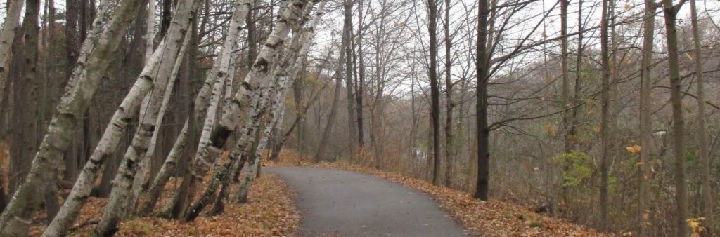
Lambton Woods contains high-quality deciduous forests on steep valley slopes and portions of a narrow floodplain, as well as a large groundwater discharge area, and smaller open wetland. It provides a habitat for many significant species, including migrating songbirds.
While we aim to provide fully accessible content, there is no text alternative available for some of the content on this site. If you require alternate formats or need assistance understanding our maps, drawings, or any other content, please contact Steven Parkes at 416-392-1338.
The timeline is subject to change.
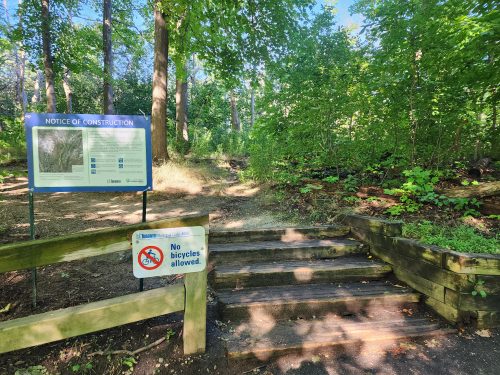
In Fall 2024, the City completed enhancements to a 300-meter section of the natural trail north of the railway bridge in Lambton Woods. The improvements included upgrading the trail surface from dirt to amended granular, removing outdated infrastructure and managing water runoff. These upgrades will enhance the user experience, improve park safety and help protect the sensitive habitat of Lambton Woods.
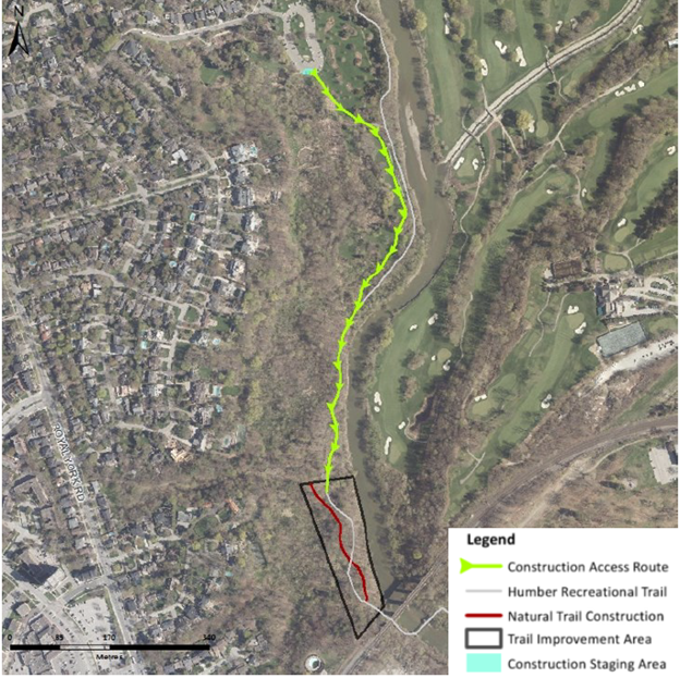
In Fall 2025, the City in partnership with the Toronto and Region Conservation Authority improved the natural surface (dirt) trail south of the James Gardens parking lot.
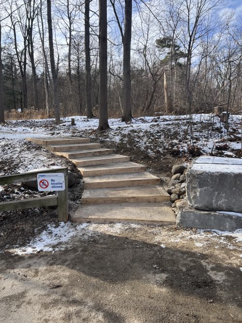
Completed in 2025, Phase 2 trail work included the removal and replacement of outdated and failing trail infrastructure, the installation of steps connecting the paved multi-use trail to the natural trail and enhancements to trail drainage.
Phase 2 upgrades including the installation of a temporary bridge were necessary to prepare for future Phase 3 trail work, scheduled to take place in late summer 2026. Phase 3 will include resurfacing sections of the trail and installing new steps to protect sensitive tree roots and reduce erosion.
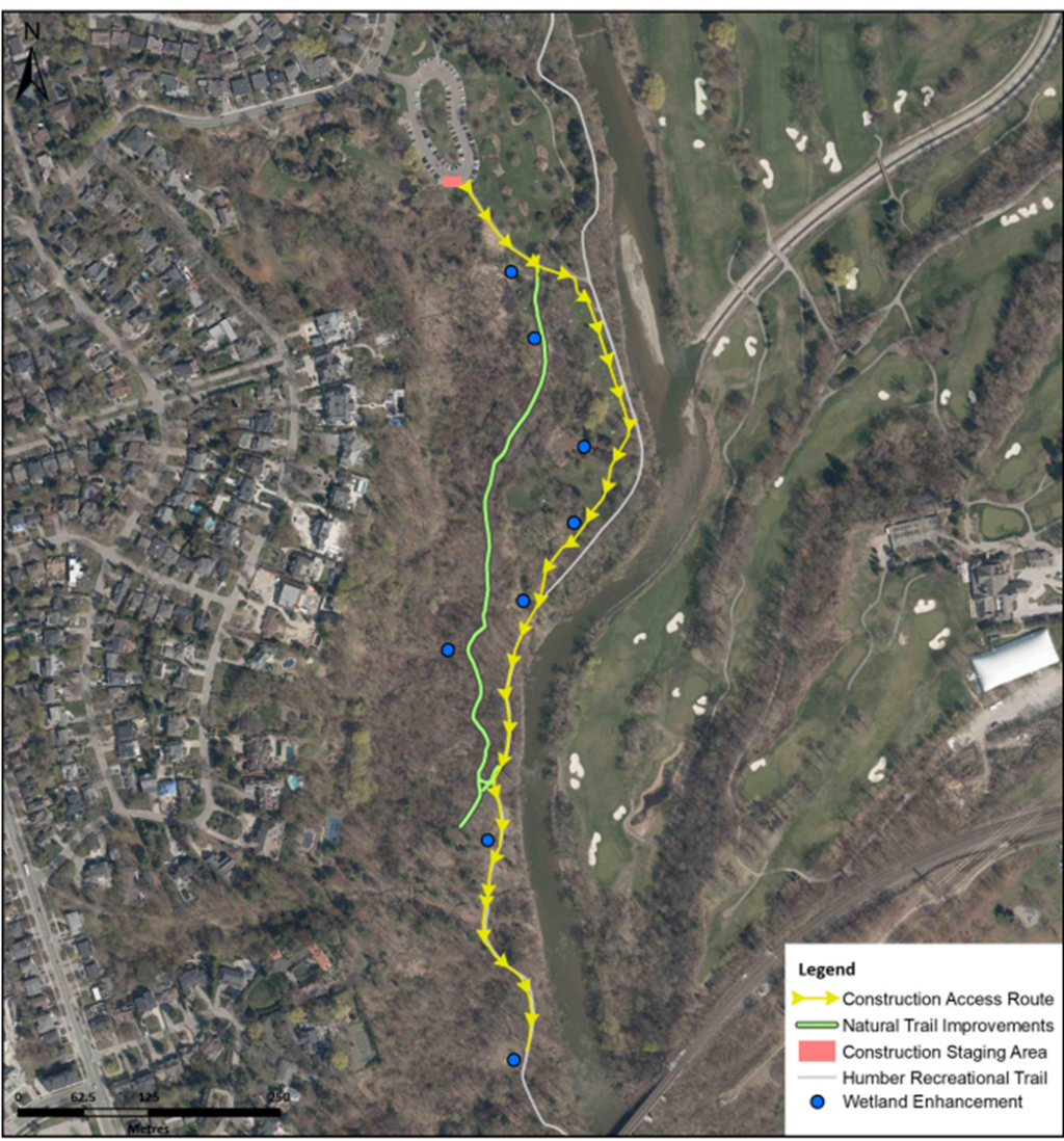
In Fall 2025, the Toronto and Region Conservation Authority, in partnership with the City of Toronto, completed wetland restoration work at eight sites in Lambton Woods to help reduce trail flooding and improve wildlife habitat. These wetlands are designed to hold water during the spring and fall seasons, helping to keep nearby trails dry. Natural woody debris was placed within the wetlands to provide shelter, refuge, spawning and nesting opportunities, and perches for wildlife such as birds, amphibians and mammals.
The City has been working for several years to manage natural environment trails in parks and ravines to ensure the protection of our forests and natural areas while allowing for compatible recreational uses. These trails are well-used by hikers, dog walkers, mountain bikers and natural environment enthusiasts and are highly valued as an important part of the recreational trail network. Growing demand for recreational trails is leading to unsustainable trail use, unauthorized trail creation and damage to natural areas.
Download the final trail concept plan.
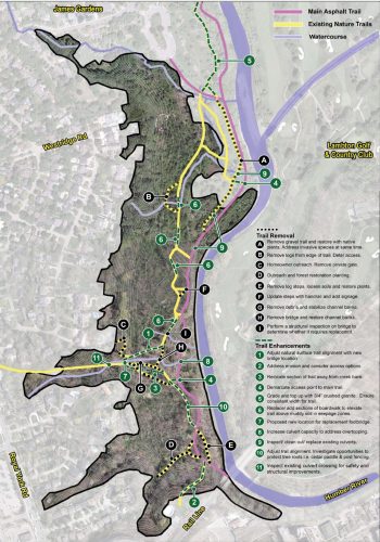
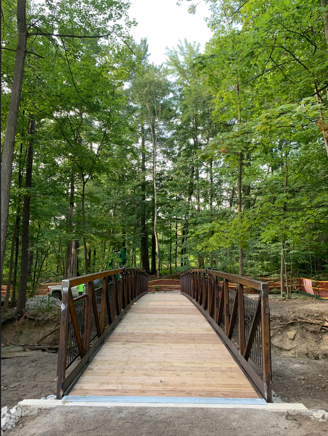
Replacement of a wood pedestrian bridge (labelled H in Trails Map, found in the About the Trail Concept Plan section) was the first step in implementing the trail concept plan.
Construction was completed in 2021 and coordinated with restoration work for invasive species removal and native planting.
As part of the bridge design and approvals process, a number of studies were completed to determine the required size and placement of a new bridge. The new bridge was installed approximately 25 meters upstream where there is less projected streambank erosion. The existing trail network was realigned to meet with the new bridge location. The bridge was designed in sections that could be assembled onsite to minimize impacts to the surrounding forest.