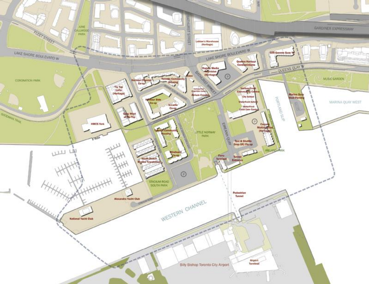
The Bathurst Quay Neighbourhood Plan commenced in January 2015 with the goal of creating a long-term vision for the Bathurst Quay community, supported by an implementation strategy to start delivering needed improvements. The study developed recommendations for public realm, pedestrian and transportation improvements; improved water’s edge access and dockwall rehabilitation; approaches to the rehabilitation and re-use of heritage buildings on the Canada Malting property; and the creation of new and improved open space and park facilities.

The Bathurst Quay Neighbourhood Plan was adopted by Toronto City Council in July 2017, with implementing land use policies adopted in 2018.

Map of Bathurst Quay Neighbourhood Plan Study Area

Council Reports

  • On June 26, 27, 28 and 29, 2018, City Council adopted amendments to the Official Plan for the lands within the Bathurst Quay neighbourhood substantially in accordance with the draft Official Plan Amendment attached to the report on the Bathurst Quay Neighbourhood Plan.
  • On July 4, 5, 6 and 7, 2017, City Council endorsed the vision, guiding principles and action plan contained in the attached staff report on the Bathurst Quay Neighbourhood Plan.
  • On July 7, 8 and 9, 2015, City Council considered a report on the study.
  • On April 1, 2 and 3, 2014, City Council directed the Chief Planner and Executive Director, City Planning to report back to City Council through the Planning and Growth Management Committee on alignment of the Airport Master Plan with the City’s policies and objectives, the Official Plan and the Bathurst Quay Precinct Plan.

Related Information