Midtown in Focus was an inter-divisional initiative led by City Planning in response to the rapid intensification and change underway in parts of the Yonge-Eglinton Secondary Plan area. An era of sustained development in Midtown has been underway since the early 2000s. The study aimed to address the challenges from this intensification by ensuring that growth positively contributes to the vitality and quality of life in one of Toronto’s most dynamic neighbourhoods.
The Midtown in Focus study was a comprehensive response to these opportunities, outlining a clear and compelling vision and detailed plan for the continued evolution of the community. This study built on the direction of the 2014 Midtown in Focus: Parks, Open Space and Streetscape Plan to address other key contributors to a livable community.
The review informed the development of up-to-date planning policies and identified key capital upgrades needed to improve the area’s parks, public realm and other local infrastructure.
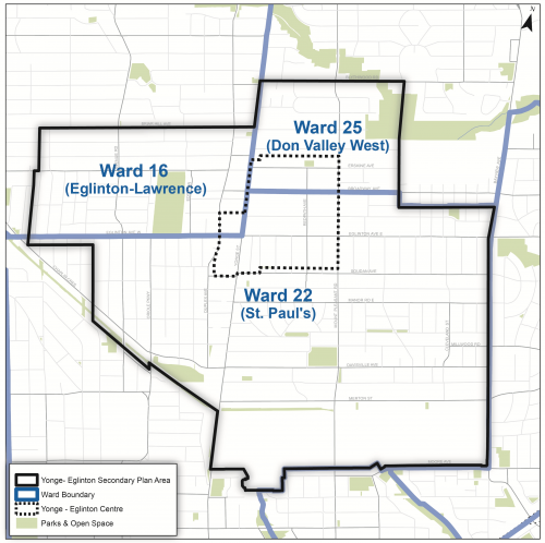 The Yonge-Eglinton Secondary Plan area is situated in Midtown Toronto, focused around the intersection of Yonge Street and Eglinton Avenue and extending across six square kilometres.
The Secondary Plan area is generally bounded by Briar Hill Avenue and Blythwood Road to the north, Mount Pleasant Cemetery to the south, Bayview Avenue to the east, and Chaplin Crescent and Latimer Avenue to the west. The area includes the Yonge-Eglinton Centre, one of four Centres identified in the City of Toronto’s Official Plan and an Urban Growth Centre in the Province of Ontario’s Growth Plan for the Greater Golden Horseshoe.
The area is represented by City Councillors for Wards 16 (Eglinton-Lawrence), 22 (St. Paul’s) and 25 (Don Valley West).
The study includes the following activities: