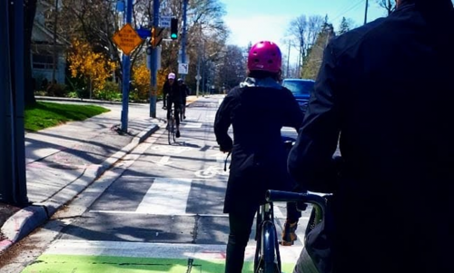
For both The Esplanade and Mill Street, bi-directional cycle tracks are being added. They will allow for cycling in both directions on one side of the road. They are attractive to a wide range of people at all levels and ages, and will connect to other bi-directional trails to the east. They will encourage people cycling to use the cycling facilities on the road instead of the promenade. The protected bike lane will run on the north side of Parliament Square Park through the southern edge of the parking lot. The protected bike lanes will connect to existing bikeways on Bayview Avenue, Cherry Street, Lower Sherbourne Street and Yonge Street. Intersection changes will also enhance the safety of vulnerable road users.
To learn more about the changes on The Esplanade, Parliament Square Park and Mill Street, watch the following video.
The following changes are coming to The Esplanade as part of Phase 1 (east of Sherbourne Street) and Phase 2 (west of Sherbourne Street):
To find out more about the road safety upgrades on The Esplanade, watch the following video.
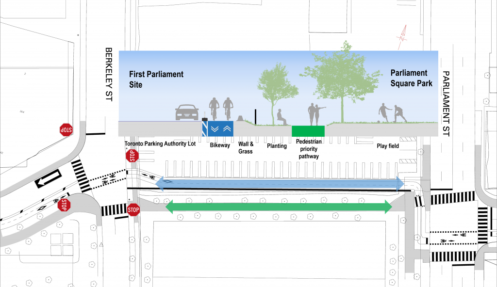
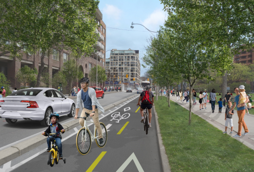
The existing path through Parliament Square Park is too narrow to accommodate the existing number of people walking and cycling. A bikeway will run through the parking lot just to the north of the Park. This will provide separate space for people walking and cycling, creating a safer and more desirable experience for all users.
To find out more about the upgrades north of Parliament Square Park, watch the following video.
The following changes are coming to Mill Street as part of Phase 1:
To find out more about the road safety upgrades on Mill Street, watch the following video.
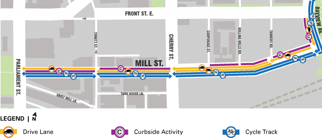
The project design includes:
In pre-COVID-19 traffic conditions, the TTC bus routes that run along The Esplanade and Mill Street serve thousands of passengers each day. The many seniors who live in the area, and who may have limited ability to walk long distances, rely on the bus for basic mobility. Due largely to cut-through traffic, the bus can be caught in traffic, reducing its reliability and desirability as a way of getting to and from destinations. The project will restrict traffic to certain blocks along The Esplanade to preserve bus movements. This will reduce non-local motor vehicle traffic and reduce congestion that slows the bus.
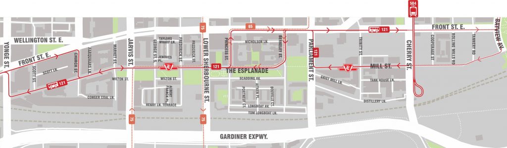
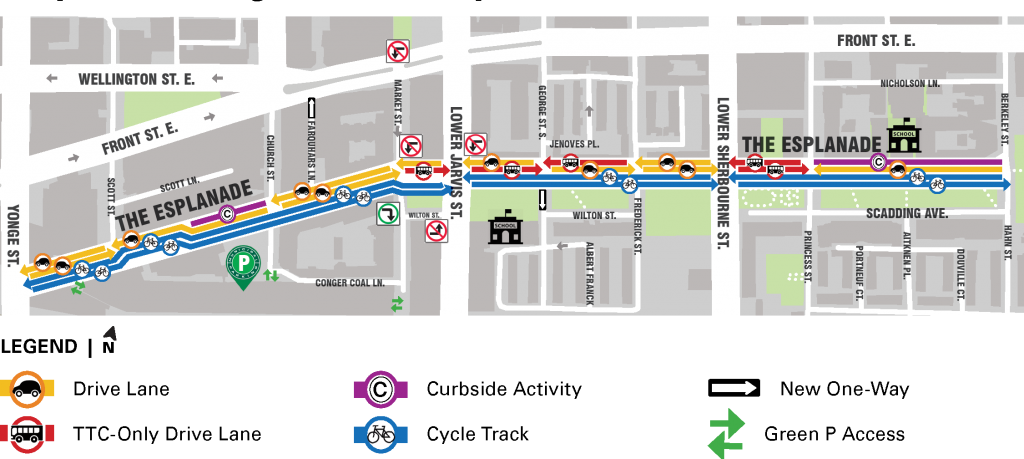
The changes on The Esplanade and Mill Street will prioritize local access and reduce non-local cut-through traffic for people driving. Some blocks on The Esplanade will be dedicated for transit only. Some blocks on both streets will be converted to one-way streets to accommodate the bikeway and transit operations within a narrowed street.
These changes aim to reduce or eliminate cut-through traffic, while preserving access by vehicle for local residents, visitors and businesses.
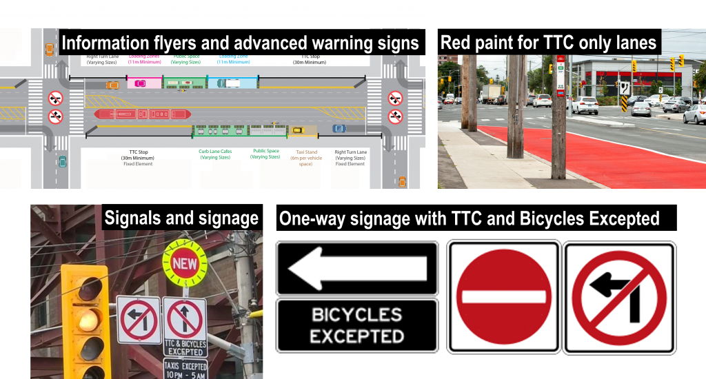
Various tools will be used to communicate the changes to local residents and visitors as outlined below.
To accommodate the cycle track, parking will be reduced to one side on some blocks and removed all together from other blocks. The number of paid, on-street parking spaces will be reduced to approximately 60 spaces, with 10 spaces available on The Esplanade and 50 spaces available on Mill Street.
Other curbside uses such as accessible loading, commercial loading, pick-up and drop-off, as well as short term parking spaces, will be prioritized over paid parking, based on local stakeholder feedback. There are currently over 5,400 nearby spaces in off-street paid parking lots. The Toronto Parking Authority is proposing to designate 38 new paid on-street spaces on Frederick Street between Front Street East and The Esplanade, and Scadding Avenue, between Princess Street and Hahn Place.
Permit parking areas 6H, 6K and 6N will remain at or below capacity. There will be no change to Area 7C. Ten (10) new permit parking spaces will be added to Front Street East between Trinity Street and Cherry Street.
| Area | Spaces Today | Proposed Spaces | Utilization Today | New Spaces Proposed | Utilization Proposed |
|---|---|---|---|---|---|
| 6K | 176 | 157 | 66% | 0 | 74% |
| 6H | 123 | 110 | 84% | 0 | 96% |
| 6N | 40 | 30 | 100% | 10 | 100% |
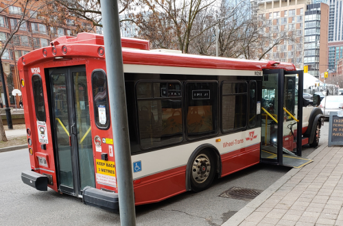
All accessible loading zones will be maintained or shifted slightly. An additional accessible loading zone will be designated on the north side of The Esplanade between Princess Street and Berkeley Street to replace accessible parking spaces. These accessible parking spaces were initially added to support accessible loading to and from Market Lane School. Wheel Trans vehicles will continue to be able to serve all addresses.
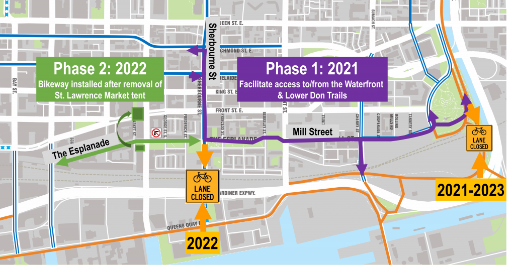
The new bikeway and associated changes along The Esplanade and Mill St between Lower Sherbourne Street and Bayview Avenue is proposed to be installed in 2021 as part of Phase 1. This willprovide a physically separated, east-west cycling route for people cycling between the Downtown and Waterfront neighbourhoods. This connection is permanent, but is timed, in part, to act as a cycling route in lieu of the closure of the Lower Sherbourne Street bikeway underpass starting in 2022 (due to planned Metrolinx work), and the Lower Don Trail closure from 2022 to 2023 (due to planned Waterfront Toronto work).
In 2022, the bikeway will extend west from Lower Sherbourne Street to Yonge Street. Construction on Phase 2 will commence as soon as the temporary St. Lawrence Market tent is removed, south of The Esplanade, as the Farmers Market activities move to the new North Market Building. The block between Church Street and Scott Street will be implemented along with a planned resurfacing of this block of The Esplanade.