

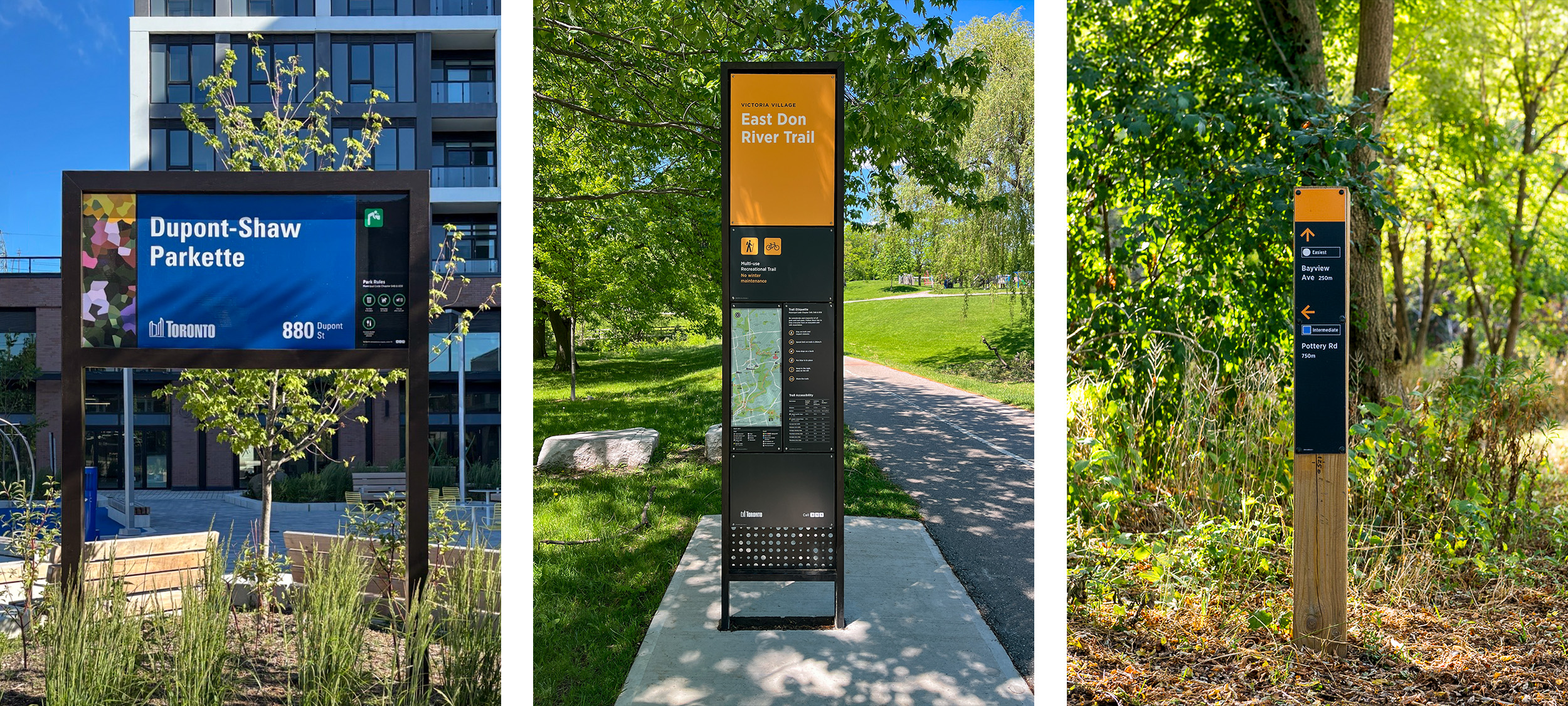
The City is implementing a wayfinding sign system for parks, trails and natural areas. Clear, consistent signs help people find their way, whether they’re locating a trailhead, checking accessibility information or exploring a new park.
Wayfinding signs are being installed on portions of Black Creek Trail (Finch Avenue West to Shoreham Drive), Highland Creek Trail (within Morningside Park) and The Meadoway Trail (Ellesmere Road to Neilson Road).
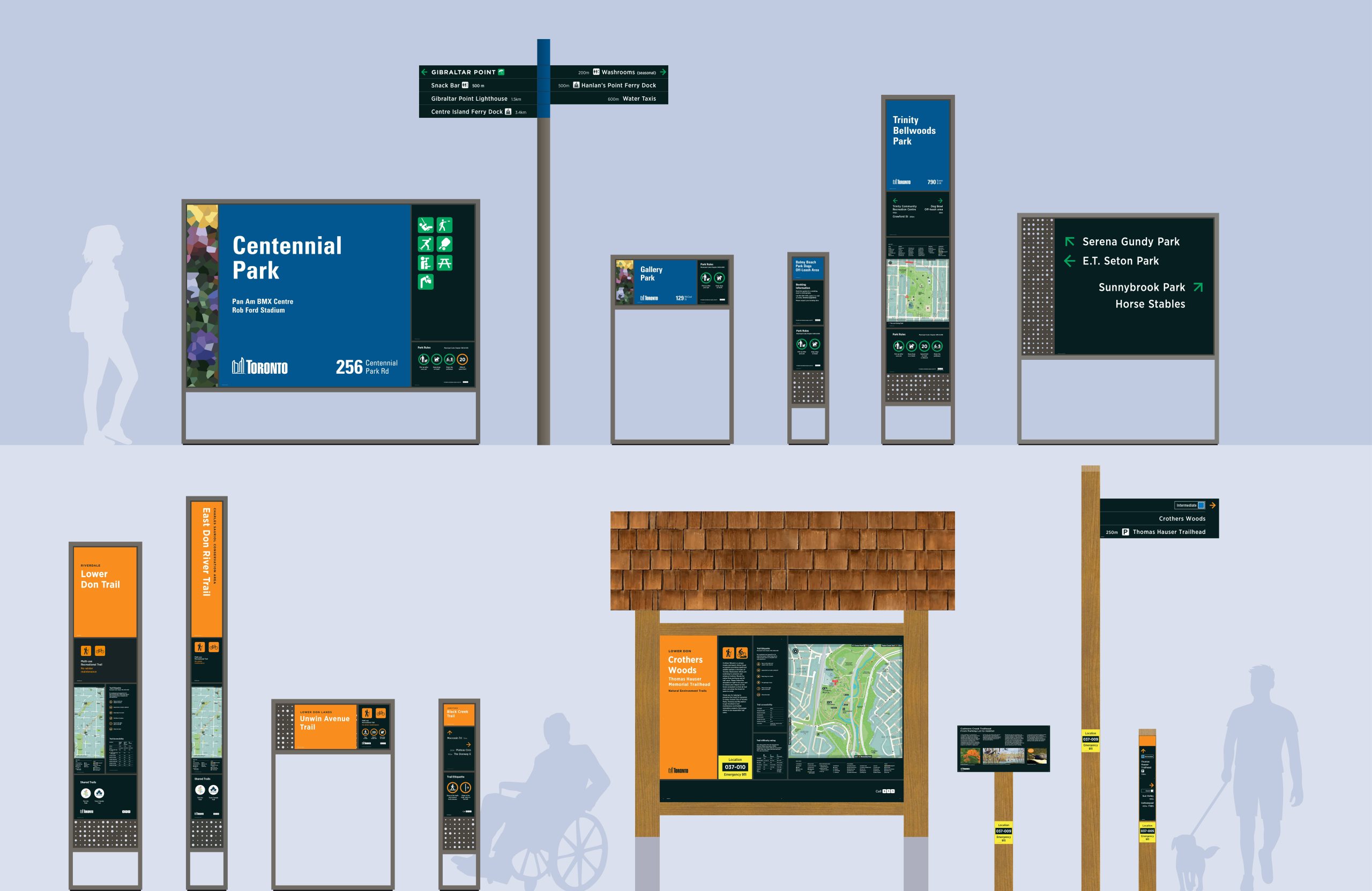
The Parks and Trails Wayfinding System includes over 20 different types of signs, designed for the wide range of park and trail conditions across Toronto.
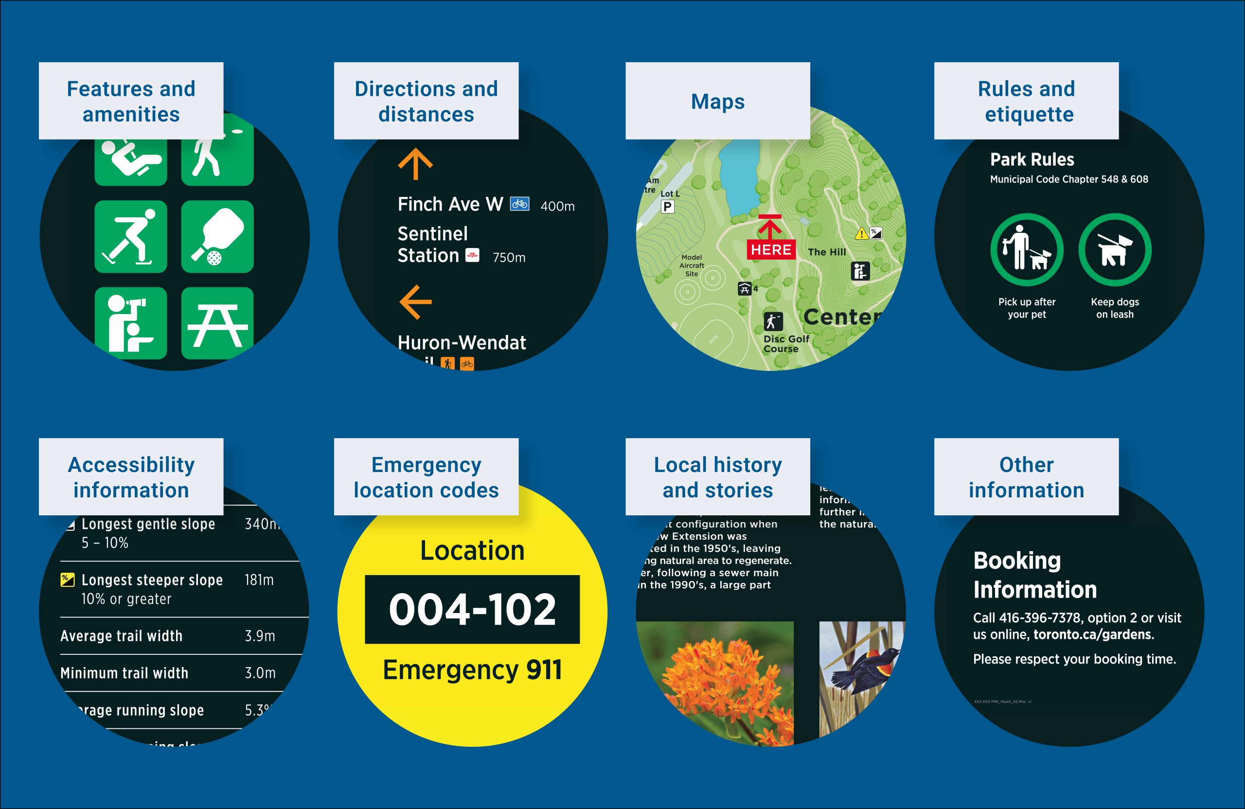
The wayfinding signs display a wide range of information to provide consistent identification, orientation and navigation in and around parks and trails.
Signs can display:
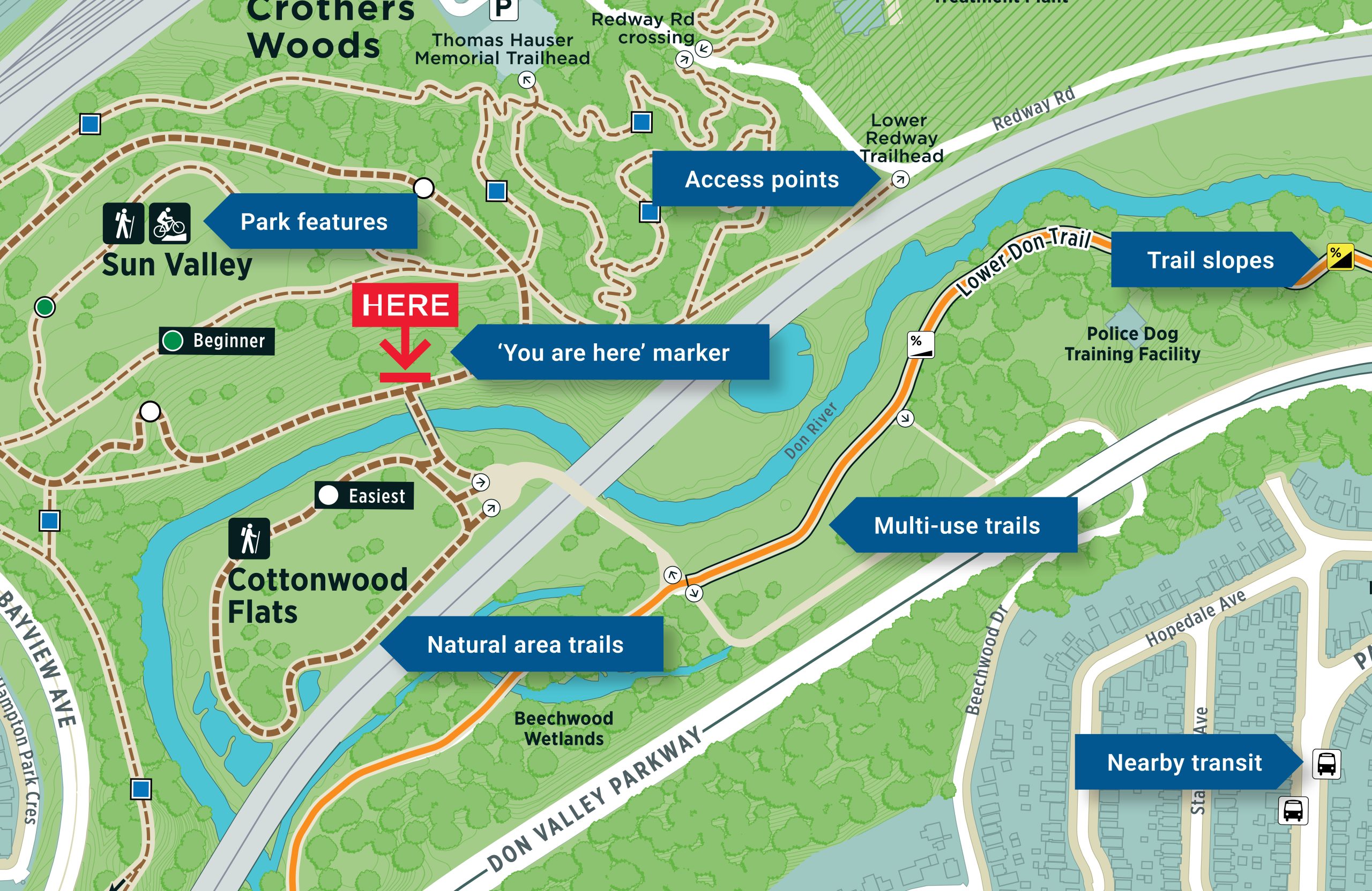
At many trails, natural areas and large parks, signs will include maps to help people to understand the location’s layout, features and connections to transit and local landmarks.
These maps are coordinated with other wayfinding systems delivered by the City of Toronto and its partners.
The maps can display a range of information, including:
The Parks and Trails Wayfinding System includes features that help people with a wide range of abilities to access and enjoy Toronto’s parks and trails.
Accessibility features on wayfinding signs include:
Wayfinding signs will be installed at major parks, multi-use trails and natural areas. Locations are prioritized based on criteria such as the location’s size, number of users and the need to coordinate with other initiatives.
| Park, Trail or Natural Area | Planned Sign Installation Year |
|---|---|
| Black Creek Trail (Finch Avenue West to Chalkfarm Park) | 2028 |
| Centennial Park – Etobicoke | 2027 |
| East Don River Trail (Don Mills Road to Bermondsey Road) | 2028 |
| Finch Hydro Corridor Trail | 2028 |
| Guild Park and Gardens | 2027 |
| Gus Harris Trail | 2027 |
| High Park | 2028 |
| Highland Creek Trail | 2028 |
| Humber River Recreational Trail (Eglinton Avenue West to Finch Hydro Corridor Trail) | 2028 |
| Humber River Recreational Trail (Waterfront to Eglinton Avenue West) | 2027 |
| Lower Don River Trail | 2027 |
| Martin Goodman Trail (Stadium Road to Windermere Avenue) | 2028 |
| Taylor Creek Trail | 2027 |
| The Beltline Trail | 2028 |
| Toronto Island Park | 2027 |
| West Don River Trail | 2027 |
| Wilket Creek Trail | 2027 |
The location and installation year is subject to change.
To-date, wayfinding signs have been installed at:
In 2014, the City initiated the development of a unified wayfinding strategy for Toronto’s parks and trails. The strategy recommended that a new sign system be designed, tested and implemented, in order to modernize how information (including wayfinding directions and maps) is communicated in parklands managed by the City.
The Parks and Trails Wayfinding System aims to:
These objectives shaped the system’s design and implementation, informed by stakeholder and community engagement, as well as international best practices tailored to Toronto’s context.
The City follows a multi-stage process to implement the Parks and Trails Wayfinding System at a park, trail or natural area:
Maps are currently available for the following parks and natural areas. Additional maps will be added here as they are completed.