The City completed an Avenue Study to assess the land uses, transportation and servicing infrastructure, community services and facilities, built form character and redevelopment potential for Bloor Street West between Keele Street and the Humber River.
The Bloor West Village Avenue Study included extensive community consultation and technical review in order to evaluate existing conditions, develop a vision for the study area and set out recommendations for an area-specific planning framework that will guide future development and infrastructure improvements.
The study was conducted by a consulting team led by DTAH and includes R.E. Millward + Associates Ltd., WSP | MMM Group Limited, Swerhun, Taylor Hazell Architects, and J.C. Williams Group. The study began in December 2016 and the Final Consultant Report was completed in May 2018.
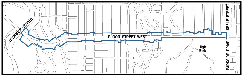
The Bloor West Village Avenue Study Area covers approximately 2.75 km of Bloor Street West between Keele Street and the Humber River and includes all properties fronting on Bloor Street. The study area was further subdivided through the study process to address changes in land use designations, local character and Official Plan policy directions related to growth, stability and transition.
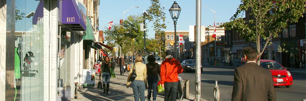
The Bloor West Village Avenue Study Area is defined by a unique mix of land uses and built form character along the corridor, two significant natural features – High Park and the Humber River – and a vibrant, pedestrian-oriented commercial strip at the Village core. While some Avenue Studies seek to stimulate pedestrian life where it has yet to take hold, Bloor West Village is already an established main street, serving local needs with a variety of small-scale commercial businesses and services in traditional storefronts. As the first Business Improvement Area in the world, Bloor West Village is a success story of community collaboration and placemaking.
The success of Bloor West Village is a contributing factor to the ongoing redevelopment interest in the area. In light of recent intensification pressures in the study area, as well as the Official Plan Avenues overlay and the Mixed Use Areas designation, City Council directed that City Planning conduct an Avenue Study to review the current built-form, density, height and heritage value of the properties on Bloor Street West between Keele Street and the Humber River. Further to this City Council direction, Toronto Water has identified significant servicing capacity issues which impact current and future development in the area.
Chapter 2 of the Official Plan sets out the City’s long-term growth management strategy and identifies areas where growth should and should not take place. As the Plan states, growth areas are locations where good transit access can be provided along transit routes and at rapid transit stations. These areas are identified as Avenues, Centres, Employment Areas and the Downtown and Central Waterfront on Map 2 Urban Structure in the Official Plan. Bloor Street West from Keele Street to the Humber River is identified as an Avenue on Map 2.
The avenues are important corridors along major streets where reurbanization and intensification can create new housing and employment opportunities while improving the pedestrian environment, the scale and appearance of the street, local shopping opportunities and transportation choices for community residents. Achieving appropriate, high-quality development along the avenues that significantly increases the range of housing choices in the city is a key direction of the Official Plan.
While the Official Plan’s growth management strategy is set out in Chapter 2, it is implemented through the land use designations set out in Chapter 4, which direct growth toward certain areas and away from others. Four land use designations, Mixed Use Areas, Employment Areas, Regeneration Areas and Institutional Areas are identified by the Official Plan as Designations for Growth and are intended to accommodate most of the increased jobs and population anticipated by the Plan’s growth strategy.
Furthermore, while Apartment Neighbourhoods are considered stable areas within the Plan, there may be opportunities for additional townhouses or apartment buildings on certain underutilized sites. Specific development criteria that guide potential infill redevelopment in Apartment Neighbourhoods are set out in Policy 2 of Section 4.2 to evaluate such situations.
The Bloor West Village Avenue Study Area includes five of the land use designations identified in Chapter 4 of the Official Plan, including Mixed Use Areas, Apartment Neighbourhoods, Neighbourhoods, Parks and Natural Areas.