The West Toronto Junction (“The Junction”) HCD Study has commenced with the consulting firm of EVOQ Architecture Inc. leading the Study.
The West Toronto Junction (“The Junction”) HCD Study was prioritized by Council in 2018 and approved to be an active study in February 2023. The Study’s aim is to provide an understanding of the area’s history and heritage character and to determine if designation as a heritage conservation district would be an appropriate heritage planning tool for the area.
The Study is in its initial stages . The final staff recommendations will be presented to the Toronto Preservation Board upon completion, likely in April 2026.

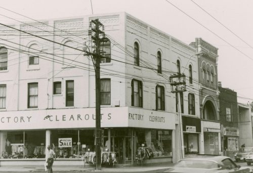
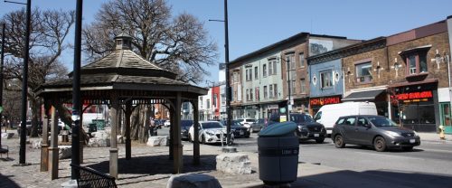
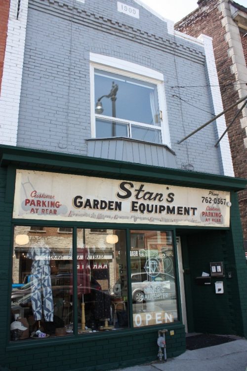
A Heritage Conservation District Study will provide an understanding of the area’s history and heritage character and will provide recommendations to determine if a Heritage Conservation District (or HCD) would be an appropriate heritage planning tool for the area. The Junction Phase 1 HCD Study Area reflects a portion of Dundas Street West that historically functioned – and continues to function – as the commercial centre of West Toronto Junction prior to and following its 1909 annexation by the City of Toronto. The area also operates as a dividing line between the historic industrial sites to the north, and the residential neighbourhoods to the south.
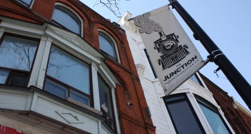
The area’s development has close ties to the topography created by the Lake Iroquois shoreline as well as several creek valleys, which ultimately dictated the location of major transportation routes including trails, roads and railway lines. The interconnection of the area’s development with that of several intersecting railways established an association that lent the wider neighbourhood its well-known moniker, the Junction.
The Junction Phase 1 HCD Study Area includes commercial, mixed-use, residential and institutional properties situated along a curving portion of Dundas Street West, bound by Gilmour Avenue to the west and Humberside Avenue to the southeast. Properties fronting onto a small section of Keele Street are also included in the Study Area from Vine Avenue to the north, and Annette Street to the south. The Study Area boundary may be refined through the Study process and does not necessarily reflect any future HCD boundary.
This study is being conducted in Ward 4, Parkdale-High Park.
At its February 28, 2023 meeting, the Planning and Housing Committee approved City Planning’s workplan, which included the commitment that the Junction HCD Study would be made active in 2023. City Planning are currently taking steps to prepare for a procurement process to hire a consultant team to undertake the Study, which will include engagement with Indigenous nations and urban communities and public stakeholder consultation. The Study will determine whether to proceed with an HCD Plan. Once complete, the HCD Study report and an accompanying staff report will be presented to the Toronto Preservation Board for consideration, before proceeding to a HCD Plan.

Public and community advisory group meetings will be listed below. Once available, material from the meetings, including presentations, display boards and meeting summaries will be posted here. Heritage Planning Staff will be reaching out to community members and stakeholders as the Study progresses.
June 11, 2025, 5:30 to 7:30 p.m. drop in at the West Toronto Junction Baptist Church, 3049 Dundas St. W., Toronto.

Study information, reports and publications will be listed below as they become available over the course of the Junction Phase 1 Heritage Conservation District Study.
On May 13, 2014, the Toronto and East York Community Council adopted TE32.87, which nominated the Junction (east of Keele Street) for consideration as a Heritage Conservation District.
On April 5, 2017, the Planning and Growth Management Committee adopted PG19.2 with amendments, which directed the Chief Planner and Executive Director, City Planning to report on recommendations for the prioritization of outstanding Heritage Conservation District Studies authorized by City Council, but not yet prioritized, including the Junction Phase 1.
On January 31, 2018, City Council adopted PG25.4 with amendments, which directed that Heritage Conservation District studies be prioritized for several study areas including the Junction Phase 1. At the same meeting, City Council directed that the boundary of the Junction Phase 1 HCD Study Area be expanded westward to Gilmour Avenue.
On February 28, 2023, the Planning and Housing Committee adopted PH2.6 (the City Planning Division’s Study Work Program) with amendments, which identified the Junction Phase 1 HCD Study as active.
The Junction Phase 1 Heritage Conservation District Study staff report will be submitted for review to the Toronto Preservation Board once complete.
The Junction Phase 1 HCD Study is being completed in accordance with Heritage Conservation Districts in Toronto: Policies, Procedures and Terms of Reference as adopted by City Council.
Section 3.1.5 of the City of Toronto’s Official Plan includes policies that direct the City to identify, protect and conserve heritage conservation districts within the City.
The Ministry of Tourism, Culture and Sport created the Guide to District Designation under the Ontario Heritage Act to inform the identification, study and implementation of heritage conservation districts in Ontario.
Part V of the Ontario Heritage Act allows municipalities to designate heritage conservation districts.
West Toronto Junction Historic Context Statement
The West Toronto Junction Historic Context Statement was initiated by the City of Toronto’s Heritage Planning division in October 2019 in order to pilot a contextual approach to heritage evaluation. Unlike traditional narrative histories, historic context statements explain the contemporary form and character of an area through the identification of significant periods of historical evolution and analysis of key themes.

We encourage you to get involved in the Junction Phase 1 HCD Study by:
A Community Advisory Group (CAG) will be formed upon retention of a consulting team and community members. Details on how to participate in the group will be forthcoming.