The City of Toronto is inviting residents to learn more and provide feedback on road safety upgrades on Brimorton Drive as part of Phase 2 consultation. Starting in 2026, road work is planned on parts of Brimorton Drive between Brimley Road and Markham Road. Inspection of the road shows that it needs repaving and sections of damaged curb and sidewalk need to be replaced. The planned road work provides an opportunity to make changes to create a safer, more accessible and green street.
Changes on Brimorton Drive would support the City’s commitment to the Vision Zero Road Safety Plan. The Plan’s goal is to eliminate traffic-related fatalities and serious injuries by making our roads safer for everyone, especially for seniors, school children and people walking and cycling. Between 2014 and 2023, there were 656 collisions in the project area Seven of these resulted in a person being killed or seriously injured. All proposed changes are focused on reducing future collisions by improving visibility between road users, reduce speeding in school zones and reducing crossing distances.
The proposed changes include no reduction in vehicle lanes and no poured-in place barriers separating the bike lanes.
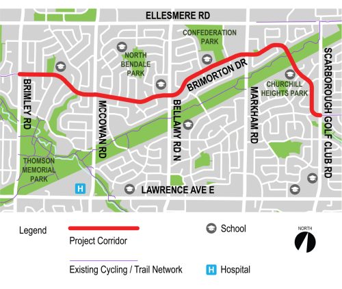
Map of the project area
The project area extends along Brimorton Drive between Brimley Road and Scarborough Golf Club Road.
This project includes improvements to minor side street intersections along Brimorton Drive.
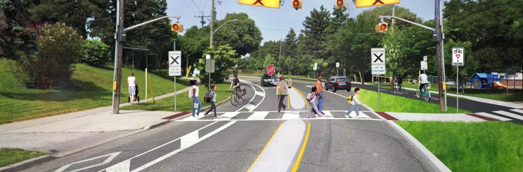
The following measures are proposed to reduce turning vehicle speeds, improve visibility and shorten pedestrian crossing distances.
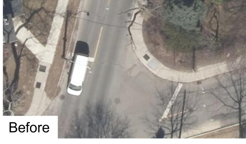
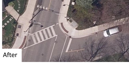
Photo examples of before and after a curb radii reduction
Reducing curb radii shortens pedestrian crossing distances and encourages lower motor vehicle speeds.
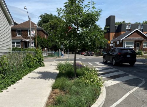
Photo of an example of a curb extension
Curb Extensions visually and physically narrow the roadway at side streets and improve the visibility of people crossing. They also create smaller turning radii and encourage people driving to turn at slower speeds.
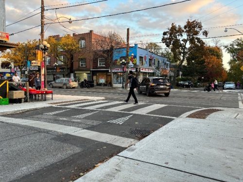
Photo of an example of a raised pedestrian crossing
Raised Pedestrian Crossings improve the visibility of people crossing at side streets to people driving. Raised crossings also help people driving to be more aware of their speeds.
Changes are proposed to all existing pedestrian crossovers along the corridor. All pedestrian crossovers are adjacent to schools. From Phase 1 consultation, we heard that increased safety features are desired at these locations to reduce speeds and increase visibility and yielding by people driving to people waiting to cross.
The following measures are proposed:
Curb extensions also prevent illegal parking in signed ‘no parking’ zones near the crossing and make sure people driving and people waiting to cross have good visibility of each other.
The following measures are proposed to reduce speeds and discourage risky vehicle maneuvers within the school zone at St. Andrews Public School:
The bike path on the south side will remain a painted bike lane with no raised separation.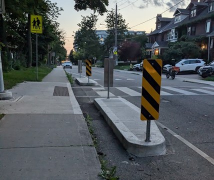
Photo of an example of a raised median
Raised median is a poured-in place curb extension at a pedestrian crossover to shorten the crossing distance and discourage parking in the signed ‘no parking’ zone which may block visibility of people waiting to cross.
The following measures are proposed to reduce speeds within the school zone around Churchill Heights Public School and provide an improved connection to the Meadoway Trail:
A pedestrian crossover is under construction at the Meadoway Trail crossing per SC17.17.
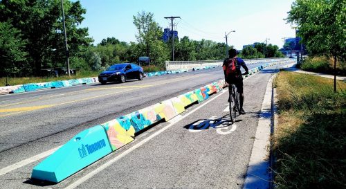
Photo of an example of a low wall barrier
Low wall barriers are a pre-cast concrete separator for on-road bikeways. They have gaps for drainage, are visible for snow removal and other maintenance operations and provide physical protection for people cycling and encourage slower motor vehicle speeds. Low wall barriers are often painted by local artists.
Phase 2 public and interest group consultation for Brimorton Drive Roadway Improvements took place from November 10 to December 7th, 2025.
Phase 1 of public consultation took place from January 20th to February 17th, 2025, to gather input from the public on existing road safety issues and ideas for improvement. Top priorities and issues raised were excessive speeding of motor vehicles around the schools, conflicts during school pick-up and drop-off times, the poor state of repair of the road, and concerns that upgrades to the existing bike lanes would impact motor vehicle travel. Feedback from Phase 1 was used to inform the proposed changes for the project, along with technical considerations and City policies and guidelines. The changes aim to achieve the project goals of a safer, more accessible and green street.
In 2010, bike lanes were installed on Brimorton Drive from Brimley Road to Scarborough Golf Club Road following a 2008 report presented to City Council, as part of the 2008 Bicycle Network Program.
In 2014, City Council moved that streets programmed for roadworks should follow a complete street approach. This means that the street should be redesigned to consider the needs of all users, such as pedestrians and people who bike, take transit or drive, and people of varying ages and levels of ability.
Since then, City Council has adopted new policies and goals under TransformTO Net Zero Strategy, Vision Zero 2.0 Road Safety Plan and the Cycling Network Plan.
To receive project updates by email, please contact BrimortonDrive@toronto.ca and indicate that you would like to be added to the mailing list.