

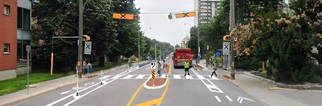
City Council has approved the installation of traffic calming features and intersection safety improvements on Davisville Avenue from Yonge Street to Mount Pleasant Road. A copy of the staff report is available at IE.30.2.
Additional recommendations for Davisville Avenue will be presented to Infrastructure & Environment Committee in early 2027.
The project area is Davisville Avenue from Yonge Street to Mount Pleasant Road.
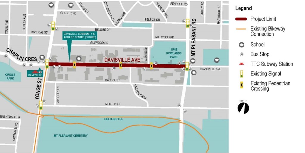
Transportation Services will adopt a phased approach to road safety changes and its report to Infrastructure and Environment Committee recommends the following:
The comment period for this consultation has closed. The Phase 2 Public Consultation Report summarizes feedback received.
Consultation Materials
Phase 1 Public consultation on this project took place in 2024. The report below provides a detailed summary of all consultation activities and feedback received.
The City of Toronto is proposing changes as part of the Vision Zero Road Safety Plan. The Plan’s goal is to eliminate traffic-related fatalities and serious injuries by making our roads safer for everyone, especially for seniors, school children, pedestrians and people cycling. This project is coordinated with ongoing studies for crossing and safety improvements along Davisville Avenue.
The City Council-approved 2025-2027 Cycling Network Plan Near-Term Implementation Program identifies Davisville Avenue from Yonge Street to Mount Pleasant Road for cycling improvements to connect people to destinations and existing cycling routes. The Cycling Network Plan is a comprehensive roadmap that outlines the City’s planned investment in the cycling network. It aims to connect gaps in the current cycling network and create safer and more comfortable cycling options.
Midtown in Focus (Yonge Eglinton Secondary Plan Study) was an inter-divisional study led by City Planning. The Ready, Set, Midtown: Public Realm Implementation Strategy identifies a long-term vision for Davisville Avenue as a generous pedestrian promenade with cycling lanes and large planting areas with wide-canopied trees and ample space for street furniture and other landscape elements.
Sign up to receive project updates by email.