In consultation with the local community, the City is developing a Neighbourhood Streets Plan (NSP) for the Oakridge area that will address three main areas of concern:
The project area is located between Victoria Park Avenue to the west, the Bloor-Danforth subway line, Leyton Avenue, and Burn Hill Road to the north, Warden Avenue to the east and the Lakeshore East GO rail corridor to the south.
What is a Neighbourhood Streets Plan?
Neighbourhood Streets Plans (NSPs) identify and recommends traffic operations and street design measures to create safer streets in the neighbourhood.
The Oakridge Streets Plan will:
Streets Plans follow several steps outlined below, and public consultation takes place in two stages.
Streets Plans result in short-term actions which can be made using temporary, flexible materials like signs, asphalt, paint, and bollards, and identify longer-term changes which can be accomplished alongside future programmed road work.
The outcomes of each Streets Plan is different based on local conditions and the needs of each neighbourhood. Generally, Streets Plans recommend actions related to motor vehicle speed and volume management, and traffic safety conflicts on local streets. Streets Plan recommendations are informed by the City’s Traffic Calming Guide, Vision Zero Action Plan, and Complete Streets Guidelines.
The City of Toronto is inviting local residents, businesses and organizations to learn more and provide feedback. Public Consultation took place over two stages between Summer 2024 and Winter 2025:
In June 2024, the project team presented background information and consulted the community on issues commonly experienced in the neighbourhood and ideas for actions and changes.
View materials from phase 1:
From November 13 to December 15, 2025, the project team presented an updated proposal based on Phase 1 feedback, data analysis, and review of City programs and policies. The team hosted a public event on December 1, and received online feedback from the community over this period.
View materials from Phase 2:
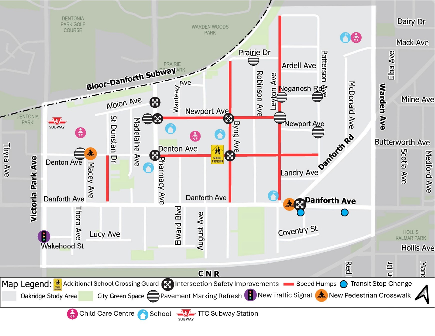
Through public feedback and research, staff have identified safety concerns at multiple intersections, including Danforth Avenue and Danforth Road and Wakehood Street and Victoria Park Avenue. Proposed changes to address these concerns include:
See map and details on pages 17-22 of the information panels.
Improvements are also proposed at intersections near schools and where markings are faded or missing, see details below.
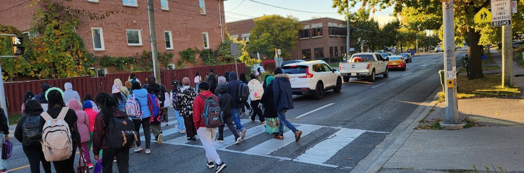
Based on community feedback and a thorough investigation, staff identified several safety concerns around Oakridge Junior Public School and Samuel Hearne Middle School. To address the identified safety and accessibility issues, the following improvements are proposed:
See map and details on pages 25-26 of the Information Panels.
Several locations have been identified where pavement markings such as stop bars, zebra markings, and tail lines are missing or faded. Missing and faded pavement markings reduce visibility and guidance for road users, leading to confusion at intersections and an increased risk of collisions. Proposed changes to this issue will include:
See map and details on pages 27-28 of the Information Panels.
Speeding concerns were raised during public consultations and data from the last five years shows speeding on multiple streets in the study area.
See map and details on pages 23-24 of the Information Panels.
To receive project updates by email, please contact OakridgeStreets@toronto.ca to be added to the list.
Personal information is collected under the authority of the City of Toronto Act, 2006. The information is used to allow the City to send you emails about project updates and future consultation opportunities. Questions about this collection may be directed to the Manager, Public Consultation at 416-392-2990 or tracy.manolakakis@toronto.ca