Cycling is one of the fastest growing transportation modes in Toronto. The City is working to make travel by bike safer and more inviting.
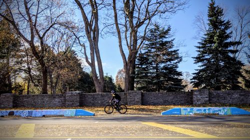
In 2019, the City of Toronto installed a physically separated bike lane (cycle track) along Scarlett Road from the Humber River to just north St. Clair Avenue at Bernice Crescent.
View the Scarlett Road Bike Lanes Public Consultation Summary Report.
This project was approved at the City’s Infrastructure & Environment Committee on June 27, 2019, and City Council on July 16, 17, 2019.
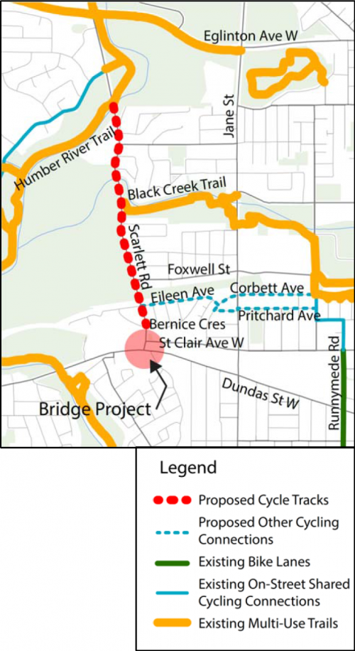
The cycle tracks provide a dedicated space for people cycling, improving safety and comfort for all road users. The cycle tracks expand the local cycling network by connecting to the existing multi-use trail on the Humber River, at Black Creek Trail, and future bike lanes under the Scarlett Road Bridge.
In 2022, the City of Toronto is installing new east-west cycling connections to the Scarlett Road cycle tracks.
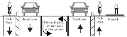
The installation of the cycle tracks on each side required a reduction in the number of motor vehicle travel lanes from four lanes, to two, plus centre turning lane.
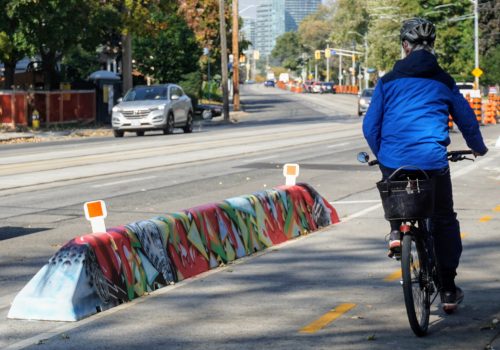
The Scarlett Road cycle tracks included short concrete walls where possible, bollards (short posts) and curbs in some locations, along with signs and pavement markings throughout. No stopping or parking is permitted next to or in the cycle tracks.
TTC bus stops continue to function along the route. This work was coordinated with TTC’s planned Junction Area TTC route and stop location updates.
This project also included road resurfacing and traffic signals will be optimized to keep traffic moving.
The lane reduction in this project reduced the recognized road safety problem of high vehicle speeds along Scarlett Road.
In support of pedestrian safety, a new traffic signal at Eileen Avenue is also proposed, which will replace the existing pedestrian crossover at Bernice Crescent.
The centre turn lane will make it easier and safer to turn to and from the side streets.
The short concrete walls separating the cycle track from the traffic were covered in painted murals through a partnership with StreetARToronto.
The Scarlett Road Bridge project included public art throughout the site: in the underpass, along retaining walls, and in the parkette.
On April 29, 2019, the City hosted a public consultation meeting to provide residents with an opportunity to learn more and provide comments about the proposed bike lanes. Over 100 residents attended. View the bike lane information materials below (PDF):
Scarlett Road Bridge Update was also presented at this April 29 meeting.
The short URL for this page is toronto.ca/cycling/scarlett