Update: The Lower Don Trail between the Belleville Underpass and Queen Street will reopen on August 1, 2026 (weather permitting). Upon reopening, users will have full through access along the entire length of the Lower Don Trail from E.T. Seton Park to Corktown Common.
A temporary trail closure is planned for Fall 2026 to complete the Sloped Pathway connection to the Riverdale Pedestrian Bridge. Details will be posted in advance onsite and on the web page.
The Lower Don River Trail is undergoing improvements to upgrade accessibility, mitigate erosion and flooding from the Don River, resolve drainage issues and enhance overall trail connections. Guided by the 2013 Lower Don River Trail Master Plan, the trail improvements are complemented by a series of projects (several of which have already been completed) that will protect and enhance the Don Valley environment and its recreational amenities.
While we aim to provide fully accessible content, there is no text alternative available for some of the content on this site. If you require alternate formats or need assistance understanding our maps, drawings, or any other content, please contact lowerdontrail@toronto.ca.
The timeline is subject to change.
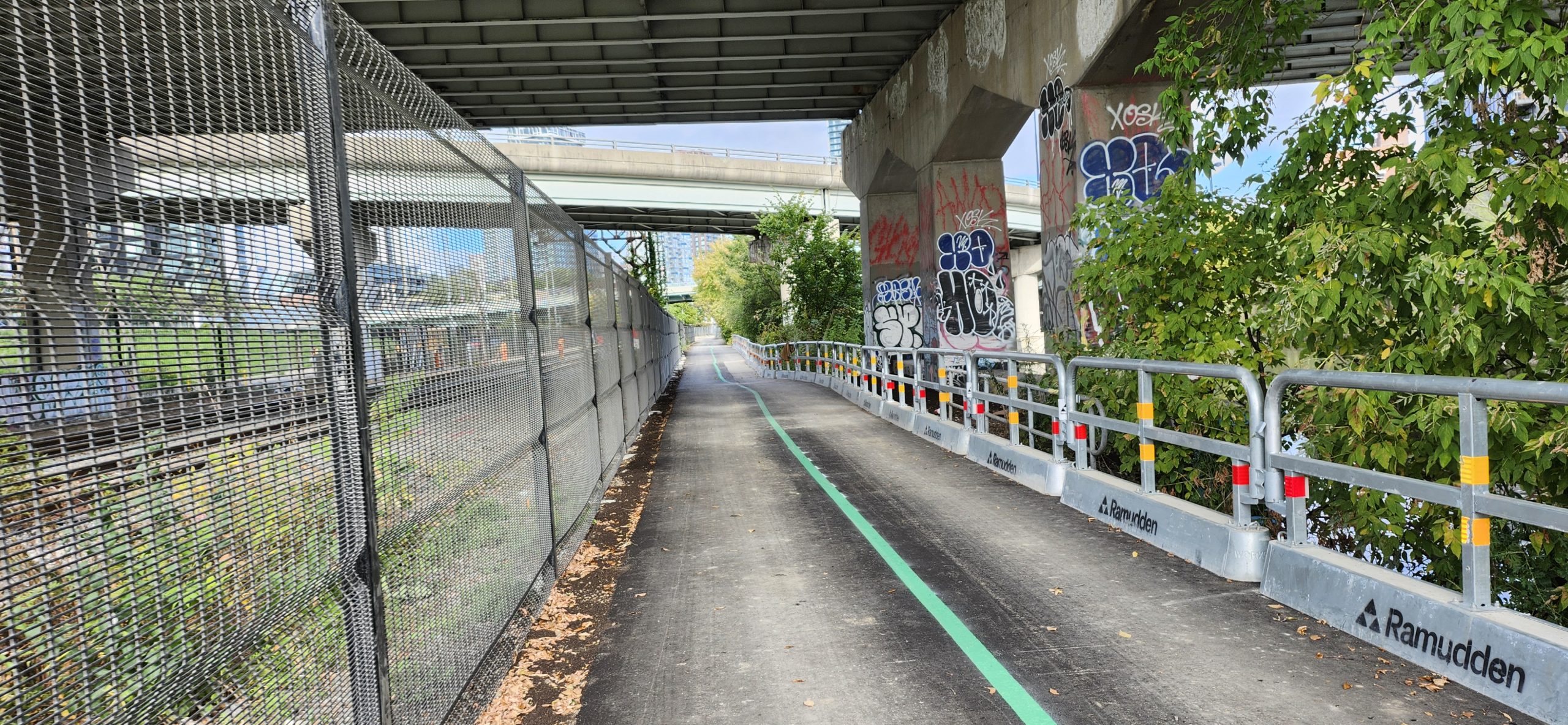
The section of the Lower Don trail from the Belleville Underpass to Queen Street currently closed for construction is planned to open on August 1, 2026, pending no severe weather.
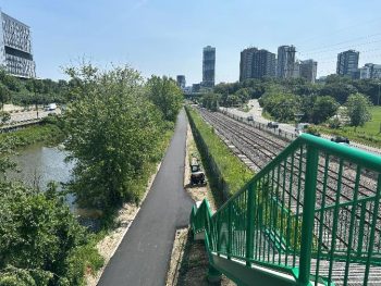
Final paving, trail markings and seeding will be completed prior to opening. The existing staircase at Riverdale Park Pedestrian Bridge and the new staircase at Dundas Street will also open.
To prioritize trail opening, work on the new sloped path connecting to Riverdale Park Pedestrian Bridge will be paused and the structure will remain closed. A temporary closure of the trail is planned for late fall to complete the sloped path and other finishing work. Details of the temporary trail closure will be shared in advance of the work later this fall.
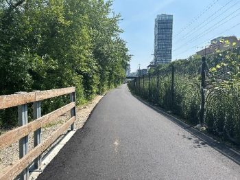
Progress continues on the Lower Don Trail Improvement project with the majority of the repaving of the southern section of the trail between Dundas Street and Queen Street now complete. Work on the Dundas Stair is also nearing completion with final painting and installation of finishing elements, including handrails and bicycle troughs, currently underway.
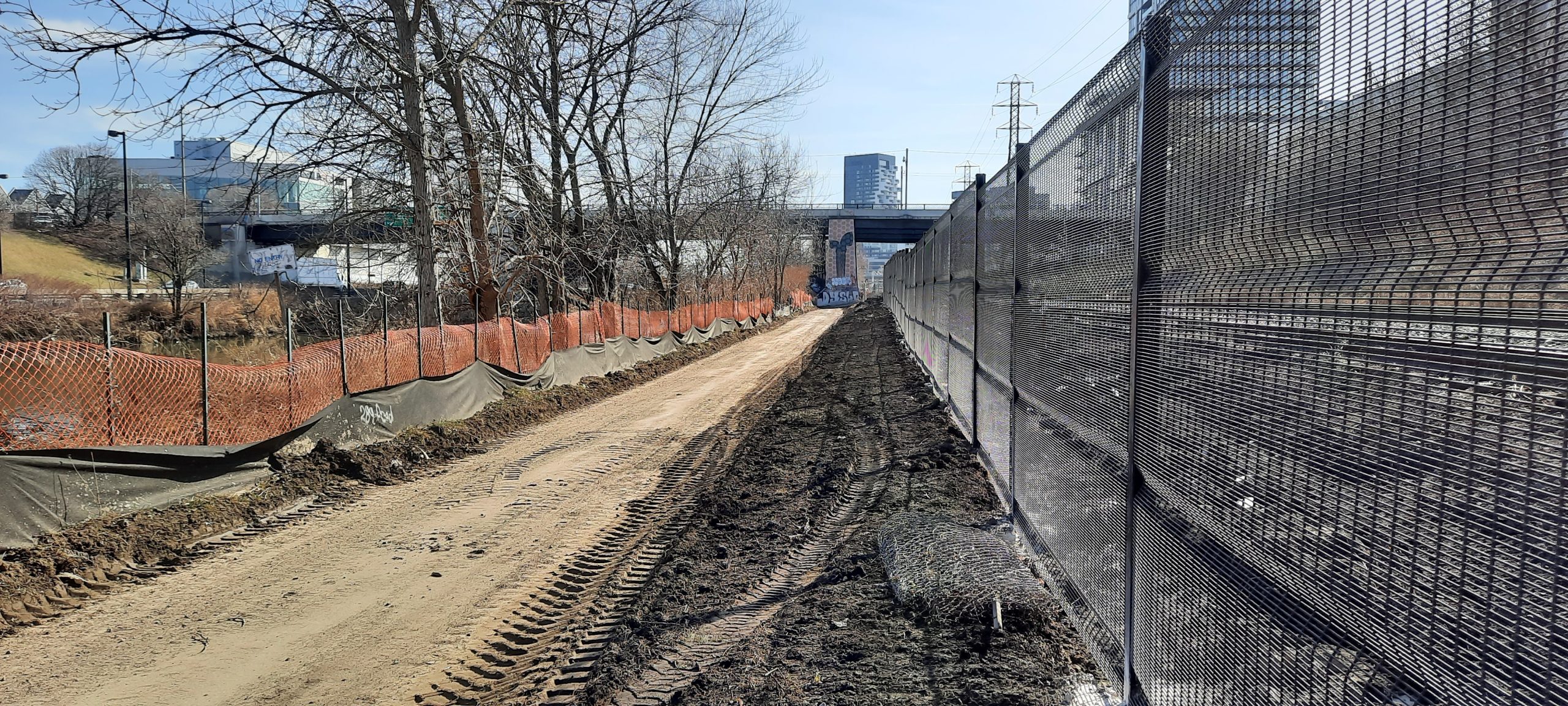
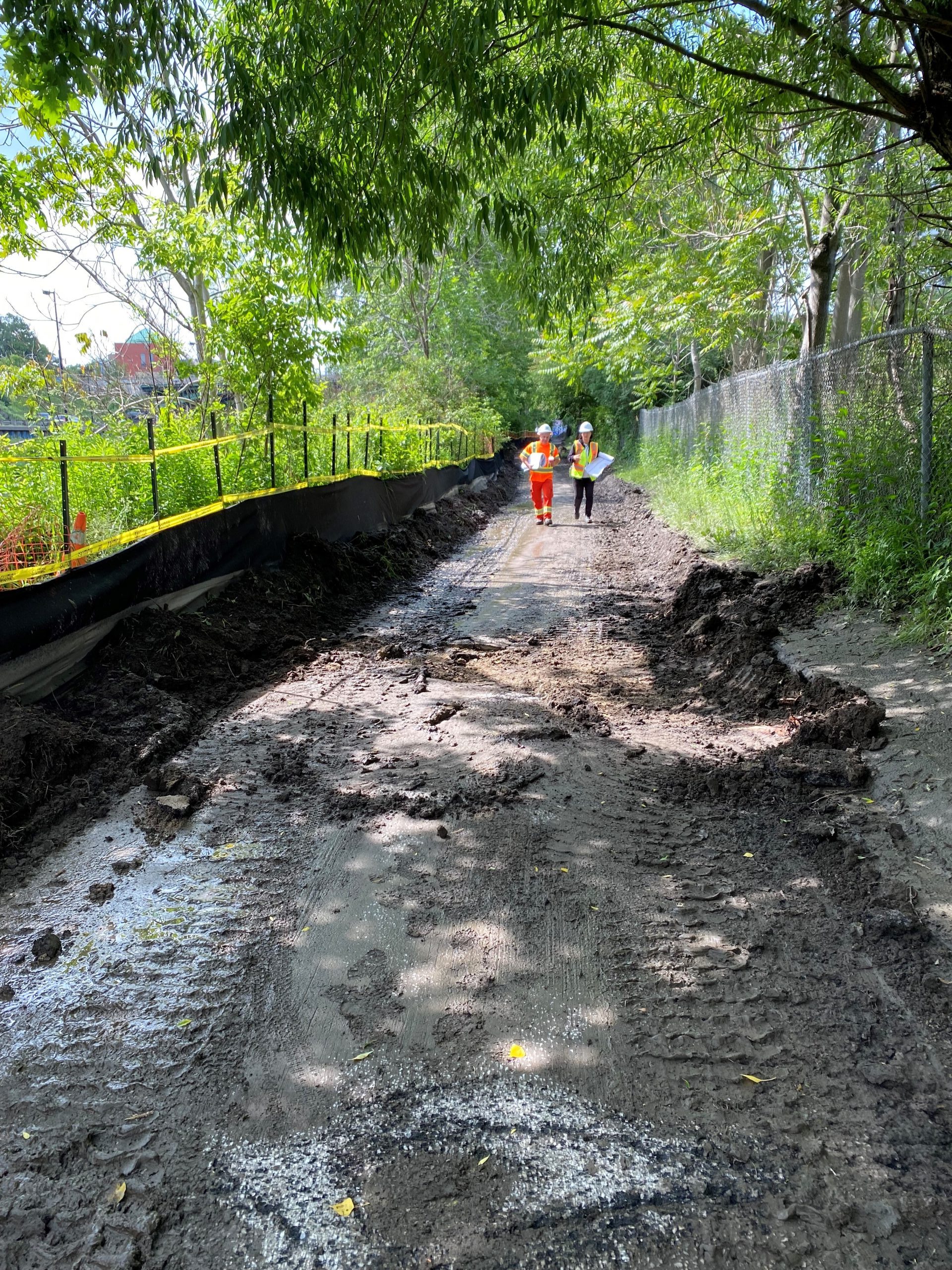
Construction progress has been slower than anticipated due to the complexities of working across an active rail corridor combined with a harsh winter and a particularly wet summer. Installation of the sloped path is ongoing; however, unsuitable soil conditions in the final section have delayed construction of the concrete foundation, extending the timeline for completion.
Paving of the remaining trail section was temporarily deferred to accommodate sloped path construction. To mitigate impacts, the contractor will pause the work at the sloped path and proceed with paving the remaining trail, temporarily cordon off incomplete areas and reopen the trail for public use. The contractor will return in the fall to complete the final section of the sloped path and other minor outstanding works. An updated trail reopening date will be confirmed soon and the webpage will be updated.
The City recognizes the significant impact that the extended trail closure has had on the community and is prioritizing trail reopening as quickly as possible.
Progress continues on the Lower Don Trail improvements project with two new trail access points nearing completion and trail opening planned for late spring.
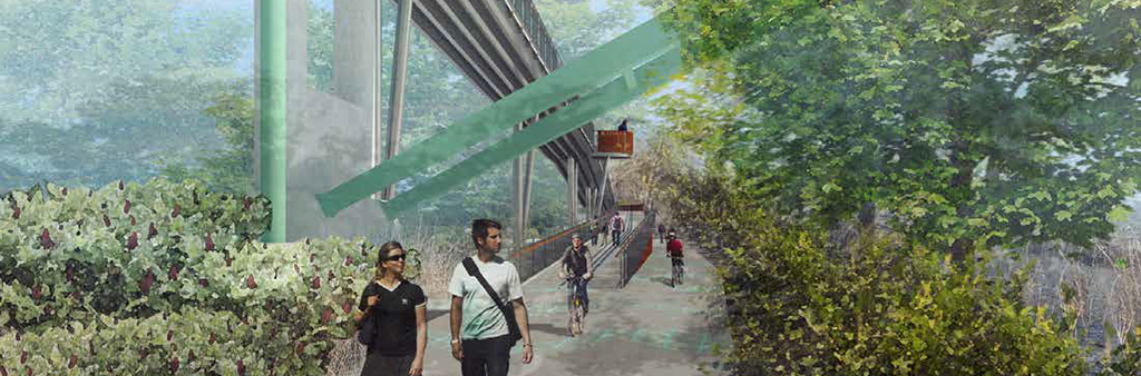
At the Riverdale Park Pedestrian Bridge the new sloped path will provide a safe and accessible connection to the trail for users. The design includes a lookout point, a seating area and railing panels that showcase bird species of the surrounding Lower Don area.
At Dundas Street East a new staircase will provide access to the trail and includes lookouts over the river and bicycle troughs to assist cyclists using this access point.
The wet nature of site within the flood plain, combined with harsh winter and spring weather, and coordination of work hours outside commuter rail service have limited appropriate working conditions this spring and presented challenges for construction crews.
Repaving of the final section of the Lower Don Trail (between Pottery Road and Queen Street) is targeted for late May, pending suitable weather and site conditions, with trail re-opening to follow shortly afterwards. After trail re-opening, crews will continue to be present on-site to complete installation of plantings, signage and other finishing touches throughout the summer season.
A section of the Lower Don Trail from Bala Underpass to the Queen Street Bridge has reopened, including access from the Queen Street staircase. The trail north of the Queen Street stairs remains closed for ongoing construction. This area is an active work zone, and public access is not permitted. Trail users must turn around at Queen Street. Construction north of Queen Street will continue through winter 2025/2026, with the full trail reopening expected in spring 2026.
The trail section between the Bala Underpass and Queen Street Bridge was completed in October 2024 but could not be opened due to the demolition of the Old Eastern Bridge and ongoing Metrolinx work. Metrolinx has advised that fence installation is nearly complete, and this section is expected to reopen in November 2025.
Installation of the new steel staircase at Dundas Street is also nearing completion. This staircase will improve pedestrian access to the Lower Don River Trail.
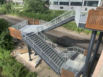
Work on the new steel Riverdale accessible sloped path is scheduled to begin in early November and is expected to be substantially completed by the end of 2025. The concrete deck and finishing work will follow in early 2026.
The contractor experienced delays installing the ramp and sloped path due to fitting issues with several steel components, which required rework and were identified as a supplier-related problem. Additional delays were caused by new Metrolinx crane travel restrictions, effective September 2025, which have limited the contractor’s working hours.
The full trail section north of Queen Street, including the Dundas Street staircase and Riverdale accessible sloped path, is now anticipated to reopen in spring 2026.
The reopening of the section between Bala Underpass (the south side of the trail) and Queen Street Bridge is delayed. While the City’s work in the area is complete, the section cannot reopen until Metrolinx finishes installing fencing along the railway corridor. The section is now scheduled to reopen in late October to early November 2025, when fencing is anticipated to be completed.
The project continues to face significant challenges due to safety-related requirements from Metrolinx, challenges working within a narrow work area between the Don River and Metrolinx tracks and due to very poor soil conditions in the river valley. Staff and the contractor are working closely with Metrolinx and other stakeholders to complete the remaining work safely and open the trail for community use.
A sequenced reopening is planned as per the following:
The project not only involves trail construction but also complex structural ramp and stairs installation, and requires deep footing to bedrock to support the structures. Once complete, it will offer a lasting experience for the community that improves accessibility.
As mentioned in the May 2024 update, the project has faced significant challenges, including poor soil conditions, erosion, and the complex underground network of utilities like gas mains, internet and railway cables, Toronto Water chambers, water mains and sewers. As the project has been a utility corridor for more than a hundred years some of these utilities are not mapped and are found through the construction process. Each time these issues arise, the project team works closely with various groups to find solutions, which sometimes requires redesigning parts of the project. Additionally, external factors such as Hydro One’s emergency work on nearby towers, Metrolinx’s railway maintenance and July’s flooding have further impacted progress.
Despite these challenges, significant progress has been made on the following items since the trail closure:
For more information about the Old Eastern Bridge demolition, contact Waterfront Toronto at info@waterfrontoronto.ca. For information on the Enbridge Utility Bridge demolition, contact MunicipalAffairs@enbridge.com
The work is still anticipated to be completed by July 2025.
Work is progressing with revised foundation construction for the elevated sloped path. This foundation work will help stabilize the ground to address poor soil conditions discovered in late 2023. This additional work, and delays in obtaining the required structural steel, have impacted the sequencing for the fabrication and installation of the elevated ramp at Riverdale pedestrian bridge and the new staircase at Dundas Street bridge, delaying the project completion date.
While this work will continue through winter 2024/2025, other landscape and site restoration work will need to be completed in spring 2025 because it cannot be done during the winter. With construction ongoing until July 2025, the active construction site will stay closed for public safety.
The City continues to work closely with the contractor to identify opportunities to complete the work sooner and investigate where work can be phased to allow for earlier opening at sections of the trail, if feasible.
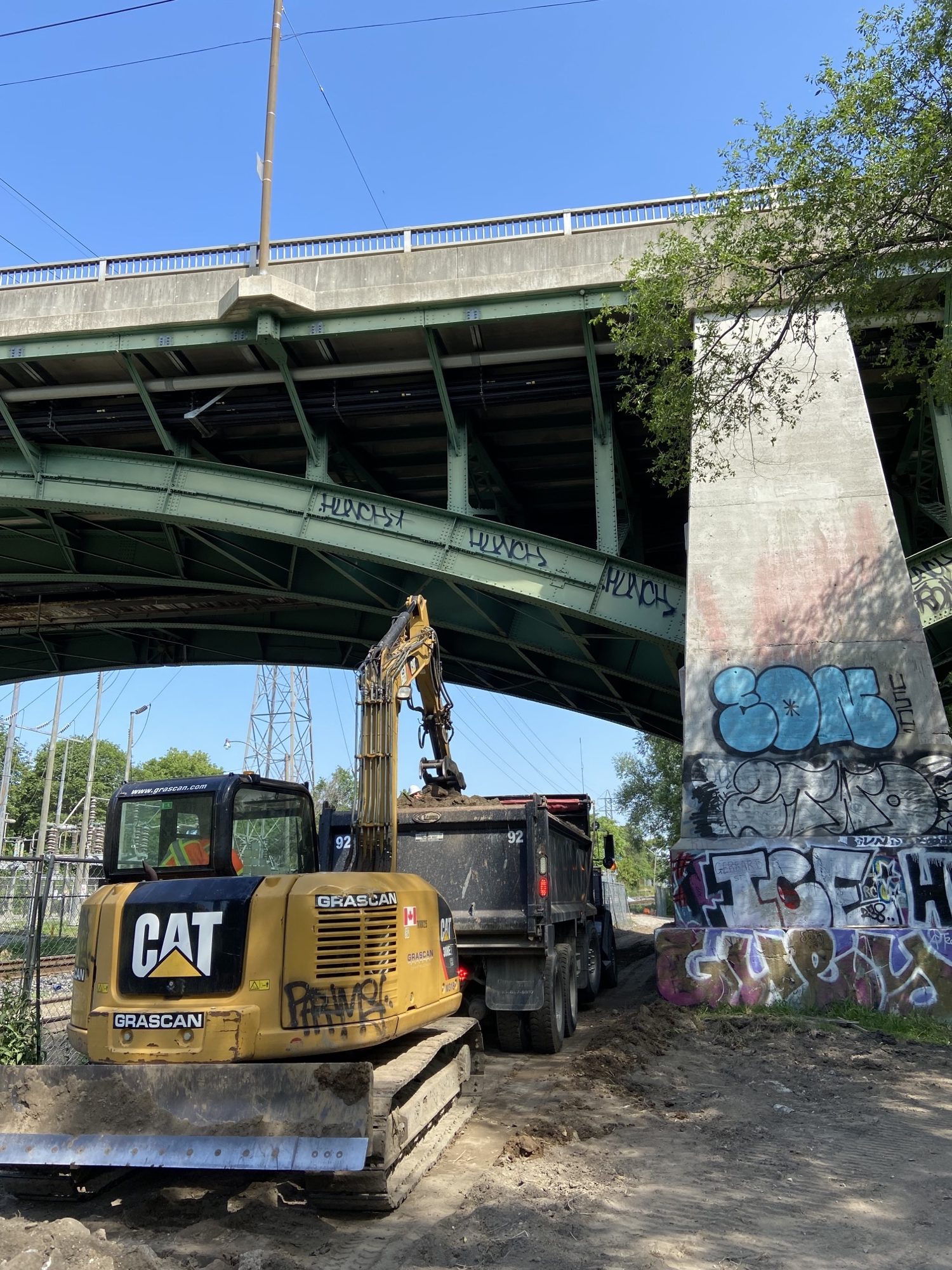
Construction is delayed and is anticipated to be completed in late summer 2024. The project site is complex, narrow and located between the Don River and a rail corridor, resulting in some challenges with getting materials and equipment in and out of the site. Additionally, a section of the site experienced erosion from the nearby river (a geotechnical review for a solution is underway) and some of the required permitting and approvals from other infrastructure located nearby took longer than anticipated.
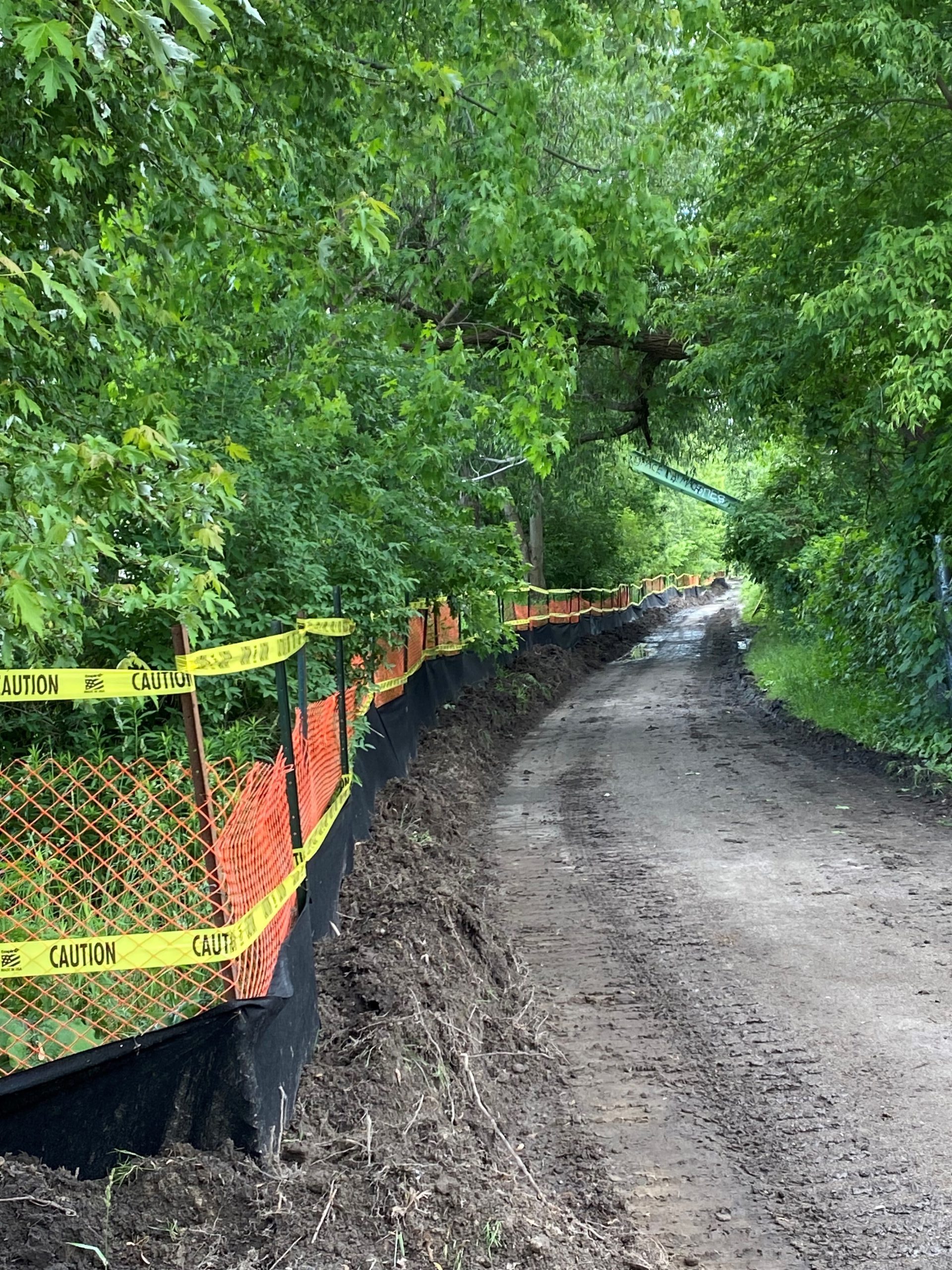
Construction is active on the Lower Don River Trail. All trees permitted for removal have been removed, with some exceptions. Existing site features including asphalt pavement, Metrolinx fences at the railway side and pedestrian guardrails at the riverside have been removed in sections throughout the entire site. Construction vehicles travel throughout the site and will start excavating the foundations and preparing the site for slope path construction at the Riverdale bridge area and staircase construction at Dundas bridge. The trail should not be used by the public at all, as it is unsafe.
Trail entrances at Pottery Road, the Riverdale bridge staircase, Queen bridge staircase and Corktown are closed. Additional barriers are also located within the closed area at the Bellville Underpass, and the bridge over the Don River, north of the pedestrian bridge. The City monitors and reinforces the trail closures daily.
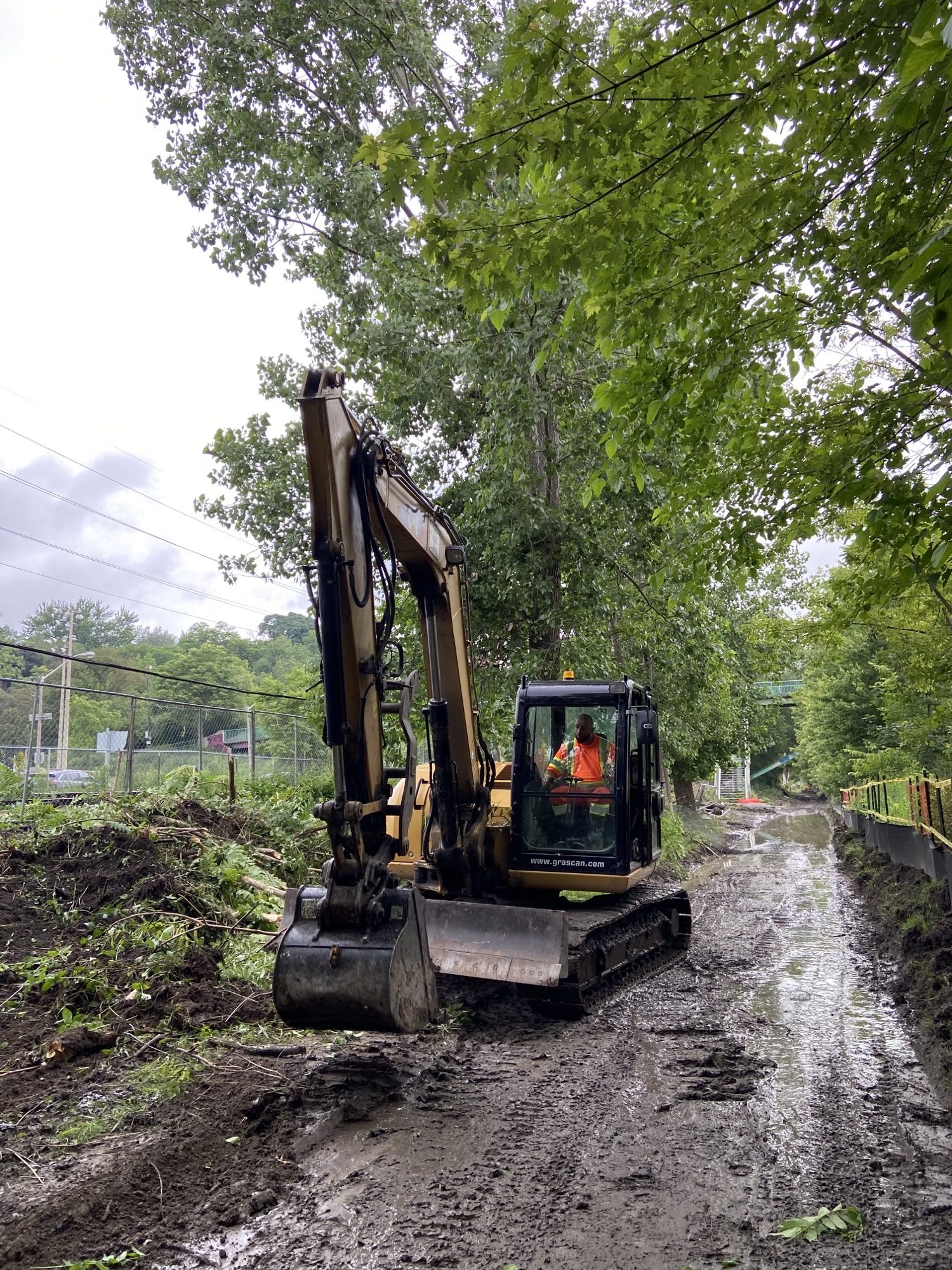
Construction has started with site preparation work, which is taking longer than anticipated due to the irregular topography of the site and approvals and inspection for the permit conditions. The trail closed in May so that the contractor could access and set up the staging area, tree protection and sediment control required for the permits.
Due to the few entry/exit locations along the trail, 4 km of the trail is closed to the public to allow for the contractors to start work in an area that encompasses both south and north of the mid-access point (Riverdale Parks East and West into the trail and vice versa). While it is possible to briefly open the very small area at the south end of the trail, from Queen Street to Corktown, the closure would be hidden from the entrance and confusing as pedestrians and cyclists would need to turn around and detour. Additionally, construction will move to this area soon. In mid-June, other construction activities like excavation will start and create unsafe conditions, even during the weekends when construction work has paused.
The Bayview Avenue Multi-Use Trail is available as an alternative route for the entire distance of the closure and is parallel to the trail.
From May 2, 2023, to summer 2024, the Lower Don River Trail will be closed from Pottery Road to Bala Underpass at Corktown Common, including the Riverdale pedestrian bridge and Queen Street bridge stairs, for construction. Signs with a detour map are posted at all trail access points. The Bayview Multi-Use Trail, west of the Metrolinx Railway, is available as an alternative route.
The pedestrian bridge connecting Riverdale Park West and Riverdale Park East is open to the public but will not provide access to the Lower Don Trail during construction.
Areas near the Lower Don River Trail are undergoing improvements as part of the 2013 Master Plan implementation.
The project will improve the marsh’s water retention and habitat quality with new plantings and invasive species management. A new lookout will be added with interpretive elements and Indigenous placekeeping. The project is funded in part by the Federal Natural Infrastructure Fund (NIF).
The project will add a kiosk and signage to the trail entrance from Crothers Woods.
The Cudmore Creek Wetland and Trailhead Improvements project will revitalize the new trailhead with signage to improve overall safety and visitor experience and restore the wetland habitat. The project is funded in part by the Federal Investing in Canada Infrastructure Program (ICIP) and the Hydro One Biodiversity Initiative.
The Riverdale Park East Top of Bank Improvements project will establish a lookout point with seating at the top of the hill.
The project will improve accessibility to Wellesley Park.
The 2013 Lower Don River Trail Master Plan was developed in consultation with project partners and key stakeholders, including the Toronto Region Conservation Authority (TRCA), Metrolinx, the Toronto Accessibility Advisory Committee and the City’s maintenance and operations team. The 2013 Master Plan aims to generate a strong identity for the entire trial while also improving it by adding trail connections and safety features, upgrading accessibility, better managing natural environments and developing a strategy for public art installations.
Since the 2013 Master Plan, improvements were completed at:
![]()