As part of the long-term vision for Downsview, new community facilities will be developed to support future residents, workers and visitors of all ages and abilities. Over the next 30 years, at least one new community recreation centre and 14 hectares of parkland – about the size of 28 football fields – will be created in phases alongside this new mixed-use community.
The designs for the parks and community recreation centre will be guided by key City plans, such as the Parks and Recreation Facilities Plan and Downsview Community Development Plan, both shaped by extensive community engagement. Each of these individual projects will also have their own engagement process, ensuring that the community’s needs and feedback continue to inform their development.
While we aim to provide fully accessible content, there is no text alternative available for some of the content on this site. If you require alternate formats or need assistance understanding our maps, drawings, or any other content, please contact Leigh Lichtenberg at 437-235-7022.
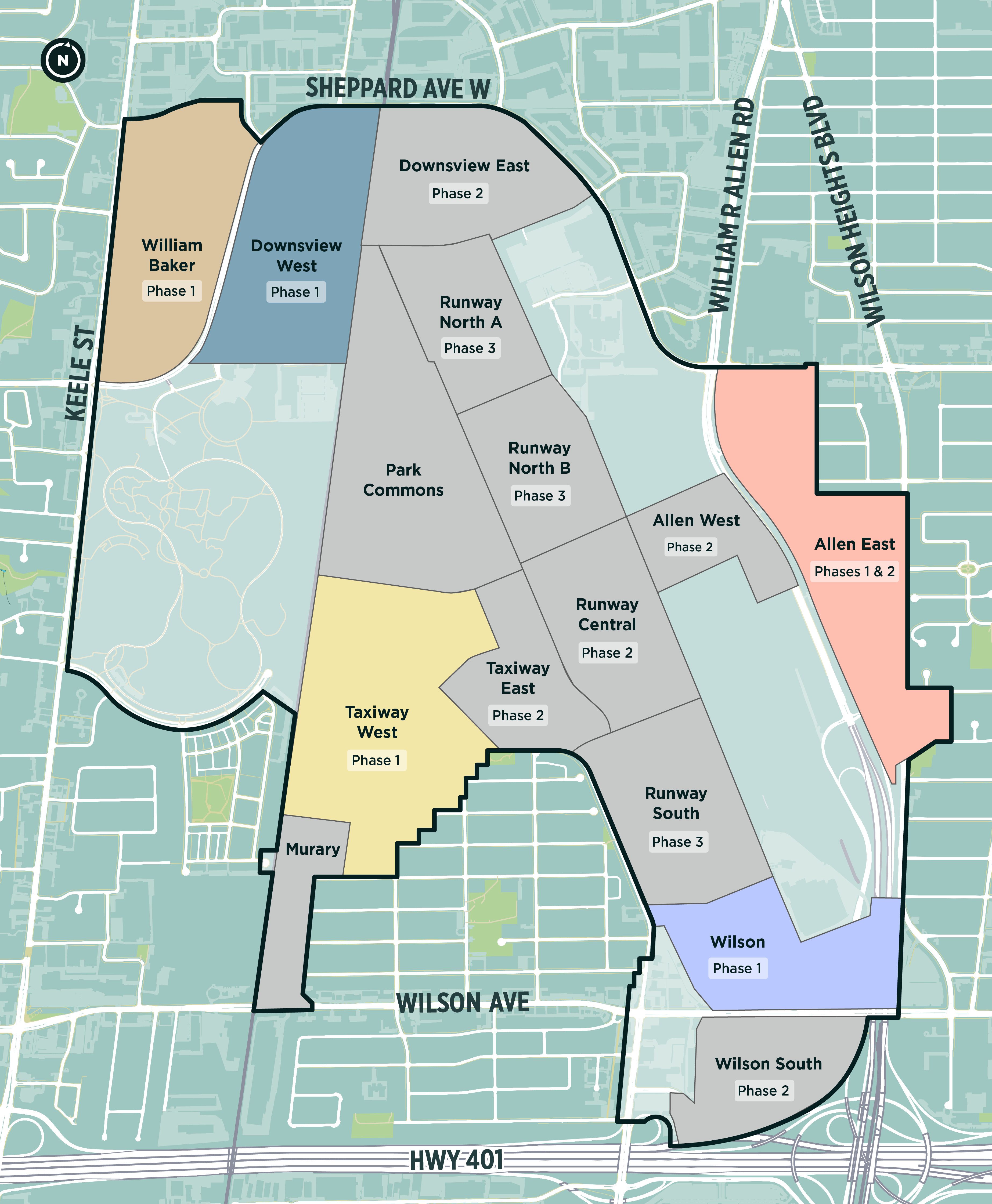
Over the next 30+ years, new parks and recreation facilities will be introduced in the Downsview area. Community engagement for new parks will occur in phases, aligned with district development application submissions to the City.
As this will be a phased approach, not all projects are listed here yet. New projects will be added as they are developed and posted when their engagement process begins.
A new community recreation centre is coming to 1377 Sheppard Ave. W., near Sheppard Avenue West and Keele Street. The approximately 7,431 m2 (79,000 ft2) facility will be designed with a target of Net Zero emissions.
Three new parks are planned for the Taxiway West District, with community engagement for the first park starting in spring 2025. The other two parks will follow in future phases. The first park, located off Garratt Boulevard, will cover 6,000 m2 (approximately the size of a soccer field).
Two new parks are planned for the William Baker/Arbo District, near Sheppard Avenue West and Keele Street, as part of the Downsview Secondary Plan. Park A will cover 4,840 m2 (approximately the size of a baseball diamond and five basketball courts), while Park B will cover 10,636 m2 (roughly the size of three baseball diamonds and three basketball courts).
The Downsview Parks and Recreation Facility projects have a Community Resource Group (CRG) organized by the City, Northcrest Developments and Canada Lands Company. The CRG will provide input on behalf of the people they represent on the planning and development of Downsview. The CRG will meet every other month. The CRG is not a decision-making body and does not speak on behalf of the entire community. Members of the CRG include representatives of the following organizations:
The Downsview Parks and Recreation Facility projects have an Indigenous Community Resource Group (ICRG) organized by the City, Northcrest Developments and Canada Lands Company. The ICRG will provide Indigenous-led dialogue, community input and culturally grounded guidance for the redevelopment of Downsview, specifically as it relates to Downsview’s District Plans, Community Development Plan, and parks and recreational spaces. In addition to individuals, the ICRG includes representatives of the following organizations:
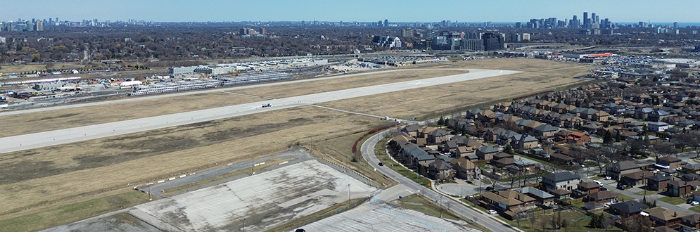
In fall 2021, the City launched the Update Downsview Study to guide future development in the area in response to the departure of Bombardier operations and closure of Downsview Airport. This study resulted in several key planning documents, including an updated Downsview Secondary Plan, a Community Development Plan, Urban Design Guidelines, a Zoning By-law for Meanwhile Uses and a Master Environmental Servicing Plan. Together, these documents establish a long-term vision for a complete community focused on transit investment, job creation, parks and open spaces, and essential community services.
In 2024, City Council adopted the Downsview Secondary Plan and its related documents, formalizing this vision for the area’s future development.
A full history of the City-led community engagement, including presentation boards, meeting summaries and recordings is available on the Update Downsview Background page.