The Jane Finch Initiative followed Keele Finch Plus as the second City Council directed study in focus areas along Finch Avenue West to plan for significant growth and change ahead of the opening of the Finch West Light Rail Transit (LRT) – an 11-kilometre, 18-stop LRT line between the TTC’s Finch West Station and Humber College. This rapid transit investment is designed to conveniently and reliably connect area residents, businesses and institutions, and improve linkages to the city’s higher-order transit network.
Several City divisions collaborated to develop an integrated complete-community framework for the Jane Finch area. Through the engagement process, residents helped shape these plans for their community. This community planning exercise aligned people- and place-focused initiatives to advance social equity and economic inclusion for current and future residents, encourage the appropriate kinds of growth and development in the area, and guide investment in community improvements.
The initiative involved three streams of work:
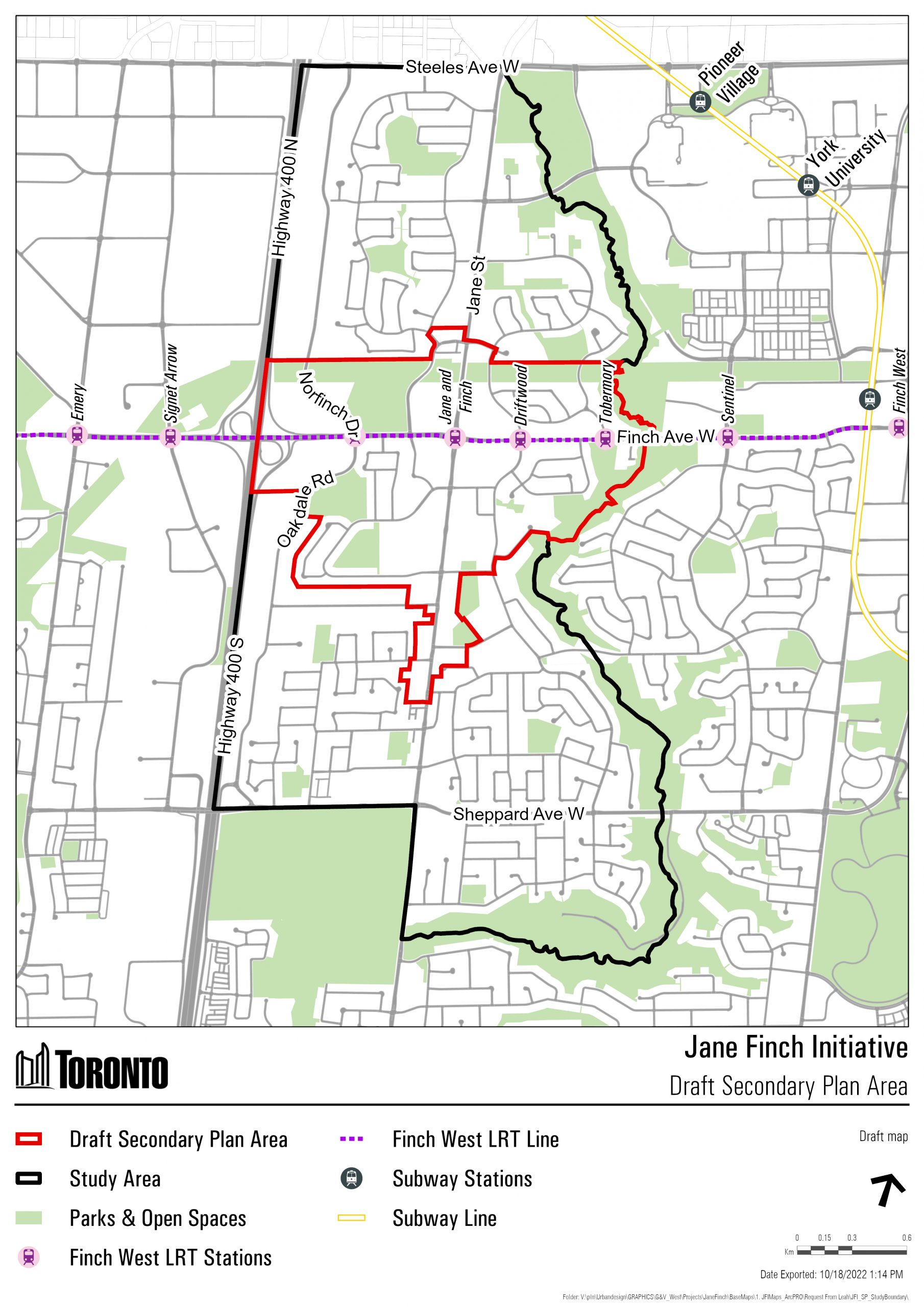
The boundaries of the Jane Finch Initiative study area align with Neighbourhood 24, Black Creek and Neighbourhood 25, Glenfield-Jane Heights. The study area is roughly bounded by Highway 400 to the west, Steeles Avenue West to the north, Black Creek to the east and Sheppard Avenue West and a portion of Black Creek to the south.
The boundaries of the secondary plan area are based on criteria including walkability (500- to 800-metre walking radius from planned LRT stops), land use (areas where growth and change may be desirable and warranted), lot sizes and ownership patterns (larger parcels where development potential is greater), and other factors that arise during community consultations or planning analysis.
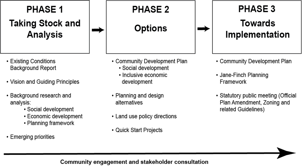
The Jane Finch Initiative was carried out in three phases with community engagement and stakeholder consultation at each phase. Phase 1 required staff to take stock of the existing conditions.
In Phase 2, options for the community were developed. In Phase 3, the policies were refined and incorporated in the final framework for recommendation to Community Council, Committee and City Council.
The study was completed in June 2024 following City Council adoption of the planning framework for the area.