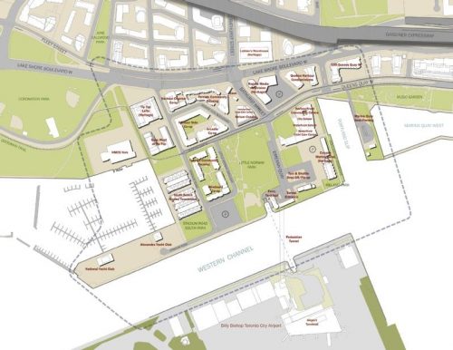
A Neighbourhood Study was initiated in response to Porter Airlines’ request to amend the tripartite agreement to allow jet aircrafts at Billy Bishop Airport and extend the runway
Porter Airline’s request was denied by the Federal Government
The City of Toronto proceeded with the Study to provide a framework for development and transportation pressures within the neighbourhood
City Council endorsed the guiding principles and action plan for the Bathurst Quay Neighbourhood Plan in July 2017
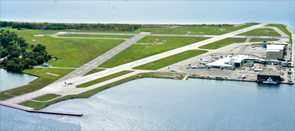
The Bathurst Quay Neighbourhood Association (BQNA), the City, including Toronto Public Health and PortsToronto collaborated on a community-initiated air quality study with the University of Toronto.
The study objectives include an assessment of air pollution exposure, its main sources and measures to reduce air pollution.
Reports were finalized and released in 2024.The University of Toronto study team’s key findings were:
On average, the concentrations of the air pollutants measured in Bathurst Quay are similar to other urban locations in Toronto.
The airport is a major source of ultrafine particles (UFP) in the neighbourhood.
Ferry electrification brought measurable reduction in the concentrations of some air pollutants.
The report, which includes recommended next steps, will inform future policy and program development.
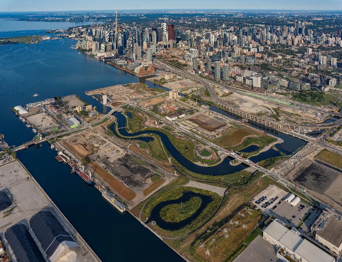
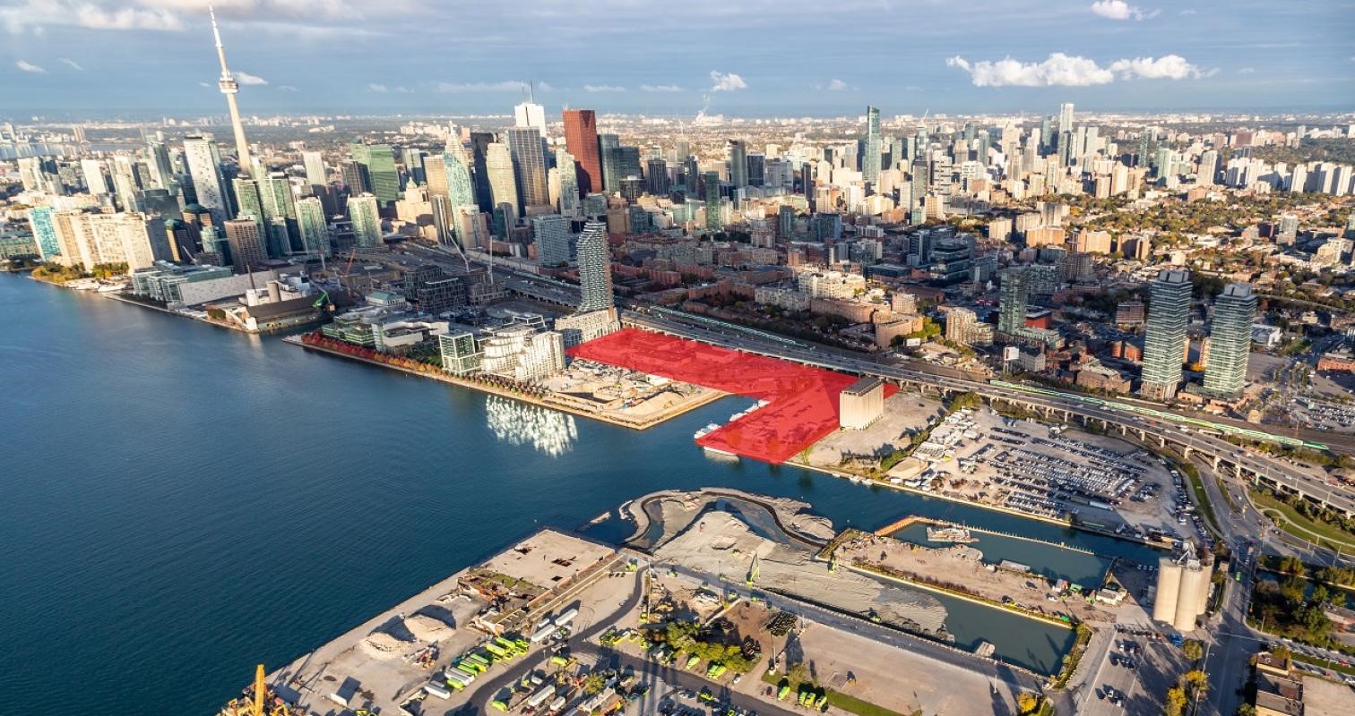
Image of the renaturalized mouth of the Don River on Ookwemin Minising in the Port Lands
A renewed vision for Toronto’s waterfront was endorsed by City Council in 2022 which sets out the following priorities:
Strategic economic development;
Truth, justice and reconciliation, including through Indigenous engagement;
Equity, inclusion and access, including through housing; and,
Climate resilience and sustainability.
On January 28, 2025, the Government of Canada, the Government of Ontario and the City of Toronto announced $975 million for the Next Phase of Waterfront Revitalization, to be advanced with Waterfront Toronto. The Next Phase represents a significant step forward in realizing the broader effort of waterfront revitalization, which, over 50+ years, is expected to result in housing for over 100,000 people and create space for approximately 50,000 jobs in the central waterfront east, including the Port Lands.
Guided by the Reconciliation Action Plan (2022), Indigenous community engagement and relationship building with First Nations, Inuit and Métis communities is ongoing across waterfront projects. Opportunities for advancing the Reconciliation Action Plan through waterfront revitalization include:
Action #2: Enhancing Indigenous education and awareness among the public
Actions #5 & #6: Improving relationship-building with Indigenous communities;
Action #14: Increase access to affordable housing
Action #15: Supporting Indigenous placekeeping;
Action #17: Supporting the revitalization of Indigenous languages;
Action #16: Celebrating Indigenous arts and culture;
Action #19: Return of Land and Stewardship Rights;
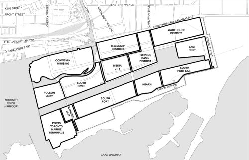
Port Lands include several districts including Media City, Turning Basin District, Warehouse District, East Port, South Port East, Maritime Hub and South Port, South River, Ookwemin Minising, Polson Quay, McCleary District and Ports Toronto.
The Port Lands Planning Framework and the Port Lands Official Plan Modification, adopted by Council December 2017, provides land use directions for the “Regeneration Areas” in the Central Waterfront Secondary Plan
Council also directed staff to develop more detailed plans in key areas of the Port Lands including;
an update of the zoning for approximately 2000 hectares of employment lands to increase as-of-right permissions
the creation of urban design guidelines for Media City District and the Turning Basin District
Public and stakeholder consultations begin Winter 2019
Additional information is available on the Port Lands web page.
Quayside is a 4.9 hectare parcel of land on Toronto’s waterfront, located at Queens Quay East and Parliament Street. Quayside will be a master-planned mixed-use complete community that builds on the development in the adjacent Bayside and Dockside lands, and the emerging Keating Channel West Precinct. A key driver for Quayside is the provision of affordable rental housing units, estimated to deliver between 800 and 875 affordable rental units and approximately, a further 200 affordable ownership units.
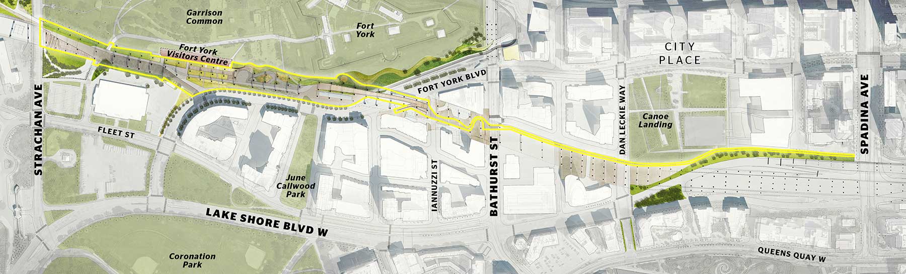
Thanks to a $25 million private family donation, the City of Toronto and Waterfront Toronto are transforming lands under a western segment of the Gardiner Expressway into a 1.75 kilometre vibrant gathering place
Known as the Bentway, the initiative extends from approximately Strachan Avenue in the west to Spadina Avenue, knitting together a number of waterfront destinations and the neighbourhoods of Exhibition Place, Liberty Village, Niagara, Fort York, Bathurst Quay, Wellington Place, and City Place
Upcoming programming includes a skating rink, terraced gardens, public markets, festivals, theatre and a continuous multiuse trail
32 hectares of former industrial lands that are being transformed into a sustainable, mixed-use community
Key feature is 8 hectare flood protection landform that provides critical flood protection for the downtown and serves as the foundation for Corktown Commons park
Upon completion, will feature approximately 6,000 new residential units, employment and commercial space, an elementary school, childcare centres, and 9.3 hectares of parks and public spaces
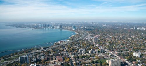
The Western Waterfront Master Plan (WWMP) was approved by City Council in 2009. It was developed to provide a vision for the Western Beaches of Toronto’s Western Waterfront and to guide future decisions related to improvements in the area.
Almost 15 years later the City is formally reviewing the Plan with a staff team from City Planning, Transportation Services, Parks, Forestry and Recreation, Corporate Real Estate Management and the Toronto and Region Conservation Authority to check in on implementation progress and update the project’s priorities with fresh input.
The Western Beaches Public Realm Plan is part of the Western Waterfront, with the study area extending east of the Humber River to Ontario Place, including Sir Casimir Gzowski Park, Budapest Park, Sunnyside Park, the Lake Shore Boulevard Parklands, and Marilyn Bell Park.
The team is: checking in with the community about their current experience of the Western Beaches; taking stock of which initiatives should be advanced; considering emerging issues and priorities; and refreshing the list of implementation items.