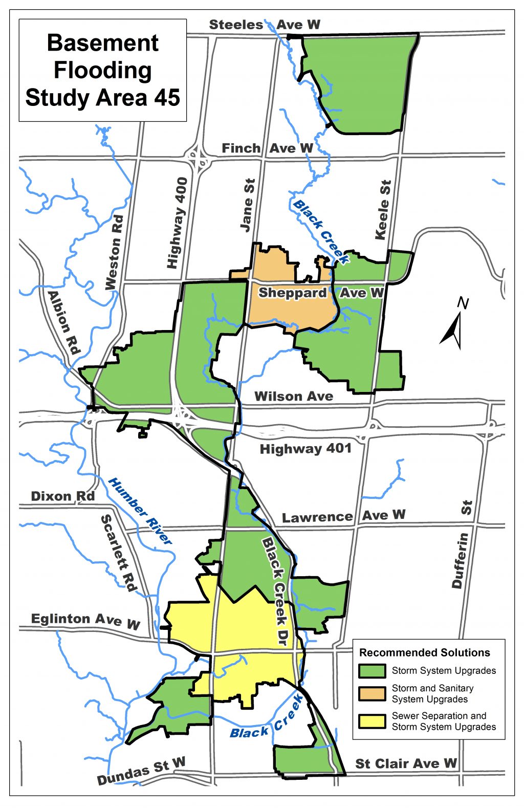
Study Area 45 is located in the Black Creek and Highway 401 area and has experienced recurring basement and surface flooding during extreme storm events.
Following consultation, the study recommends:
The study was carried out following the requirements for Schedule B projects under the Municipal Class Environmental Assessment process. The Project File was available for public review from July 29 to September 17, 2021. View the Executive Summary.
In December 2019, a drop-in event was held to showcase the recommended solutions in the study area.
View consultation materials:
Ontario’s Environmental Assessment (EA) program promotes good environmental planning by determining and managing the potential effects of a project prior to implementation.
The EA program ensures that public concerns are heard. EA balances economic, social, cultural and natural environmental needs so that projects benefit Ontario.
This study is being carried out according to the Municipal Class Environmental Assessment process. This is an approved approach to satisfying requirements of the Environmental Assessment Act specifically tailored to municipal infrastructure. The process includes identifying the problem or opportunity to be addressed, developing and evaluating a range of alternative solutions, providing opportunities for public input and identifying a preferred solution.