The City of Toronto is proposing a Complete Street on Dupont Street between Dundas Street West and Davenport Road. Complete Streets enhance road safety and accessibility for all road users, including pedestrians, people cycling, driving and taking transit. Designs will consider impacts to on-street parking and loading, and traffic operations.
In October 2025 the City began installation of several intersection safety improvements on streets intersecting Dupont Street between St. Clarens Avenue and Manning Avenue. These changes will not impact existing parking or the number of vehicle lanes.
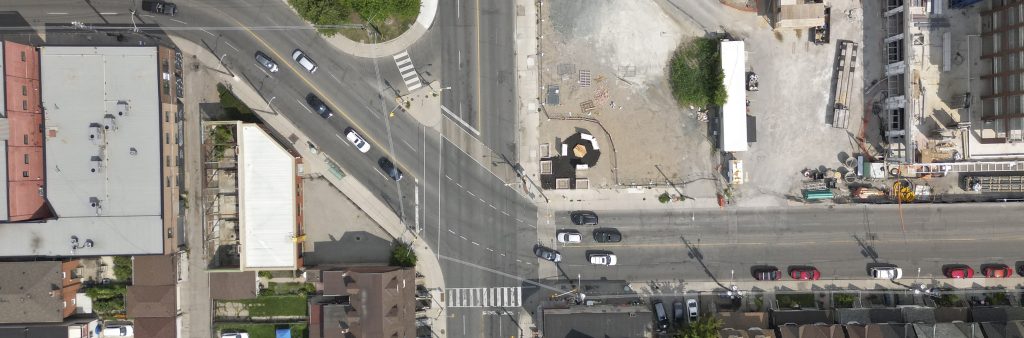
The City will install curb extensions (sidewalk extended into the curb lane to narrow the roadway) and curb radii reductions (intersection corner design changes) using pink paint, white painted edge lines and white bollards. Used together, these road safety features help slow vehicle turning speeds, decrease pedestrian crossing distances and improve visibility at crossings and intersection corners.
Changes are planned at the following intersections:
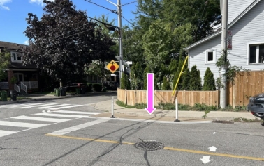 Photo showing an example of a curb extension with bollards.
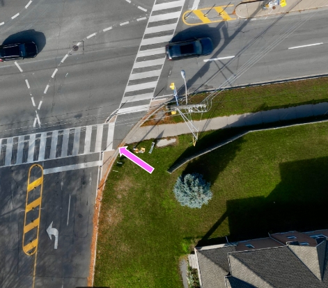
Photo showing an example of a curb radii reduction.
Quick-build improvements are installed by City workers or external contractors, under the supervision of Transportation Services staff. Installation at each site typically takes several days, and the installation of bollards and signage and the installation of pavement markings undertaken in separate stages.
Once the new safety improvements are completed, there is typically a short period of adjustment for road users to become familiar with the new roadway design, and to navigate through the locations safely and at appropriate speeds.
In 2026, it is planned to complete watermain replacement and road rehabilitation work on Dupont Street between Spadina Road and Davenport Road, providing an opportunity to make additional safety and streetscape improvements. Improvements will include:
In 2026, the City is proposing to widen the sidewalk on the south side of Dupont Street between Spadina Road and Davenport Road as part of state of good repair road work and to improve pedestrian safety. Improvements will include the relocation of poles and addition of planters and seating. Corner curb radii will be tightened for safer vehicular turning movements. Curb extensions will be added at Madison Avenue and Huron Street to reduce crossing distances and to provide planting opportunities.
On St. George Street, changes will include upgrades to the existing southbound bike lane to a protected cycle track and widening of the sidewalk on the east side, 25 metres south of Dupont Street. The existing westbound farside TTC bus stop will be moved nearside at Huron Street. Notifications will be sent prior to construction.
Phase 1 consultation took place in 2024 to receive feedback on existing conditions, including loading and parking needs, safety concerns and streetscape opportunities for all modes of transportation. View the Phase 1 Consultation Report to learn more about all activities and feedback received.
Consultation on the remainder of this project, between Dundas Street West and Spadina Road, continues to be paused due to uncertainties surrounding the Province’s amendments to the Highway Traffic Act (Bill 212).
With the exception of roadwork between Spadina Road and Davenport Road the project is paused due to uncertainties surrounding the Province’s amendments to the Highway Traffic Act (Bill 212), which indicates that the City will require Provincial approval to implement bikeway features if vehicle lanes are impacted. Opportunities for interim safety improvements are being assessed.
Once the Province provides criteria for approving cycling-related projects with impacts to vehicle lanes, staff will adapt the Dupont Complete Street project accordingly.
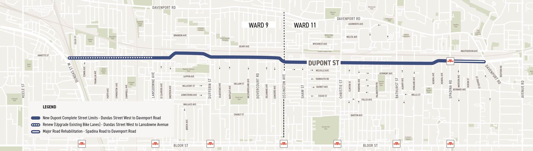
The project is located on Dupont Street, spanning 4.7 kilometres between Dundas Street West and Davenport Road.
Since the early 1900s, Dupont Street has been a manufacturing and retail hub due to its proximity to the rail corridors.
In 2014, the City adopted the Dupont Street Regeneration Area Study from Ossington Avenue to Kendall Avenue, setting a vision to accommodate the demands and the physical realities of this unique street prior to development.
Since then, City Council has adopted new TransformTO, Vision Zero and Cycling Network coverage goals and policies.
With increased residential density through new developments, the 2025-2027 Cycling Network Implementation Plan directed Transportation Services to initiate a complete street design of Dupont Street between Dundas Street West and Davenport Road.
Stay Informed
The project team is working to actively keep local residents and businesses informed throughout different stages of this project. To receive updates by email, subscribe to the project email.