The Eglinton East LRT (EELRT) is a light rail system operating in the centre of the roadway separated from vehicle traffic by a dedicated guideway. Design priorities for the EELRT (future Line 7) are informed by the City of Toronto Accessibility Design Guidelines and the Complete Streets Guidelines which enhance multi-modal transportation options and improved public realm spaces.
The design varies slightly through different segments of the EELRT route to correspond to relevant policy, local constraints and context. View the Phase 2 project information panels for more information about the design elements within each segment of the project.
There are 27 stops, 400 metres to 1 kilometre apart. Stop platforms will be 50 metres long targeting major intersections.
LRTs operate on electrical power but require special infrastructure to run Traction Power Substations (TPSSs).
TPSSs use electricity from the local power supply to generate the consistent power needed to operate light rail vehicles.
The substations are similar in size to a shipping container and are designed with safety in mind:
The functional (10%) design includes 15 TPSSs located every 1.5 to 2 kilometres along the EELRT corridor.
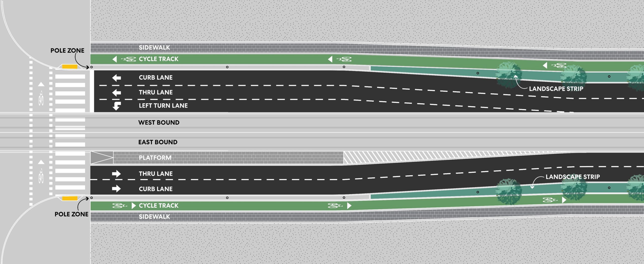
The current project design also includes new and extended roadways and changes to vehicle travel lanes to accommodate various infrastructure for the LRT stops, and to reduce impacts on private properties:
Left turns for vehicular traffic will only be permitted at signalized intersections; protected left-turn phases and LRT signal priority will be provided at stoplights traffic lights. All other areas are restricted to right-turn in and right-turn out of traffic flow, including driveways.
The EELRT will be a separate service from existing transit infrastructure in the area, meaning passengers will transfer at Kennedy Station Line 2 and Line 5, and at the future Line 2 terminus at Sheppard-McCowan Station.
Advantages of a separate service include:
The construction of the EELRT presents an opportunity to bring infrastructure up to current Complete Streets design standards by implementing high-quality and safe infrastructure for pedestrian and people cycling and create a well-functioning street network that is planned and designed to provide safe access and efficient operation for all street activities and functions.
The key design principles for EELRT’s public realm improvements include:
To receive updates by email, subscribe to the project email.