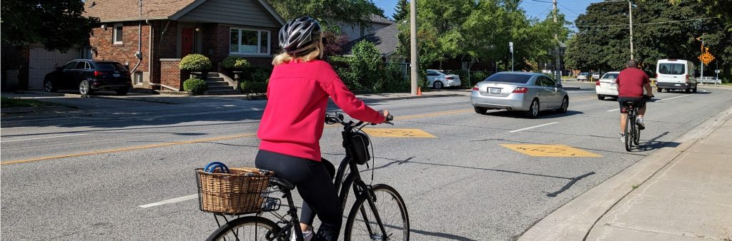
The Leaside Bridge to Danforth Avenue Cycling Connections project connects the Thorncliffe Park Neighbourhood to the Bloor – Danforth Corridor.
The project is part of the Council approved Cycling Network Plan and advances the goals of several City of Toronto Strategies including the Vision Zero Road Safety Plan and the TransformTO Net Zero Strategy.
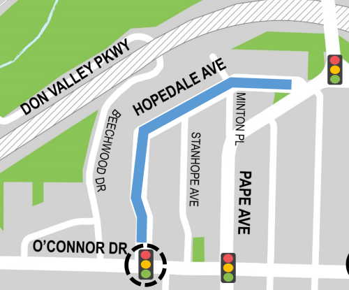
Expected installation of the traffic signal on Hopedale Avenue and O’Connor Drive, as approved in June 2024.
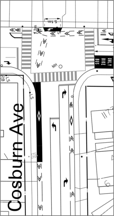
Installation of approved changes on Logan Avenue, between Danforth Avenue and Cosburn Avenue; on Gowan Avenue, between Logan Avenue and Carlaw Avenue; and on Carlaw Avenue, between Gowan Avenue and Danforth Avenue. View the Installation Notice.
City Council approved interim measures for the cycling connection between Cosburn Avenue and Danforth Avenue. Based on community feedback, further review of the design options presented in June 2025 is needed.
The City consulted on a new proposal to complete the Leaside Bridge to Danforth Avenue Cycling Connection that includes contra-flow bike lanes on both Logan Avenue and Carlaw Avenue to connect Cosburn Avenue and Danforth Avenue.
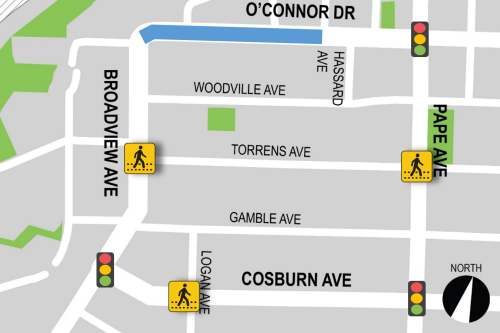
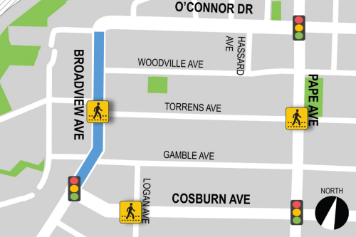
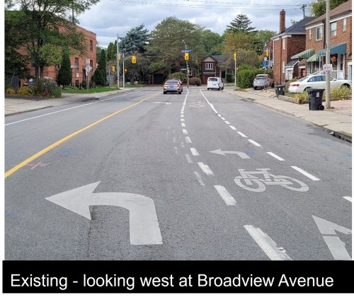
Cycling connections along Hopedale Avenue, O’Connor Drive, Broadview Avenue and Cosburn Avenue were installed in the Fall 2024. Details are in the installation notice.
Further consultation on bikeways south of Cosburn Avenue to Danforth Avenue is expected to take place in Spring 2025.
City Council adopted proposed changes along Hopedale Avenue, O’Connor Drive, Broadview Avenue and Cosburn Avenue as part of the Cycling Network Plan Update (2025 – 2027) on June 26, 2024.
While there was community support for improved cycling connections, there were concerns about impacts of adding traffic diverters or changing traffic direction along Logan Avenue. After reviewing public feedback, the City is no longer advancing these options.
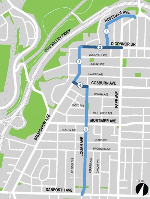
The bikeway is divided into five segments. Changes for the following segments have been approved:
The list below identifies the approved changes following Council approval:
This section of the bikeway connects to the new bikeways installed on the Leaside Bridge in 2024.
In this section, the following has been approved:
In this section the following has been approved:
In this section, the following has been approved:
In this section, the following has been approved:
Phase two: Spring 2025
Based on public feedback in winter 2024, a revised plan for bikeway options between Cosburn Avenue and Danforth Avenue was presented to the community. Consultation took place June 6 to June 20, 2025. Feedback has been captured in the Staff Report.
Consultation Materials
Phase one consultation took place February 8 to March 21, 2024. The public consultation report provides a detailed summary of all activities that took place, proposed changes, and feedback received.
While we aim to provide fully accessible content, there is no text alternative available for some of the content on this site. If you require alternate formats or need assistance understanding our maps, drawings, or any other content, please contact us at leasidedanforthcycling@toronto.ca or 416-338-2985.
The City Council-approved Cycling Network Plan is a comprehensive roadmap and work plan that outlines the City’s planned investment in our cycling network. It includes a Long-Term Cycling Network Vision, the planned Major City-Wide Cycling Network Routes, and a three-year rolling Near-Term Implementation Program which was recently updated by Council in June 2024 for the 2025 – 2027 period. The Leaside Bridge to Danforth Avenue Cycling Connections Project was as part of the Near-Term Implementation Program (2025-2027).
The aim of the Cycling Network Plan is to connect gaps in Toronto’s current cycling network by growing existing and future cycling opportunities with safer and more comfortable cycling route options where quality can be improved.
There are a number of policy objectives and guiding policy documents that inform cycling connections projects like this, including:
Council makes the final decisions on project implementation based on policies and guidelines, technical considerations and public input.
For the Leaside Bridge to Danforth Cycling Connection the Project team studied the motor vehicle lane reduction and potential impacts to parking. Pre-installation traffic volumes are 11,000-12,000, which are below the typical capacity threshold for a two-lane road (20,000 vehicles/day). Peak hour volumes are also below the capacity thresholds.
The observed parking demand is very low with 1-4 cars parked on O’Connor Drive and 3-5 cars parked on Broadview Avenue. The area between Broadview Avenue, Pape Avenue and Coburn Avenue has a total of 75 available parking spaces. There are no impacts to on-street parking permits.
To receive study updates by email, please email leasidedanforthcycling@toronto.ca and indicate that you would like to be added to the mailing list.