Approved changes include:
Approved changes include:
Approved changes include:
Public opinion, along with technical and policy considerations, will be used to inform staff recommendations and decisions made by City Council.
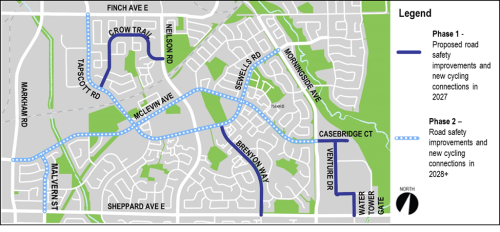
The Malvern Neighbourhood Connections project will have two phases of consultation. Currently, the project is in Phase 1 consultation.
A Public Drop-In Event was held on Tuesday, June 24, 2025 that included the opportunity to speak with project staff and view information panels (see below).
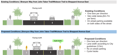
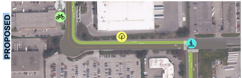
Planned Road Work: In 2027 road resurfacing is planned on Crow Trail, Casebridge Court, Venture Drive, Water Tower Gate and Brenyon Way. Making changes with planned road work is cost effective and minimizes repeated construction.
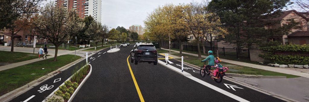
Vision Zero Road Safety Plan: This project is part of the Vision Zero Road Safety Plan, which aims to eliminate traffic-related fatalities and serious injuries by making our roads safer for everyone, especially for seniors, school children, pedestrians and people cycling.
Missing Sidewalk Projects: Casebridge Court, Venture Drive, Water Tower Gate are collector roads and currently only have a sidewalk on one side of the street. These streets are identified for a new sidewalk in 2027.
Cycling Network Plan: The City Council approved 2025-2027 Near Term Implementation Program includes new cycling connections in the Malvern Neighbourhood that aim to connect gaps in the network and people to places and grow the cycling network in parts of the City.
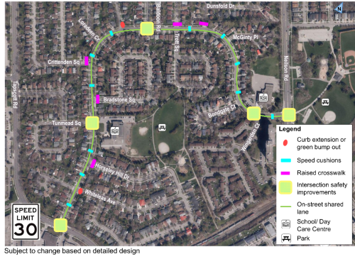
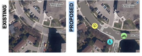
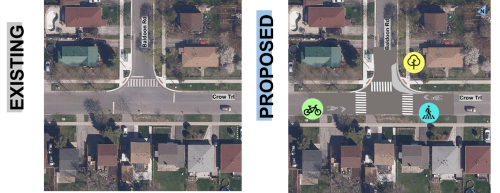
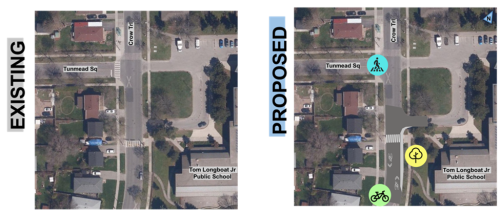
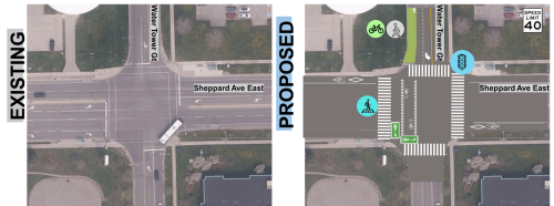
Malvern West Streets Plan: The changes proposed on Crow Trail as part of Malvern Neighbourhood Connections are informed by public feedback received in 2024 through the Malvern West Streets Plan, which aimed to address concerns related to excessive speeding, road safety and pedestrian connectivity.
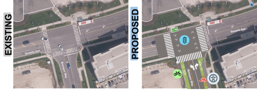
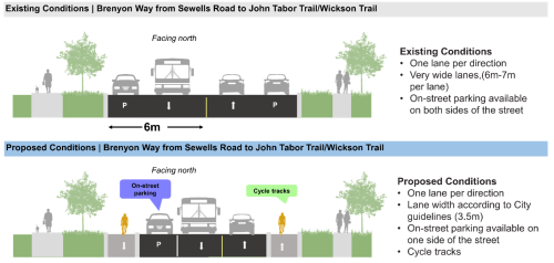
The proposed changes to on-street parking on Brenyon Way as part of the Malvern Neighbourhood Connections project are informed by parking surveys that were conducted multiple times during the current construction at 25 Sewells Road. The surveys measured on-street parking needs and usage on Brenyon Way. On average, 32 vehicles were observed parked on Brenyon Way between Sewells Road and John Tabor Trail during all surveyed periods. The proposed changes therefore include retention of 31 to 36 on-street parking spaces on Brenyon Way (the final number will be confirmed during detailed design) to ensure that current parking needs are not impacted.
In addition to on-street parking, the development at 25 Sewells Road upon completion will include a total of 53 dedicated visitor parking spaces shared by both 25 Sewells Road and 250 Brenyon Way.
Approximately 30 visitor spaces existed prior to construction so this means the site will provide 23 additional visitor spaces once the new development is complete.
The City is striving to schedule work to reduce impact to on-street parking needs on Brenyon Way. The proposed bikeways on Brenyon Way will not be installed until 2027 as part of a planned road resurfacing project. The proposed bikeways would be installed after the completion of the construction at 25 Sewells Road (Phase One occupancy is expected in Fall 2026).
Decisions concerning the allocation of bus stops are made by the TTC.
The TTC conducts its own review of bus stops and applies service standards which include criteria about safety, engineering, stop spacing, accessibility and demographic characteristics. These standards help to ensure transit stop networks prioritize safety while balancing customer access to transit and reliable customer journey times for those onboard TTC vehicles.
The TTC strives to place transit stops, where reasonably possible, at signalized or protected pedestrian crossings with crosswalks afforded by traffic signals, stop signs and other street facilities that provide opportunities for pedestrians to safely cross the road.
The TTC also tries to place bus stops several hundred meters apart except in locations where high pedestrian volumes exist.
The City considers potential changes to the proposed design through review of feedback from the community representatives, businesses and the public, alongside technical information, policies, guidelines and site observations.
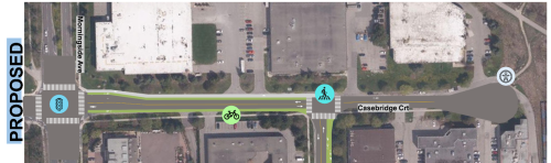
Following consultation, the following changes were made to the proposed design on Brenyon Way:
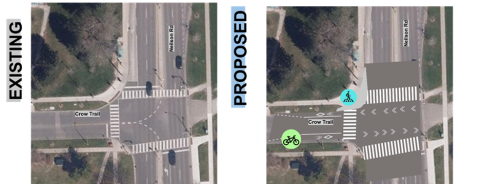
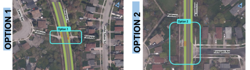
Following consultation, the following changes were made to the proposed design on Crow Trail:
To receive project updates by email, please contact us and indicate that you would like to be added to the mailing list.