In consultation with local community, the City is developing a Neighbourhood Streets Plan (NSP) for the Maple Leaf and Rustic area that will address five main areas of concern:
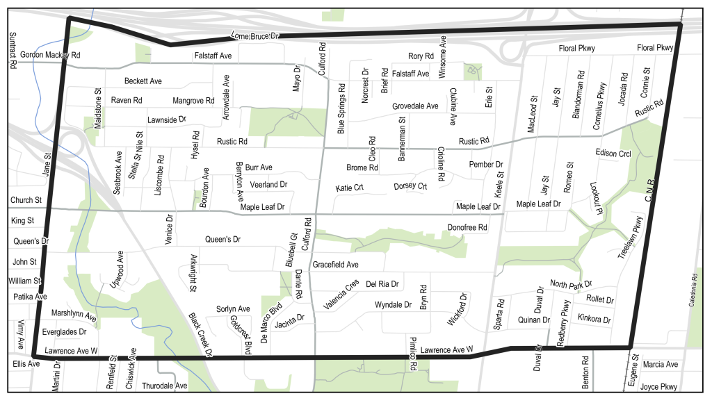
The project area is located between Jane Street to the west, the rail corridor to the east, Highway 401 to the north, and Lawrence Avenue West to the south.
In 2020, the Etobicoke York Community Council directed City staff to work with the Maple Leaf and Rustic communities to develop a comprehensive plan to address community concerns regarding traffic safety and mobility. City staff will use a Neighbourhood Streets Plan process to develop this plan.
Neighbourhood Streets Plans (NSPs) serve neighbourhoods where traffic and travel patterns challenge the safety and mobility of people using the streets. Through the NSP process, a team of City staff work with communities to identify local issues and opportunities, prioritize the greatest needs, and recommend changes to traffic operations and street designs. NSPs consider the needs of all road users and emphasize the safety of vulnerable road users such as seniors, school children, and people walking and cycling.
NSPs result in short-term actions which can be made using temporary, flexible materials like signs, asphalt, paint, and bollards. NSPs can also identify medium and long-term changes which can be accomplished as part of future planned road work.
The outcomes of each NSP are different based on local conditions and the needs of each neighbourhood. Typically, NSPs recommend actions related to motor vehicle speed and volume management, and traffic safety conflicts on local streets. NSP recommendations are informed by the City’s Traffic Calming Guide, Vision Zero Action Plan, Cycling Network Plan, Congestion Management Plan, and Complete Streets Guidelines.
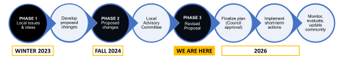
Public consultation on the Maple Leaf and Rustic Neighbourhood Streets Plan has included two phases of public consultation, a Local Advisory Committee, and a consultation update on how the proposed changes have been revised based on feedback from the Local Advisory Committee.
All previous consultation materials are available on the project web page.
Phase 3 consultation took place in November and December 2025.
View the display panels and meeting summary notes from the public meeting below.
A Local Advisory Committee (LAC) was formed to provide additional feedback and detail through in-depth conversations over three in-person meetings held in January, March and September 2025. Committee members emphasized a desire for congestion management, especially at the Keele Street and Lawrence Avenue West intersection, improved safety while maintaining resident driver access, and changes on roads inside the neighbourhood to be less disruptive.
View the meeting summary notes and presentations below.
Phase 2 consultation took place in October 2024 and proposed actions and changes to respond to issues identified in Phase 1. Phase 2 consultation participants were divided over their support for proposed changes.
View the display panels, meeting summary notes and consultation report below.
Phase 1 consultation on the Maple Leaf and Rustic Neighbourhood Streets Plan was conducted in December 2023 and invited residents and interest groups to identify issues and suggestions for changes to respond to transportation safety and mobility concerns. View the display panels and consultation report below.
Phase 1 feedback centered around six main themes: road safety concerns for all road users; high motor vehicle speeds throughout the neighbourhood; concern about the impact of congestion along major corridors on neighbourhood streets; lack of desirable travel alternatives to motor vehicle travel; conflicts between parking/loading and motor vehicle flow; and concerns about the impact of development on the transportation network.
Based on previous feedback received from the community, the City has revised the proposed plan for the neighbourhood. The City is currently seeking feedback on the new plan. Proposed changes include:
In addition to the proposed changes, the City is moving forward with two separate projects that respond to community concerns:

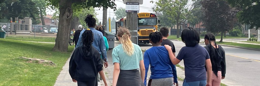
The Plan proposes to improve safety for school children and people travelling around schools by focusing safety improvements on streets near schools and supporting efforts to organize pick-up drop-off areas.
Similar to all schools across the city, Falstaff Avenue in front of the new location for St. Fidelis Catholic School will be designated as a School Safety Zone and standard measures will be installed such as School Safety Zone signs, flashing beacons and pavement markings.
The following changes are proposed to support safety around school zones:
Refer to proposal map above and slides 17 and 18 on information panels.
The Plan proposes to make walking more comfortable, convenient and safe, by reducing conflict and making space.
The following changes are proposed to support pedestrian safety:
Residents have raised concerns about congestion at the Keele Street and Lawrence Avenue West intersection affecting the rest of the neighbourhood.
A separate study focused on this intersection has begun. The study will investigate signal timing changes, bus stop relocations, changes to intersection layout, and restrictions at nearby intersections and driveways. When the study is complete, its findings will be shared via the project mailing list
Comments received during public consultation for the Neighbourhood Streets Plan and from the Local Advisory Committee will be considered. Potential changes may include:
Residents have raised concerns about east-west infiltration in the area, however, changes to address these concerns would also limit resident access. Previous feedback is clear that residents are not in favour of changes that would limit local resident access. During earlier consultation, more than half of respondents to the survey were very unsupportive of any changes to street direction, turn restrictions or directional closures.
In general, it is not feasible to introduce new restrictions from Jane Street and Keele Street without limiting access for residents.
Traffic calming locations (speed humps and speed cushions) are identified as a future opportunity for consideration to slow speeds and discourage east-west infiltration on specific streets on a case-by-case basis through the Councillor’s Office.
To receive project updates by email, please contact MapleLeafRusticStreets @toronto.ca and indicate that you would like to be added to the mailing list.