Neighbourhood Streets Plans (NSPs) are a new service for neighbourhoods where traffic and travel patterns may be impacting the safety and mobility of people using the streets. Through the NSP process, a team of City staff will work with communities to identify local issues and opportunities, prioritize the greatest needs, and recommend changes to traffic operations and street designs.
NSPs consider the needs of all road users and emphasize the safety of vulnerable road users such as seniors, school children, and people walking and cycling. NSPs will result in short-term actions (1 to 2 years) which can be made using temporary, flexible materials like signs, paint, and bollards, and will identify longer term changes which can be accomplished alongside future programmed road work.
The outcomes of each NSP will be different based on local conditions and the needs of each neighbourhood. Generally, NSPs will recommend actions related to motor vehicle speed, volume management, and traffic safety conflicts on local streets. NSP recommendations are informed by the City’s Traffic Calming Guide, Vision Zero Action Plan, and Complete Streets Guidelines.
Excessive speeds on local streets can lead to more frequent collisions and substantially increases the likelihood of those becoming fatal collisions. Changes to address excessive speeds that will be considered include:
- Lane narrowing can reduce speeds and encourage driver alertness. The space removed from existing lanes can be repurposed to expand sidewalks, cycling facilities, and green space.
- Speed humps are raised sections of the roadway designed to discourage motor vehicle drivers from travelling at excessive speeds.
- A curb extension is a horizontal intrusion of the curb into the roadway, resulting in a narrower section. Curb extensions help reduce speed and increase visibility of people walking when placed at intersections.
- Chicanes are a series of curb extensions on alternate sides of a roadway which narrow the roadway and requires drivers to steer from one side to the other to travel through the chicane. Chicanes help reduce speed and discourage shortcutting and through traffic.
Excessive volumes of motor vehicles on local streets can lead to an increased risk of a collision for vulnerable road users, noise pollution, and reduced air quality in the neighbourhood. Changes to address excessive volumes that will be considered include:
- One-way street conversions conversions change the direction of one or more segments of an existing one-way street to remove direct routes through a neighbourhood. These conversions discourage short-cutting traffic or through traffic in a neighbourhood.
- Directional closures are a curb extension or vertical barrier extending to approximately the centerline of a roadway, effectively obstructing one direction of traffic at a specific location.
- Raised medians at intersections are vertical barriers located on the centerline of a two-way roadway through an intersection, which prevent left turns and through movements on one of the roadways. Raised medians can obstruct short-cutting or through traffic while maintaining access for people walking or cycling.
- Turn restrictions prohibit turning movements onto or off of a street in order to discourage short-cutting traffic through a neighbourhood and can also help improve the flow of traffic by prohibiting turns onto busy roads at unsignalized intersections.
- Modal filters restrict the movement of cars to reduce short-cutting traffic in a neighbourhood while maintaining access for people walking or cycling.
Conflicts between road users can be caused by the competition for space between people walking, and biking, and driving as well as by road users taking unexpected actions. Changes to address road user conflicts that will be considered include:
- School crossing guards help children to safely cross the street during their walks to and from school and remind drivers of the presence of pedestrians at key intersections.
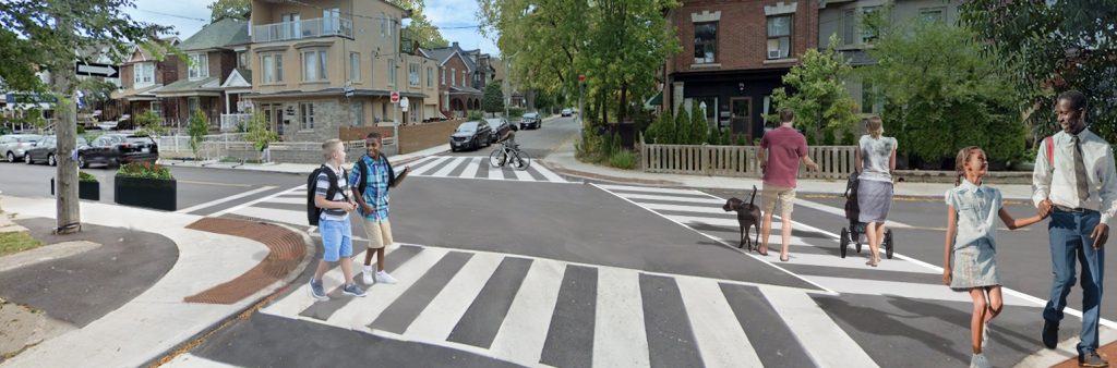
- New or expanded sidewalks create access, connectivity, and improve safety for people walking along a street. Separating vulnerable road users like people walking from cars on the roadway reduces the likelihood of a collision occurring.
- Dedicated cycling facilities like contraflow lanes on local streets create access and connectivity through a neighbourhood for people on bikes.
- Intersection controls like stop signs and traffic signals provide for an orderly flow of traffic and reduce conflicts by regulating movements through an intersection. When considering locations for stop signs or traffic signals, City staff follow the Ontario Traffic Manual guidelines which set out the warrants for implementing these measures.
- Advisory signs and beacons help alert drivers to potential dangers and conflicts with other road users or fixed objects near the roadway.
Neighbourhood nominations can be made at any time.
City staff will review all nominations between July and September each year to select the next set of neighbourhoods. Neighbourhoods nominated by June 30, 2025 will be considered for the 2025-26 program cycle.
Neighbourhoods will be selected based on prioritization criteria that considers equity, potential for impactful change, alignment with planned road works, and community support.
A plan typically takes 12 to 18 months to complete from time of selection.
Nomination Form
Fill out the form below to nominate your community for a Neighbourhood Streets Plan. Nominations remain open all year round. March 31st of each year is the deadline to be considered in that year’s selection process.
Nomination Form
Neighbourhood Streets Plans are only one of many ways that the City addresses local traffic concerns. This program is best suited to neighbourhoods facing several, complex, interconnected issues that need to be studied and addressed as a whole.
For help addressing traffic concerns at a specific location please call 311 or email 311@toronto.ca.
Eligibility
All neighbourhoods in Toronto are eligible to be nominated for a Neighbourhood Streets Plan. However, a nomination may be screened out in a given year if it is deemed unsuitable at that time.
Circumstances that make a neighbourhood unsuitable include:
- Proposed area size (too small): Nominations focused on the safety of a single street or intersection are best addressed as a service request through 311.
- Proposed area size (too big): Nominations that include multiple neighbourhoods, including nominations of an entire ward, will be screened out; requests for active transportation, road safety, or state-of-good-repair work at this scale should be considered through the Cycling Network Plan, Vision Zero Road Safety Plan, and Asset Management processes.
- Impact management of temporary conditions: Nominations that emphasize management of traffic patterns that are the result of temporary conditions such as road closures or construction are best addressed through the construction management plan. Information on active road restrictions can be found on the Road Restrictions & Closures webpage. Inquiries related to road closures or construction can be submitted to 311.
- Impact management of future development: Nominations that emphasize anticipated traffic impacts associated with a future development are best addressed through the statutory Development Application Review process. Information on active applications, including application status and community meeting dates, can be found through the Application Information Centre.
- Redundancy with other planning processes: Nominations that are concentrated on a neighbourhood that is currently the subject of another City-led planning process, or is intended to be soon, will be screened out as an unnecessary duplication of effort. In this case, a member of the NSP team will connect the nominator with the appropriate project.
Annual Neighbourhood Selection
To appropriately allocate the available resources for this service, a prioritization framework is used to rank the nominated neighbourhoods that are screened in as suitable candidates each year.
The framework consists of four categories, each scored separately based on defined criteria, with a total maximum score of 100 points. The four categories are:
- Equity (up to 40 points): to support equitable distribution of the City’s attention and investment into the street network and the communities that depend on it;
- Impact (up to 30 points): to prioritize neighbourhoods where the issues are those that can be meaningfully addressed by the typical scope of an NSP;
- Alignment (up to 20 points): to prioritize neighbourhoods where opportunities exist to deliver changes efficiently and effectively as part of upcoming planned road works; and
- Community (up to 10 points): to acknowledge and respond to efforts made by community members to affect change and garner support for change.
2025-26 Program Cycle
2024-25 Program Cycle
2023-24 Program Cycle
Prior Projects