

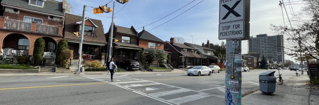
Toronto and East York Community Council and City Council approved changes recommended through the Oakwood Village Streets Plan. The related staff reports are available at 2026.TE33.52 and 2026.TE33.53.
Installation of painted sharrows, contra-flow bikeway and moving on-street parking to be fixed to one side is expected to take place from the week of July 27, 2026, to the week of August 10, 2026, on several streets in Oakwood Village. Details on what to expect during installation are available in the notice.
In June 2026, City Council approved the Oakwood Village Streets Plan – Non-Delegated Road Safety Improvements with amendments including the east-west connection, new signals on Oakwood Avenue and Vaughan Road, and other infrastructure improvements (TE33.53). For more information, refer to the Vaughan Road Safety Improvements project.
In May 2026, Toronto and East York Council adopted the Oakwood Village Streets Plan with amendments (TE33.52).
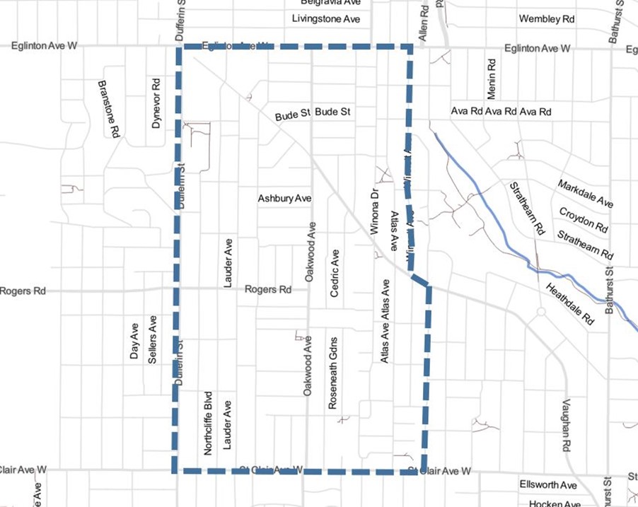
The project area is located between Dufferin Street to the west, St. Clair Avenue West to the south, Eglinton Avenue West to the north, and to the east from Arlington Avenue at St. Clair Avenue West to Vaughan Road to Winnett Avenue at Eglinton Avenue.
The Oakwood Village neighbourhood was nominated for a Neigbourhood Streets Plan in 2023 by the Ward 9 City Councillor on behalf of concerned residents. Issues identified in the nomination were:
Neighbourhood Streets Plans (NSPs) serve neighbourhoods where traffic and travel patterns challenge the safety and mobility of people using the streets. Through the NSP process, a team of City staff work with communities to identify local issues and opportunities, prioritize the greatest needs, and recommend changes to traffic operations and street designs. NSPs consider the needs of all road users and emphasize the safety of vulnerable road users such as seniors, school children, and people walking and cycling.
Streets Plans follow several steps outlined below, and public consultation takes place in two stages.
All previous consultation materials are available under the Public Consultation tab.
The City of Toronto invited local residents, businesses and organizations to learn more and provide feedback. Consultation took place in two phases conducted between spring 2024 and fall 2025:
Information, reference materials and reports on public consultation activities are posted below.
Public consultation for Phase 1 took place in spring 2024.
Public consultation for Phase 2 took place in fall 2025.
Toronto and East York Council adopted the Oakwood Village Streets Plan with amendments (TE33.52), and City Council adopted the components of the Streets Plan that required City Council approval (TE33.53). Following that decision, staff will proceed with implementing these changes:
Most changes will proceed over the short-term (6 months to 2 years). Pedestrian signal replacement and intersection safety improvements will proceed over the medium-term (2 to 5 years). Other changes to be considered in the long-term (5+ years), is subject to programming, feasibility study, public consultation, detailed design, and/or Council approval. For more information, refer to the Implementation and Monitoring section of the Streets Plan report.
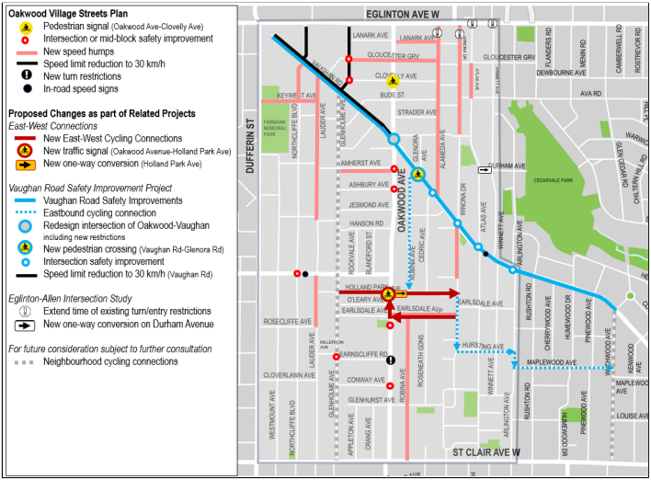
This map shows approved changes that will be implemented in the short to medium term. The map also shows additional changes proposed by the Streets Plan that require further coordination, study, consultation or City Council approval to be implemented through related projects.
Installation of some sections of the east-west cycling connections on neighbourhood streets are expected to take place from the week of July 27, 2026, to the week of August 10, 2026. Details on what to expect during installation are available in the notice.
The Streets Plan proposed to install:
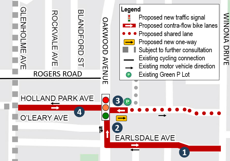
The new traffic signal at Holland Park Avenue would have an impact to on-street parking and would require the removal of 11 spaces.
See map on page 36 of the information panels, and proposed cross-sections on pages 38 to 41.
Refer to the cycling roll plan for details.
More details about the need for East-West Connections and New Signal are shown on pages 35 to 41 of the information panels.
Please register to be added to the project list to receive updates by email, including information about public events or online surveys.