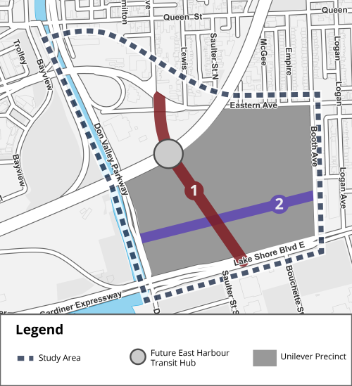
The City of Toronto has completed the Broadview Avenue Extension Municipal Class Environmental Assessment (MCEA) Study for the following planned new streets: Broadview Avenue Extension, between Eastern Avenue and Lake Shore Boulevard East; and, the New East-West Street, between Don Roadway and Booth Avenue.
These two streets were previously identified as Schedule C projects in the Port Lands and South of Eastern Transportation & Servicing Master Plan (TSMP), completed in 2017, which satisfied Phases 1 and 2 of the MCEA process.
The Broadview Avenue Extension MCEA Study satisfies Phases 3 and 4 of the MCEA process and was closely co-ordinated with the East Harbour Transit-Oriented Community development, the East Harbour Transit Hub, the Broadview and Eastern Flood Protection project, and several other ongoing studies and initiatives underway in the area.
The Environmental Study Report (ESR) has been posted online for public review on the City’s project website, below. See the Notice of Completion for further details.
While we aim to provide fully accessible content, there is no text alternative available for some of the content on this site. If you require alternate formats or need assistance understanding our maps, drawings, or any other content, please contact us.
The EA recommends the following preferred designs to continue into further detailed design and construction:
The above recommended preferred designs will improve connectivity; prioritize space for surface transit, pedestrians, and cyclists; allow auto access; create green streets; and provide space for vehicle lay-bys.
The City held an in-person drop-in event and virtual public meeting in June 2022 to gather feedback on the proposed changes. View information below.