The City of Toronto completed state-of-good-repair work on Millwood Road, Pape Avenue and Donlands Avenue due to the poor condition of the roads. This project was part of the Council-approved 2024 Capital Works Program to renew aging City roads and sidewalk for current and future needs.
As part of the work, the City made improvements to increase safety and connectivity for all road users. Changes include:
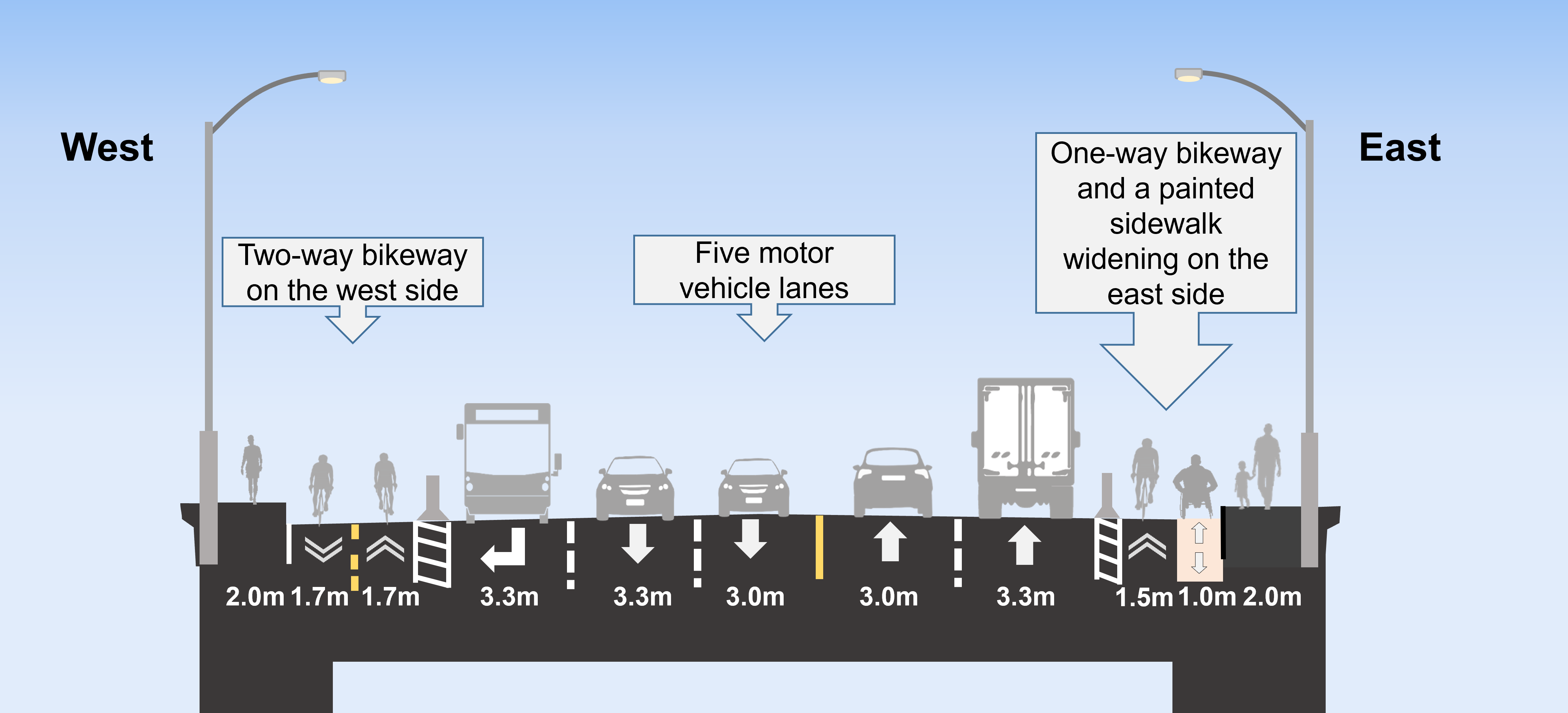
On the Leaside Bridge, south of Overlea Boulevard, the following changes were completed:
Interim changes were installed as part of the City’s 2024 construction work. Future changes will be installed by Metrolinx.
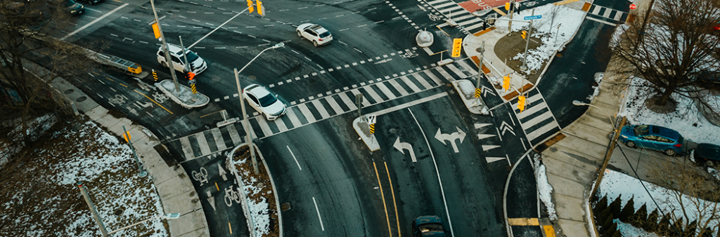
At the Pape Avenue & Donlands Avenue intersection, the following changes have been completed:
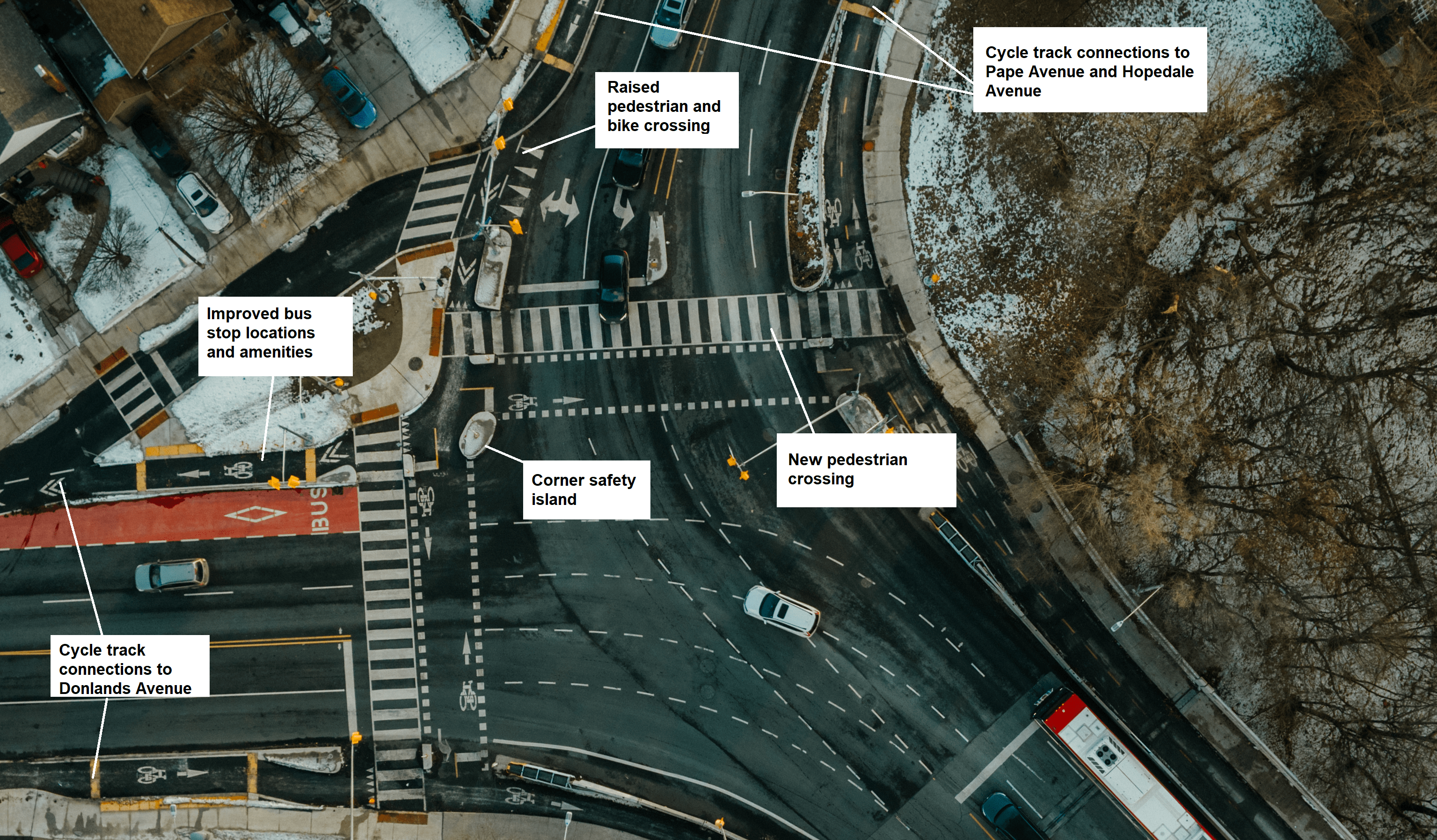
To improve safety for vulnerable road users, roadway space was reallocated to sidewalks and bikeways.
| Location | Permit Parking Area | Available Parking Spaces | Permits Issued | Number of Parking Spaces Removed |
|---|---|---|---|---|
| 541 to 553 Donlands Avenue | 9 off-peak | |||
| Chilton Avenue, near Donlands Avenue | 8F | 13 | 4 | 1 |
As work with the Ontario Line subway moves forward, Metrolinx will construct different elements of the Millwood Road Safety Improvements project.
At the Overlea Boulevard intersection, the following changes will be made:
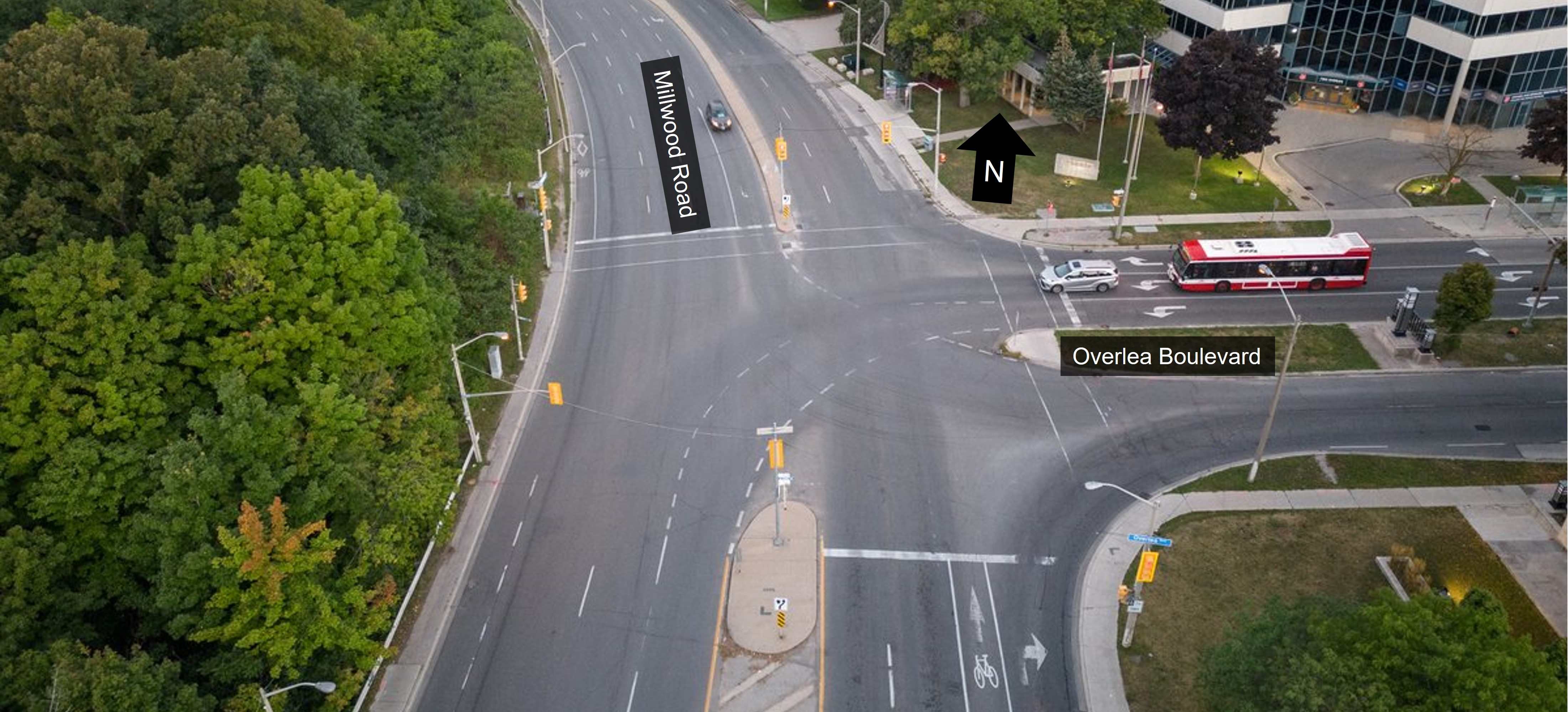
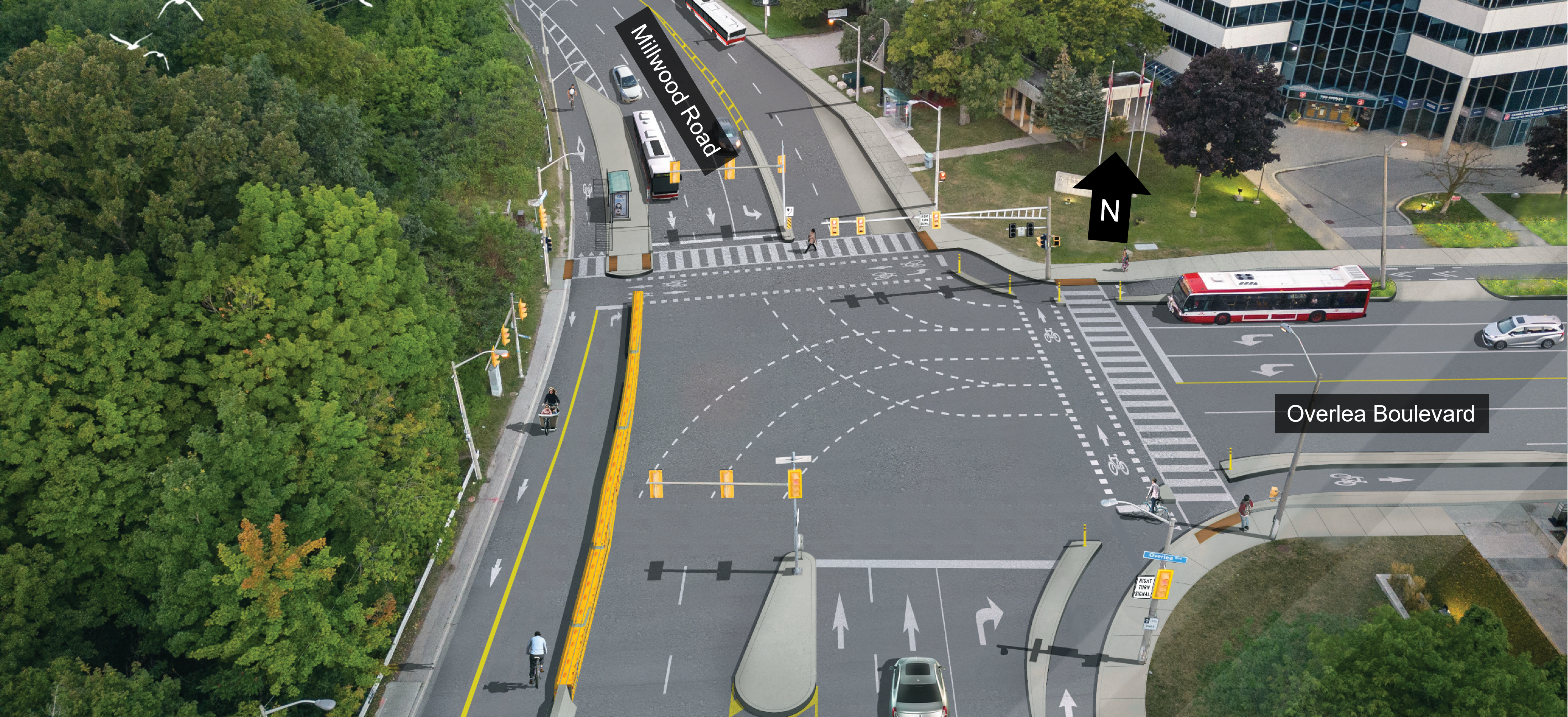
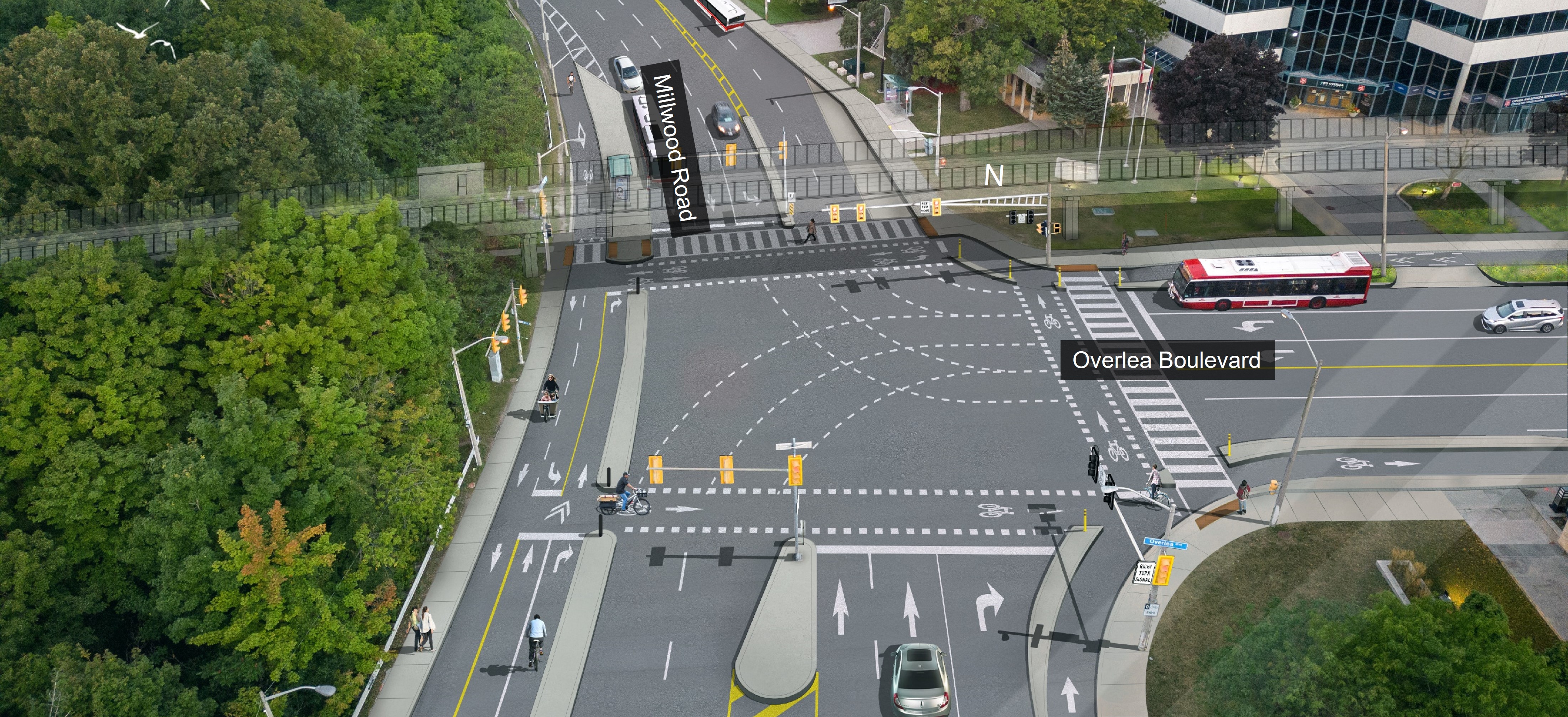
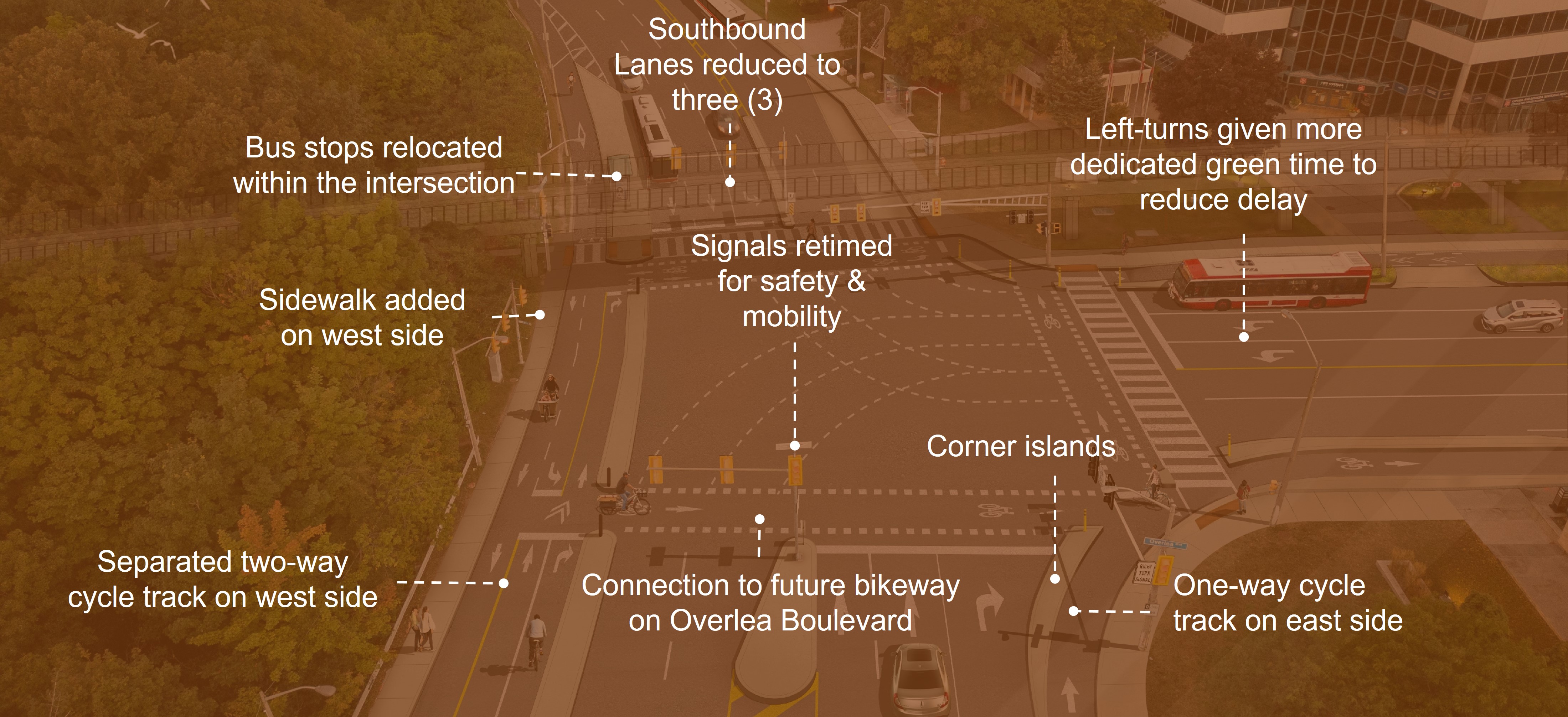
The design is focused on improving the southbound left-turning movement for people driving, improving pedestrian conditions by reducing crossing distances, filling the missing sidewalk gap on the west side, improving and making accessible the bus stops and connecting the bicycle lanes.
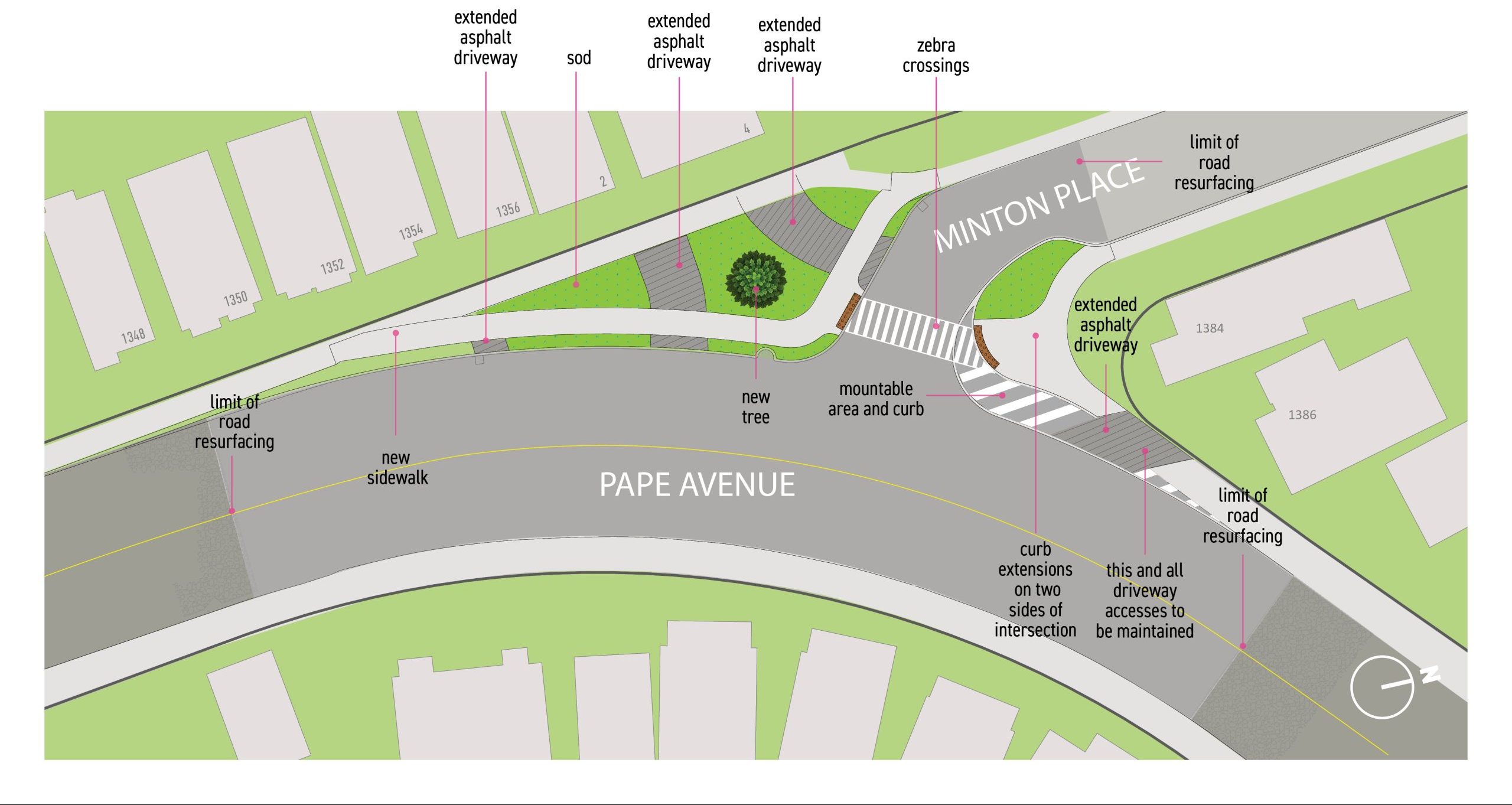
The City is planning to make safety improvements at the intersection of Pape Avenue and Minton Place in support of the Council-approved Vision Zero Road Safety Plan. Vision Zero Projects has been directed by Council to incorporate safety features such as these in state-of-good repair projects wherever possible. After Metrolinx has completed Ontario Line work at Minton Place and Hopedale Avenue, work at Minton Place and Pape Avenue will proceed.
The work will involve realigning and narrowing the intersection and extending the sod boulevard. The new design will bring the intersection up to current City standards and guidelines. The planned changes will address safety concerns by reducing crossing distances, improving sightlines and visibility and slowing vehicle speeds.
| Location | Permit Parking Area | Available Parking Spaces | Permits Issued | Number of Parking Spaces Removed |
|---|---|---|---|---|
| Minton Place, near Pape Avenue | 8G | 7 | 2 | 2 |
City staff presented recommendations to Infrastructure and Environment Committee on April 26, 2023, which were approved by City Council on May 10, 2023 (IE3.8).
Public and stakeholder consultation was carried out from January 25 to February 21, 2023.
The City has completed safety improvements on Millwood Road as part of the planned state-of-good-repair work as part of the City’s commitment to the Vision Zero Road Safety Plan. The Plan’s goal is to eliminate traffic-related fatalities and serious injuries by making our roads safer for everyone. Separately, Metrolinx is planning roadway work at the Millwood Road and Overlea Boulevard intersection.
In the last ten years, one person was killed and three people were seriously injured travelling on Millwood Road. It was identified that some collisions could be due to:
All approved changes are focused on reducing future collisions.
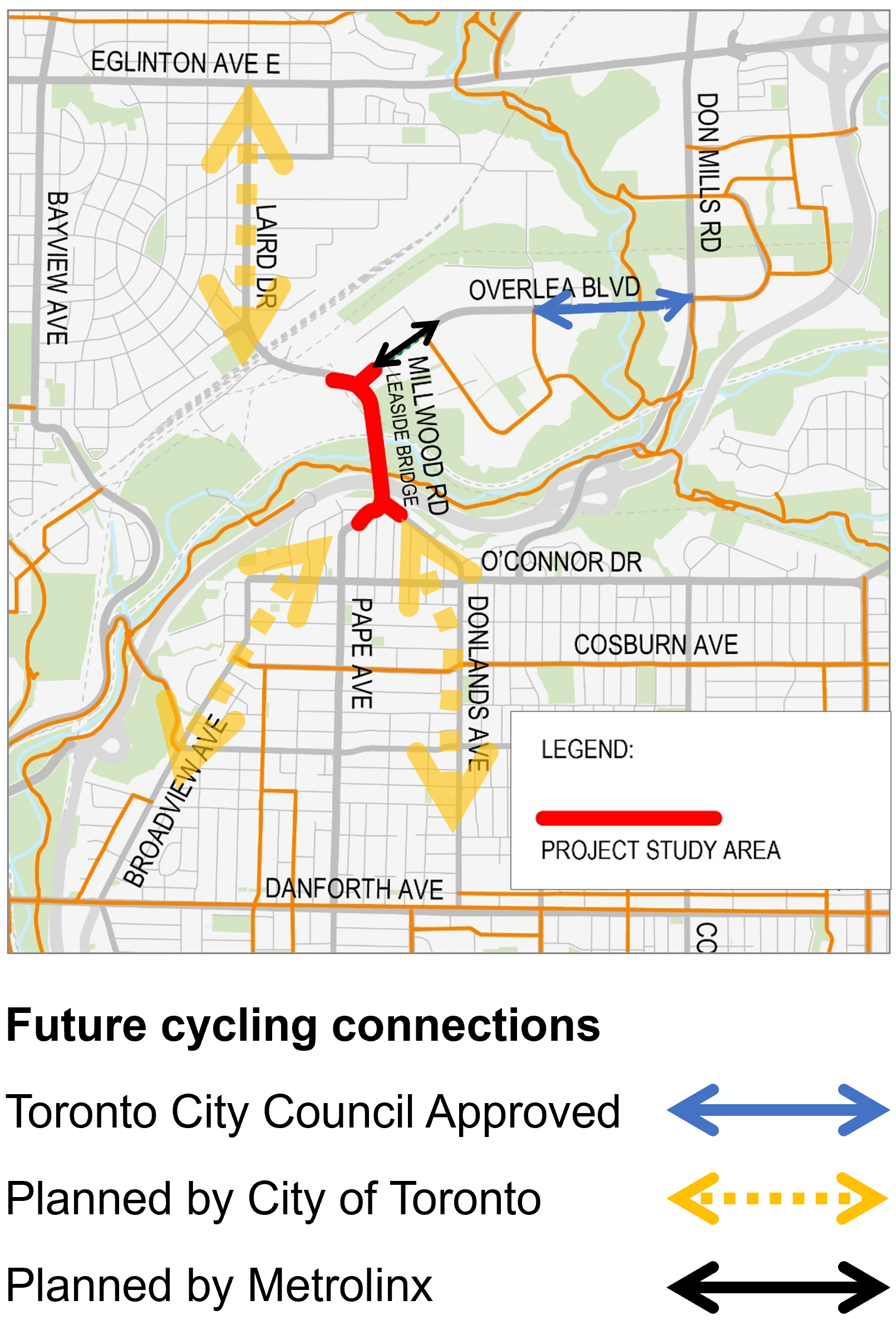
In 2021, City Council approved the Cycling Network Plan, a comprehensive road map and work plan that outlines the City’s planned investment in our cycling network.
The plan is focused on connecting, growing and renewing Toronto’s cycling network. The Millwood Road Safety Improvements project was included in the 2022–2024 Near-Term Implementation Program, along with the future area cycling connections.
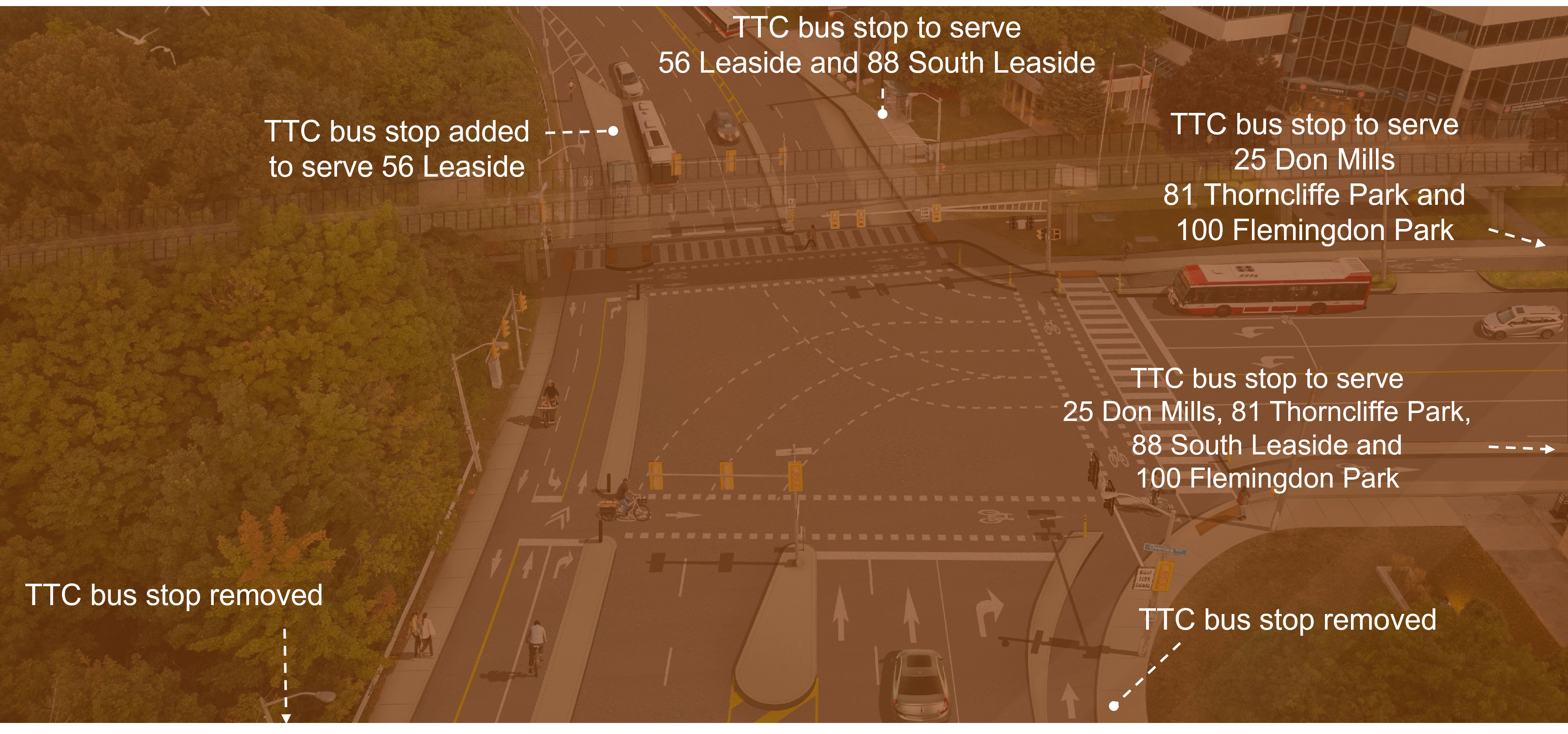
The TTC bus stops on the west side and east side south of Overlea Boulevard will be removed and the bus stops will be moved just north and east of the intersection to cover all existing bus routes.
Community members raised safety concerns about the implementation of the proposed crossride (bicycle crossing) on the south side of the intersection, saying that pedestrians may use it, especially, as people adjust to the initial implementation.
The crossride will now be implemented as part of the Overlea Boulevard (Millwood Road to Thorncliffe Park Drive West) cycle track construction by Metrolinx at a later date. The crossrides on the north and east legs of the intersection remain unchanged from the original proposal.
A pedestrian crosswalk was also considered on the south side of the intersection, but it was ruled out because it would increase motor vehicle and bus delays.
The left-turn lane on Millwood Road, north of Overlea Boulevard, will be lengthened to increase the number of motor vehicles that can wait to turn. More dedicated green time would be provided so that left-turning drivers have more time to clear the intersection.
The design has been reviewed by City services that use the road (Fire, EMS, Police, Solid Waste pickup, TTC, Wheel-Trans, road maintenance and snow clearing) and they have provided feedback to ensure it provides access that meets their needs.
The unprotected bicycle lanes were converted to a one-way cycle track on the east side and a two-way cycle track on the west side. This arrangement is to reduce the number of required signalized crossings and, thus, reduce delay and encourage cycling.
The number of motor vehicle lanes heading southbound on the Leaside Bridge were reduced from three (3) lanes to two (2) lanes. Both the existing and forecasted motor vehicle volumes can be accommodated in the two (2) southbound lanes. The northbound lanes were retained.
Based on public feedback, the City has initiated the feasibility analysis for the addition of a safety fence on the bridge.
Reducing speed limits, in conjunction with lane narrowing, has safety benefits for all road users, including drivers.
The connecting roads of Pape Avenue and Donlands Avenue both have speed limits of 40 km/h, and so this speed limit reduction would normalize the speed in the project area.
Studies have shown that there is little evidence that proposed speed limit reductions will impact travel times. Learn more.
Sign-up to receive Ontario Line project updates by email from Metrolinx.