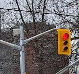
The City’s network of designated cycling routes are used by people to access neighbourhoods and destinations across Toronto. The cycling network includes many types of infrastructure, such as cycle tracks, bicycle lanes, shared roadway routes and multi-use trails. The City uses different infrastructure and separation for its on-street cycling infrastructure depending on the nature and use of the road.
The distances of completed projects are listed in the network status table. These totals are summarized into different infrastructure categories.
| Street/Route | Installation Year | Cycling Infrastructure Type | Ward | Status |
|---|---|---|---|---|
| Millwood Road, Pape Avenue, Donlands Avenue | 2024 | Cycle Track | Toronto-Danforth | Completed |
| College Street | 1993 | Cycle Track | University-Rosedale | Completed, Upgraded in 2006 (Spadina Avenue to Manning Avenue) and 2023 (Manning Avenue to Bay Street) |
| Harbord Street and Hoskin Avenue | 1997 (extended in 2007) | Cycle Track | University-Rosedale | Completed, Upgrades in progress in 2024-2025 |
| Ferrand Drive, Rocheford Drive and Deauville Lane | 2024 | Cycle Track, Contra-flow Bicycle Lane, Sharrows | Don Valley East | Completed, Programmed for 2025+ (Ferrand Drive to Eglinton Avenue East and at Don Valley Parkway southbound on-ramp) |
| Avenue Road | 2024 | Cycle Track | University-Rosedale | Completed |
| Sheppard Avenue East | 2024-2025 | Cycle Track | Don Valley North, Willowdale | Completed (Midland Avenue to Brimley Road), In Progress (Brimley Road to McCowan Avenue) |
| Ontario Street, Sackville Street, Sumach Street and Winchester Street | 2023 | Contra-flow Bicycle Lane, Sharrows | Toronto Centre | Completed |
| Palmerston-Tecumseth Cycling Connections | 2022-2023 | Contra-flow Bicycle Lane, Sharrows | University-Rosedale, Spadina-Fort York | Completed |
| Chesswood Drive | 2023 | Cycle Track | York Centre | Completed |
| Kipling Avenue | 2004 | Multi-use Trail | Etobicoke North | Completed, Upgraded in 2022 |
| Ellesmere Road | 2021 | Multi-use Trail | Scarborough-Guildwood | Completed |
| The Kingsway and Dundas Street West Infrastructure Improvements | 2022 | Cycle Track | Etobicoke Centre | Completed |
| College-Dundas Intersection Improvements | 2020-2021 | Left-turn Bike Box | Davenport | Completed |
| Finch Corridor Trail | 2011-2025 | Multi-use Trail | Humber River-Black Creek, York Centre, Willowdale, Don Valley North, Scarborough-Agincourt, Scarborough North | Completed (Norfinch Drive to Yonge Street, Birchmount Road to Middlefield Road, and Willowdale Avenue to Pineway Boulevard), Programmed for 2025 (Birchmount Road to Pharmacy Avenue) |
| Knox Avenue | 2025 | Cycle Track | Toronto-Danforth | In progress |
| Scarlett Road-Runnymede Road | 2022 | Cycle Track, Sharrows | York South-Weston | Completed |
| Birmingham Street | 2007 | Cycle Track | Etobicoke-Lakeshore | Completed, Upgraded in 2021 |
| Yonge Street | 2021 | Cycle Track | University-Rosedale, Toronto-St. Paul’s | Completed |
| Bloor Street-Danforth-Avenue-Kingston Road | 2016-2024 | Cycle Track | Etobicoke-Lakeshore, Parkdale-High Park, Davenport, University-Rosedale, Toronto-Danforth, Beaches-East York | Completed (Beamish Drive to Victoria Park Avenue) |
| Conlins Road | 2009 | Cycle Track | Scarborough-Rouge Park | Completed, Upgraded in 2019 |
| Argyle Street | 2015 | Contra-flow Bicycle Lane, Sharrows | Spadina-Fort York, Davenport | Completed, Extended in 2020 |
| West Toronto Railpath | 2008 | Multi-use Trail | Davenport | Completed (Cariboo Avenue to Dundas Street West), Programmed for 2025 (Dundas Street West at Sterling Road to Abell Street at Sudbury Street) |
| Shaw Street | 2013 | Contra-flow Bicycle Lane, Sharrows | University-Rosedale | Completed, Upgraded in 2020 |
| Cummer Avenue | 2022 | Cycle Track | Don Valley North | Completed |
| Davenport Road (Yonge Street to Dupont Street) | 2021-2025 | Cycle Track | University-Rosedale | Completed (Yonge Street to Bedford Road), In progress (Bedford Road to Dupont Street) |
| Lake Shore Boulevard West (Norris Crescent to First Street) | 2018 | Cycle Track | Etobicoke-Lakeshore | Completed |
| Peter Street | 2016 | Cycle Track | Spadina-Fort York | Completed |
| Woodbine Avenue | 2017 | Cycle Track, Bicycle Lane, Sharrows | Beaches-East York | Completed |
| Rathburn Road | pre-2001-2010 | Bicycle Lane | Etobicoke Centre | Completed, Upgraded in 2020 |
| Martin Grove Road | 2024 | Bicycle Lane | Etobicoke Centre | Completed |
| Richmond Street and Adelaide Street | 2014-2016 | Cycle Track | Toronto Centre, Spadina-Fort York | Completed |
| Scarlett Road | 2019 | Cycle Track | York South-Weston | Completed |
| The Esplanade and Mill Street | 2021-2025 | Cycle Track | Spadina-Fort York | Completed (George Street South to Bayview Avenue), Programmed (Lower Jarvis Street to Yonge Street) |
| Willowdale Avenue | 2019 | Cycle Track | Willowdale | Completed, Extended in 2023 |
| Borden Street and Brunswick Avenue | 2020 | Contra-flow Bicycle Lane | University-Rosedale | Completed |
| Denison Avenue and Bellevue Avenue | 2017 | Contra-flow Bicycle Lane | University-Rosedale, Spadina-Fort York | Completed |
| Simcoe Street | 2014-2016 | Contra-flow Bicycle Lane | Spadina-Fort York | Completed |
| Winona Drive | 2021 | Contra-flow Bicycle Lane, Bicycle Lane, Sharrows | Toronto-St. Paul’s | Completed |
| Woodfield Road-Monarch Park | 2021-2022 | Contra-flow Bicycle Lane, Bicycle Lane, Multi-use Trail | Toronto-Danforth | Completed |
| Duncan Creek Trail | 2021 | Multi-use Trail | Don Valley North | Completed |
| East Don Trail | 2018-2025 | Multi-use Trail | Don Valley East | Completed (Phase 2 – Wynford Heights Crescent to Elvaston Drive), In progress (Phase 1 – Forks of the Don to Bermondsey Road) |
| Eglinton Avenue West | 2021 | Multi-use Trail | York South-Weston | Completed |
| Eglinton TOday | 2024-2025 | Cycle Track | Eglinton-Lawrence, Toronto-St. Paul’s | Completed (Avenue Road to Chaplin Crescent), Programmed (Keele Street to Mount Pleasant Road) |
| King-Liberty Pedestrian/Cyclist Bridge | 2021 | Multi-use Trail | Spadina-Fort York | Completed |
| Kingston Road Trail | 2021 | Multi-use Trail | Scarborough Southwest | Completed |
| Rosedale Valley Road | 2022-2025 | Multi-use Trail | University-Rosedale | Programmed for upgrades in 2025 |
| Shuter Street | 2003 | Cycle Track | Toronto Centre | Completed, Upgraded in 2020 |
| The Meadoway | 2018 | Multi-use Trail | Scarborough-Rouge Park, Scarborough- Guildwood, Scarborough Centre, Don Valley East | Completed (Eglinton Avenue East to Kennedy Road, Marcos Boulevard to Neilson Road, Military Trail to Morningside Avenue, Conlins Road to Route Urban National Park), Programmed (Bermondsey Road to Eglinton Avenue East, Kennedy Road to Marcos Boulevard, Neilson Road to Military Trail, Morningside Avenue to Conlins Road) |
| Unwin Avenue | 2019 | Multi-use Trail | Toronto-Danforth | Completed |
| Flemingdon Park and Thorncliffe Park | 2018 | Cycle Track | Toronto-Danforth | Completed, Upgraded in 2021 |
| Lawrence Avenue East | 2019 | Bicycle Lane | Scarborough-Rouge Park | Completed |
| York University and Downsview Road | 2021-2022 | Cycle Track, Bicycle Lane, Multi-use Trail | Humber River-Black Creek | Completed |
| Dowling Avenue and Beaty Avenue | 2018 | Sharrows | Parkdale-High Park | Completed |
| Bartlett Avenue-Havelock Street-Gladstone Avenue | 2022-2023 | Contra-flow Bicycle Lane, Bicycle Lane, Sharrows, Cycle Track | Davenport | Completed |
| Steeprock-Bathurst Manor | 2024 | Cycle Track, Bicycle Lane, Sharrows | York Centre | Completed |
| West Parkdale Cycling Connections | 2024 | Contra-flow Bicycle Lane, Sharrows | Parkdale-High Park | Completed |
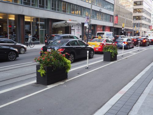
Cycle tracks are separate lanes for bicycles that are adjacent to the roadway, but separated from vehicular traffic. Cycle tracks help distinguish the area for cycling from motor vehicle traffic (more than a painted bicycle lane). The tracks create an environment which is safer for cycling.
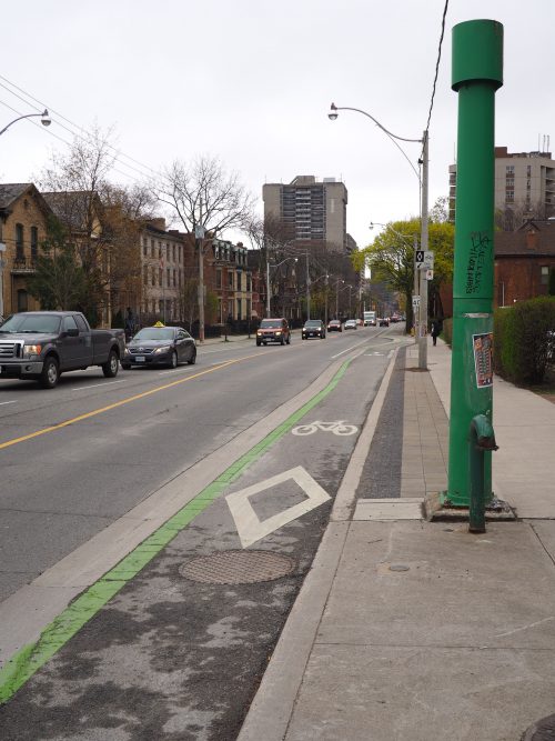 The diamond marking in cycle tracks is the symbol for a “reserved lane.” Every lane with a diamond in it has accompanying lane restriction by-laws.
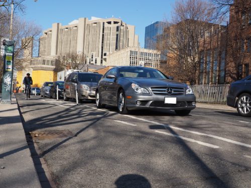 Some cycle tracks have spaces for vehicle parking beside the lane. When passengers and drivers are exiting their vehicles, they must first ensure the cycle track is clear. Pedestrians crossing the street must treat the cycle track as a live vehicle lane and wait until the lane is clear before crossing.
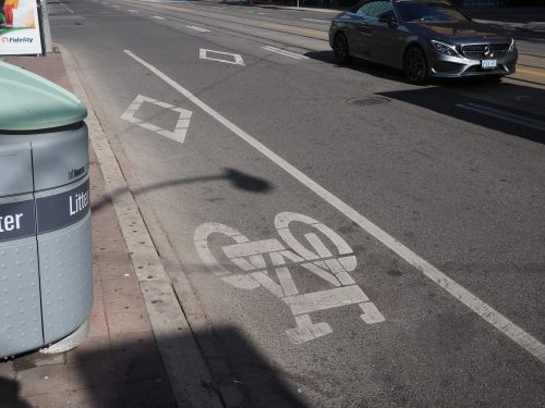
Designated bicycle lanes are a dedicated part of the roadway for the exclusive use of people cycling. Other road users may not lawfully drive, stand, stop or park in a designated bicycle lane.
The diamond marking in bicycle lanes is the symbol for a “reserved lane.” Every lane with a diamond in it has accompanying lane restriction bylaws.
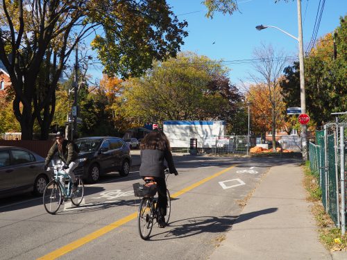 Contra-flow bicycle lanes allow people cycling to travel in two directions on a street, which is one-way for all other vehicles. People must cycle in one direction in the designated bicycle lane. When travelling in the opposite direction, people will cycle in the mixed-use traffic lane or marked cycle lane.
Bicycle symbols and diamonds are located inside the contra-flow bicycle lane. The diamond symbol is the symbol for a “reserved” lane. Every lane with a diamond in it has accompanying lane restriction bylaws. The contra-flow bicycle lane will also include painted arrows, communicating that people must only cycle in one direction in this lane.
Making a street dual direction can create valuable neighbourhood connections for people cycling who wish to avoid busy arterial roadways.
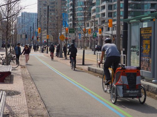 Trail projects play an important role in connecting and expanding Toronto’s cycling network. Within this network, each trail, park, bicycle lane or other component has a particular role to play. As a result, each trail needs to have certain characteristics to ensure that it can perform appropriately. Three classes of trails are identified by their role in the network.
Learn more about Toronto’s Multi-Use Trail Design Guidelines.
When a multi-use trail (or two-way bikeway) is within two metres of the roadway, a splash guard or other approved physical separation is required between the roadway and multi-use trail or bikeway.
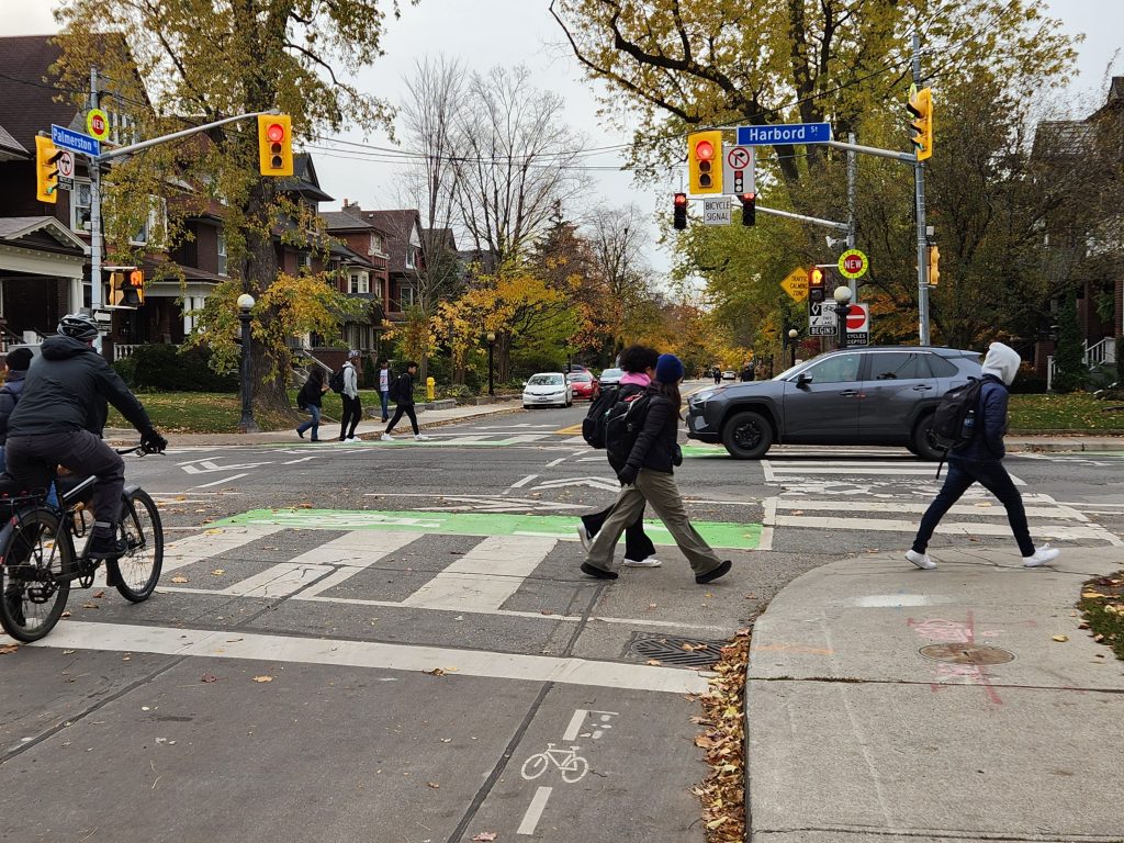 Neighbourhood Greenways are routes where people cycling and pedestrians are given priority by creating an environment with low motor vehicle volumes and speeds.
Neighbourhood Greenways typically feature speed management features, one-way streets, raised crossings, contra-flow bicycle lanes, traffic diverters, wayfinding signage and safe crossings of major roadways.
Reasons for building Neighbourhood Greenways include providing parallel routes to major corridors, reducing non-local traffic infiltration and speeds, and encouraging cycling among less experienced cyclists.
Download the Neighbourhood Greenways Guide to learn more about the benefits, criteria and features of Neighbourhood Greenways.
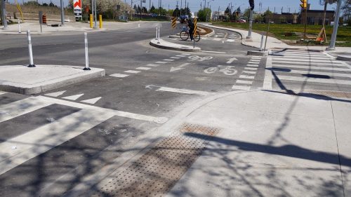
The City is in the process of installing more protected intersections. They enhance safety for all road users by reducing the likelihood of high-speed turns and improving sightlines.
Benefits of protected intersections include:
When approaching a protected intersection, please do the following:
The Cycling Network Plan, adopted by City Council in 2019, seeks to build on the existing network of cycling routes to Connect gaps in the current network, Grow the network into new parts of the city, and Renew existing parts of the network to improve safety – with corresponding objectives and indicators for measuring and evaluating success.
Learn more about Cycling Upgrades & Renewals that are carried out by implementing new line markings, bundling with state-of-good repair road or water projects, or standalone cycling or intersection improvements.
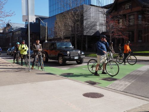 Bike boxes are used at intersections to designate a space for people cycling to wait in front of cars at the red light. People on bicycles may then proceed first when the light turns green. At red lights, the drivers must stop at the stop line, behind the bike box. A bike box means right hand turns on red lights are not permitted.
When you are cycling, you should position yourself at the right, left, or center of the bike box, depending on the direction you want to travel.
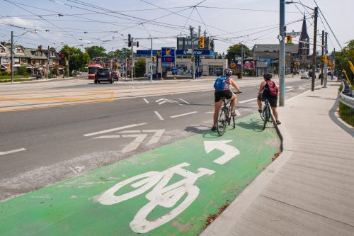
Left-turn bike boxes indicate a designated area for people cycling to safely make a left turn at multi-lane signalized intersections from a right side cycle track or bicycle lane.
Left-turn bike boxes offer several benefits to people cycling, such as providing a formal waiting space to make a two-stage turn, reducing turning conflicts between people cycling and driving, and separating people who are cycling through an intersection from those who are turning.
To use a left-turn bike box, people cycling should proceed through the intersection in the bikeway or right lane, and position themselves in the designated area while waiting for their signal, facing the direction in which they would like to travel. When the traffic or bicycle light turns green, they may continue cycling through the intersection.
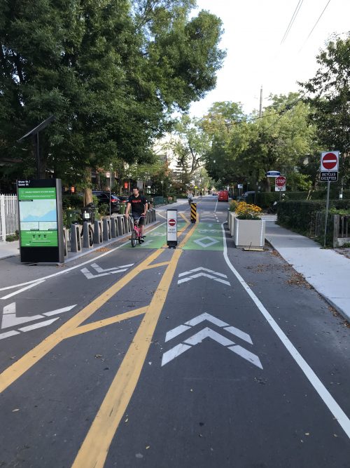 Cycling-only blocks are located at intersections and restrict travel by motor vehicles, while allowing people cycling to pass through.
Cycling-only blocks offer the following benefits:
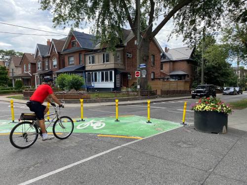 Diagonal diverters are located at four-way minor intersections, which require all motor vehicle traffic to turn in one direction only, while allowing people cycling and walking to proceed through.
Diagonal diverters offer the following benefits:
A truck apron is a mountable curb that can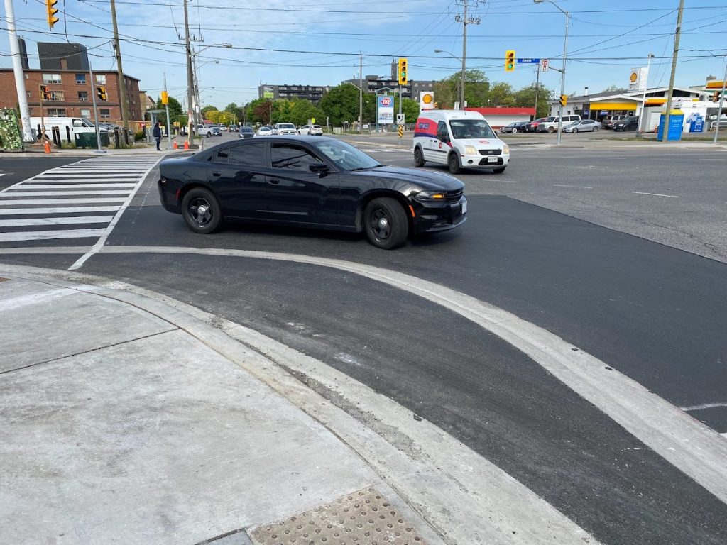 accommodate passenger vehicles and/or design vehicles. The truck apron radius is mounted by trucks when making right
turns.
Truck aprons allow for intersection corners to be designed for smaller vehicles, while also accommodating larger vehicles to turn at
an intersection corner.
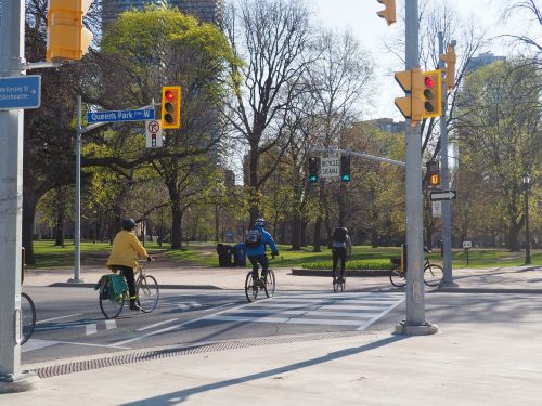
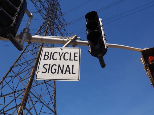
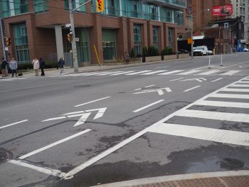 Chevron pavement markings indicate the route people cycling should take through the intersection. This increases drivers’ awareness of people cycling and makes their travel more predictable at intersections.
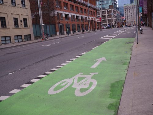 Green markings are used at intersections and driveways where vehicles interact with bikeways. They serve to increase the visibility of bikeways, making drivers aware of people cycling.
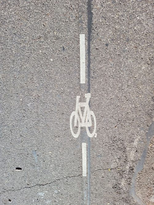 Bicycle detector symbols indicate where people cycling should position themselves at an intersection to be detected by the traffic signal.
There are two types of bicycle detector symbols in Toronto: those with a line through the symbol (induction loop) and those without (non-intrusive). If you see a line on the pavement, lean forward on your bike with the crank and wheels positioned on top of it inside the rectangle. The induction loop will then sense the presence of something metal, which will trigger the traffic signal to change.
A non-intrusive detector consists of a radar, infrared, video or microwave sensor located on a traffic signal pole that is aimed down. Ensure that you are positioned either within the bike lane or behind the stop bar to be detected by the traffic signal.
The City’s standard bicycle detector symbol consists of a bicycle located between two vertical lines, which replaced the previous symbol of three vertical dots.