The Cycling Network Plan, adopted by City Council in 2019, seeks to build on the existing network of cycling routes to Connect gaps in the current network, Grow the network into new parts of the city, and Renew existing parts of the network to improve safety – with corresponding objectives and indicators for measuring and evaluating success.
Renewing existing cycling network routes can include:
Upgrades and renewals may be carried out by implementing new line markings, bundling with state-of-good repair road or water projects, or standalone cycling or intersection improvements.
In 2021 and 2022, the Oakwood Neighbourhood Cycling Connections and the Bartlett-Havelock-Gladstone Cycling Connections projects were installed, respectively. As part of both projects, new traffic signals were installed at Davenport Road and Shaw Street and at Bartlett Avenue to improve pedestrian and cycling safety and connectivity. These new traffic signals and associated intersection changes highlighted the need for accessibility improvements for all road user on the Davenport Road, particularly for transit users and pedestrians.
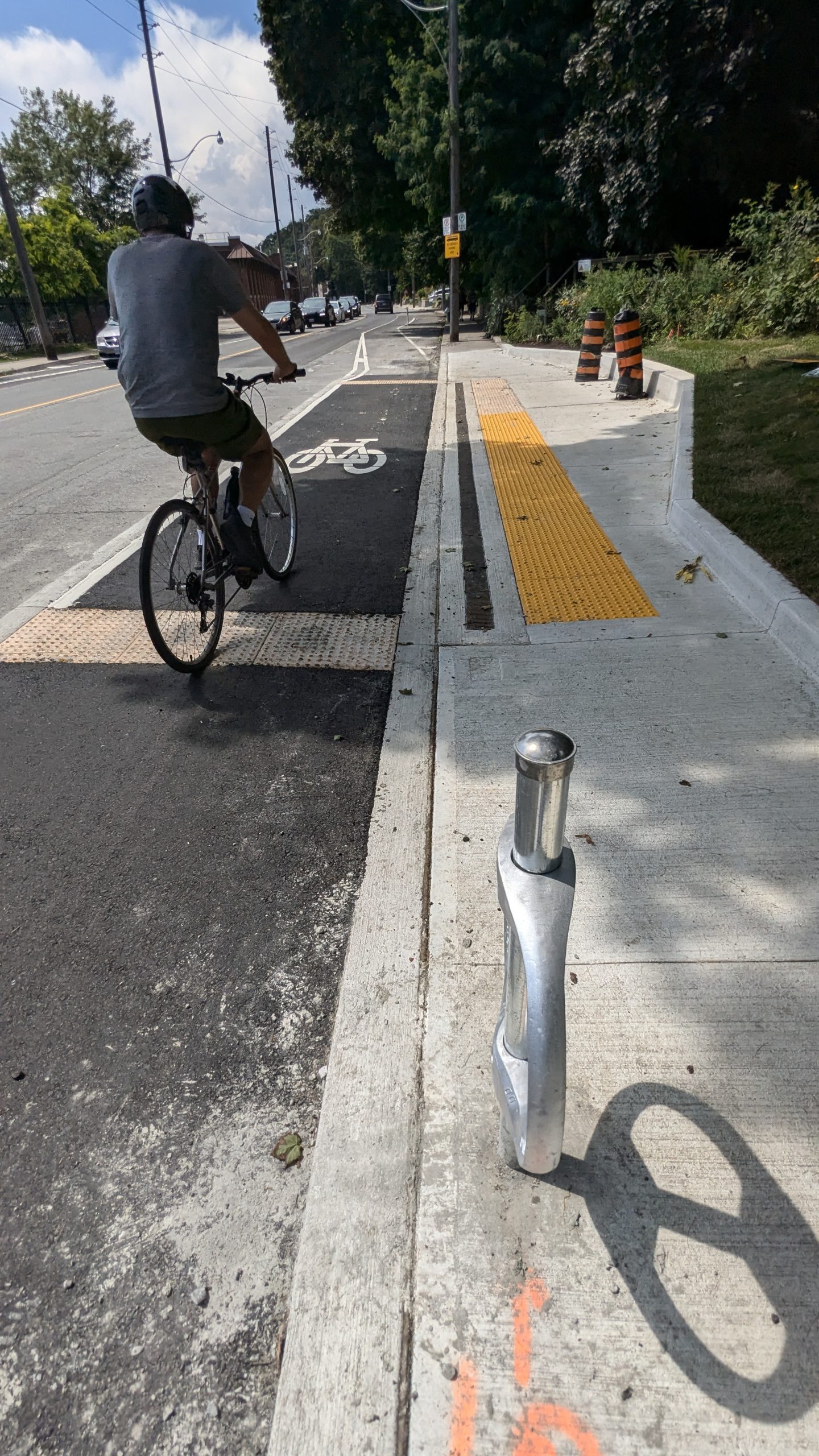
In 2023, the first phase of accessibility improvements was installed at the intersection of Davenport Road and Bartlett Avenue. Additional pedestrian space was added at two bus stops, along with a raised bike/bus platform. These platforms keep the bikeway clear for people cycling, while providing sidewalk-level access for people boarding and exiting TTC buses.
In 2024, accessible raised bike/bus platforms were constructed in the bicycle lane on the north and south sides of Davenport Road, west of Bathurst Street, and on the south side of Davenport Road, west of Shaw Street. The pre-cast concrete curbs that previously separated the two-way cycle track on the northside of Davenport Road between Shaw Street and Bracondale Hill Road from motor vehicle traffic on the north side of Davenport Road was replaced with poured-in-place concrete as permanent protection for people cycling.
In 2025, accessible raised bike/bus platforms were constructed in the bicycle lane on the north and south sides of Davenport Road at the Christie Street and Dovercourt Road intersections.
The City of Toronto is also upgrading the existing Davenport Road bicycle lanes between Dupont Street and Yonge Street. Learn more about the Bike Lane & Road Safety Upgrades on Davenport Road project.
In February 2024, City Council approved upgrades on Dundas Street East from bike lanes to cycle tracks between Broadview Avenue and West Avenue and between Logan Avenue and Pape Avenue. Within these segments of Dundas Street East, motor vehicle parking is on one side of the street and is adjacent to the sidewalk with the bike lane between the ‘door zone’ of the parking lane and the motor vehicle travel lane.
Improvements on these sections of Dundas Street East will be similar to those completed in 2023 between Greenwood Avenue and Alton Avenue, which include adding green infrastructure and poured-in-place concrete curbs. Parking spaces would also be retained, but the location would be reconfigured to between the motor vehicle lane and the curbside cycle track for improved cycling safety.
The following upgrades were completed in August 2024:
Please see the Installation Notice for more details.
In June 2023, City Council directed staff to make road safety improvements along Dundas Street East between Greenwood Avenue to Alton Avenue in support of the Vision Zero Road Safety Plan, as the current section of roadway does not meet current design standards and presents safety and accessibility concerns. The changes are intended to improve road safety and accessibility for pedestrians crossing the intersections, provide greater protection and safety for people cycling, slow turning vehicles and enhance compliance at crossings and intersections, and increase visibility for people cycling and pedestrians.
The following upgrades were completed in July 2023:
Please see the Construction Notice for more details.
As part of the ActiveTO temporary cycling network, cycle tracks were installed on Dundas Street East between Broadview Avenue and Sackville Street in 2020 to connect the existing Dundas Street bicycle lanes (Broadview Avenue to Kingston Road) into the downtown core via River Street and Shuter Street. This is the only protected, accessible, and connected cycling route over the Don Valley Parkway south of Bloor Street and north of the waterfront trail.
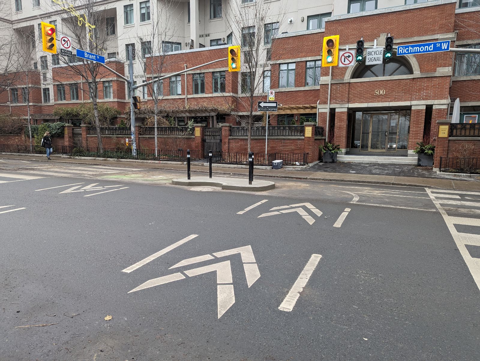
Further improvements to the now-permanent ActiveTO section between Sackville Street and Broadview Avenue were completed in Spring 2023. This work included refreshing the existing line markings, adding chevrons to guide people cycling across the intersection, and installing flexible bollards and concrete curbs as separation between people cycling and motor vehicle traffic in specific locations.
Road resurfacing took place on Jones Avenue between Queen Street East and Dundas Street East, which included proposed potential design changes to fulfill the City’s commitment to the Vision Zero Road Safety Plan. The Plan’s goal is to eliminate traffic-related fatalities and serious injuries by making our roads safer for everyone, especially for seniors, school children, people cycling and pedestrians.
A public survey was conducted in January 2024, which asked for input on two proposed options for Jones Avenue.
The main concern expressed for Option 2 was permit parking loss. Following feedback received in the public survey, the Option 2 design was approved by City Council in April 2024 to convert the existing bike lanes to cycle tracks. Since advancing the design, City staff determined that the Option 2 design would not be feasible without impacting significantly more parking than was approved by Council. An additional 18 spaces, for a total of 48 permit parking spaces, would need to be removed to achieve the Option 2 design.
The previously approved changes on Jones Avenue from Queen Street East to Dundas Street East were rescinded, which included the following:
Please see the Public Notice for more details.
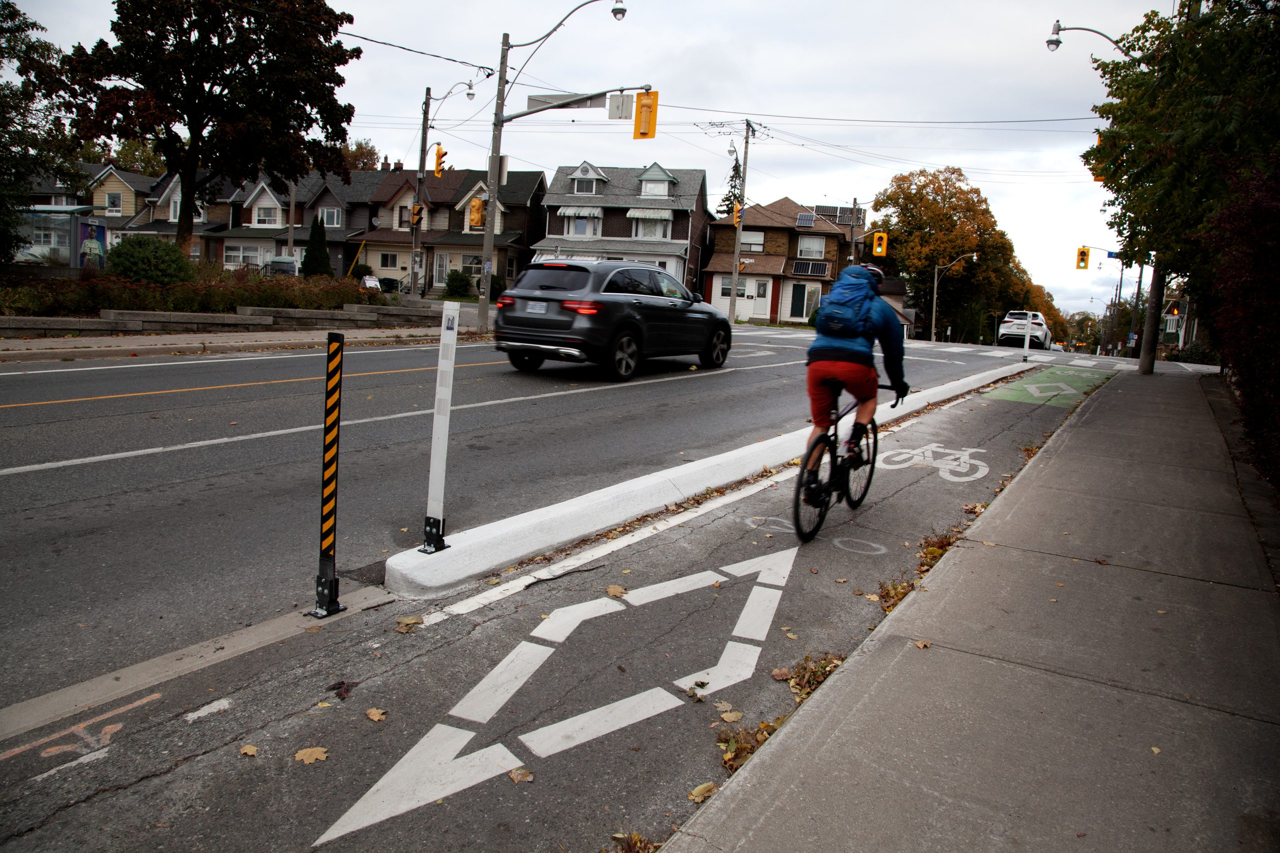
Recent upgrades to the cycling network include low barrier walls and islands as a permanent replacement for quick-build features (such as bollards, concrete curbs and temporary barriers) at intersections. These upgrades provide increased safety for people cycling from motor vehicle drivers entering an intersection, and a protected area for people cycling to wait while turning.
Low barrier concrete islands have been installed at the following locations:
In 2026, state-of-good-repair road resurfacing is planned on Willowdale Avenue between Finch Avenue East and Bishop Avenue. The planned work provides an opportunity to review Willowdale Avenue for safety improvements and upgrades and slightly extend the bikeway, without removing any motor vehicle lanes. The existing quick-build cycle tracks are proposed to be enhanced with permanent, poured-in-place concrete curbs. The cycle tracks are proposed to be extended north of Bishop Avenue to include a northbound cycle track for approximately 85 metres and a southbound cycle track for approximately 35 metres. Additional improvements include raised integrated bike/bus platforms at TTC bus stops which improve transit operations by eliminating buses pulling to the curb, as well as increase accessibility and comfort for transit users.
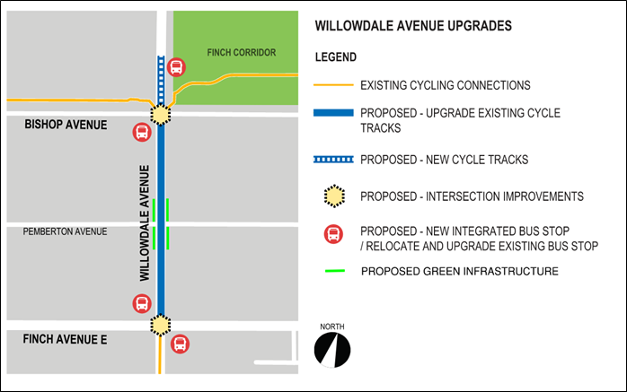
Proposed Changes
Learn more about existing bikeways on Willowdale Avenue.
While we aim to provide fully accessible content, there is no text alternative available for some of the content on this page. If you require alternate formats or need assistance understanding our maps, drawings, or any other content, please contact us at cycling@toronto.ca.