The ActiveTO temporary cycling network aims to allow people on bikes to move around Toronto safely, to better connect the city, and to mirror major transit routes.
New ActiveTO routes in 2021 include:
Key corridors in the Council-adopted 2019 Cycling Network Plan were accelerated and installed in June and July 2020, with particular focus on routes that mirror major transit routes and/or connected trails and greenspace.
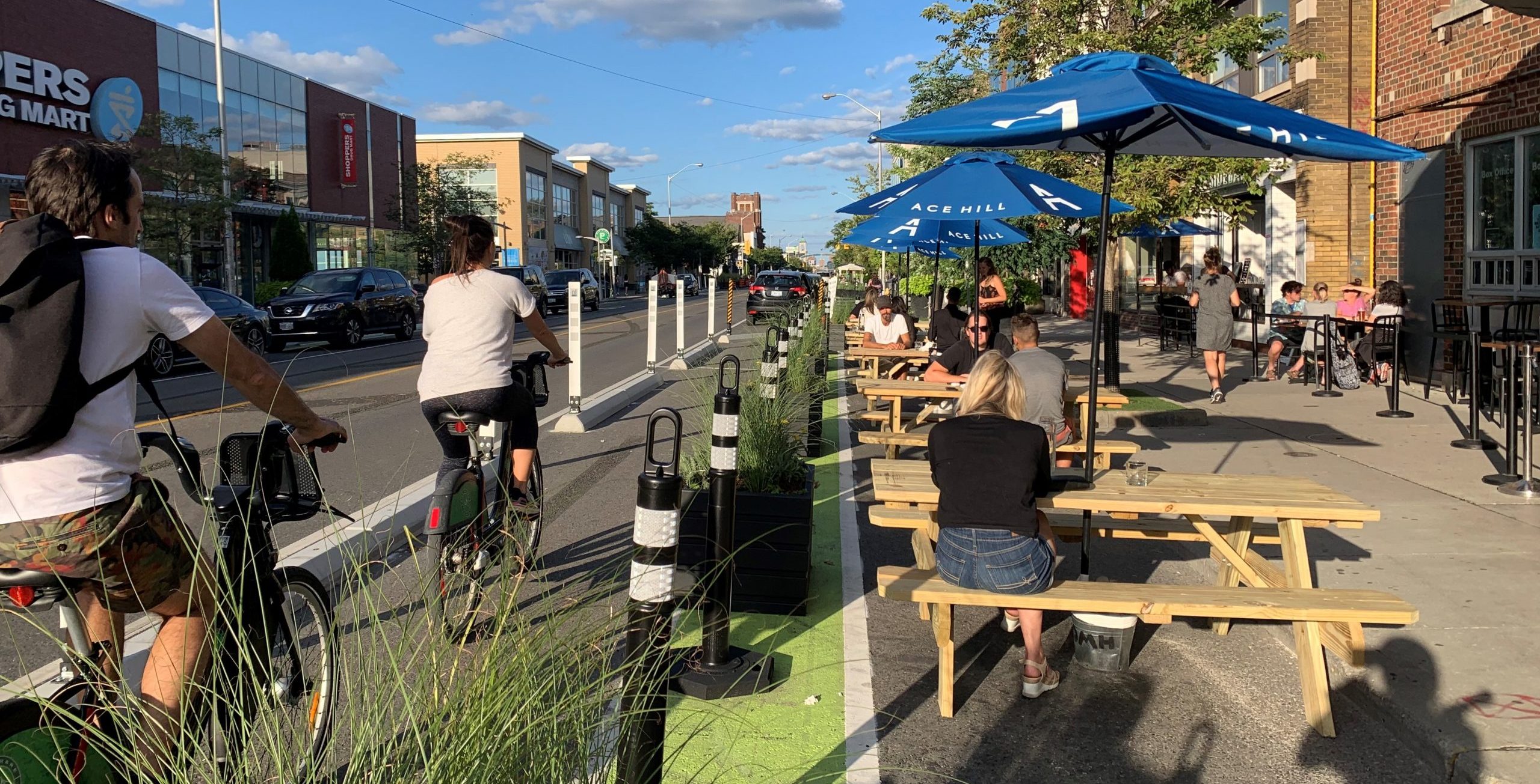
The 2020 ActiveTO cycling projects coupled with the City’s permanent on-street cycling network and trail projects represents the largest, single-year increase in new bikeways in the City of Toronto. Twenty four (24) km of new cycle tracks and bike lanes were rapidly installed through temporary materials by re-purposing curb lanes, along with the delivery of sixteen (16) km of Council-approved 2020 Cycling Network on-street projects including the Bloor Street West Bikeway Extension, as well as five (5) km of multi-use trails.
The Council-approved plan is the largest one-year expansion of on-street bike lanes ever in Toronto, approximately 25 kilometres of new bikeways have been installed, for a total of approximately 40 kilometres of on-street cycling lanes approved for accelerated installation in 2020. The plan includes flexibility so that bikeway installations can be adjusted based on considerations such as changing traffic volumes, and the evolving needs of residents and businesses in the wake of the pandemic.
The new cycling corridors below were achieved quickly through temporary installations by repurposing curb lanes along the identified key corridors.
Map of Council approved cycling routes.
Based on the data collected to-date, the ActiveTO cycling network expansion projects have been generally successful. Cycling and bike share volumes rose, while vehicular traffic impacts were minimized. Additional data can be found in the City Council staff report.
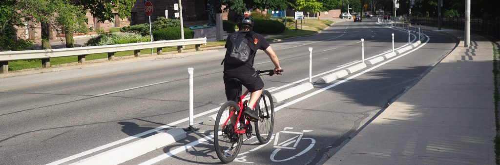
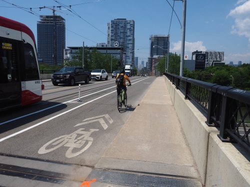
In 2020, temporary cycle tracks were installed on Bloor Street between Sherbourne Street and Avenue Road to fill a key gap in the Bloor/Danforth bikeway. This corridor is above a transit line and the bikeways serve as another multi-modal option for people traveling along the corridor. This gap was identified as a priority for new bikeways in the Major City-Wide Cycling Corridor in Toronto’s Cycling Network Plan.
Between Sherbourne Street and Church Street, cycle tracks were installed, parking was maintained on both sides, and a westbound shared right-turn lane was installed at Church Street.
Between Church Street and Avenue Road, cycle tracks were installed and short pick-up / drop-off areas were marked to address the delivery needs of the businesses along the corridor. A westbound shared right-turn lane was installed at Avenue Road.
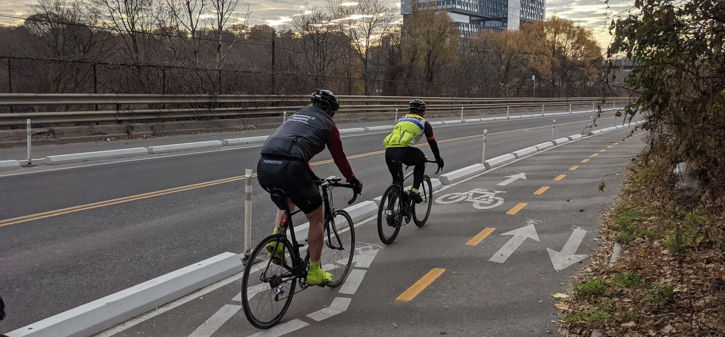
In 2021, Bloor Street between Church Street and Avenue Road was further upgraded with new concrete curbs, planters and pick up-drop off areas.
Bloor Street between Sherbourne Street and Castle Frank Road is the only remaining stretch along the 15 km-long Bloor-
Danforth bikeway without protection for people cycling from motor vehicles. It is also the only section with multiple motor vehicle lanes in either direction. Further, there are several upcoming construction projects including the Glen Road Bridge reconstruction and the Castle Frank TTC Station Accessibility upgrades that will reduce the number of motor vehicle lanes.
Through the use of traffic volume and travel time data collected in 2020 and 2021, Bloor Street East has seen an increase in cycling traffic and a decrease in motor vehicle traffic with minimal impacts to travel time.
These circumstances have provided an unique opportunity to pilot a new temporary configuration on Bloor Street between Sherbourne Street and Castle Frank Road that will improve safety, increase cycling comfort, and normalize motor vehicle movement through construction areas. Installation will begin in August 2021.
For more information view the brochure.
Temporary cycle tracks were installed on Dundas Street East between Broadview Avenue and Sackville Street to connect the existing Dundas Street bike lanes (Broadview Avenue to Kingston Road) into the downtown core via River Street and Shuter Street. The new bikeway is the only protected, accessible, and connected cycling route over the Don Valley Parkway south of Bloor Street and north of the water. This gap was identified as a priority for a new bikeway as a Major City-Wide Cycling Corridor in Toronto’s Cycling Network Plan.
Both curb lanes (westbound and eastbound) were converted to protected cycle tracks. Two-stage left-turn boxes were added at the terminus and people cycling are encouraged to connect to River Street, Sackville Street, Sumach Street and Shuter Street if traveling further west into the core.
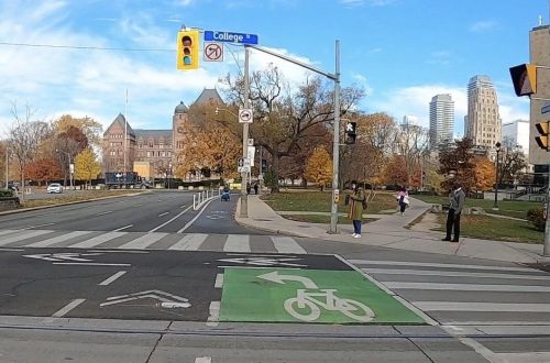
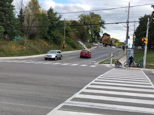
Temporary cycle tracks were installed on University Avenue/Queens Park between Avenue Road and Adelaide Street to provide multi-modal capacity along the Line 1 subway and as a connection for essential workers at the four hospitals that face the street. This corridor also connects well used east/west cycling corridors including Harbord Street, College Street, Richmond Street, and Adelaide Street. This route was identified as a priority Major City-Wide Cycling Corridor in Toronto’s Cycling Network Plan.
Between Avenue Road and College Street, both curb lanes (northbound and southbound) were converted to protected cycle tracks.
Between College Street and Adelaide Street, parking protected cycle tracks were installed. Parking was maintained and converted to 24/7 access (parking was banned during peak hours previously) due to the demand for hospital pick-up and drop-off.
Raised platforms were added for accessible bus and hospital loading and green markings were added at hospital driveways to alert all users of the conflict area. For people cycling further south of Adelaide Street, it is encouraged to turn onto Adelaide and use the Lower Simcoe bikeway to connect to the waterfront.
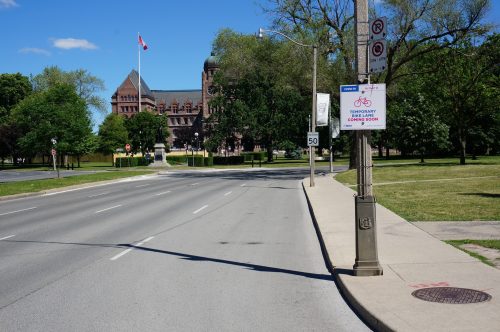
Avenue Road between Bloor Street East and Davenport Road is under consideration for temporary cycling tracks. Currently there are several on-going developments under construction with lane closures. Once the construction hoardings are removed, the City will consider the northern extension.
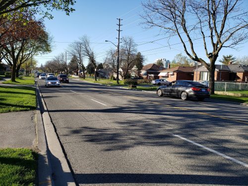
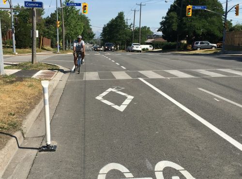
Temporary buffered bike lanes were installed on Huntingwood Drive between Victoria Park Avenue and Brimley Road to form the first on-street east-west cycling route in Ward 22 (Scarborough-Agincourt) & 23 (Scarborough North) and expand the short existing bike lane segment between Brimley Road and McCowan Road. This route connects key neighbourhood destinations including parks, trails, schools, community centres and places of worship. This route was identified as a near term implementation project in Toronto’s Cycling Network Plan.
Based on community feedback, upgrades are under consideration including the installation of parking protected cycle tracks and other protection along the corridor.
Temporary cycle tracks were installed on Brimley Road between Lawrence Avenue and Kingston Road to form an on-street north-south cycling route in Scarborough in July 2020. This route connected key outdoor destinations including the Gatineau Trail system and Bluffers Park. It served as a connection to the new RapidTO bus lanes along Eglinton Avenue East. This route also served as a pilot for future improvements for a scheduled reconstruction. This route was identified as a near term implementation project in Toronto’s Cycling Network Plan.
To address the concerns raised through community feedback, staff implemented the following modifications between August – November, 2020:
It was determined in December 2020 to remove the temporary bike lanes on Brimley Road, immediately. Removal of the bike lanes was based on:
Learn more about the Brimley Road Bike Lane evaluation and removal.
The Danforth Avenue temporary cycle track was part of a larger Complete Street pilot and study. Find out more details by visiting the Danforth Avenue Complete Street and Planning Study page.
In 2020, temporary cycle tracks and a multi-use trail were installed on Bayview Avenue/River Street between Gerrard Street and Rosedale Valley Road to provide more direct and accessible access to the Don Trails, Evergreen Brickworks and Rosedale Valley Road Trail. Before installation, there was no accessible pedestrian or cycling access for communities between Rosedale Valley Road and Corktown Commons. There were no sidewalks on the roadway beforehand.
On the west side of the street, a motor vehicle lane was removed and a multi-use trail was installed for people walking and cycling. On the eastside of the street, a motor vehicle lane was removed and a uni-direction cycle track was added for people cycling.
In 2021, the City is set to construct Phase 2 Lower Don Trail Improvements including the addition of an accessible ramp at Riverdale Park, a staircase at Dundas Street and a trail widening and surface improvements between Riverdale Park and Queen Street. The construction could start as soon as 2021 and will result in a closure of the Lower Down Trail between Pottery Road and Corktown Commons.
To reduce the impact of the Lower Don Trail closure, the City is extending the temporary multi-use trail on Bayview Avenue between River Street and Mill Street to provide a safe, direct, and comfortable Lower Don Trail construction detour route. Due to the width of the roadway, Bayview Avenue in this section will be converted to one-way southbound for motor vehicles to accommodate a multi-use trail on the east side of the street. The 2020 Bayview project between Rosedale Valley Road and River Street will be upgraded to have a multi-use trail on both the east and west side of the street.
Temporary bike lanes, and shared lane markings were installed on Wilmington Avenue and Faywood Boulevard between Finch Avenue West and Wilson Avenue to provide a north-south cycling route in North York that connects six schools, the Finch Trail and numerous community connections. The bikeways also reduced the travel lane widths between Finch Avenue West and Sheppard Avenue West, where there were previous concerns with high motor vehicle speeds. This route was identified as a priority Major City-Wide Cycling Corridor in Toronto’s Cycling Network Plan.
Buffered and conventional bike lanes were installed on Wilmington Avenue between Finch Avenue West and Sheppard Avenue. Shared lane markings were installed on Faywood Boulevard between Sheppard Avenue and Wilson Avenue, due to width constraints.
Further improvements to the temporary bikeway will be explored as part of the Bathurst Manor Transportation Area Study.
This corridor is still under consideration. Staff are monitoring the evolving transit, pedestrian and cycling activity on the corridor and will review opportunities for changes in 2021.
Visit ActiveTO Midtown Complete Street Pilot web page for information about the pilot or get involved by April 27 in the following: