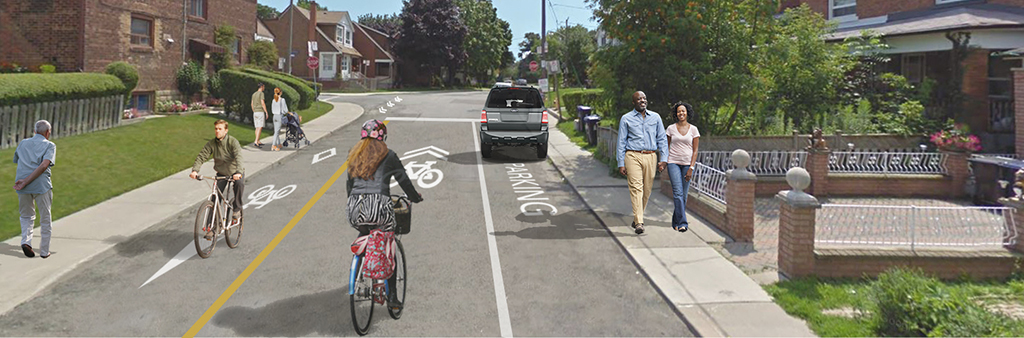
The City is working to make travel by foot and bike safer and more inviting. The City has installed cycling, pedestrian, and road safety upgrades on Winona Drive to lower speeds, reduce cut-through traffic, and create safer, more comfortable conditions. The upgrades include:
The proposed contra-flow bike lane on Glenholme Avenue and Earlsdale Avenue will be revisited in the future.
A final recommendation was approved at Infrastructure and Environment Committee and City Council (IE22.11) in spring of 2021.
The Virtual Public Meeting: Winona Drive was held on Monday, March 22, 2021 from 6:30 – 8:30 p.m.
Download and review a copy of the presentation.
The online feedback form was closed on Monday, April 5, 2021.
On June 9, 2016 Toronto City Council approved the 10 Year Cycling Network Plan to connect, grow and renew infrastructure for Toronto’s cycling routes. On July 17, 2019 Toronto City Council approved the Cycling Network Plan Update, which provides a new timeframe to improve road work coordination, accountability, and implementation.
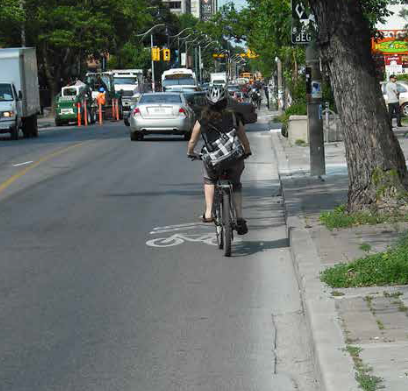
The new cycling infrastructure provides a dedicated space for people cycling, improved safety and comfort for all road users. The bike lanes expand the local cycling network by providing improved connections to the existing bike lanes on Shaw Street and Davenport Road.
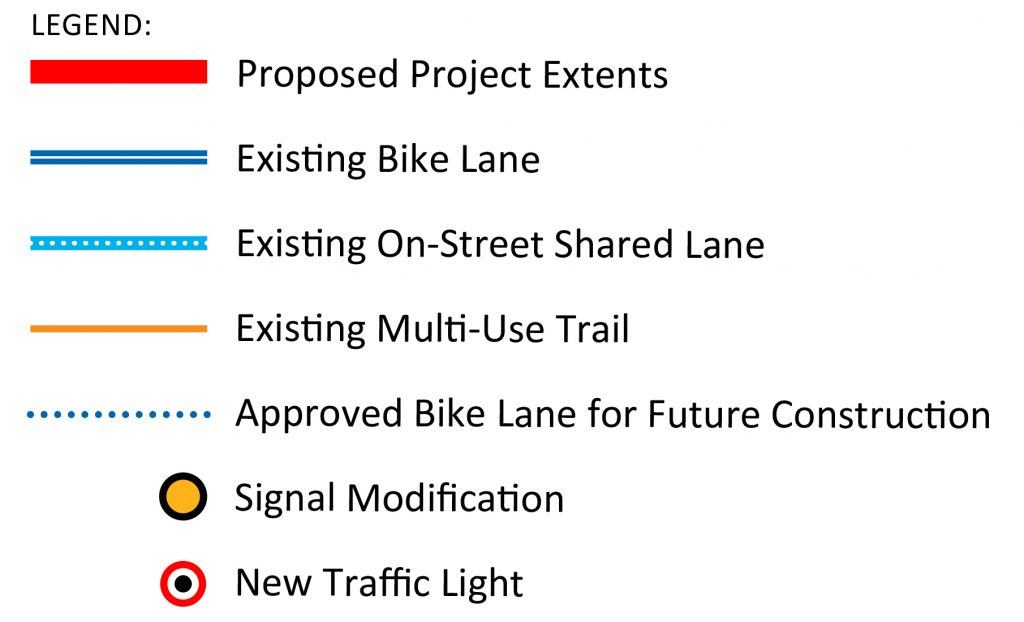
While we aim to provide fully accessible content, there is no text alternative available for some of the content on this page. If you require alternate formats or need assistance understanding our maps, drawings, or any other content, please contact us at cycling@toronto.ca.
If you drive or park on the street:
If you cycle:
If you walk:
If you live or work in the neighbourhood:
Download the Public Consultation Report.
Three (3) options were proposed for motor vehicle travel:
Option 1 was selected, with no proposed changes to traffic operations.
Considerations for physical separations
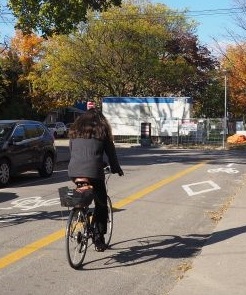
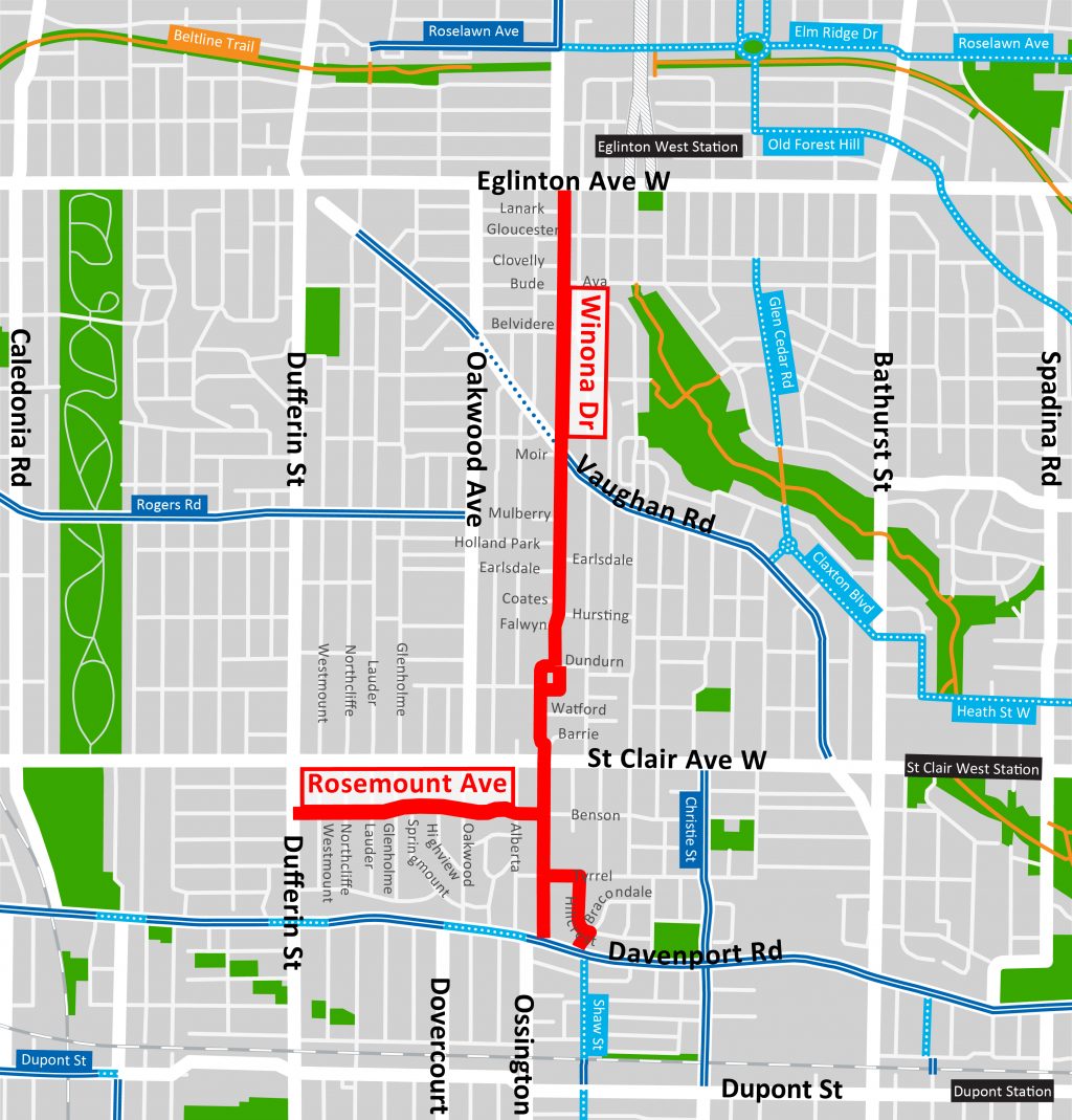
The proposed cycling infrastructure included contra-flow bike lanes on Winona Drive as well as wayfinding markings on Rosemount Avenue, Bracondale Hill Road, Tyrrel Avenue and a portion of Winona Drive. Markings on Rosemount Avenue were not added, as further consultation is required for this section.
Contra-flow bike lanes allow people cycling to travel north and south, including on one-way vehicular blocks. People cycle in one direction in the designated bicycle lane and, when travelling in the opposite direction, the person cycling will travel in the mixed-use traffic lane or marked cycle lane. As such, physical separators were not installed, as they would prevent vehicle movements and restrict movement for the mixed-use traffic lanes.
Considerations for other traffic calming measures
Painted curb extensions are being considered to help calm traffic by visually narrowing the roadway and create safer crossings for pedestrians. Requests to consider additional traffic calming measures on Winona Drive and adjacent side streets were received during public consultation and are under review.
Traffic infiltration and monitoring
The changes on Winona Drive are not expected to impact traffic. Traffic monitoring will be completed pre- and post-installation.
Other Oakwood Cycling Connections
Glenholme Avenue and Earlsdale Avenue have also been identified for future study as part of the Oakwood Neighbourhood Cycling Connections projects.
This Virtual Public Meeting was held on Monday, March 22, 2021 from 6:30 – 8:30 p.m.
Download and review a copy of the presentation.
The online feedback form was closed on Monday, April 5, 2021.
This event was held on Tuesday, June 18, 2019, 6:30 to 8:30 p.m.
At this public drop-in event, attendees had an opportunity to:
This event was held on Tuesday, April 23, 2019, 6:30 to 8:30 p.m.
At Public Drop-In Event #1, attendees had an opportunity to view the draft designs, speak to City of Toronto staff, and provide feedback on the following proposed cycling routes:
While we aim to provide fully accessible content, there is no text alternative available for some of the content on this page. If you require alternate formats or need assistance understanding our maps, drawings, or any other content, please contact us at 416-397-4675 or cycling@toronto.ca.