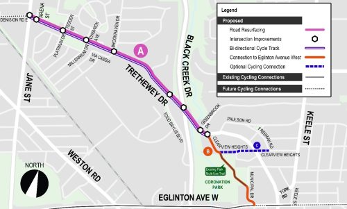
City Council has authorized installation of the bikeway project on Trethewey Drive from Jane Street to Freeman Road and on Clearview Heights from Trethewey Drive to Freeman Road. A copy of the staff report is available at 2025.IE26.6.
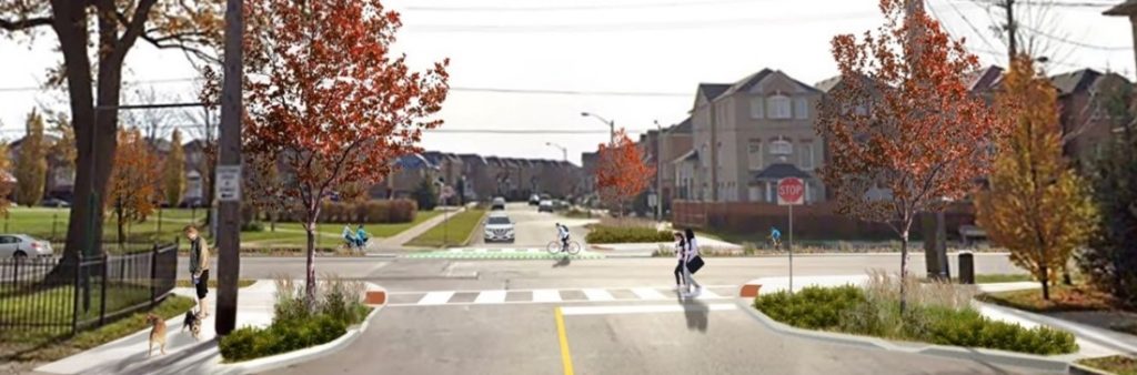
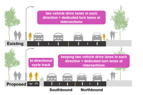
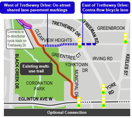
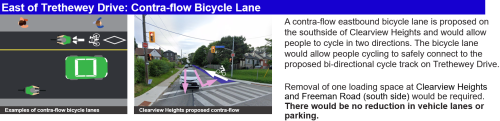
The City of Toronto has approved a new cycle track on the south side of Trethewey Drive between Jane Street and Clearview Heights, intersection safety improvements along Trethewey Drive, and shared lane markings and connections along Clearview Heights, through Coronation Park and along Municipal Drive to connect to Eglinton Avenue West. There will be no reduction in vehicle lanes or parking.
The project includes three segments:
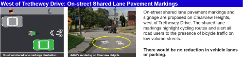
Trethewey Drive’s existing lane widths are wider than they should be. When the City undertakes road work, the design must follow current guidelines. Implementing narrower lane widths encourages drivers to respect the speed limit, results in reduced impact speeds and impacts in the event of a collision and provides space to accommodate dedicated separated cycling facilities.
Approved changes include:
There will be no reduction in vehicle lanes or parking.
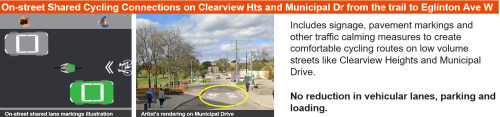
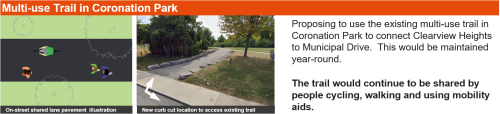
People cycling will be guided to Eglinton Avenue West through signage and pavement markings on Clearview Heights, through Coronation Park and Municipal Drive. The vehicle volumes on Clearview Heights and Municipal Drive are low and do not require dedicated space for people cycling. There will be no reduction in vehicle lanes, parking and loading.
Approved changes include:
We heard from some local residents that they want safer cycling facilities on Clearview Heights to connect to the Greenbrook Neighbourhood.
An optional connection is being proposed and could be installed as part of this project or at a later date. Feedback will be considered for each segment.
Approved changes include:
There will be no reduction in vehicle lanes and parking.
Consultation 2 took place from October 15 to November 9, 2025. Consultation activities included a public meeting, a survey and comment tracking. The public drop-in event was held on October 29, 2025. It included a presentation and question & answer period, as well as opportunity to speak with project staff and view display panels. View the display panels, meeting summary notes and consultation report below.
Consultation Materials
Public opinion, along with technical and policy considerations, will be used to inform staff recommendations and decisions made by City Council.
Initial public engagement on this project took place in 2024. The public consultation report provides a detailed summary of all activities that took place, proposed changes, and feedback received.
Spring 2024: Consultation 1 on Opportunities and Constraints
October/November 2025: Consultation 2 on Preliminary Design
December 2025: Report to Infrastructure and Environment Committee
2027-2028: Construction Pending Council Approval
2027-2029: Monitoring
*Timelines are subject to change
The City Council-approved Cycling Network Plan is a comprehensive roadmap and work plan that outlines the City’s planned investment in our cycling network. It includes a Long-Term Cycling Network Vision, the planned Major City-Wide Cycling Network Routes, and a three-year rolling Near-Term Implementation Program.
The aim of the Cycling Network Plan is to connect gaps in Toronto’s current cycling network by growing existing and future cycling opportunities with safer and more comfortable cycling route options where quality can be improved.
Trethewey Drive is identified in the 2025-2027 Near-Term Implementation Plan as a New and Major upgrade.
The City of Toronto is proposing changes on Trethewey Drive as part of planned road resurfacing in support of the City’s commitment to the Vision Zero Road Safety Plan. The Plan’s goal is to eliminate traffic-related fatalities and serious injuries by making our roads safer for everyone, especially for seniors, school children, and pedestrians and people cycling. In the past 10 years, there have been 1,330 vehicle collisions on Trethewey Drive, 11 of which resulted in serious injuries. Proposed changes are focused on reducing future collisions.
The City has several guiding policy documents and objectives that inform road safety projects:
To receive project updates by email, please contact Rachel Yanchyshyn, Senior Coordinator Public Consultation and indicate that you would like to be added to the mailing list, at trethewey@toronto.ca.