The City of Toronto has approved the first on-street cycling facilities within the Weston neighbourhood. Weston Cycling Connections will connect local destinations within the community and neighbouring areas, and enhance safe, active mobility options for residents.
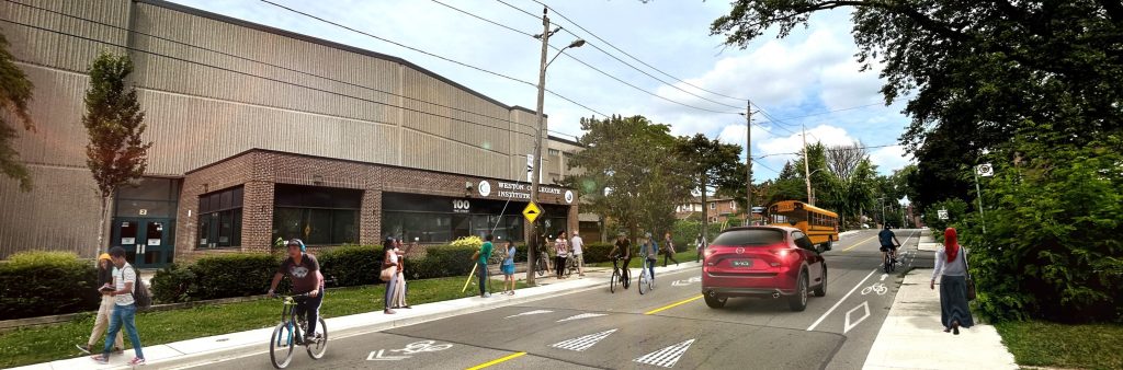
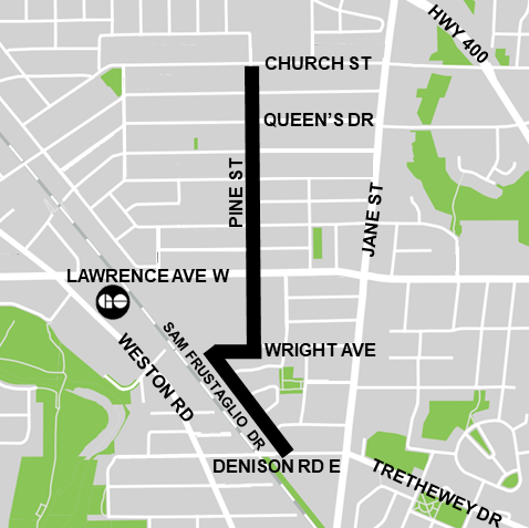
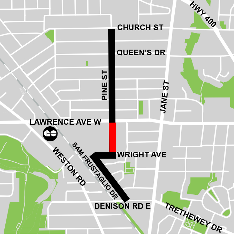
In May 2024 the City installed bike lanes, shared lane markings, and other road safety improvements on Pine Street from Church Street to Wright Avenue, on Wright Avenue from Pine Street to Sam Frustaglio Drive, and on Sam Frustaglio Drive from Wright Avenue to Denison Road East. View the Installation Notice for more details.
Weston Cycling Connections will take place over three phases:
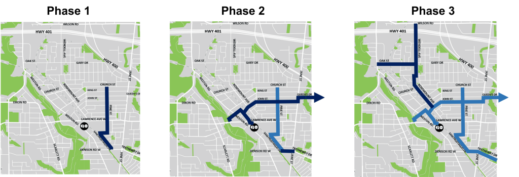
The following streets were approved by City Council for cycling facilities in Phase 1, for installation in spring 2024:
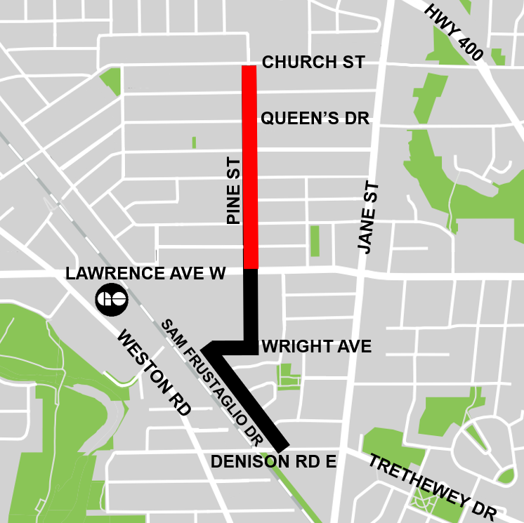
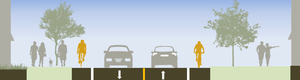
For Pine Street from Lawrence Avenue West to Church Street, the following design has been approved to improve safety for people cycling and predictability for people driving by providing clear separation from motor vehicle lanes.
Approved changes:
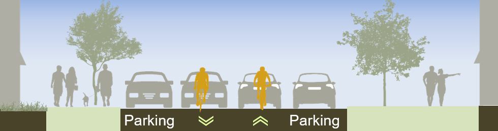
On Pine Street from Wright Avenue to Lawrence Avenue West, motor vehicle volumes are relatively low and a TTC bus loop utilizes the northbound lane for the 32C Eglinton West route and the 79 Scarlett Road route. There are also several driveway entrances serving the businesses on the west side of the street.
Approved changes:

On Sam Frustaglio Drive and the short section of Wright Avenue connecting to Pine Street, motor vehicle volumes are low enough to warrant using shared lane markings to designate the route.
Approved changes:
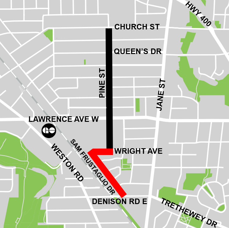
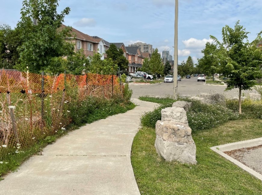
In Phase 2 of this project, the existing connection from the cul-de-sac of Sam Frustaglio Drive to Denison Road East, pictured below, is proposed to be upgraded and connected to a new proposed bikeway on Trethewey Drive. Public consultation for this connection and for Trethewey Drive will take place separately in 2024.
Public opinion, along with technical and policy considerations, will be used to inform staff recommendations and decisions made by City Council.
Public consultation and installation for Weston Cycling Connections will take place over three phases. More information including information on public events and opportunities to provide feedback will be listed here and sent to the project email list in advance.
Phase 1 public consultation took place in fall 2023. The public consultation report (linked below) provides a detailed summary of all activities that took place, proposed changes, and feedback received.
The City Council-approved Cycling Network Plan is a comprehensive roadmap and work plan that outlines the City’s planned investment in our cycling network. It includes a Long-Term Cycling Network Vision, the planned Major City-Wide Cycling Network Routes, and a three-year rolling Near-Term Implementation Program.
The aim of the Cycling Network Plan is to connect gaps in Toronto’s current cycling network by growing existing and future cycling opportunities with safer and more comfortable cycling route options where quality can be improved.
The 2022-24 Near-Term Implementation Program identifies several key cycling routes throughout the Weston neighbourhood to connect key destinations and neighbouring community links.
On March 27, 2024, the Infrastructure and Environment Committee of City Council approved the staff-recommended design for Phase 1 of Weston Cycling Connections with one amendment to preserve on-street parking between Church Street and King Street.
On April 18, 2024, Toronto City Council approved the amended design.
More details are available at IE12.4 and in the Approved Changes accordion tabs above.
Please contact Pragya Priyadarshini at westoncycling@toronto.ca to be added to the project list to receive updates by email.
The personal information on this form is collected under the authority of the City of Toronto Act, 2006. The information is used to allow the City to send you emails about project updates and future consultation opportunities. Questions about this collection may be directed to the Manager, Public Consultation at 416-392-2990 or tracy.manolakakis@toronto.ca