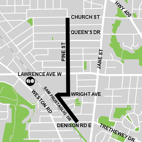
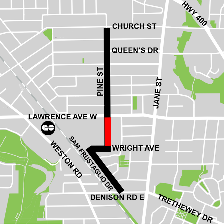
Starting May 12, the City will begin installation of bike lanes, shared lane markings, and other road safety improvements on Pine Street from Church Street to Wright Avenue, on Wright Avenue from Pine Street to Sam Frustaglio Drive, and on Sam Frustaglio Drive from Wright Avenue to Denison Road East. View the Installation Notice for more details.
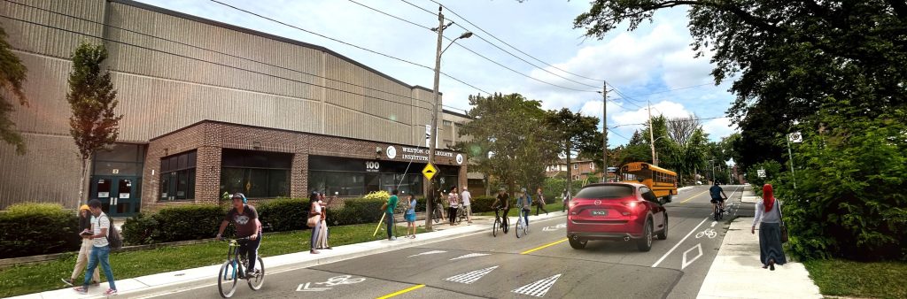
Residents can expect new pavement markings, road safety upgrades, and changes to signage and parking. These changes are being implemented to improve safety and comfort for all road users.
Key changes will include:
City services such as Fire, Paramedics and garbage pick-up will continue as usual.
On March 27, 2024, the Infrastructure and Environment Committee of City Council approved the staff-recommended design for Phase 1 of Weston Cycling Connections with one amendment to preserve on-street parking between Church Street and King Street.
On April 18, 2024, Toronto City Council approved the amended design.
More details are available at IE12.4 and in the Approved Changes accordion tabs below.
The public consultation process for Phase 1 is complete. The Public Consultation Report summarizes feedback received.
Transportation Services is seeking City Council authority to install the proposed bikeway. If approved, the bikeway would be installed as early as May 2024.
Highlights of the proposed design include the following:
As part of the approval process, staff will report to the Infrastructure and Environment Committee of City Council on March 27, 2024. A copy of the staff report is available at IE12.4, with the Weston Cycling Connections project presented on pages 26 to 29 of the Cycling Network Plan 2024 Second Quarter Update.
Members of the public can arrange to speak or submit comments to the Committee by contacting the Infrastructure and Environment Committee Administrator at 416-392-4666 or iec@toronto.ca by 4:30 p.m. on March 26, 2024. You can also submit comments by emailing the Committee at iec@toronto.ca.
All communications and public submissions will become part of the public record and will be listed in the legislative record of the meeting. Learn more about this process.
Weston Cycling Connections will take place over three phases:
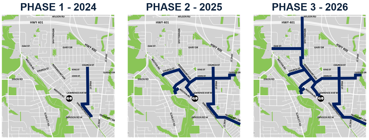
The following streets were approved by City Council for cycling facilities in Phase 1, for installation in spring 2024:
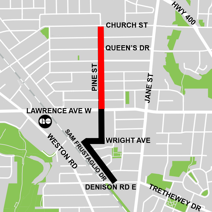
For Pine Street from Lawrence Avenue West to Church Street, the following design has been approved to improve safety for people cycling and predictability for people driving by providing clear separation from motor vehicle lanes.
Approved changes:

On Pine Street from Wright Avenue to Lawrence Avenue West, motor vehicle volumes are relatively low and a TTC bus loop utilizes the northbound lane for the 32C Eglinton West route and the 79 Scarlett Road route. There are also several driveway entrances serving the businesses on the west side of the street.
Approved changes:

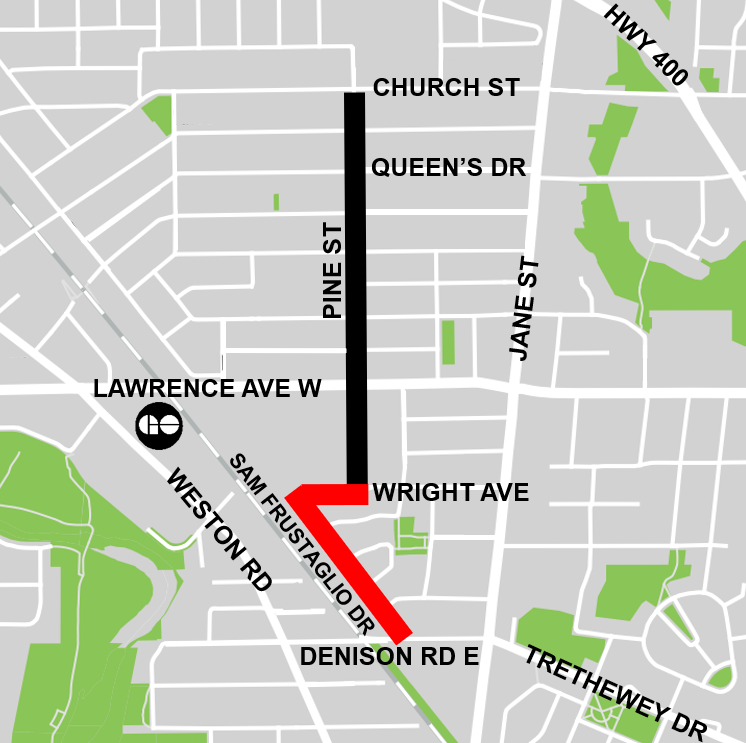
On Sam Frustaglio Drive and the short section of Wright Avenue connecting to Pine Street, motor vehicle volumes are low enough to warrant using shared lane markings to designate the route.
Approved changes:

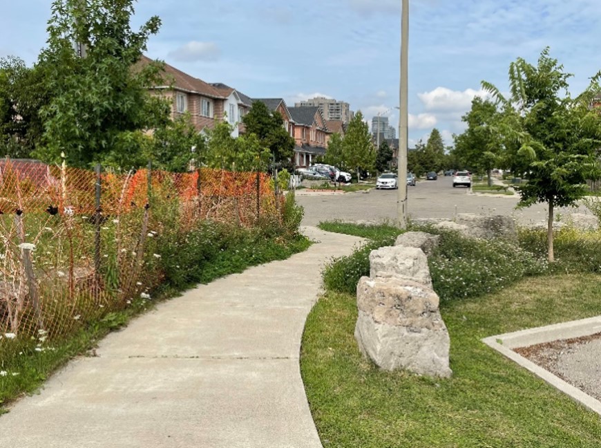
In Phase 2 of this project, the existing connection from the cul-de-sac of Sam Frustaglio Drive to Denison Road East, pictured below, is proposed to be upgraded and connected to a new proposed bikeway on Trethewey Drive. Public consultation for this connection and for Trethewey Drive will take place separately in 2024.
A public drop-in event was held on November 28, 2023. It included a presentation and question & answer period, as well as opportunity to speak with project staff and view display panels. View the display panels and consultation report below.
Download and read the Public Consultation Report for Phase 1 of Weston Cycling Connections from Denison Road East to Church Street along Sam Frustaglio Drive, Wright Avenue and Pine Street.
Feedback from residents and community interest groups was generally positive regarding the proposed bikeway between Denison Road East and Church Street along Sam Frustaglio Drive, Wright Avenue and Pine Street. A major reason given for supporting the bikeway is that it formalizes a route that is already in use by people cycling in Weston, thereby making the route safer and more welcoming.
While we aim to provide fully accessible content, there is no text alternative available for some of the content on this page. If you require alternate formats or need assistance understanding our maps, drawings or any other content, please contact us at 416-392-9510 or email westoncycling@toronto.ca.
The City Council-approved Cycling Network Plan is a comprehensive roadmap and work plan that outlines the City’s planned investment in our cycling network. It includes a Long-Term Cycling Network Vision, the planned Major City-Wide Cycling Network Routes, and a three-year rolling Near-Term Implementation Program.
The aim of the Cycling Network Plan is to connect gaps in Toronto’s current cycling network by growing existing and future cycling opportunities with safer and more comfortable cycling route options where quality can be improved.
The 2022-24 Near-Term Implementation Program identifies several key cycling routes throughout the Weston neighbourhood to connect key destinations and neighbouring community links.
Please contact Sivahami Vijenthira at westoncycling@toronto.ca to be added to the project list to receive updates by email.