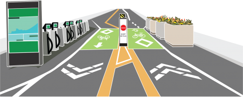
Since the contra-flow bike lane installation in 2013, Shaw Street has become a popular north-south cycling route. In 2020, Transportation Services resurfaced and made major upgrades to Shaw Street, between Dupont Street and Dewson Street. The upgrades were focused on improving the safety and comfort for pedestrians and people cycling and creating a premier cycling and walking street, and included:
The upgrades have resulted in an overall increase in cycling volumes and a decrease in motor vehicle traffic volumes on Shaw Street and connecting local streets.
Read more about these results at the “Post-Construction Results” tab.
In September 2024, the City will construct short, protected cycle tracks with poured in place concrete curbs along the existing contra-flow bike lanes north and south of the Bloor Street West intersection on Shaw Street. Please see the Construction Notice for more details.
In May 2022, the City installed decorative road markings at the cycling-only block on Shaw Street, between the two Essex Streets, to further reinforce curb radii at this location.
As part of the Shaw Street Improvements project in 2020, Transportation Services is committed to monitoring the changes. The before and after data can be found under the “Post-Construction Results” tab.
The safety improvements were approved at the City’s Infrastructure & Environment Committee on March 11, 2020, and City Council on April 30, 2020.
After the 2020 work was completed, the City observed the behaviour patterns of road users, obtained new traffic data and evaluated before and after conditions. Data collected between September and November 2021 (during which time there were no significant lockdowns or restrictions) revealed notable changes as a result of the safety improvements.
On Shaw Street between Dupont Street to Dewson Street, average cycling volumes increased between 90% (from 1,305 trips to 2,470 trips) to 310% (from 1,055 trips to 4,310 trips), while average motor vehicle traffic volumes decreased between 8% (from 1,601 trips to 1,479 trips) to 60% (from 1,894 trips to 766 trips) over a 24-hour period compared to pre-2020 levels.
Motor vehicle volumes also decreased overall on adjacent streets, ranging from an average reduction of 58 to 1,060 vehicles over a 24-hour period.
See the Shaw Safety Improvements Infographic for more details.
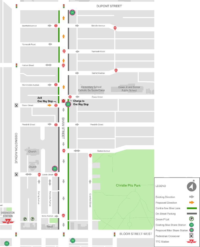
These changes resulted in the removal of 18 on-street parking spaces in Permit Parking Zone 3L (which has 605 total spaces) in order to provide better sight-lines for all road users. City permit parking records show there are more on-street parking spaces available in the area than are currently being used.
The City undertook a public consultation exercise between November 8 and December 5, 2019, through an online survey (December 5 closing date) and public drop-in event held on November 21, 2019, from 6 p.m. to 8 p.m. at Bob Abate Community Centre. A total of 45 people attended the public consultation and 190 people participated in the survey. Notice of the open house was mailed to over 5,800 properties in the area bounded by Dupont Street, Ossington Avenue, Christie Street/Grace Street and Harbord Street.
Several different street design options were developed with the overarching goals of:
The options all maintained bicycle travel in both directions along Shaw Street.
For more information, please refer to the following documents:
There are no plans to reduce the speed limit on any of the streets in the area bounded by Dupont Street, Harbord Street, Grace/Christie Street and Ossington Avenue
Depending on the street, residents may end up with limited access to their homes and will have to take a different route to get home
Yes, the City’s contractor will begin by resurfacing the road as well as repairing any deficient sidewalks and curbs. Once this work is completed, the traffic and parking changes will be implemented by the contractor. These changes will be in the form of pavement markings and signage.
No, any existing traffic calming measures and speed humps/bumps will be maintained. Any existing damaged speed humps will be repaired.
One of the goals of this project is to have on-street parking and the contraflow bike lane on opposite sides of the street. In the event that the contraflow bike lane in place, all parking spaces including Accessible Parking/Loading will also be relocated across the street.
The installation of the proposed changes will require that 19 on-street permit parking be removed. This is necessary in order to improve sight lines and accommodate driveways, fire hydrants, etc. Shaw Street is located in Permit Area 3L where 21 per cent of permit spaces remain available. The current demand for permit parking can continue to be accommodated with the proposed changes.
For Shaw Street between Dupont Street and Bloor Street, Option 4 is being recommended. This is based on consultation feedback and because the design is expected to result in the reduction of the number of motor vehicles travelling along the corridor, making it safer and more comfortable for people of all ages and abilities walking and cycling.
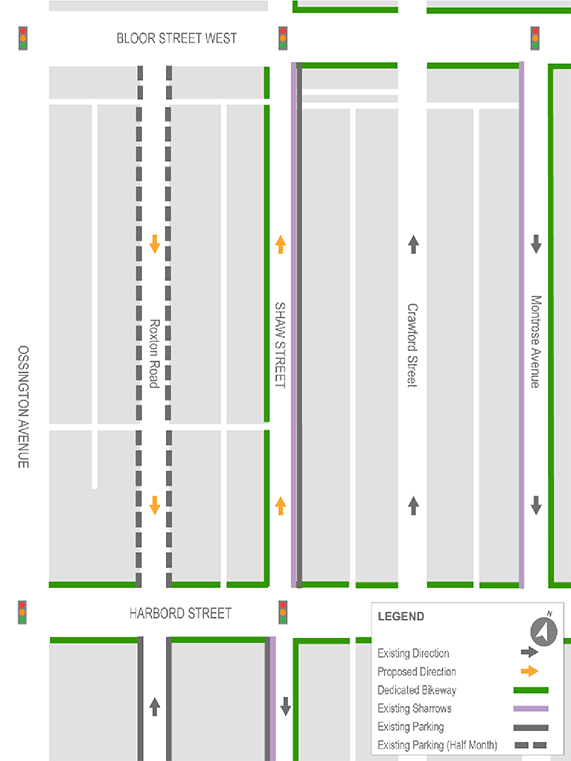
For Shaw Street between Bloor Street West and Harbord Street, Option 1 is being recommended, based on consultation feedback and also to avoid having three parallel northbound-only one-way streets in a row.
After all work is completed, the City will observe the new behaviour, obtain new traffic data on Shaw Street and evaluate before and after conditions. If there are operational challenges, further changes will need to be considered.
While we aim to provide fully accessible content, there is no text alternative available for some of the content on this page. If you require alternate formats or need assistance understanding our maps, drawings, or any other content, please contact cycling@toronto.ca.