

The Mimico Neighbourhood Mobility Plan (NMP) identified, prioritized and recommended short and long-term improvements to traffic operations and road design to support road safety for all modes of transportation including vulnerable road users (e.g. seniors, school children, people walking and cycling) in the Mimico study area.
The following areas of concern were addressed:
The Mimico Neighbourhood Mobility Plan (NMP) project area is located between Royal York Road to the west, Manchester Street/Burlington Street/Victoria Street to the north, Louisa Street to the east, and Lake Shore Boulevard West to the south. The area also includes Judson Street/Royal York Road intersection and the Newcastle Street /Royal York Road intersection, and considered the broader context area.
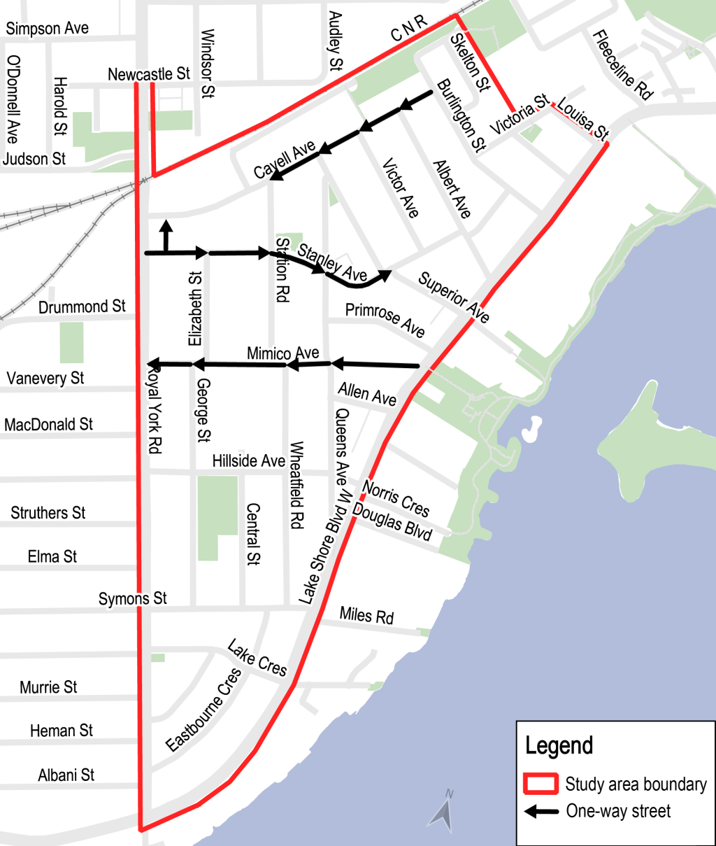
Leading up to the study, there had been requests for traffic calming service requests, stop signs, roundabouts, speed reductions and safety assessments. Automated Speed Enforcement results also showed a high rate of violations.
As part of the evaluation, the City retained a consultant to conduct an In-Service Road Safety Review (ISSR) of the study area. Using site visits, collision history, traffic counts and other data, this review identified and prioritized safety issues across the neighbourhoods and options to address them.
In 2018 Etobicoke York Community Council directed City staff to work with the community to develop a comprehensive plan to address community concerns. Staff used a holistic approach to assess and manage traffic issues within the neighbourhood. The NMP considered all modes of transportation, with an emphasis on improving conditions for vulnerable road users.
Historically, traffic management issues have been addressed by making changes only to a particular street or intersection. Instead of making one isolated change, a NMP employed a broader, neighbourhood perspective to develop integrated solutions that, together, support local objectives for mobility. Through an NMP approach, the City worked with local communities and neighbourhoods to identify short-term improvements that can be implemented in one to five years, as well as a longer-term vision for projects over five years into the future.
The participation of local residents and stakeholders was essential to identifying appropriate and effective traffic, speeding and road safety improvements for the neighbourhood.
The NMP process involved:
Many factors are considered when providing recommendations to Council including public opinion, technical considerations, policy considerations, costs and timelines.
As part of the approval process, staff reported to the Etobicoke York Community Council (EYCC) on June 3, 2024.
Highlights of the plan and specific recommendations that required Community Council approval included the following:
Directional changes previously proposed on Cavell Avenue and Mimico Avenue are not being recommended.
EYCC also requested staff to:
The City hosted a drop-in event on December 11, 2023 from 6 p.m. to 8 p.m. Members of the public were able to view project information panels and speak with staff one-on-one. The meeting was attended by over 100 participants. Public consultation was also conducted with an online survey, by phone and by mail. View the public event materials below:
The City hosted a virtual public meeting on June 14, 2022, from 6:30 p.m. to 8:30 p.m. Members of the public were invited to provide feedback and ask questions. Public consultation was conducted online, by phone and by mail. The meeting was attended by 39 participants. View the public event materials below:
Individual one-on-one meetings with local stakeholders like schools, businesses and other local organizations helped to confirm local issues and specific opportunities and challenges (e.g. school drop off and pickup, nearby intersections, parking, etc.).
A range of options are proposed and planned to improve traffic operations and road design to support road safety for all modes of transportation. An overview of the actions are summarized below.
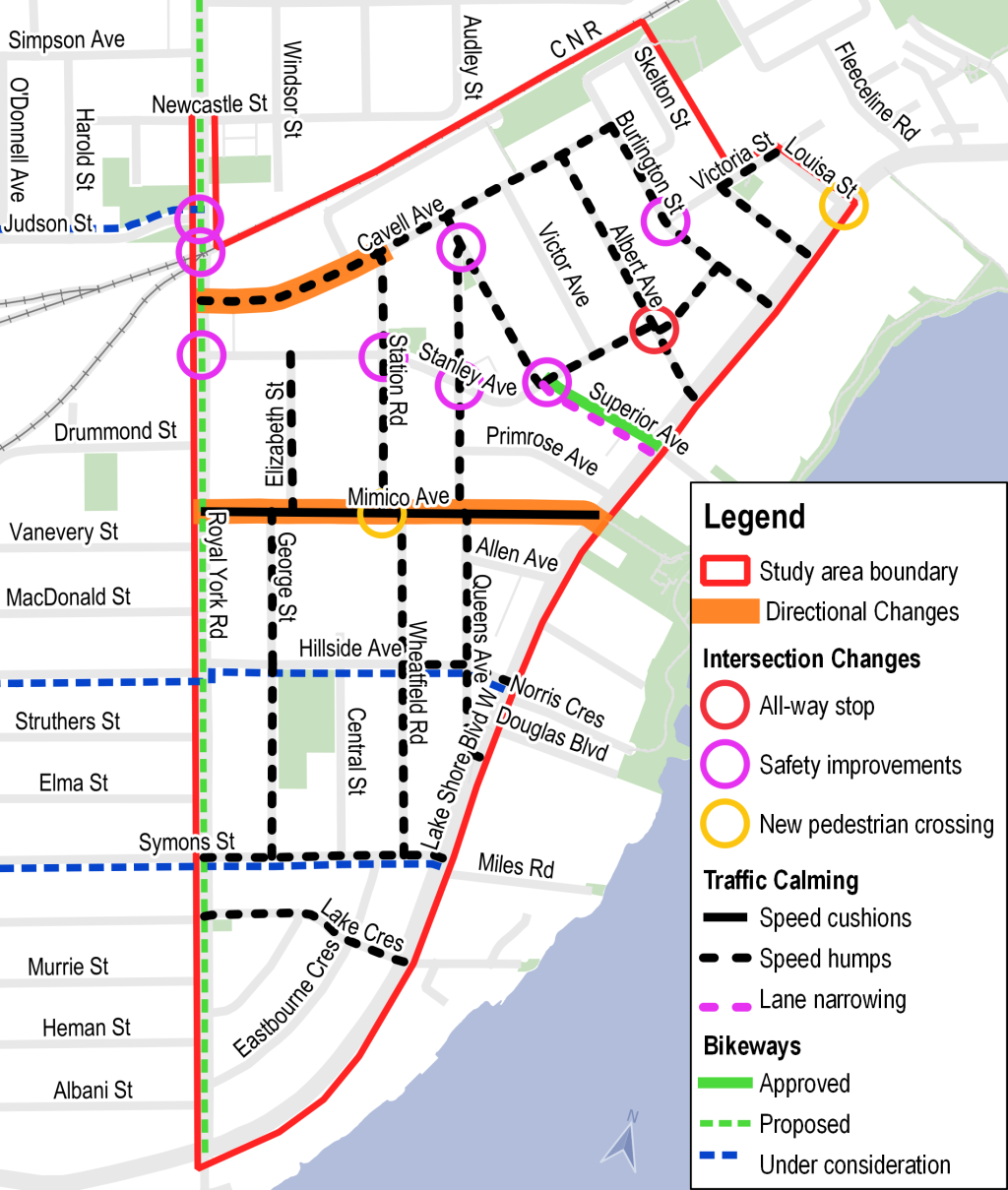
Due to the condition of the street and sewers, Superior Avenue was programmed for road resurfacing and sewer upgrade in 2024. The Superior Avenue bikeways were bundled with the planned work. Council approval was sought earlier in the process so the work could begin. The design was approved by City Council for implementation in 2024 Agenda Item History - 2023.IE4.3 (toronto.ca).
Designs for Superior Avenue were developed in advanced of the Neighbourhood Mobility Plan (NMP) and then modified based on the feedback received. Originally, the City was planning to replace the existing shared lane markings and install uni-directional cycle tracks (one westbound track and one eastbound track) and safety enhancements on Superior Avenue from Stanley Avenue to Lake Shore Boulevard West. In response to consultations with residents, the design was revised (see Planned Changes below).
These changes addressed excessive speeding, aggressive driving, and discouraged non-local traffic on local streets. These were key concerns identified by the community in the first phase of engagement for the Mimico NMP. Community feedback from Superior Avenue residents was critical and informed the final design.
On April 17, 2024, City Council approved item IE12.8 to update design elements to support reducing motor vehicle speeds with the addition of on-street parking for Superior Avenue and include:
Proposed change:
Impacts