Skip to content
I want to...
Navigation Menu
Search
Increase text size
A+
Decrease text size
A-
I want to...
Contact 311
City of Toronto
City Government
Accountability, City Administration & Customer Service
Access City Information or Records
City of Toronto Archives
What’s Online
Maps
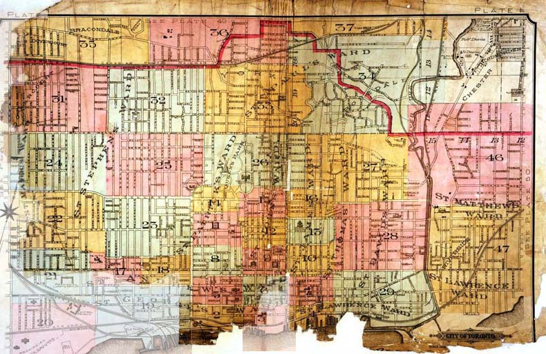
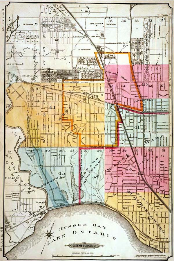
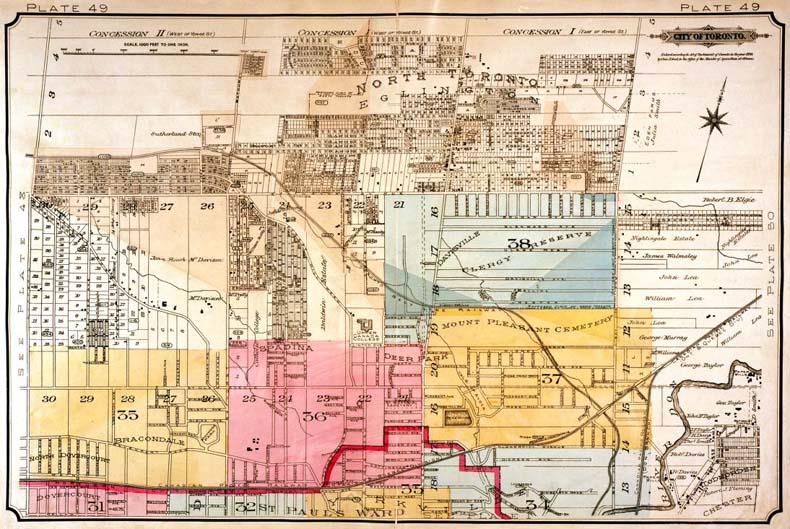
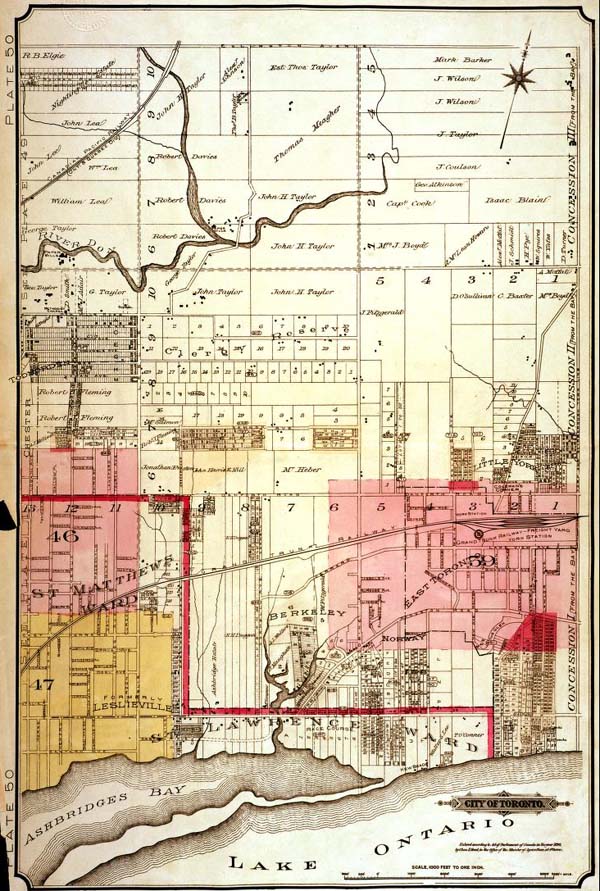
Fire Insurance Plans
Fire Insurance Plans 1894
Fire Insurance Plans 1894
Share
This Page
Share to
Facebook
(opens in a new window)
Share to
X
(opens in a new window)
Share to
LinkedIn
(opens in a new window)
Share to
Copy Link
(opens in a new window)
Print
Translate
Click on any map area to see a more detailed plan.
Central City
West of Dufferin Street
North of Dupont Street
East of Logan Avenue
Date modified: April 14, 2023