
The City is implementing a comprehensive and unified signage system across its 1,600 public parks and 600 kilometre trail system as part of a series of coordinated pedestrian, cycling, and vehicle wayfinding initiatives. The wayfinding system reflects the guidance provided in the Toronto Parks and Trails (TPT) Wayfinding Strategy for scoping, planning, fabricating and installing the signage products.
Wayfinding is the process of finding your way around. A wayfinding strategy provides the right information, in the right format, at the right moment in a person’s journey. For example, signage is a form of wayfinding that helps people to locate and access entrances to the parks and trail system and find nearby streets, recreational centres, and other points of interest.
Sign up for updates related to the Parks and Trails Wayfinding Strategy or unsubscribe from the mailing list.
During the community engagement process, the City worked with community members to collect feedback which will guide the implementation of the wayfinding system in late 2023.
Community Engagement Activities included:
The outcome is a Black Creek Sign Location Map.
A Social Pinpoint activity was available from December 13 to February 10, 2023. The activity involved an interactive map that allowed participants to drop pins and leave comments on precise locations. There were a total of 153 unique visitors, with 12 participants providing 45 comments. The most mentioned comments related to where people access the trail system (24 comments), followed by places of interest (12 comments), place-based stories (six comments) and points of confusion (three comments).
Review the closed Social Pinpoint Activity.
In January, three pop-up events took place inside Jane Finch Mall, York University at the Faculty of Environmental and Urban Change, and Jane Finch Community and Family Centre during youth drop-in hours. The pop-up events lasted 120 minutes each and allowed participants to learn more about the project, use the QR code to participate in the online interactive map, leave comments, and ask questions.
On December 21, 2022, a meeting took place to present the Jane Finch Citizen Advisory Committee with information about the wayfinding system. The presentation was well received and feedback collected will inform implementation in late 2023.
Download the Citizen Advisory Committee meeting presentation.
Wayfinding systems are currently being developed for the following multi-use trail systems:
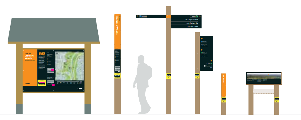
In addition to our existing network of paved multi-use trails, Toronto is home to over 300 kilometres of natural surface (dirt) trails that wind through our forests and ravines. These natural environment trails tend to be narrower and more remote than paved trails and present a unique challenge for wayfinding.
These signs use timber posts that are more suited to natural forested environments and easier to install and maintain in remote locations.
In fall 2022, wayfinding signs were installed in two areas of the city:
A public feedback activity was available on Social Pinpoint from May 9 to 23, 2023. The activity involved an interactive map that allowed participants to drop pins and leave comments about the pilot wayfinding installation, as well as take a survey about the new sign types. There were a total of 398 unique visitors, with 28 participants providing 34 comments and survey responses.
Review the closed Social Pinpoint activity.
In May 2022, the City prepared a draft interactive map to collect public feedback on accuracy, omissions, errors and priority destinations. The pilot maps can be reviewed in person at Jack Layton Ferry Terminal or any of the three ferry docks on the Islands.
The Parks and Trails Wayfinding Strategy is focused on improving wayfinding in parklands managed by the City. The goal of this ambitious project is to implement a signage system for parks and trails that:
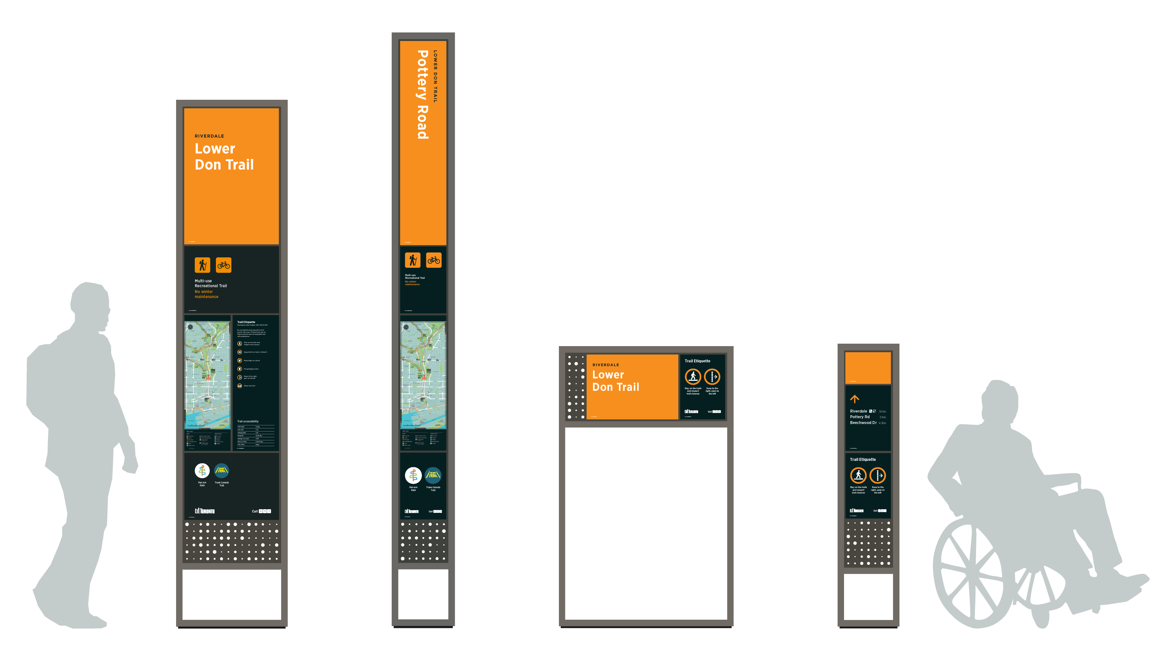
A pilot scheme consisting of a new family of wayfinding signage was implemented in 2017 in the Lower Don Trail, Riverdale Park East, and Riverdale Park West.
Lessons learned during the pilot informed refinements to the signage products, graphics, and construction, which are being incorporated into the rollout of the system.