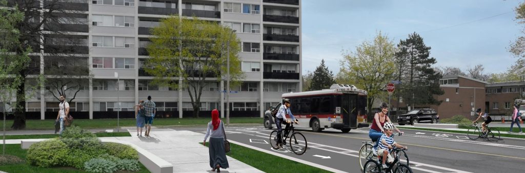
The City of Toronto is planning to reconstruct the intersection at Deauville Lane and Grenoble Drive. As part of the upcoming construction work, the City will be making changes to the design of the intersection to increase safety and connectivity for all road users. Changes will include:
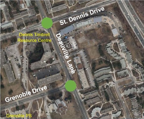
Vision Zero improvements have been designed for two intersections in Flemingdon Park, along Deauville Lane at St. Dennis Drive and Grenoble Drive. The Vision Zero Road Safety Plan calls for engineering improvements where they are most needed to protect vulnerable users of our transportation system – people walking, children, seniors and people cycling.
This project is part of the City Council-approved 2024 Capital Works Program to renew aging city roads and sidewalk for current and future needs.
Starting early June the City’s contractor will be moving forward with planned road reconstruction at the intersection of Deauville Lane and Grenoble Drive.
In August 2024, the City of Toronto notified residents of planned road reconstruction at the intersection of Deauville Lane and Grenoble Drive, including making changes to improve pedestrian safety and connectivity for all road users.
Due to delays encountered with the electrical design, this work will be deferred until spring 2025.
An update notice will be provided before work is to take place again.
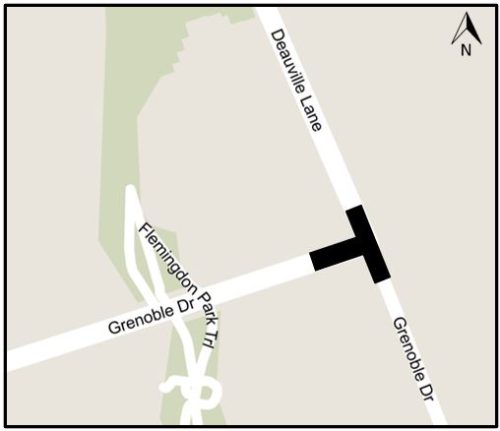
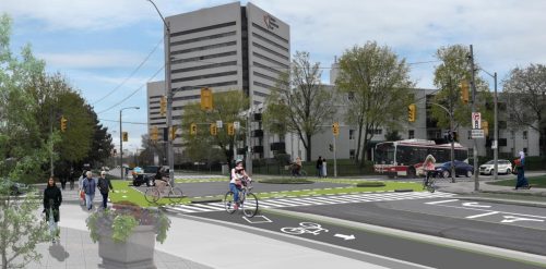
The construction area, illustrated below is Grenoble Drive at the intersection of Deauville Lane.
The City of Toronto will be installing cycle tracks on Ferrand Drive, Rochefort Drive and Deauville Lane, from Rochefort Drive to St. Dennis Drive. Installation will start in July 2024. Learn more about the installation of the cycle tracks on Ferrand Drive at toronto.ca/ferrand.
The City is making changes to the intersection of Grenoble Drive and Deauville Lane in 2024. Changes to the intersection at St. Dennis Drive and Deauville Lane are planned as part of future construction in 2025.
At the Deauville Lane and Grenoble Drive intersection, the following changes will be implemented as part of the 2024 construction:
At the Deauville Lane and St. Dennis Drive intersection, the following changes will be implemented as part of the 2025 construction:
A Public Drop-In Event was held on June 12, 2019, and included an opportunity to speak with project staff and view display boards.
This project will address recent City Council decisions including:
To receive construction updates by email, please contact us contact us and indicate that you would like to be added to the mailing list.