
In 1934, a committee chaired by Lieutenant Governor Herbert Bruce released a report on slum conditions in Toronto. The Bruce Report put forward a number of proposals for clearing and redeveloping several blocks east of downtown, described as full of structurally unsound buildings, with poor sanitation, pollution and overcrowding. It recommended the City demolish its slums and replace them with low-cost housing.
Development of the area, later to become Regent Park, was revisited three times. In the City’s 1943 master plan, by architects Mathers and Haldenby after the Second World War, and finally by architect J.E. Hoare, whose plans were approved in 1947.
The Hoare plan was to feature row-houses, three-storey walk ups and six-storey apartment buildings. It was also to feature open, green spaces creating a safer, healthier environment.
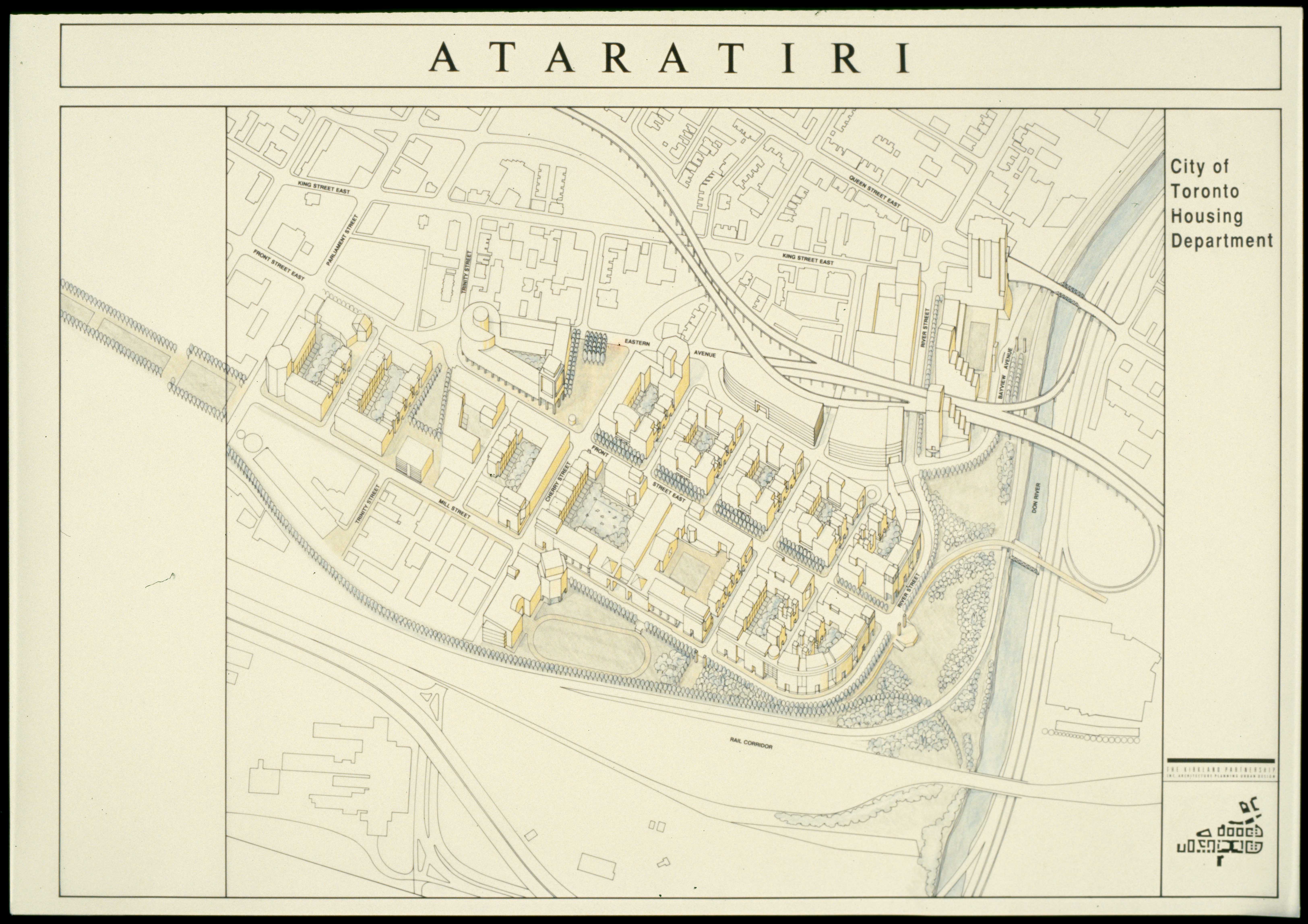
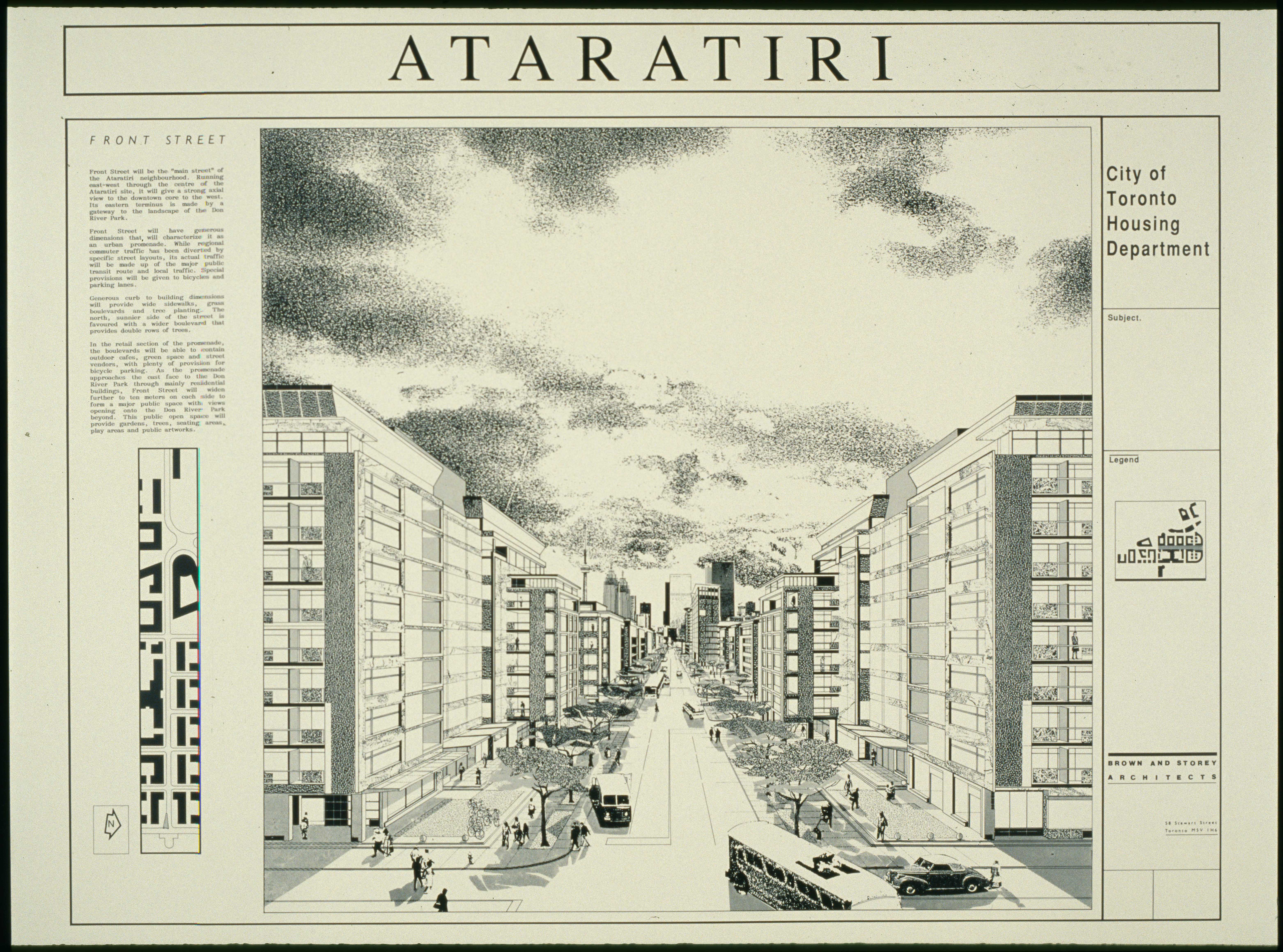
Toronto’s hosting of the Pan Am/Parapan Am Games in the summer of 2015 marked the first use of the new West Don Lands community, to serve as the athletes’ village. This community represents the belated fulfillment of the earlier, failed Ataratiri redevelopment proposal of the late 1980s.
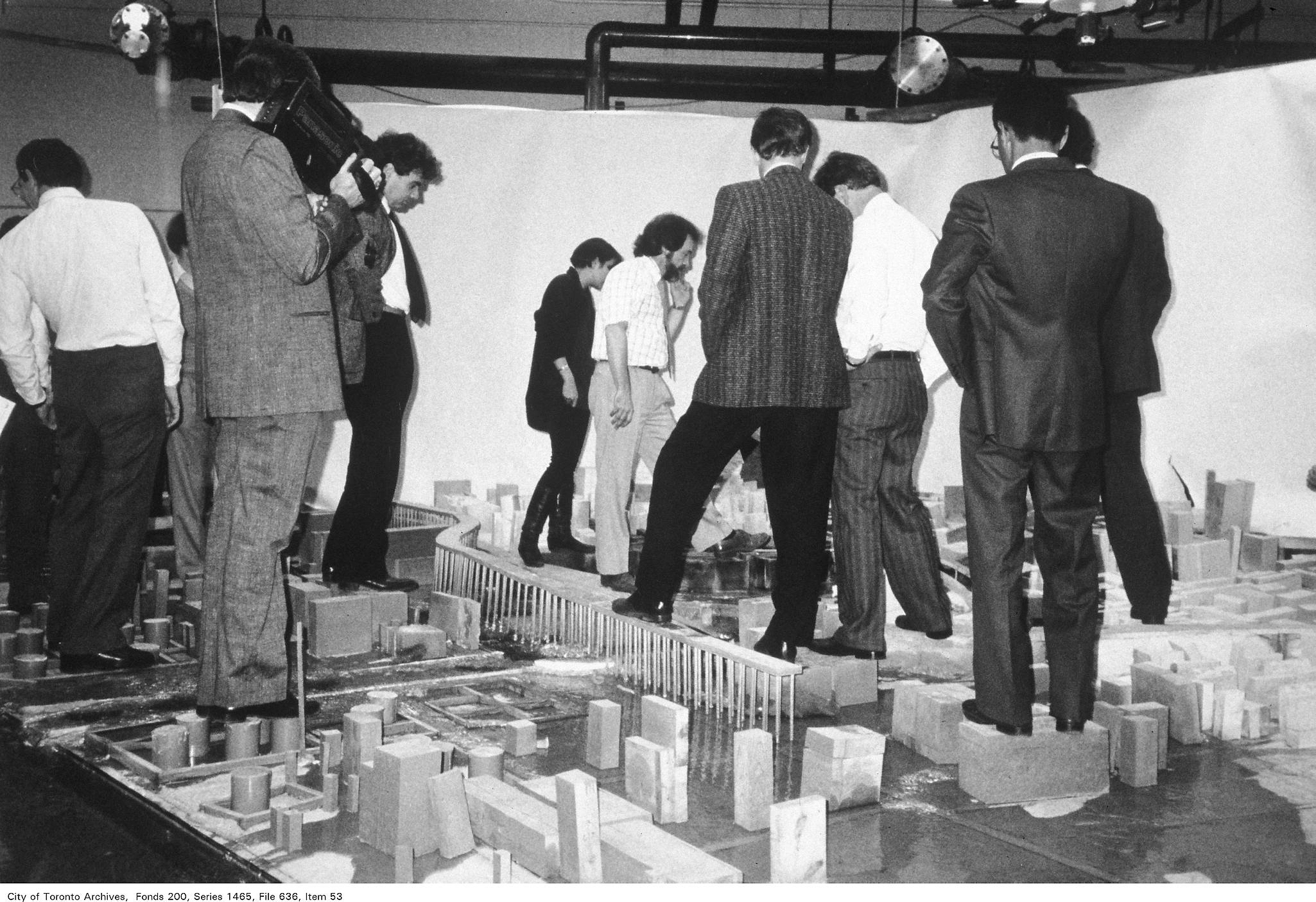
As residential vacancy rates dropped below one per cent in Toronto in the 1980s, it was widely recognized that major government intervention was needed to avoid a crisis in affordable housing. With financial backing from the Province, and the City acting as developer, 80 acres of industrial land just east of the downtown core were to be redeveloped as a mixed-use development of six to seven thousand new residential units, sixty per cent of which were to be subsidized.
However, the timing could not have been worse. The City had acquired the land at the height of the 1980s real estate boom, but would be selling development-ready parcels in the depressed market of the recessionary 1990s. With costs for flood and environmental remediation disastrously over budget, the City refused to continue with Ataratiri without further provincial backing. The Province, declining to throw good money after bad, cancelled Ataratiri in 1992 assuming losses of $413 million.
Back to Introduction
Next page - Roads