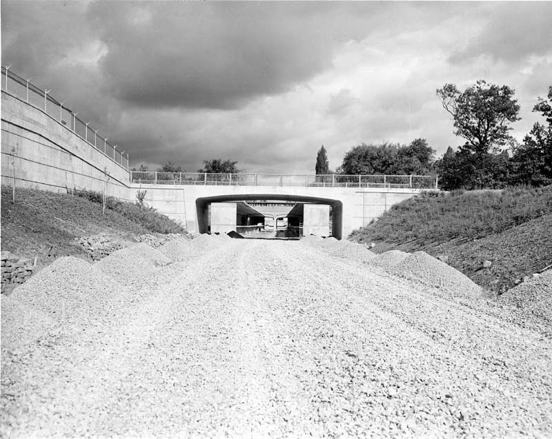
North of Bloor Street, part of the subway ran in an open cut, that is, a valley lower than the surrounding land but open to the sky. The route ran through residential lands parallel to Yonge Street, and some houses were expropriated and demolished to make way for the cut. Bridges were built to allow some streets to continue over the subway cut, while other streets became dead ends. In two spots, where the subway ran under the CPR train tracks and where it crossed from the east to the west side of Yonge Street, the subway was tunnelled underground without affecting the surface.
Excavation, Davisville station and yards area May 15, 1951 Photographer: Canada Pictures Limited City of Toronto Archives Series 381, File 126, Item 8258-10
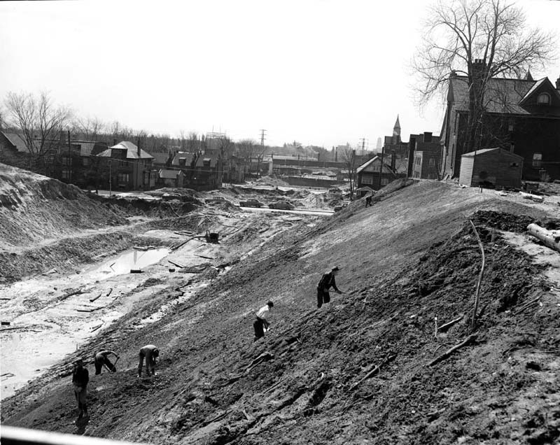
Open cut looking south from Jackes Avenue bridge, just south of St. Clair Avenue April 20, 1951 Photographer: Canada Pictures Limited City of Toronto Archives Series 381, File 188, Item 8170-2
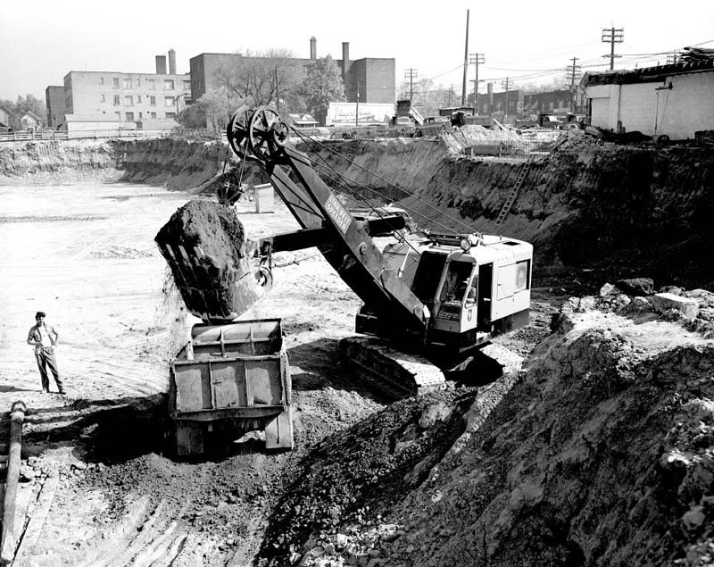
Excavation for open cut between Summerhill and Davisville stations April 4, 1951 Photographer: Canada Pictures Limited City of Toronto Archives Series 381, File 113, Item 8117-4
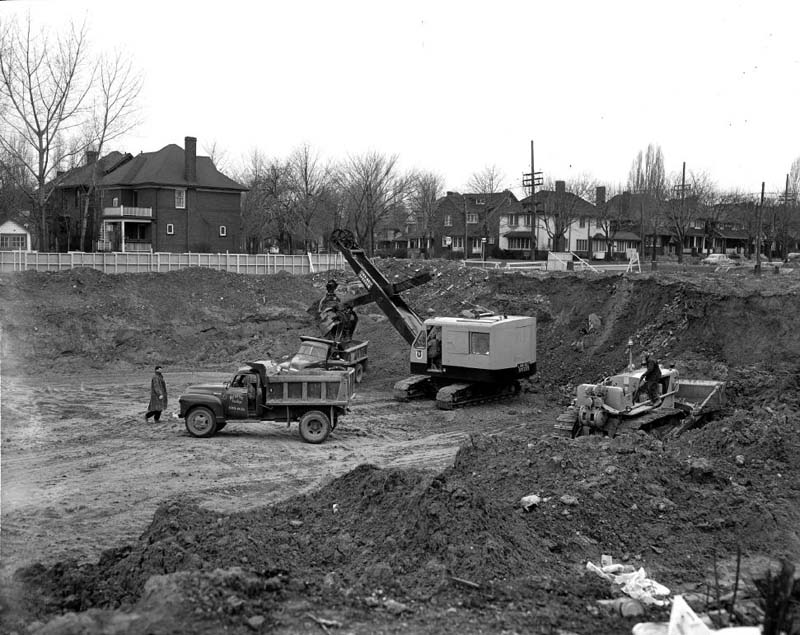
Unidentified excavation, probably at St. Clair Avenue or Eglinton Avenue October 30, 1952 Photographer: Canada Pictures Limited City of Toronto Archives Series 381, File 217, Item 10060-9
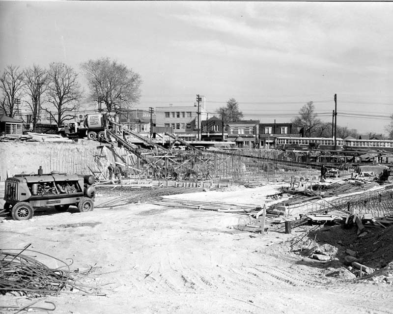
Preparing wooden forms for concrete platform, probably Rosedale or Summerhill station October 26, 1951 Photographer: Canada Pictures Limited City of Toronto Archives Series 381, File 147, Item 8734-1
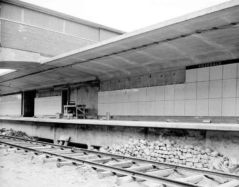
Looking north to Rosedale station April 18, 1952 Photographer: Canada Pictures Limited City of Toronto Archives Series 381, File 181, Item 9332-2
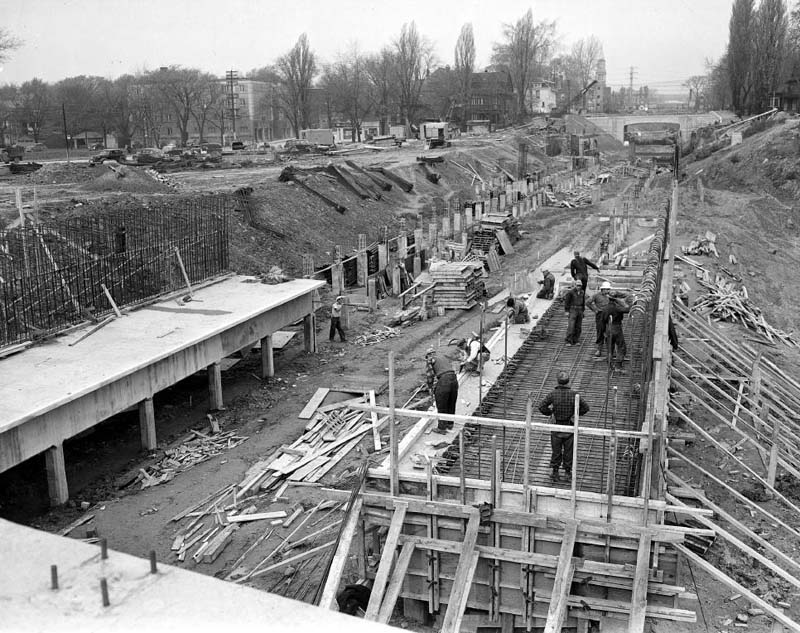
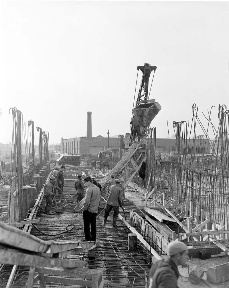
Because of the steel shortage caused by the Korean War (1950-1953), most of the bridges that connected streets across the subway cut were made from reinforced concrete. As the project progressed, even reinforcing steel rods for the concrete became scarce, and rather than using Canadian suppliers the TTC was forced to buy steel from the United States and Britain at considerably higher cost.
Concrete work, Rosedale station November 20, 1953 Photographer: Canada Pictures Limited City of Toronto Archives Series 381, File 278, Item 11442-7
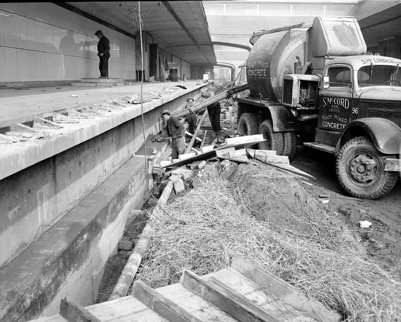
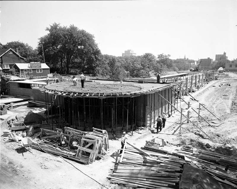
Rosedale station September 18, 1953 Photographer: Canada Pictures Limited City of Toronto Archives Series 381, File 265, Item 11122-20
Preparing reinforcing rods and forms for concrete, Davisville station, looking north January 22, 1953 Photographer: Canada Pictures Limited City of Toronto Archives Series 381, File 228, Item 10311-10
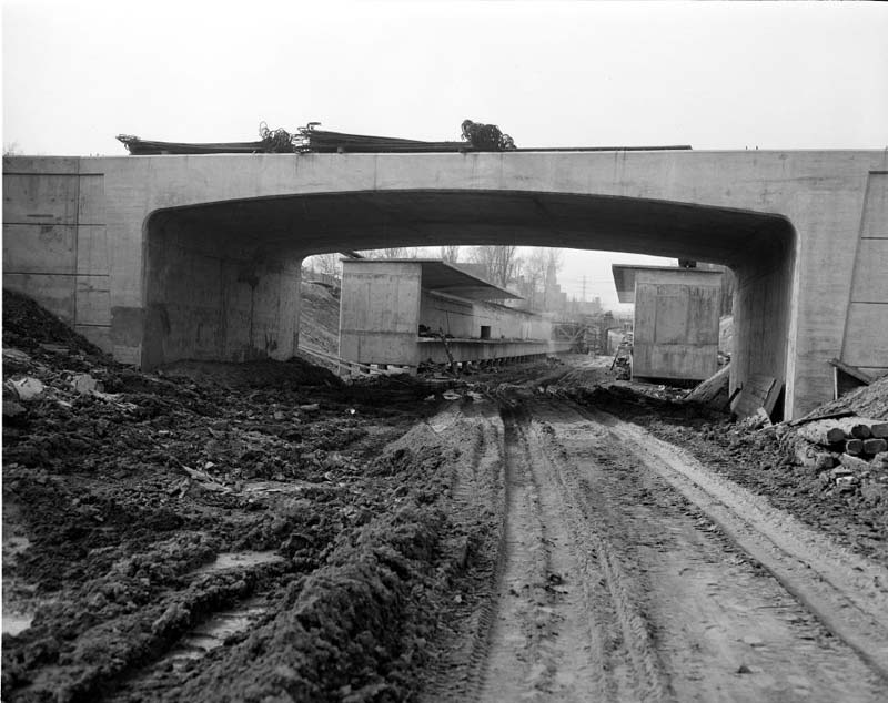
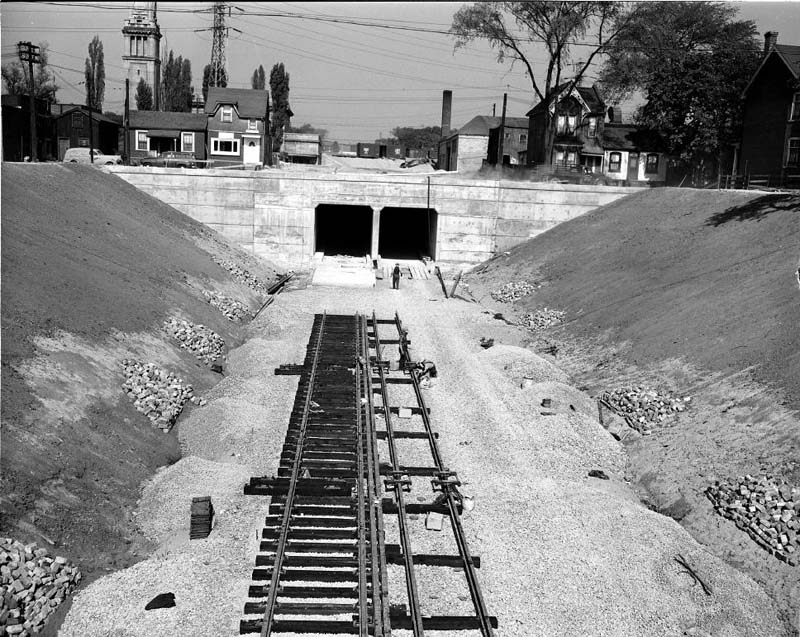
Portal to Summerhill Station, looking north September 29, 1952 Photographer: Canada Pictures Limited City of Toronto Archives Series 381, File 214, Item 9896-4
In open cut areas such as this one, rails were set on creosoted ties over crushed stone, similar to railway tracks.
Looking north to Rosedale station, showing retaining wall and gravel bed for tracks September 16, 1952 Photographer: Canada Pictures Limited City of Toronto Archives Series 381, File 211, Item 9837-1
Davisville station, looking south August 13, 1952 Photographer: Canada Pictures Limited City of Toronto Archives Series 381, File 207, Item 9703-6
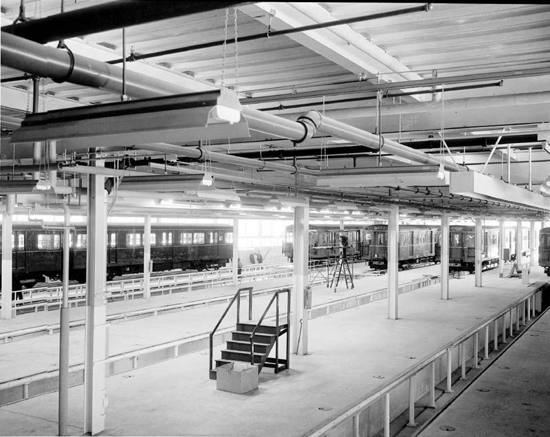
Directly west of Davisville station was built Davisville yard, including storage for 104 subway cars and a 69,000-square-foot shop equipped for minor repair and maintenance of subway cars (major work would be done at the larger Hillcrest shop at Bathurst Street and Davenport Road). Also at Davisville station was the control panel for the automatic block signal system that used red, green, and yellow lights to direct subway drivers.
Davisville station entrance, looking east April 23, 1953 Photographer: Canada Pictures Limited City of Toronto Archives Series 381, File 247, Item 10633-1
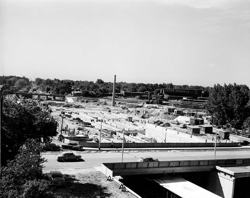
Open Davisville station and yard under construction, looking south July 22, 1952 Photographer: Canada Pictures Limited City of Toronto Archives Series 381, File 206, Item 9653-2
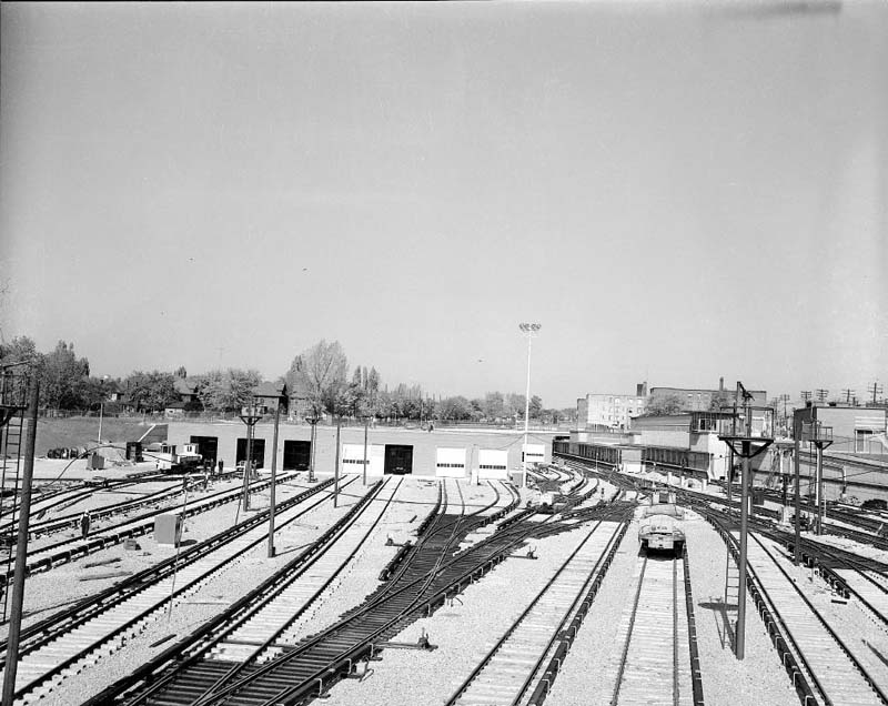
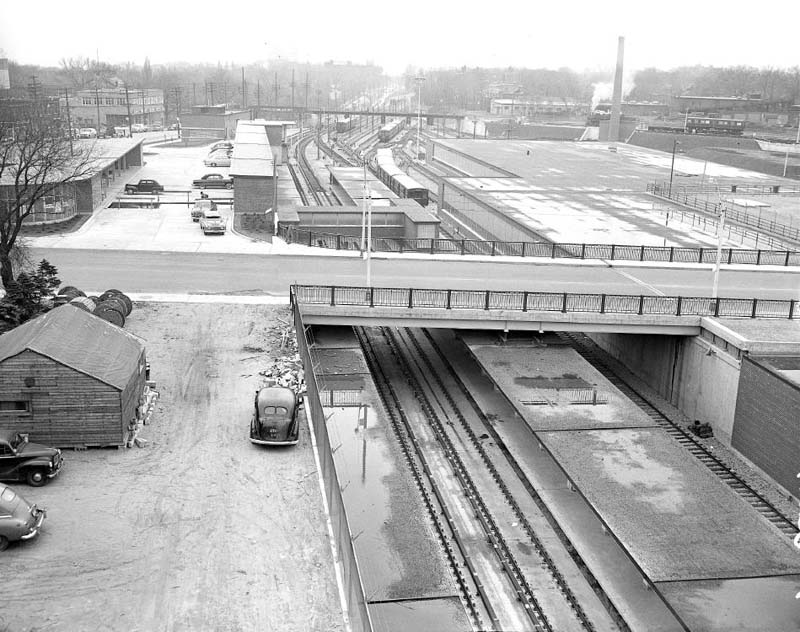
Davisville yard, looking north, with station at upper right October 20, 1953 Photographer: Canada Pictures Limited City of Toronto Archives Series 381, File 271, Item 11271-10
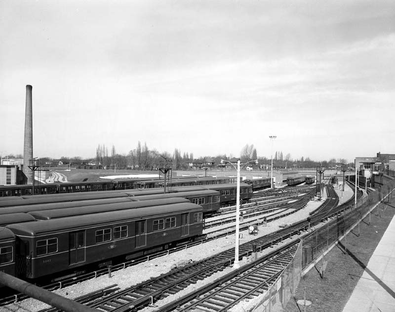
Subway cars in Davisville yard, looking north March 11, 1954 Photographer: Canada Pictures Limited City of Toronto Archives Series 381, File 295, Item 11816-4
Davisville shop interior October 20, 1953 Photographer: Canada Pictures Limited City of Toronto Archives Series 381, File 271, Item 11271-14
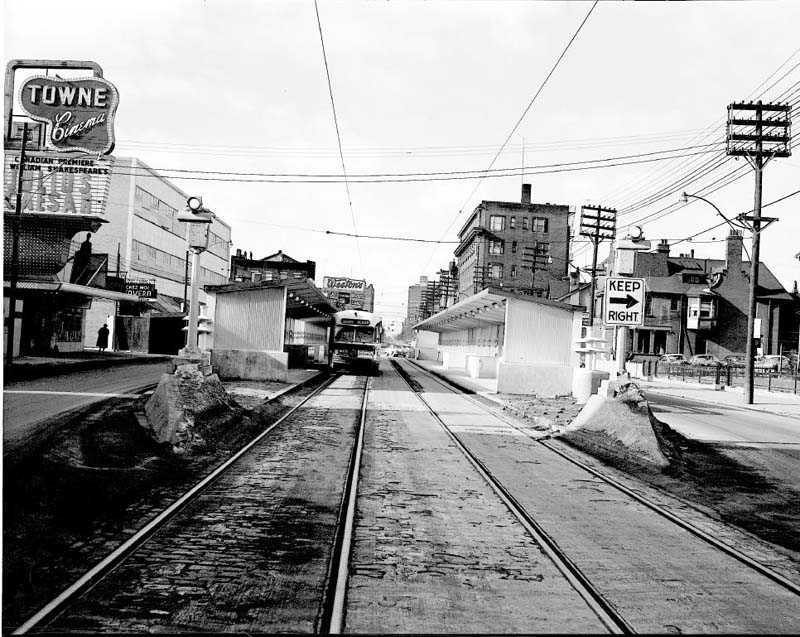
Platform for transfer from streetcar to subway, Bloor Street east of Yonge Street, looking west February 11, 1954 Photographer: Canada Pictures Limited City of Toronto Archives Series 381, File 291, Item 11718-1
This platform in the centre of Bloor Street was removed in 1966 when the east-west Bloor-Danforth subway line (originally Keele to Woodbine stations only) was built and streetcars were discontinued on Bloor Street.
Davisville station, looking south November 24, 1953 Photographer: Canada Pictures Limited City of Toronto Archives Series 381, File 280, Item 11459-1