The Bathurst Manor Neighbourhood Mobility Plan (NMP) identified, prioritized and recommended short-, medium-, and long-term improvements to traffic operations and road design to support safety for all modes of transportation, including pedestrians and people driving and cycling.
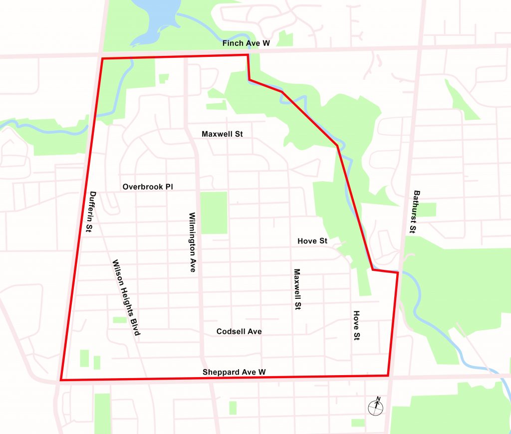
In 2019, North York Community Council directed City staff to work with the community to develop a comprehensive plan to address community concerns about mobility and safety for road users in Bathurst Manor. City staff have used a holistic approach to assess and manage traffic issues within the neighbourhood. The Bathurst Manor NMP considers all modes of transportation, with an emphasis on improving conditions for vulnerable road users such as seniors, students, pedestrians and people cycling. The final NMP recommend actions related to moto vehicle speed and volume management, and traffic safety conflicts on local streets. NMP recommendations are informed by the City’s Traffic Calming Guide, Vision Zero Action Plan, and Complete Streets Guidelines.
In 2023, the City launched Neighbourhood Streets Plans to make it fair and transparent for neighbourhoods to access City-led, community guided plans for traffic, road safety, and active transportation. The Bathurst Manor NMP is considered and early entrant and model for this new program.
The Bathurst Manor NMP will use the following process:
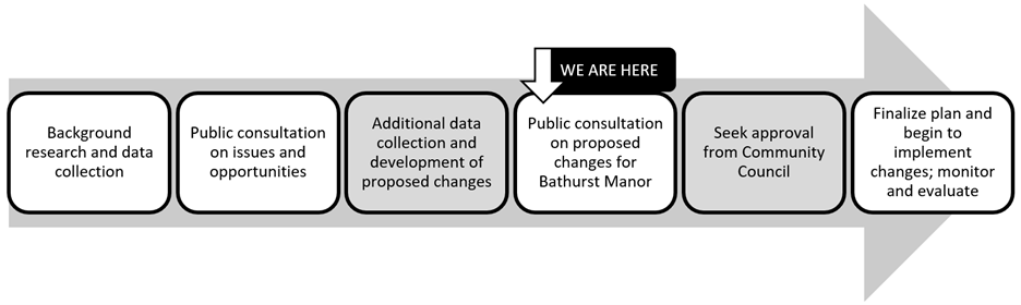
The participation of local residents and stakeholders was essential to identifying appropriate and effective traffic, speeding and road safety improvements for the neighbourhood. Following the first round of consultation, the NMP process identified and implemented 'quick win' improvements supported by the community, such as edge lines and geometric safety improvements. Medium and long-term improvements were then proposed during the second round of consultation for feedback. Staff made final recommendations informed by consultation and these changes were approved at North York Community Council in fall 2023 and spring 2024.
Phase 1 consultation took place from July 8 to December 1, 2023 and included a Local Advisory Committee (LAC) meeting, virtual public meeting, and interactive online mapping survey, and was promoted by notice distribution and a project webpage. The consultation focused on understanding issues and opportunities for the neighbourhood, and collecting input on proposed short-term actions.
Phase 2 took place from September 13 to October 11, 2023, and included a LAC meeting, online survey, and in-person drop-in event with a presentation and Q&A. It was promoted by a mailed notice and project webpage. The consultation focused on collecting input on other short, medium and long-term improvements for the neighbourhood.
Consultation materials:
On April 2, 2024, North York Community Council meeting approved additional elements of the Bathurst Manor NMP (2024.NY12.14.), including:
On November 14, 2023, North York Community Council approved some elements of the Bathurst Manor NMP (2023.NY9.20, 2023.NY9.22) including:
Staff reports summarizing recommendations can be found here:
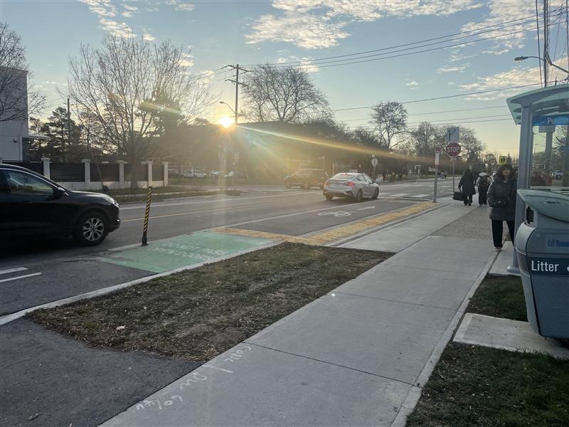
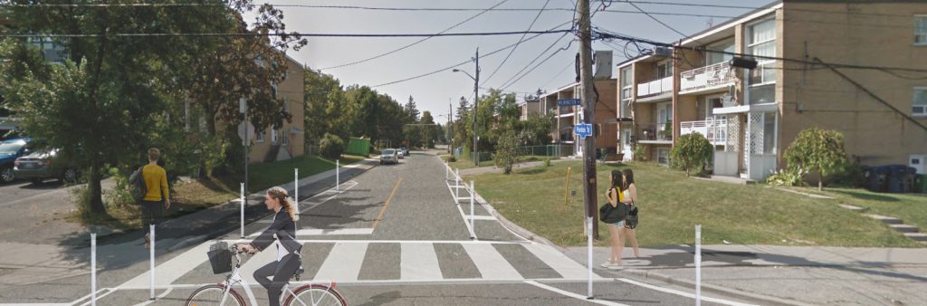
Bike lanes and shared lane markings were installed on Wilmington Avenue and Faywood Boulevard between Finch Avenue West and Wilson Avenue to provide a north-south cycling route in North York that connects six schools, the Finch Trail and numerous community connections. The bikeways also reduced the travel lane widths between Finch Avenue West and Sheppard Avenue West, where there were previous concerns with high motor vehicle speeds. This route was identified as a priority Major City-Wide Cycling Corridor in Toronto’s Cycling Network Plan.
Buffered and conventional bike lanes were installed on Wilmington Avenue between Finch Avenue West and Sheppard Avenue. Shared lane markings were installed on Faywood Boulevard between Sheppard Avenue and Wilson Avenue, due to width constraints.
In 2023, road resurfacing took place on Wilmington Avenue from Kennard Avenue to Overbrook Place, and from Cavotti Crescent to Finch Avenue West. Sections of damaged curb and sidewalk were also replaced to bring them to a state of good repair.
As part of the road resurfacing project, the following changes were made to Wilmington Avenue: