These aerial photographs of the Don and Humber River valleys, and other open spaces in Toronto, were taken from 1937 to 1942. They relate to early planning efforts to create a ‘greenbelt’ in the region.
In this series of 173 photographs, rivers, forests, parks, roads, etc., are clearly visible.
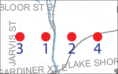
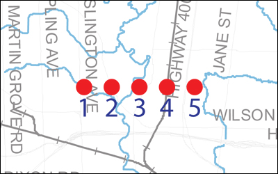
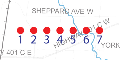
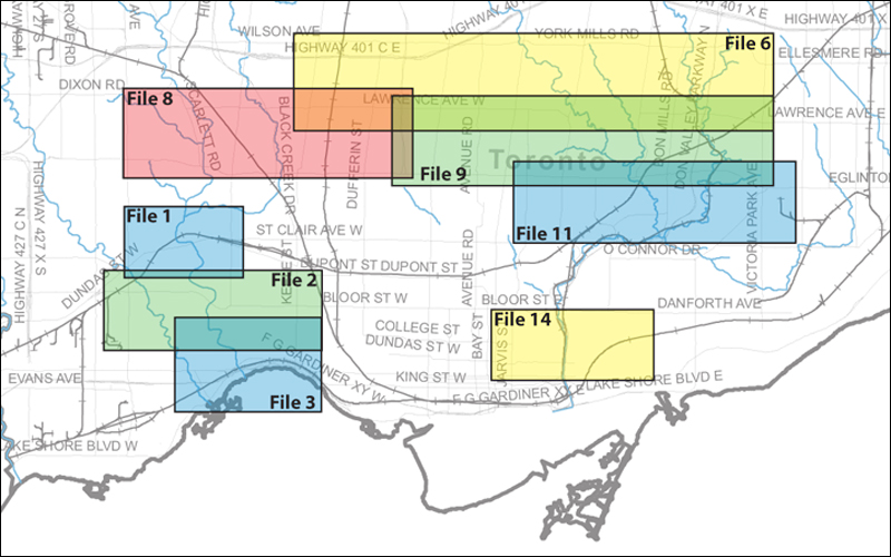
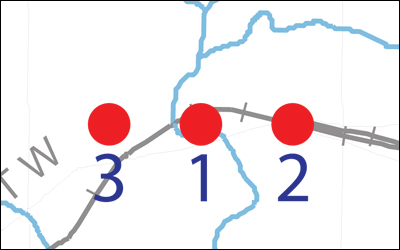
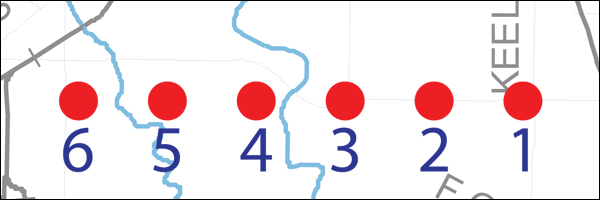
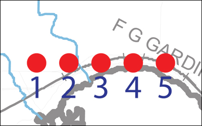
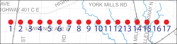
The Archives has these aerial photographs available to view online. Due to the large amount of overlap, the index has been placed on two maps.
Aerial photographs are fully accessible for viewing online. Should you require copies of aerial photographs, plates must be purchased individually.
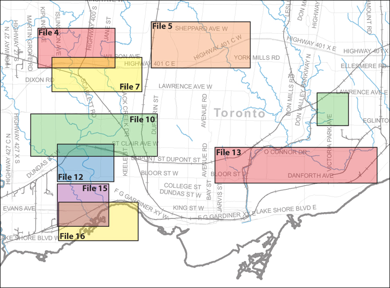
File consists of aerial photographs of Humber River and Black Creek valley lands, probably taken during the early 1940s. The area covered is bounded by Sheppard Avenue West in the north, Jane Street in the east, Wilson Avenue in the south, and Islington Avenue in the west.
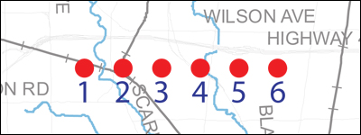
File consists of aerial photographs of Don River valley lands and the Downsview Airport area, probably taken during the early 1940s. The area covered is bounded by Sheppard Avenue West in the north, Yonge Street in the east, Wilson Avenue in the south, and Dufferin Street in the west.
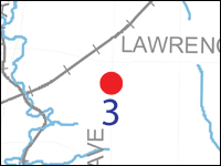
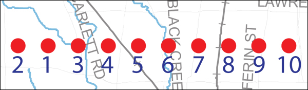
File consists of aerial photographs of Humber River and Black Creek valley lands and the Town of Weston area, taken April 3, 1942. The area covered is bounded by Wilson Avenue in the north, Keele Street in the east, Lawrence Avenue West in the south, and Islington Avenue in the west.
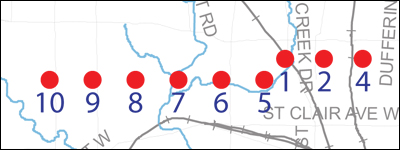
File consists of vertical aerial photographs of Humber River and Black Creek valley lands, taken April 3, 1942. The area covered is bounded by Eglinton Avenue East in the north, Prospect Cemetery in the east, St Clair Avenue West in the south, and Kipling Avenue in the west.
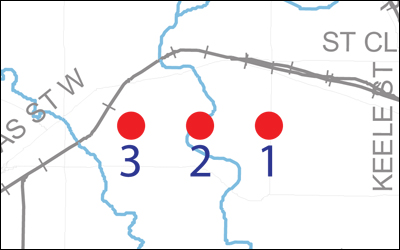
File consists of aerial photographs of Humber River valley lands, taken April 3, 1942. The area covered is bounded by St Clair Avenue West in the north, Jane Street in the east, Bloor Street West in the south, and Royal York Road in the west.
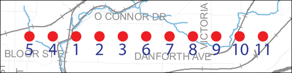
File consists of aerial photographs of Don River and Taylor and Massey Creek valley lands, taken April 3, 1942. The area covered is bounded by St Clair Avenue East in the north, Kennedy Road in the east, Bloor Street East and Danforth Avenue in the south, and Yonge Street in the west. Prominent in one photograph is the Rosehill Reservoir prior to being covered over.
File consists of aerial photographs of Humber River and Mimico Creek valley lands, taken April 8, 1942. The area covered is bounded by Berry Road in the north, The South Kingsway in the east, Lakeshore Boulevard West in the south, and Islington Avenue in the west.
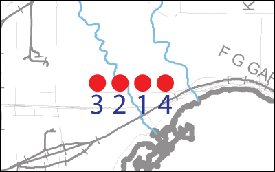
File consists of aerial photographs of the City of Toronto waterfront at Humber Bay, taken April 8, 1942. The area covered is bounded by The Queensway in the north, Roncesvalles Avenue in the east, Lakeshore Boulevard West in the south, and Royal York Road in the west.
File consists of aerial photographs of Humber River and Mimico Creek valley lands, taken on November 22, 1937. The area covered is bounded by St Clair Avenue West in the north, Jane Street in the east, the Kingsway in the south, and Islington Avenue in the west.
File consists of aerial photographs of Humber River and Mimico Creek valley lands and the High Park area, taken November 22, 1937. The area covered is bounded by Annette Street in the north, Roncesvalles Avenue in the east, Morningside Avenue in the south, and Islington Avenue in the west.
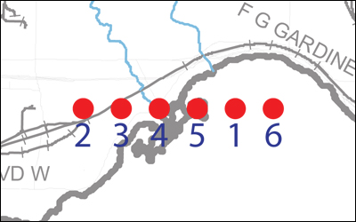
File consists of aerial photographs of the City of Toronto waterfront at Humber Bay, taken November 22, 1937. The area covered is bounded by Morningside Avenue in the north, Roncesvalles Avenue in the east, Humber Bay in the south, and Royal York Road in the west.
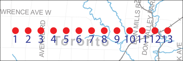
File consists of aerial photographs of Don River valley lands and other lands in the southern part of North York Township, probably taken during the early 1940s. The area covered is bounded by Wilson Avenue and York Mills Road in the north, Victoria Park Avenue in the east, Lawrence Avenue East and West in the south, and Keele Street in the west.
File consists of aerial photographs of Humber River and Black Creek valley lands and other lands in York Township, taken April 3, 1942. The area covered is bounded by Lawrence Avenue West in the north, Bathurst Street in the east, Eglinton Avenue West in the south, and Islington Avenue in the west.
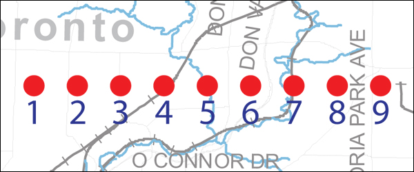
File consists of aerial photographs of Don River valley lands and other lands in York Township, taken April 3, 1942. The area covered is bounded by Lawrence Avenue East and West in the north, Victoria Park Avenue in the east, Eglinton Avenue East and West in the south, and Bathurst Street in the west. The Bridle Path and the Lawrence Park development are prominent in the photographs.
File consists of aerial photographs of Don River valley lands, taken April 3, 1942. The area covered is bounded by Eglinton Avenue East in the north, Victoria Park Avenue in the east, St Clair Avenue East in the south, and Mt Pleasant Road in the west. Thorncliffe Park race track is prominent in the photographs.
File consists of aerial photographs of Don River valley lands, taken in the spring of 1942. The area covered is bounded by Danforth Avenue in the north, Greenwood Avenue in the east, Bloor Street East and Queen Street East in the south, and Yonge Street in the west.