After locating a desired tour, you can download and print the map.
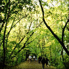
Interest: Ravines, nature
Estimated time: Two hours or longer.
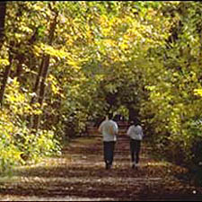
This Discovery Walk leads you on a loop through the West Humber River valley on a mixture of paved, hard-packed and grass trails. You can start at the Humber Arboretum (adjacent to Humber College) or at the Humberwood Centre. This delightful walk takes you through ornamental gardens, to an environmentally significant woodland and along the West Humber River, an area once travelled by First Nation peoples.
View the Humber Arboretum and West Humber River Valley route map and additional walk details.
Nearest TTC Station: Contact TTC
Interest: History, ravines, nature
Estimated time: Two hours or longer.
This Discovery Walk leads you on a loop through the Humber River Valley from approximately Bloor Street south to Lake Ontario. Although you can begin this Discovery Walk at any point along the route, a good starting point is the Old Mill Subway Station (see top left corner of map). From the subway station, the route leads you past the historic Old Mill and Old Mill Bridge. Afterwards, you’ll visit riverside parklands, charming neighbourhoods, the Humber River and its marshes.
View the Humber River, Old Mill & Marshes route map and additional walk details.
Nearest TTC Station: Old Mill
Interest: History, ravines, nature
Estimated time: One hour to less than two hours.
This Discovery Walk leads you on a loop through the lower Humber River valley between Dundas Street and Bloor Street. Although you can begin this walking tour at any place along the route, a good starting point is the restored Lambton House (originally the Lambton House Hotel) on Old Dundas Street. From Lambton House, walk clockwise through historic neighbourhoods to Etienne Brûlé Park. From there, you can walk up either side of the river back to the starting point.
View the Lambton House Hotel & Lower Humber River route map and additional walk details.
Nearest TTC Station: Old Mill
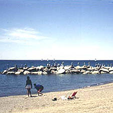
Interest: Ravines, nature, waterfront
Estimated time: Two hours or longer.
Although you can begin this walking tour at any point along the route, a good start and end point is the High Park subway station (see top of map). After leaving the station, the route leads you into High Park. Afterwards, you can wander along the Western Beaches Boardwalk, visit the Sunnyside Bathing Pavilion, and the Humber Bike/Pedestrian Bridge. Finally, you can explore Rennie Park Ravine and the Swansea neighbourhood, before returning to High Park and the subway station.
View the Western Ravines & Beaches route map and additional walk details.
Nearest TTC Station: High Park
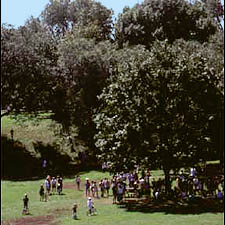
Interest: History, ravines, nature
Estimated time: Two hours or longer.
Explore wooded Don River ravines and follow a lost historic rail line. Discover industrial heritage and the splendid park like environment of Mount Pleasant Cemetery.
Although you can begin this Discovery Walk at any point along the route, a good starting point is Eglinton West Subway Station(see top left corner of map). After leaving the station, the route leads you along the Belt Line Linear Park. The trail then crosses Yonge Street and enters Mount Pleasant Cemetery. After exploring the cemetery, you will enter a system of natural ravines, which lead you to the St. Clair Subway Station.
View the Discovery Walk: Central Ravines, Belt Line & Gardens route map and additional walk details.
Nearest TTC Station: Eglinton West
Interest: Ravines, nature
Estimated time: One hour to less than two hours.
Although you can begin this Discovery Walk at any point along the route, a good place to start is the Lawrence Subway Station (see top of map). The route leads you through Lawrence Park, Chatsworth, Blythwood and Sherwood Park ravines.
View the Discovery Walk: Northern Ravines & Gardens route map and additional walk details.
Nearest TTC Station: Lawrence
Interest: Ravines, nature
Estimated time: Two hours or longer.
This Discovery Walk leads you on two overlapping loops through the Don Valley and nearby neighbourhoods. Although you can begin this Discovery Walk at any point along the route, a good starting point is the Broadview Subway Station (see middle right side of map). From the subway station, the tour guides you through the Lower Don Valley. Along the way you can visit Riverdale Farm, Prince Edward (Bloor Street) Viaduct, Chester Springs Marsh and Todmorden Mills. Side trips allow you to explore the Cabbagetown and Rosedale neighbourhoods.
View the Discovery Walk: Don Valley Hills & Dales route map and additional walk details.
Nearest TTC Station: Broadview
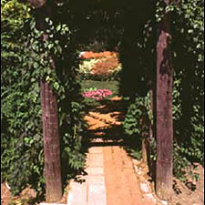
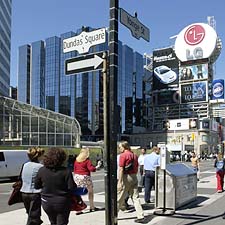
Interest: Architecture, history, nature
Estimated time: Two hours or longer.
This Downtown Discovery Walk leads you through the dense core of the City. Hidden among the skyscrapers, you will discover a rich variety of parks, gardens and streetscapes. Since the 1960s, most of these parks and gardens have been created through building demolition, land exchanges, street closures, lease agreements, land purchases and through the City’s development approval process for major projects.
These parks and gardens have design features ranging from traditional to
contemporary, from pastoral to urban. Cloud Gardens, Simcoe Park and Olympic Gardens are a few of the many parks noted for their unique design. Other open spaces include a Victorian garden, a sculpture garden, a cloud forest in a greenhouse, a historic railway round-house park and ceremonial squares, all within the core of Canada’s largest City.
View the Discovery Walk: Downtown Toronto route map and additional walk details.
Nearest TTC Station: Union
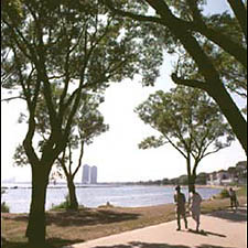
Interest: Ravines, nature, waterfront
Estimated time: Two hours or longer.
Although you can begin this Discovery Walk at any point along the route, a good starting point is the northern end of the enchanting Glen Stewart Ravine (see top of map). Follow this ravine down to the Lake Ontario shore and explore the Eastern Beaches and its boardwalk. Along the way, you’ll visit an Art Deco water treatment plant and a charming Beaches neighbourhood.
View the Discovery Walk: Eastern Ravine & Beaches route map and additional walk details.
Nearest TTC Station: Main or Queen bus/streetcar, 64 Main or 501 Queen
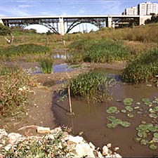
Interest: History, nature
Estimated time: One hour to less than two hours.
Although you can begin this Discovery Walk at any point along the route, a good starting point is Christie Pits Park (see top of map), across the street from the Christie Subway Station. The route leads you along the now-buried Garrison Creek valley from the park down to Lake Ontario. You’ll visit other parks including Trinity Bellwoods and one of Toronto’s premier historical sites, Fort York.
Lieutenant Governor John Graves Simcoe founded modern urban Toronto (i.e. Town of York), when he established Fort York in 1793. At that time, Garrison Creek flowed in a large deep ravine with several tributaries, from north of St. Clair Avenue to Lake Ontario. The creek had sparkling clear water and was famous for its salmon fishing. The British built Fort York at the mouth of the creek to guard against possible American attempts to invade Canada.
View the Discovery Walk: Garrison Creek route map and additional walk details.
Nearest TTC Station: Christie
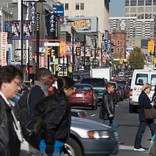
Interest: Architecture, history, nature
Estimated time: Two hours or longer.
This Uptown Discovery Walk leads you through neighbourhoods just north of the City’s core. Hidden among the low-rise and high-rise residential, commercial and institutional buildings, you will discover a rich variety of parks, gardens and streetscapes. Since the 1960s, many of these parks and gardens have been created through building demolitions, land exchanges, street closures, lease agreements, land purchases and the City’s development approval process for major projects.
These parks and gardens have design features ranging from traditional to contemporary, from pastoral to urban. Visit two of the City’s traditional parks —Allan Gardens and Queen’s Park. At Allan Gardens, admire the extensive horticultural displays both outdoors and inside the ornate greenhouses. Queen’s Park provides a picturesque forested setting for the Provincial Parliament buildings. The more contemporary parks and gardens include quiet neighbourhood meeting spots, an award winning park (e.g. Village of Yorkville Park) and outdoor recreation facilities. You will visit extensively landscaped institutional grounds and the remains of a ravine where Taddle Creek once flowed but is now buried in a sewer.
View the Discovery Walk: Uptown Toronto route map and additional walk details.
Nearest TTC Station: Wellesley